
Where Flight Simulation Enthusiasts Gather from Around the World!
AVSIM Library - Search Results

| Category: Flight Simulator 2004 - Scenery | |
| Dease Lake CYDL 2010 v1.1 |

|
Images related to this file:
File Description:
Version 1.1 adds the three hazard beacons that define the boundaries of the night circuit, as depicted in the included chart. Many thanks to Lane Street for creating the beacons and giving us permission to include them in the scenery. This scenery is complete and does not require the previous verion. Dease Lake CYDL airport is located about 2 miles south of Dease Lake in stunningly beautiful northwest British Columbia. (The lake directly to the east of the airport is Allan Lake.) Scheduled passenger service to Smithers and Bob Quinn Lake is provided by Northern Thunderbird Air (http://ntair.ca/). CYDL also serves as a base for Pacific Western Helicopters (http://www.pwh.ca/). This version moves the airport slightly to its correct location. All aprons & taxiways have been redone and all default buildings replaced. The little terminal building is photo real. The missing town of Dease Lake and the missing lake south of Allan lake have been added. This scenery was designed for use with Ultimate Terrain and was not tested in the default scenery. It may or may not work in FSX. Previous version had 307 downloads.
| Filename: | Dease_Lake_CYDL_2010_v11.zip |
| License: | Freeware |
| Added: | 6th November 2010, 22:30:24 |
| Downloads: | 793 |
| Author: | Sidney Schwartz & Peter Ham |
| Size: | 1.8 MB |
| Category: Flight Simulator 2004 - Scenery | |
| Tampa General Aviation Airports |
|
File Description:
Tampa General Aviation Airports for FS9
Tampa has three General Aviation Airports: Tampa Executive Airport, Peter O. Knight Airport and Plant City Municipal Airport. They are operated by the Hillsborough Aviation Authority, in addition to Tampa International Airport.
All three airports are represented in this package. The airports were made using Aircraft Design Editor. This program was produced by Scruffyduck Software. I also wish to thank John B. Loney who has kindly consented to allow me to use the buildings and textures from his original release of Peter O. Knight Airport in 2005. This is the first version of KPCM designed over and above the original FS9 stock airport.
Here is a list of the scenery objects used in Tampa Executive and Plant City Muni:
DB Parkinglots
ez-extra-objects
ga hangars ss vol vol 2 v1
ga hangars ss v3
large hangars ss v2
loney's buildings
loney's hangars and buildings
loney's hangars and buildings2
warehouse airport vehicles
You must have these objects installed in a folder in your FS9 Addon Scenery folder
You may download these from AVSIM and Flightsim.com
John Loney's Objects may be downloaded from www.lfssd.net
| Filename: | Tampa_General_Aviation_Airports.zip |
| License: | Freeware, limited distribution |
| Added: | 11th August 2013, 22:56:15 |
| Downloads: | 370 |
| Author: | Michael Verlin /John B. Loney |
| Size: | 1021.15 KB |
| Category: Flight Simulator 2004 - Scenery | |
| Legnano scenery - Italy |
|
Images related to this file:
File Description:
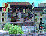
Homage to my town, scenery built mainly with existing objects, buildings by sintax and few experiments by GMax. It DOES NOT include any airport, but represents some pictures of Legnano town
Informations: Legnano is a town in north of Italy (approx 25 kmt NW Milan, ref coordinates N45 35.98 E8 54.59), reachable from Casorezzo ultralight airport (closest one) or all the near others of Milan area.
Here was done in 1176 the historical fight of the Alliance Lombarda's city-states against Federico Barbarossa German imperator. Legnano is also well known for his metallurgical and textile industries story.
Contents: rev.1 : down town square with municipal Palazzo Malinverni and S. Magno basilica, skyscraper, one of Olona river's bridges, G. Mari football stadium, Alberto da Giussano circus with related monument, encircled by the eight quarter's flags, F. Tosi and Manifattura industrial buildings, Rail station, external parking and glass building
rev.2 : Courthouse building with Teresa's face bronze statue and some more buidings, Palio hystorical figurants inside the stadium, Carroccio and Alberto da Giussano rider, Small goods train on railroad; S. Magno belltower reviewed, red sky-lights on top of skyscraper and chimney, Chimney smoke
| Filename: | Legnano_scenery__Italy.zip |
| License: | Freeware |
| Added: | 27th March 2011, 02:55:40 |
| Downloads: | 648 |
| Author: | Aldo Della Vedova |
| Size: | 6.83 MB |
| Category: Flight Simulator 2004 - Scenery | |
| Forggensee, v2 Update |
|
Images related to this file:
File Description:

This UPDATE enhances the existing Forggensee Water-Airport(EDAF).
Klaus Jone did a magnificent job in creating this scenery for us flightsimmers, and my enhancements do NOT alter any Scenery Objects by Klaus Jone. The buildings are the same. And the number of AI planes and ships are unchanged.
My enhancements modify the BEHAVIOR of the Ships.
But the floatplane traffic is so superbly programmed that no further modifications are necessary.
Mr. Klaus Jone passed away in May 2009, and it is my intention to preserve Forggensee pretty much as HE designed it. Except for modifying the BEHAVIOR of the AI traffic, to spread it out to cover the entire area of Lake Forggensee. As the screenshots I've included illustrate.
Naturally, these updated files require that Forggensee Part 1 and Part 2 are ALREADY installed in your FS2004. My part here was to perform a few tweaks to make the AI traffic spread out all over Lake Forggensee, and ensure that ALL wake/spray effects are visible. As Klaus Jone stated: "There is some amazing traffic on the lake, have a look and have fun!"
| Filename: | Forggensee_v2_Update.zip |
| License: | Freeware |
| Added: | 18th April 2011, 19:13:38 |
| Downloads: | 727 |
| Author: | Klaus Jone, Ronald Falzon |
| Size: | 1.41 MB |
| Category: Flight Simulator 2004 - Scenery | |
| Mountain View CPZ3 in Ontario, Canada |
|
Images related to this file:
File Description:
This is Mountain View, a small RCAF airfield at the eastern end of Lake Ontario on Prince Edward Island, some 40 miles west of Kingston. Mountain View is used for training during the summer months, and part of this training is for C-130 crews, who practice landing on rough or unprepared landing strips. The crews are based at Trenton, which is a large base 10 miles to the northwest on the mainland. There are (or were, I haven't seen it recently) numerous parked and ancient fighter planes such T-33's and Canadair Tutors; these could also have possibly been used for summer training or perhaps were just stored. Last summer there were only two hangars left standing; in 2002 there were five. In real life you would be on the lookout not only for C-130's but also (at certain times during the summer) for parachutists and also gliders. This airfield is one that you will fly over and not land on; I confess that I have cheated with the length of the 06L-24R gravel "practice" runway, so that it became possible for the FS version of a touch-n-go with a C-130 to be completed without using the grass. The aerial photograph shows the new "practice" gravel runway under construction.
| Filename: | Mountain_View_CPZ3_in_Ontario_Canada.zip |
| License: | Freeware, limited distribution |
| Added: | 9th March 2012, 15:05:57 |
| Downloads: | 350 |
| Author: | Roger Wensley |
| Size: | 7.26 MB |
| Category: Flight Simulator 2004 - Scenery | |
| Shaktoolik 2C7 in Alaska |
|
Images related to this file:
File Description:
Shaktoolik is a coastal village 35 miles north of Unalakleet, with a fishing population of around 250. It was originally established inland on the Shaktoolik River but moved to the coast in 1933. Due to storms and erosion it was again moved in 1967, to its current location 2 miles further north. Confusingly, what is called "New Shaktoolik 38A" was in fact only "new" in 1967 and has since been replaced by "Shaktoolik 2C7" further north, built on wider land with a longer gravel runway of 4,000 feet. 38A is still visible but unusable, with the sheds being used for other purposes. There are flights from Unalakleet, included in the AI here as a further modification to the Bethel PABE AI. A note here about my scenery making. This is post number 500 and there will not be many more to follow this as I am almost at the end of the photos I either took or found for scenery purposes. There is a limit to what can be located online and I have already been making use of the little there is; eg Unalakleet. So, if you are near an airport (preferably Canadian or Alaskan) and have a camera..... Let me know.
| Filename: | Shaktoolik_2C7_in_Alaska.zip |
| License: | Freeware, limited distribution |
| Added: | 27th July 2019, 21:00:56 |
| Downloads: | 107 |
| Author: | Roger Wensley |
| Size: | 4 MB |
| Category: Flight Simulator 2004 - Scenery | |
| RAF Middleton St. George |
|
Images related to this file:
File Description:
Representative scenery of RAF Middleton St. George in County Durham.
The airfield began its life as Royal Air Force Station Goosepool, and in 1941 became RAF Middleton St. George. The aerodrome opened as a Bomber Command station in 1941. In 1943 it was allocated to No. 6 Group, Royal Canadian Air Force. A sub-station was located at RAF Croft, Yorkshire. Squadrons based here include: 76 Squadron, which flew Halifaxes, 78 Squadron, which flew Whitleys, 419 Squadron RCAF, which flew Wellingtons, Halifaxes, and Lancasters, 420 Squadron RCAF, which flew Wellingtons, and 428 Squadron RCAF, which flew Wellingtons, Halifaxes, and Lancasters.
After the war, the aerodrome served various squadrons and units including No. 13 Operational Training Unit (OTU), No. 2 Air Navigation School, No. 4 Flight Training School, 226 OCU and squadrons that used Meteors, Hunters, Javelins and Lightnings.
The RAF left the station in 1964, but the aerodrome was reopened in 1966 as a civil airport. The airfield was named Teesside International Airport in the 1960s, and was renamed Durham Tees Valley Airport in 2004.
This scenery has been made using various scenery libraries, mainly from MAIW. Full listing in the docs.
| Filename: | RAF_Middleton_St_George.zip |
| License: | Freeware, limited distribution |
| Added: | 22nd June 2014, 18:31:59 |
| Downloads: | 1,183 |
| Author: | Brian Clarke; Daryl Payne |
| Size: | 3.84 MB |
| Category: Flight Simulator 2004 - Scenery | |
| Hana Heli-Obstacle Course v3.0 |
|
File Description:
Hana Airport is a regional airport of the State of Hawaii on the east shore of the island of Maui, 3 NM northwest of the unincorporated town of Hana. The airport covers 119 acres and has one runway. It is primarily a commuter facility used by unscheduled air taxis and general aviation. This scenery is intended as a single/multiplayer helicopter obstacle course where heli pilots can meet to compete, show off, and share their helo skills. Since birdseye (Timm Turner) already did a neat scenery called Hana_Scenery_PHHN (search for "hana" in the HoverControl Downloads), we decided to convert PHHN to a full helicopter training area. Makes a great place for helo pilots to gather to practice and perfect their skills, and challenge other pilots! And keep an eye-out for that Hot Air Balloon, cruising around an altitude of 3000 feet (don't forget to wave at them!).
Another unique thing about this scenery is the neighboring islands (Honolulu Intl/Hickam AFB, Bellows AFB, Lanai City, Kahului, Molokai, etc). If you get frustrated during your heli obstacle course training, just take a heading of 275 degrees, and relax at one of the neighboring islands. We also added an Easter Egg - If you set your FS calendar to July 21st, you'll see a large ridge fire up in the hills. Load Jordan Moore's Erickson S64E (http://www.hovercontrol.com/) & try your skills at water bombing!
| Filename: | Hana_HeliObstacle_Course_v30.zip |
| License: | Freeware |
| Added: | 28th August 2011, 17:53:18 |
| Downloads: | 468 |
| Author: | Greg Spellmen, Bob Ferguson |
| Size: | 95.52 MB |
| Category: Flight Simulator 2004 - Scenery | |
| Avon STOLPort (KWHR) |
|
File Description:
A recreation of the Avon STOLPort (ident KWHR) for MS Flight Simulator 2004, A Century of Flight. Avon was operated as an exclusive destination for Rocky Mountain Airways between (approximately) 1978 and sometime in the late 80's or early 90's. The 4,000' runway was short for the nearly 7,500' elevation, and surrounded by mountains, some towering over 6,000' above the airport elevation. To allow all weather operation, the airport eventually featured what was reported as the steepest ILS ever constructed, with a seven degree glideslope. RMA had exclusive use of the tiny STOLPort and operated it with 50-passenger De Haviland Dash 7 equipement.
Lacking the original chart, I surveyed in FS and plotted what is hopefully an accurate representation of the ILS approach, using my best understanding of TERPS - the US standard for instrument approaches. I also created an NOS-style IAP chart of this approach for the package. A text Takeoff Minimums & Procedure is also included.
AI ATC & traffic recognition of the approach will hopefully follow, but does not exist yet. In other words, you can fly this approach and see the localizer in the GPS, but AI ATC will not give you vectors to it. You'll need to follow the full procedure included on the chart.
Please see the full Readme.txt in "Flight Simulator 9\Addon Scenery\KWHR\Docs" in this zipfile for information on installation of the scenery, flying the approach, and more on the history of the Avon STOLPort.
| Filename: | Avon_STOLPort_KWHR.zip |
| License: | Freeware, limited distribution |
| Added: | 12th May 2008, 23:14:38 |
| Downloads: | 418 |
| Author: | Stephen Comer |
| Size: | 2.1 MB |
| Category: Flight Simulator 2004 - Scenery | |
| Hana Heli-Obstacle Course v2.0 |
|
Images related to this file:
File Description:
Hana Airport is a regional airport of the State of Hawaii on the east shore of the island of Maui, 3 NM northwest of the unincorporated town of Hana. The airport covers 119 acres and has one runway. It is primarily a commuter facility used by unscheduled air taxis and general aviation. This scenery is intended as a single/multiplayer helicopter obstacle course where heli pilots can meet to compete, show off, and share their helo skills. Since birdseye (Timm Turner) already did a neat scenery called Hana_Scenery_PHHN (search for "hana" in the HoverControl Downloads), we decided to convert PHHN to a full helicopter training area. Makes a great place for helo pilots to gather to practice and perfect their skills, and challenge other pilots! And keep an eye-out for that Hot Air Balloon, cruising around an altitude of 3000 feet (don't forget to wave at them!). Another unique thing about this scenery is the neighboring islands (Honolulu Intl/Hickam AFB, Bellows AFB, Lanai City, Kahului, Molokai, etc). If you get frustrated during your heli obstacle course training, just take a heading of 275 degrees, and relax at one of the neighboring islands. We also added an Easter Egg - If you set your FS calendar to July 21st, you'll see a large ridge fire up in the hills. Load Jordan Moore's Erickson S64E (http://www.hovercontrol.com/) & try your skills at water bombing!
| Filename: | Hana_HeliObstacle_Course_v20.zip |
| License: | Freeware |
| Added: | 7th December 2010, 03:28:47 |
| Downloads: | 476 |
| Author: | Greg Spellmen & Bob Ferguson |
| Size: | 58.56 MB |


© 2001-2026 AVSIM Online
All Rights Reserved
Privacy Policy |