
Where Flight Simulation Enthusiasts Gather from Around the World!
AVSIM Library - Search Results

| Category: Flight Simulator 2004 - Scenery | |
| Simplified FIR Center boundaries for FS2004 |

|
File Description:
Tired to be constantly handed over by the default ATC from one center frequency to another one? Here it comes a simplification of the boundaries for the FIR centers in FS9/FS2004.
The boundaries for Flight Information Regions (FIRs) in some areas (for example around Chicago) are subdivided into many smaller sectors, each with a different Center frequency. The result is that, while flying at >10000ft you constatly get handovered from one frequency to the next one. This file corrects this effect, by assigning the same COM frequency to all sectors a specific FIR is subdivided into. This means, for example, that "Chicago control" will have the same frequency all over the Chicago FIR; and the same applies for all the FIRs in the world. The result is that you are handovered only at the border of a FIR (for example when going from Chicago control to Cleveland Control), resilting in a much more pleasant ATC experience, especially in certain areas rich of FIR partitions.
| Filename: | Simplified_FIR_Center_boundaries_for_FS2004.zip |
| License: | Freeware |
| Added: | 2nd January 2022, 16:53:44 |
| Downloads: | 164 |
| Author: | Antonio Arreghini |
| Size: | 1.2 MB |
| Category: Flight Simulator 2004 - Scenery | |
| Milan Malpensa Airport (LIMC - MXP) |
|
Images related to this file:
File Description:
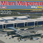
This FS2004 scenery reproduce the second-busiest italian airport "Milan Malpensa" (Iata: MXP, Icao: LIMC) located in the northwest area of Italy. The airport is used by over 100 airlines (passenger and cargo) that fly to Milan from all over the world, so this scenery is a “must have†for every simmer!
In the scenery you'll find almost all airport buldings exsisting at the real airport, hundred of custom made detailed objects, static and animated vehicles and a photoreal airport background with night lighting and hard winter textures. Each scenery part and object (frame-rate friendly thanks to the hi-performance design) has day and night photoreal textures and everything is placed in the right position which has been seen on autumn 2020 at the real airport.English extendet handbook is included and AES support is working too. Watch the screenshot inside this zip package or on the Albysim Website and enjoy all scenery features (in this free/demo edition some features are limited).
| Filename: | Milan_Malpensa_Airport_LIMC__MXP.zip |
| License: | Shareware, limited functionality |
| Added: | 15th January 2021, 20:25:12 |
| Downloads: | 2,026 |
| Author: | Alberto Di Bolzano (Albysim Scenery Design) |
| Size: | 48.72 MB |
| Category: Flight Simulator 2004 - Scenery | |
| Wake Island (PWAK) |
|
Images related to this file:
File Description:

FS2004 photo scenery and AI package for Wake Island (PWAK) in the Pacific. Seemingly drifting in a strategic yet isolated position Wake Island-an atoll really-was one of the loneliest outposts of the United States. Originally a gas station for Pan Am's 'Clipper' flying boats, Wake was also a strategic air base during the Second World War. This continued with the Cold War as Wake became a centerpiece of the Pacific Radar Net against the Soviets.
With the thawing of Eastern Europe and the advent of more efficient jet aircraft Wake slowly drifted back to the quiet backwater it is again today, home to a handful of civilian caretakers and local wildlife. This scenery attempt to recapture Wake in the early 1980's when it still performed a semi-regular duty as gas station and pit stop. (This is a reload of the scenery due to the Hack attack - no changes to previous package)
| Filename: | Wake_Island_PWAK.zip |
| License: | Freeware, limited distribution |
| Added: | 15th May 2010, 08:57:58 |
| Downloads: | 4,931 |
| Author: | John Stinstrom |
| Size: | 4.75 MB |
| Category: Flight Simulator 2004 - Scenery | |
| RAF Greenham Common |
|
Images related to this file:
File Description:
FS2004 scenery for RAF Greenham Common by Brian Clarke.The scenery uses objects from various scenery libraries, listed in the readme. I have also included some flightplans for C-130's, C-5's and C-141's to fly in and out of the base. These will also require separate downloads.
RAF Greenham Common is a former Royal Air Force station in Berkshire, England. The airfield is located to the south-east of Newbury, Berkshire, about 50 miles (80 km) west of London. Opened in 1942, it was used by both the Royal Air Force and United States Army Air Forces during the Second World War and the United States Air Force during the Cold War. After the Cold War ended, it was closed in 1993. The airfield was also known for the Greenham Common Women's Peace Camp held outside its gates in the 1980s.
In 1997 Greenham Common was designated as public parkland.
| Filename: | RAF_Greenham_Common.zip |
| License: | Freeware, limited distribution |
| Added: | 5th May 2014, 15:09:53 |
| Downloads: | 1,213 |
| Author: | Brian Clarke, Daryl Payne |
| Size: | 1.72 MB |
| Category: Flight Simulator 2004 - Scenery | |
| Vadodara International Airport (VABO) |
|
Images related to this file:
File Description:
Vadodara International Airport (VABO) for FSX and FS2004.
Virtual aviation community stands basically on the grounds of what happens in the real world aviation and simulates the real thing, virtually. So that means they always have to be a step ahead and we follow. But my friend, we have a chance to make them follow us. Thats right! The proposed (final) integrated terminal at Vadodara shall have its construction commenced in mid of 2013 (the time can be altered, as real dudes define the situation). The design is finalized and here it is ..... the airport is basically " A basin kind".
Vadodara Airport or Civil Airport Harni (IATA: BDQ, ICAO: VABO) is a civilian airport located in the north-east of Vadodara, Gujarat, India in the suburb of Harni. A domestic airport until now, Vadodara Airport will become an international airport once the proposed new terminal is operational.
| Filename: | Vadodara_International_Airport_VABO.zip |
| License: | Freeware, limited distribution |
| Added: | 7th September 2010, 11:32:31 |
| Downloads: | 1,879 |
| Author: | Ashish Singh |
| Size: | 25.19 MB |
| Category: Flight Simulator 2004 - Scenery | |
| Yellowknife CYZF, 2010 |
|
Images related to this file:
File Description:
Founded as a gold town in 1936, Yellowknife is now the capital city of the Canadian Northwest Territories, and its airport, CYZF, is the busiest airport in northern Canada. Located only 250 miles south of the Arctic Circle, it is also subject to some of the harshest and most dangerous climate conditions in the world.
This version features:
*All ramps and taxiways completely redone to be more accurate
*All default buildings replaced
*Realistic Gmax models of the main terminal and tower, the First Air, CAF Squadron 440, and Buffalo Airways hangers
*Static aircraft for the First Air, CAF Squadron 440, Air Tindi and Buffalo Airways ramps
*Visual models of the arrestor cables on the main runway
*Fences, ramp lights, cargo, ground vehicles and all the other details that bring an airport to life
*Modular construction. The main buildings, ramp objects and static aircraft are in separate files and can be selectively deactivated to improve frame rates.
| Filename: | Yellowknife_CYZF_2010.zip |
| License: | Freeware |
| Added: | 16th January 2010, 10:31:02 |
| Downloads: | 6,892 |
| Author: | Sidney Schwartz, Peter Ham |
| Size: | 15.42 MB |
| Category: Flight Simulator 2004 - Scenery | |
| Williams Lake CYWL |
|
Images related to this file:
File Description:
Founded in 1860, Williams Lake is located in the beautiful central British Columbia region known as the Cariboo. With a population of about 11,000, Williams Lake is the largest urban center between Kamloops and Prince George. The airport has one 7,000' (2,100m) runway and is served by Central Mountain Air and Pacific Coastal Airways.
This complete rebuild of CYWL features all new taxiways, aprons and buildings, an accurate custom terminal building, and the usual fences, trees, ramp objects, etc. Many thanks to Shawn Lund, Air Attack Officer, BC Wildfire Management Branch, Kamloops Fire Centre, for the photos of the terminal building and his permission to use them. Included are the Nav Canada aerodrome diagram and the two instrument approach plates. (These approach plates are out of date and obviously NOT for real world use.)
This scenery was designed for use with Ultimate Terrain and was not tested in the default scenery. It may or may not work in FSX.
| Filename: | Williams_Lake_CYWL.zip |
| License: | Freeware |
| Added: | 21st December 2010, 07:17:50 |
| Downloads: | 1,071 |
| Author: | Sidney Schwartz & Peter Ham |
| Size: | 2.07 MB |
| Category: Flight Simulator 2004 - Scenery | |
| Skysoft Simulation - ZUJZ_2011 |
|
Images related to this file:
File Description:
Jiuzhai Huanglong Airport (ICAO: ZUJZ, IATA: JZH) situated at the famous tourist
spot Jiuzhaigou in Sichuan Province, China, where is the home of pandas. With an
elevation of 3448m, it is one of the highest airports in China as well as in the world.
While enjoying the breathtaking landscape around you, you should always be cautious
about the severe turbulence and intense crosswind whenever departure or arriving the
airport. The airport was constructed in the year 2003 with a runway length 3400 meters
(11 056 ft.) and width 60 meters (147 ft.).
In the year 2007, the airport has been expanded. The runway was extended by 200
meters (650 ft.) and 7 parking gates were added. Now the airport is capable for
medium jets to takeoff and landing. Certification needed in both airplanes as well as the
crews before executing takeoff or landing on the airport. It is expected that in the year
2015, the average number of flights everyday could increased to about 100.
| Filename: | Skysoft_Simulation__ZUJZ_2011.zip |
| License: | Freeware, limited distribution |
| Added: | 1st April 2011, 15:36:44 |
| Downloads: | 2,907 |
| Author: | Skysoft Simulation DevelopTeam |
| Size: | 24.48 MB |
| Category: Flight Simulator 2004 - Scenery | |
| Chicago O'Hare International Airport circa 2018 (reupload) |
|
File Description:
This is a reupload of my Chicago O'Hare redevelopment (KORD). I apologize for the first time, but it appeared I had uploaded xml files into avsim instead of bgl files so it may not work at all.
Description from before: This is a complete makeover of the default O'Hare scenery. For a long time no freeware addon scenery existed for O'Hare, and the paywares that exist now are outdated by several years and, aren't free. I entirely used the default airport buildings utilized by the airport, but added lots of jetways and parking assignments to match the real world layout based on Google Maps. This will give you a March 2018 rendition of the airport. More about the airport in the readme file. Screenshots enclosed, however I recommend only looking at one or two of them first to evaluate, and to fly into the airport first from any other airport of your choice so you can see it for the first time flying in.
| Filename: | Chicago_OHare_International_Airport_circa_2018_reu.zip |
| License: | Freeware |
| Added: | 8th July 2020, 17:31:26 |
| Downloads: | 1,260 |
| Author: | Carlos Si |
| Size: | 37.44 MB |
| Category: Flight Simulator 2004 - Scenery | |
| Modified SRTM relief 76 m for Slovakia |
|
File Description:
This Slovak terrain mesh 76 m (LOD9) is made from the 3arc-sec SRTM. The voids in the source data were filled by the interpolation. Both the primary processing of the 3arc-sec data and the rendering of the terrain in the FS cause flattening and simplifying of the real shape of the terrain. This phenomenon was partially compensated by the sharpening of the source data.
Made by the programs Surfer (Golden Software) and MS Terrain SDK 2000 and 2002. The relief covers the area N49.9219 E016.1719 to N47.4609 E022.9687 in the boundaries of the LOD9 quadrants. This scenery contains only the elevation data. The other elements of the basic terrain as the landclass, locally used airborne photos, vector roads, rivers and lakes are available in different sceneries by other authors and they are continuously developed.
| Filename: | Modified_SRTM_relief_76_m_for_Slovakia.zip |
| License: | Freeware, limited distribution |
| Added: | 28th May 2010, 19:40:13 |
| Downloads: | 4,604 |
| Author: | Vladimir Stoje |
| Size: | 19.36 MB |
© 2001-2026 AVSIM Online
All Rights Reserved
Privacy Policy |