
Where Flight Simulation Enthusiasts Gather from Around the World!
AVSIM Library - Search Results

| Category: Flight Simulator 2004 - Scenery | |
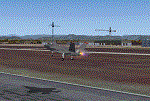
| Torrejon Air Force Base (LETO), 1957-62 |

|
File Description:
Torrejón Air Base was originally the home of the Spanish National Institute of Aeronautics, but as a result of an agreement between Franco and the Unites States in 1953 an air base was created there with a large military apron and a runway 13,400 feet long - the longest in Europe for some decades. Officially opened in June 1957, both US bombers and fighters were based there, most significantly the B-47 Stratojet, which had too short a range to be operated only from the U.S. In July of 1958 the 497th Fighter Interceptor Squadron became the first permanently stationed Air Defence Group operating F-86L Sabres and from April 1960 the F-102 Delta Dagger. Over the years many different units and therefore many different aircraft types did TDY (Temporary Duty Assignments - usually 30-90 days) at Torrejon. Units of the Spanish Air Force were also present and are represented in this scenery package.
| Filename: | Torrejon_Air_Force_Base_LETO_195762.zip |
| License: | Freeware |
| Added: | 15th August 2021, 16:11:23 |
| Downloads: | 218 |
| Author: | Al Von Pingel and Ken Lawson |
| Size: | 44.81 MB |
| Category: Flight Simulator 2004 - Scenery | |
| Leeuwarden Airbase 'EHLW' V2.0 |
|
File Description:
Detailed and accurate yet framerate friendly scenery for the Leeuwarden Airbase also known as "Fighter town Europe". (ICAO designation EHLW). Leeuwarden is one of the two Main Operating bases (MOB) of the F-16 fleet. It has two F-16 squadrons (322 & 323) and one SAR squadron which flies the AB412SP helicopter. The annual exercises Frisian Flag, DWIC en FWIT are held on this airbase. The following items are changed/new with version 2. Added new ILS for rwy 09/27 (This is ILS installation from Twente AB, which will be closed), including new ILS glide slope antennas for 09/27 and localizer antennas for all runways. Added barrier's to the runways, tuning in the ILS freq will put the cable up at the end of the runway! Upgrade and cleanup of the texture to improve frame rate. Optimalization of macro's to reduce polygon resulting a slightly higher frame rate. Also now included an AFCAD file. Scenery is compatible with default scenery and the NL2000 scenery.
| Filename: | Leeuwarden_Airbase_EHLW_V20.zip |
| License: | Freeware, limited distribution |
| Added: | 15th December 2006, 11:34:59 |
| Downloads: | 4,204 |
| Author: | Marcel Ritzema |
| Size: | 795.71 KB |
| Category: Flight Simulator 2004 - Scenery | |
| Wake Island (PWAK) |
|
Images related to this file:
File Description:

FS2004 photo scenery and AI package for Wake Island (PWAK) in the Pacific. Seemingly drifting in a strategic yet isolated position Wake Island-an atoll really-was one of the loneliest outposts of the United States. Originally a gas station for Pan Am's 'Clipper' flying boats, Wake was also a strategic air base during the Second World War. This continued with the Cold War as Wake became a centerpiece of the Pacific Radar Net against the Soviets.
With the thawing of Eastern Europe and the advent of more efficient jet aircraft Wake slowly drifted back to the quiet backwater it is again today, home to a handful of civilian caretakers and local wildlife. This scenery attempt to recapture Wake in the early 1980's when it still performed a semi-regular duty as gas station and pit stop. (This is a reload of the scenery due to the Hack attack - no changes to previous package)
| Filename: | Wake_Island_PWAK.zip |
| License: | Freeware, limited distribution |
| Added: | 15th May 2010, 08:57:58 |
| Downloads: | 4,931 |
| Author: | John Stinstrom |
| Size: | 4.75 MB |
| Category: Flight Simulator 2004 - Scenery | |
| Cameri and Turbigo sceneries (rev. 3) - north Italy |
|
Images related to this file:
File Description:
The following files are required by this file:
http://library.avsim.net/esearch.php?DLID=163723&UploadID=&Name=&FileName=&Author=&CatID=root
http://library.avsim.net/esearch.php?DLID=186350&UploadID=&Name=&FileName=&Author=&CatID=root
This scenery includes a global review of the previous Sceneries of Cameri Military airport (rev.2 Oct 2011), Cameri Museum (rev. 2 Oct 2011), Cameri Babini (rev. 2 oct 2011), Turbigo power station (rev. 2 Sep 2011 and update rev. 2.1 Oct 2014). All the above ARE NOW INCLUDED in this new unique scenery. Contents: Terrain in new version photo-realistic multi-seasons/night; adapted to Western Europe special elevation meshes; cover area of over 120 sqkm from Bellinzago-Oleggio (NW) to Magnago-Bienate (NE), from Novara (SW) to Cuggiono-Inveruno (SE); all the terrain has been restorated with 3D buildings, either through autogen that with specific dedicated objects (by GMax) and with significant addition of library objects ("dva51" and other existings). This scenery (located on the final approach to the Milan Malpensa international airport) includes the Cameri's Mil Airport with the Babini closed Army area and the planes of the Historical Museum of the airport; it is also included the thermoelectric power station of Turbigo. All the buildings are placed to recreate cities and villages covered in the photo-realistic terrain, including Bellinzago, Bienate, Buscate, Caltignaga, Cameri, Castano Primo, Castelletto Ticino, Cuggiono, Galliate, Inveruno, Magnago, Malvaglio, Nibbia, Novara, Oleggio, Pernate, Robecchetto, Romentino, Sant'Anna, San Pietro Mosezzo, Turbigo , Vanzaghello, and the covered Turin-Milan highway.
Details of the new buildings for the care and maintenance to F35 completely recreated, as obtainable from the current satellite view.
It REQUIRES the use of the following, to be downloaded separately :
- the libraries dva51 - the system of vegetations TreePlanter - the West Europe Meshes of Daniele Lanfranchi. See the Readme file. Enjoy!
Videos available here:
https://dl.dropboxusercontent.com/u/38829151/FS9/Cameri_Turbigo_v3%20shots.WMV
http://youtu.be/yVI2KeJKS5o
http://youtu.be/oKa0e_5kxIk
| Filename: | Cameri_and_Turbigo_sceneries_rev_3__north_Italy.zip |
| License: | Freeware |
| Added: | 21st January 2015, 21:32:36 |
| Downloads: | 990 |
| Author: | Aldo Della Vedova, Daniele Lanfranchi and Gian Mario Verga |
| Size: | 103.7 MB |
| Category: Flight Simulator 2004 - Scenery | |
| Driftwood Bay AK23 near Dutch Harbor Alaska |
|
Images related to this file:
File Description:
This is Driftwood Bay, an Air Force field that is just 13 miles northwest of Dutch Harbor, and was once part of a DEW line station with a road heading up the hill.
In FS9 the stock runway is concrete and if you have a mesh with the hills correctly positioned then the runway sits in a deep hole on the hillside. In fact the runway is gravel, 3,500 feet long and aligned 32/14 next to the beach, which is where I moved it to. The beach, as configured by Ultimate Terrain (and contrary to my previous doubts, UT does cover the Aleutians) is incorrect, in that a marshy area just behind the beach is shown as sea with large indentations in what should be a fairly straight line of sand. However, this does not squeeze AK23 in any way so I left it; consider it to be a spring high tide. There is very little at AK23 beyond a gravel runway and a windsock and the AI is an Alaska State Troopers Piper Super Cub from Dutch Harbor, presumably monitoring the numerous Alaska Maritime National Wildlife Refuge areas.
| Filename: | Driftwood_Bay_AK23_near_Dutch_Harbor_Alaska.zip |
| License: | Freeware, limited distribution |
| Added: | 14th August 2012, 20:32:14 |
| Downloads: | 351 |
| Author: | Roger Wensley, Sidney Schwartz |
| Size: | 3.35 MB |
| Category: Flight Simulator 2004 - Scenery | |
| Hewanorra TLPL on Saint Lucia in the eastern Caribbean |
|
Images related to this file:
File Description:
St Lucia island is to the north of the Grenadines, between Martinique and Saint Vincent. St Lucia is nearly 30 miles long and has a population of 175,000, with two airports. Hewanorra International is at the southern end of the island, the end furthest from the capital, Castries. The reason for this is that at the southern end it was possible to build a runway almost 9,000 feet long, while the airport in the north (Vigie) could not be extended further to accomodate the largest jets. The airport was originally a USAAF base, converted to commercial use.
All buildings are made with photographic textures and include the new terminal and a new control tower. The apron has been extended so that 747's etc can be accommodated, and there are regular international flights by Virgin, BA, Air Canada, Air France, etc and local connecting flights by LIAT; the AI includes both major international airlines and LIAT. The towns around the airport (Vieux Fort etc) are included here: the scenery is based on the "Lesser Antilles Mesh" which is required and can be downloaded for free.
| Filename: | Hewanorra_TLPL_on_Saint_Lucia_in_the_eastern_Carib.zip |
| License: | Freeware, limited distribution |
| Added: | 11th June 2013, 16:23:49 |
| Downloads: | 831 |
| Author: | Roger Wensley |
| Size: | 4.25 MB |
| Category: Flight Simulator 2004 - Scenery | |
| MYER Rock Sound International, Eleuthera Island, Bahamas |
|
File Description:
Googly scenery for Rock Sound International (ICAO: MYER), a grand-sounding but
quiet airport located on Eleuthera Island, Bahamas. Eleuthera is a long
and thin island east of Nassau and has three commercial airports, the busiest
being Governor's Harbour. Rock Sound is at the southern end and is served twice
daily by Dash 8 turboprops of Bahamasair, along with occasional flights by
operators such as Southern Air Charter. The airport has seen busier days and
was once even served from Europe by Alitalia.
Microsoft have only provided general aviation facilities at this airport in
Flight Simulator 2004 and this scenery seeks to redress the situation
so that you and your "AI" traffic can use the airport realistically.
The scenery does not purport to be ultra-accurate. Based on high quality
satellite imagery from Google Earth, the layout is proportionally correct but the
added airport features, such as buildings, are built from default Microsoft objects
and add-on libraries so will not look exactly like the real thing.
You are not obliged to download and install any additional scenery libraries,
but to enjoy this scenery in its entirety, you may wish to. It will work fine,
with or without.
| Filename: | MYER_Rock_Sound_International_Eleuthera_Island_Bah.zip |
| License: | Freeware |
| Added: | 13th October 2008, 11:01:56 |
| Downloads: | 1,466 |
| Author: | John Hinson |
| Size: | 61.42 KB |
| Category: Flight Simulator 2004 - Scenery | |
| Mackenzie River close to Tulita CZFN in Northwest Territories Canada |
|
Images related to this file:
File Description:
I discovered, while testing another airfield near the Mackenzie River, that along the side of the Mackenzie adjacent to Tulita, and for a considerable distance, there was a cliff of water. I have no idea if my version of Ultimate Terrain has developed a fault or if this has been caused by the installation of a terrain mesh that now argues with UT for some unknown reason. Whatever, it was impossible to leave it as it was. I have included a screenshot of the cliff further upstream. To avoid the cliff of water I have flattened that area of the Mackenzie River and the adjacent river banks and both the town and the airfield to a height above sea level of 400 feet. This does not reflect the real life situation but is the lesser of two optical evils. I have included a screenshot of the flattened area. If you do not have a problem then you do not need this. If you too have a cliff of water then you might want to try this. It does not completely get rid of the problem, but it does get rid of it in the area visible when landing or taking off at Tulita.
| Filename: | Mackenzie_River_close_to_Tulita_CZFN_in_Northwest_.zip |
| License: | Freeware, limited distribution |
| Added: | 1st August 2021, 22:27:01 |
| Downloads: | 74 |
| Author: | Roger Wensley |
| Size: | 573.48 KB |
| Category: Flight Simulator 2004 - Scenery | |
| Qikiqtarjuaq CYVM (Broughton) and DEW FOX-5 in Nunavut, Canada |
|
Images related to this file:
File Description:
Qikiqtarjuaq is an airfield on the northeast coast of Baffin Island, just over 100 miles north of Pangnirtung. The airfield is the closest Canadian airfield to Greenland and is used for ferry flights from Canada to Europe for small planes, though there is normally only JetA1 fuel available. The airfield is at only 18 feet ASL next to the sea with the village to the north; it was previously (before 1998) called Broughton Island. The runway is 3,800' of 100' wide gravel and is lighted; as it is in the Northern Domestic Airspace the runway is signed as 033T-213T, using "true" bearings instead of magnetic. There is a terminal and a small maintenance building on the apron and these have been modeled specifically for this scenery. There are AI parking spots; the AI visiting aircraft are a Canadian North Dash 8 and a First Air 42-300. Qikiqtarjuaq village is just north of the airfield and has a population of around 520; it is approximately the right size and shape but no buildings were specifically modeled for the village. There is also a North Warning System site called Fox-5 to the northeast, and this too is included. You will need Ultimate Terrain Alaska Canada.
| Filename: | Qikiqtarjuaq_CYVM_Broughton_and_DEW_FOX5_in_Nunavu.zip |
| License: | Freeware, limited distribution |
| Added: | 14th June 2011, 02:04:26 |
| Downloads: | 555 |
| Author: | Roger Wensley |
| Size: | 1.85 MB |
| Category: Flight Simulator 2004 - Scenery | |
| E T Joshua TVSV on Saint Vincent in the eastern Caribbean |
|
Images related to this file:
File Description:
Saint Vincent island is the northernmost of the group of islands known as St Vincent and the Grenadines, just south of St Lucia. St Vincent is around 17 miles long and 10 miles wide and by far the largest in the group, and the islands have a total population of around 120,000. E T Joshua is at the southern end of the island, adjacent to the capital Kingstown. There is a new airport under construction a few miles to the east which will have a longer runway and a larger apron, and when it is ready E T Joshua will probably be closed and redeveloped.
The terminal and the other smaller buildings are all made with photographic textures; the terminal is now quite old and has seen better days. The airport is a hub for small local airlines and also has regular LIAT flights connecting to other islands. The runway is just a shade under 4,700 feet of asphalt, so there are no direct flights from Europe. The new airport to the east is depicted as under construction; obviously I have not flown there and I have not tried to depict the terminal building which is also under construction but a mystery to me.
| Filename: | E_T_Joshua_TVSV_on_Saint_Vincent_in_the_eastern_Caribbean.zip |
| License: | Freeware, limited distribution |
| Added: | 11th June 2013, 16:29:42 |
| Downloads: | 536 |
| Author: | Roger Wensley |
| Size: | 3.13 MB |
© 2001-2026 AVSIM Online
All Rights Reserved
Privacy Policy |