
Where Flight Simulation Enthusiasts Gather from Around the World!
AVSIM Library - Search Results

| Category: Flight Simulator 2004 - Scenery | |
| Alaska Scenery Ellamar IZ9 and Tatitlek 7KA |

|
File Description:
2 small sceneries made using Lago's FS Enhancer 2004 (best if used with FSGenesis Alaska-Yukon mesh or some objects may be floating or sunk in terrain).
These are sceneries for two very close spots in Alaska ... They are Ellamar (IZ9), a floatplane dock and scattered houses and Tatitlek (7KA), a small gravel strip with more scattered houses.
| Filename: | Alaska_Scenery_Ellamar_IZ9_and_Tatitlek_7KA.zip |
| License: | Freeware |
| Added: | 6th July 2004, 22:46:45 |
| Downloads: | 1,744 |
| Author: | David King |
| Size: | 60.22 KB |
| Category: Flight Simulator 2004 - Scenery | |
| Anchorage to Valdez Trnn, Terrain |
|
File Description:
The files here display more scenery for default Fs2004 from Anchorage to Valdez. I wanted to make the flight from reading the report by Mac Af Uhr but wanted little better scenery. The terrain is Ocean and Inland waterbodies, Mesh, few flatten files. It might really be described “Freeware-quality” but I was trying to have it good…
| Filename: | Anchorage_to_Valdez_Trnn_Terrain.zip |
| License: | Freeware |
| Added: | 16th September 2005, 10:17:54 |
| Downloads: | 1,027 |
| Author: | Pierre G. Shlimon |
| Size: | 2.34 MB |
| Category: Flight Simulator 2004 - Scenery | |
| YWKS - Wilkins Aerodrome, Antarctica |
|
File Description:
Wilkins Aerodrome is about 10 km west from Casey Station. The blue ice, snow-capped Wilkin's single runway is capable of supporting large wheeled aircraft. The runway operates during the summer period and is capable of supporting weekly flights from Australia. Australia made aviation history this year with the landing of its first passenger aircraft, an Airbus A319, in Antarctica at Wilkins Aerodrome. The A319-115LR, REG: VH-VHA, is operated by Skytraders Pty Ltd.
The scenery adds an AFCAD, flattens the area, and a small amount of buildings. The buildings are placed as close to real world locations as I could get. I only used generic FS9 objects for ease of distribution. The file can be edited with EZScenery. The file also includes a PDF of the most current charts and a KMZ file to view the real location in Google Earth.
| Filename: | YWKS__Wilkins_Aerodrome_Antarctica.zip |
| License: | Freeware |
| Added: | 4th July 2008, 19:38:57 |
| Downloads: | 1,364 |
| Author: | Brad Banister |
| Size: | 202.94 KB |
| Category: Flight Simulator 2004 - Scenery | |
| New Terrain Mesh of the Province of Quebec in LOD09 (3/4) |
|
File Description:
The files in this package contain terrain mesh files of the province of Quebec (N45 to N53) to be used with my Quebec enhanced sceneries for FS2004 (Scenes_du_Quebec_2k4.zip). The public data sources are the Shuttle Radar Topography Mission (SRTM-3, 90m) and the Canadian Digital Elevation Data (CDED - 0.75s/arc - 23m). (QC09_2k4a.zip to QC09_2k4d.zip - 4 parts)
***********************
Les fichiers de ces archives contiennent les donnees d'elevation de terrain (mesh files - lod09), pour FS2004, du territoire de la province de Quebec sous le 53ieme degre de latitude nord. Ils ont ete crees pour etre utilises avec mes nouvelles scenes du Quebec contenues dans Scenes_du_Quebec_2k4.zip. Les donnees sources sont du domaine public et proviennent de la Shuttle Radar Topography Mission (SRTM-3, 90m) et des donnees numerique d'elevation du Canada (DNEC - 0.75s/arc -23 m). (QC09_2k4a.zip to QC09_2k4d.zip - 4 parties)
| Filename: | New_Terrain_Mesh_of_the_Province_of_Quebec_in_LOD0.zip |
| License: | Freeware, limited distribution |
| Added: | 27th January 2010, 18:15:12 |
| Downloads: | 7,500 |
| Author: | Gilles Gauthier |
| Size: | 29.35 MB |
| Category: Flight Simulator 2004 - Scenery | |
| New Terrain Mesh of the Province of Quebec in LOD09 (4/4) |
|
File Description:
The files in this package contain terrain mesh files of the province of Quebec (N45 to N53) to be used with my Quebec enhanced sceneries for FS2004 (Scenes_du_Quebec_2k4.zip). The public data sources are the Shuttle Radar Topography Mission (SRTM-3, 90m) and the Canadian Digital Elevation Data (CDED - 0.75s/arc - 23m). (QC09_2k4a.zip to QC09_2k4d.zip - 4 parts)
***********************
Les fichiers de ces archives contiennent les donnees d'elevation de terrain (mesh files - lod09), pour FS2004, du territoire de la province de Quebec sous le 53ieme degre de latitude nord. Ils ont ete crees pour etre utilises avec mes nouvelles scenes du Quebec contenues dans Scenes_du_Quebec_2k4.zip. Les donnees sources sont du domaine public et proviennent de la Shuttle Radar Topography Mission (SRTM-3, 90m) et des donnees numerique d'elevation du Canada (DNEC - 0.75s/arc -23 m). (QC09_2k4a.zip to QC09_2k4d.zip - 4 parties)
| Filename: | New_Terrain_Mesh_of_the_Province_of_Quebec_in_LOD0.zip |
| License: | Freeware, limited distribution |
| Added: | 27th January 2010, 18:17:08 |
| Downloads: | 7,859 |
| Author: | Gilles Gauthier |
| Size: | 20.94 MB |
| Category: Flight Simulator 2004 - Scenery | |
| New Terrain Mesh of the Province of Quebec in LOD09 (2/4) |
|
File Description:
The files in this package contain terrain mesh files of the province of Quebec (N45 to N53) to be used with my Quebec enhanced sceneries for FS2004 (Scenes_du_Quebec_2k4.zip). The public data sources are the Shuttle Radar Topography Mission (SRTM-3, 90m) and the Canadian Digital Elevation Data (CDED - 0.75s/arc - 23m). (QC09_2k4a.zip to QC09_2k4d.zip - 4 parts)
***********************
Les fichiers de ces archives contiennent les donnees d'elevation de terrain (mesh files - lod09), pour FS2004, du territoire de la province de Quebec sous le 53ieme degre de latitude nord. Ils ont ete crees pour etre utilises avec mes nouvelles scenes du Quebec contenues dans Scenes_du_Quebec_2k4.zip. Les donnees sources sont du domaine public et proviennent de la Shuttle Radar Topography Mission (SRTM-3, 90m) et des donnees numerique d'elevation du Canada (DNEC - 0.75s/arc -23 m). (QC09_2k4a.zip to QC09_2k4d.zip - 4 parties)
| Filename: | New_Terrain_Mesh_of_the_Province_of_Quebec_in_LOD0.zip |
| License: | Freeware, limited distribution |
| Added: | 1st November 2009, 06:47:09 |
| Downloads: | 4,634 |
| Author: | Gilles Gauthier |
| Size: | 27.78 MB |
| Category: Flight Simulator 2004 - Scenery | |
| New Terrain Mesh of the Province of Quebec in LOD09 (1/4) |
|
File Description:
The files in this package contain terrain mesh files of the province of Quebec (N45 to N53) to be used with my Quebec enhanced sceneries for FS2004 (Scenes_du_Quebec_2k4.zip). The public data sources are the Shuttle Radar Topography Mission (SRTM-3, 90m) and the Canadian Digital Elevation Data (CDED - 0.75s/arc - 23m). (QC09_2k4a.zip to QC09_2k4d.zip - 4 parts)
***********************
Les fichiers de ces archives contiennent les donnees d'elevation de terrain (mesh files - lod09), pour FS2004, du territoire de la province de Quebec sous le 53ieme degre de latitude nord. Ils ont ete crees pour etre utilises avec mes nouvelles scenes du Quebec contenues dans Scenes_du_Quebec_2k4.zip. Les donnees sources sont du domaine public et proviennent de la Shuttle Radar Topography Mission (SRTM-3, 90m) et des donnees numerique d'elevation du Canada (DNEC - 0.75s/arc -23 m). (QC09_2k4a.zip to QC09_2k4d.zip - 4 parties)
| Filename: | New_Terrain_Mesh_of_the_Province_of_Quebec_in_LOD09_14.zip |
| License: | Freeware, limited distribution |
| Added: | 27th January 2010, 18:10:18 |
| Downloads: | 8,922 |
| Author: | Gilles Gauthier |
| Size: | 23.76 MB |
| Category: Flight Simulator 2004 - Scenery | |
| Quebec sceneries Enhancements Update |
|
File Description:
Enhanced sceneries and mesh update of the province of Quebec, Canada. Must be used with
Scenes_du_Quebec_2k4.zip and qc09_2K4a.zip, qc09_2K4b.zip, qc09_2K4c.zip,
qc09_2K4d.zip files (AVSIM files library).Installation procedure in INSTALLATION_SETUP.txt.
Mise � jour et nouvelles sc�¨nes de la province de Qu�©bec. Pour utiliser cette mise � jour, il faut obligatoirement avoir d�©j� install�© les sc�¨nes du Qu�©bec contenues dans Scenes_du_Quebec_2k4.zip (sur AVSIM). Inclus aussi une mise � jour des �©l�©vations de terrain (mesh - lod09) de la province de Qu�©bec (qc09_2K4a.zip, qc09_2K4b.zip, qc09_2K4c.zip, qc09_2K4d.zip sur AVSIM). L'installation des fichiers est d�©crite dans INSTALLATION_SETUP.txt.
| Filename: | Quebec_sceneries_Enhancements_Update.zip |
| License: | Freeware, limited distribution |
| Added: | 1st November 2009, 06:49:03 |
| Downloads: | 4,760 |
| Author: | Gilles Gauthier |
| Size: | 6.81 MB |
| Category: Flight Simulator 2004 - Scenery | |
| FS2004 detailed KWYS Yellowstone |
|
File Description:
FS2004 EZ-LAGO KWYS Yellowstone
This detailed scenery replaces my previous KWYS and is FSX ready.
Covers airport and some surrounding area. Area outside of
airport needs FS Global or Abacus Extreme Landscapes for
elevation mesh. LAGO registered version AND free EZ scenery library
necessary for all items to show. If you do not have LAGO
try anyway you can still enjoy it.
| Filename: | FS2004_detailed_KWYS_Yellowstone.zip |
| License: | Freeware |
| Added: | 8th June 2006, 03:00:48 |
| Downloads: | 1,318 |
| Author: | Jimmy R Martin |
| Size: | 711.88 KB |
| Category: Flight Simulator 2004 - Scenery | |
| CYSV Canada, New Foundland, Saglek |
|
Images related to this file:
File Description:
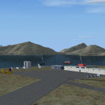
This scenery for FS-2004 as much as possible represents Saglek (CYSV), located at the north of New Foundland, Canada according to photographs found on the Web. This scenery is compatible with Mesh de M.Gilles Gauthier. Several originators took part in the design of this scenery: Regis Dassylva, Gerald Allaire, Gilles Gauthier and Jean-Pierre Fillion, all members of Concepteurs Virtual du Quebec.
| Filename: | CYSV_Canada_New_Foundland_Saglek.zip |
| License: | Freeware |
| Added: | 31st December 2009, 04:53:29 |
| Downloads: | 660 |
| Author: | Regis Dassylva |
| Size: | 2.33 MB |


© 2001-2026 AVSIM Online
All Rights Reserved
Privacy Policy |