
Where Flight Simulation Enthusiasts Gather from Around the World!
AVSIM Library - Search Results

| Category: Flight Simulator 2004 - Scenery | |
| Puerto Vallarta México Airport and Mesh (MMPR) V1 "NEW VERSION" |

|
File Description:
This new version Includes More Objects in the scene, better Ilumination effects, movements in the radar,in the Trees and Vehicles for greater realism. it is not necessary to use the previous version.
| Filename: | Puerto__Vallarta_Mxico_Airport_and_Mesh_MMPR_V1_NE.zip |
| License: | Freeware |
| Added: | 23rd September 2005, 12:33:07 |
| Downloads: | 6,390 |
| Author: | Dr. José Luis Águila Boudib. |
| Size: | 2.56 MB |
| Category: Flight Simulator 2004 - Scenery | |
| Australia, Queensland, Mundubbera (YMDA), Tambo (YTMA) and Caloundra (YCDR) |
|
File Description:
Those are 3 airports that do not have in FS2004 data. I found out that Charley Morton's flight plans and missing in FS2004. Those are little 3 airports that created some detail in improvement.
| Filename: | Australia_Queensland_Mundubbera_YMDA_Tambo_YTMA_an.zip |
| License: | Freeware |
| Added: | 2nd November 2020, 18:45:21 |
| Downloads: | 120 |
| Author: | Stuart John Gilbert II |
| Size: | 2.4 MB |
| Category: Flight Simulator 2004 - Scenery | |
| Altitude adjustment for Dawson City CYDA |
|
Images related to this file:
File Description:
I discovered that the Northern Canada Terrain Mesh that I installed a while back was dumping part of my Dawson City Airport CYDA into a deep hole. I tried making a flatten to reduce the height of the terrain mesh land but that did not look at all realistic. So, the solution is to raise CYDA to 1,457 feet above sea level instead of the correct (correct according to the Nav Canada Supplement) level of 1,215 feet so that it melts into the surrounding terrain. There are still some rocky faces but at least they are not in the airfield. Do you need it? Not if your version looks ok. If it doesn't look ok then try this, but save your current version so you can go back to it if you need to.
| Filename: | Altitude_adjustment_for_Dawson_City_CYDA.zip |
| License: | Freeware, limited distribution |
| Added: | 23rd July 2019, 17:24:26 |
| Downloads: | 104 |
| Author: | Roger Wensley |
| Size: | 855.58 KB |
| Category: Flight Simulator 2004 - Scenery | |
| US North Cascades Mountains and Northwest Washington Coast |
|
File Description:
The files in this package completely replace the FS default landscape of the North Cascades Mountains and coastal areas of northwestern Washington State. Between Bellingham and Arlington (N-S), Orcas Island and Lake Chelan (W-E) you can now enjoy your VFR flights with accurate locations of coastlines, lakes, rivers, streams, roads, railroads, and power lines, as well as land use type (landclass) and terrain (add-on mesh). Also added are the larger glaciers of the majestic North Cascades volcanoes and peaks as well as several forestry roads and clearcuts outside the National Park and Wilderness areas. Made mostly with Christian Fumey's "Ground2K4" and Jim Keir's "Slartibartfast". Fully compatible with the recent freeware LOD10 add-on meshes of the western US. Mesh and landclass files will work in FS2002 but not the special scenery enhancements.
| Filename: | US_North_Cascades_Mountains_and_Northwest_Washingt.zip |
| License: | Freeware, limited distribution |
| Added: | 18th May 2004, 23:12:57 |
| Downloads: | 14,321 |
| Author: | Holger Sandmann |
| Size: | 12.72 MB |
| Category: Flight Simulator 2004 - Scenery | |
| Glacier Bay National Park, Alaska |
|
File Description:
Add-on meshes can greatly improve the detail of the FS terrain but often conflict with the inaccurate placement of the other default FS landscape elements, particularly in coastal and mountainous areas. This project showcases new methods and software that allow for semi-automated development of FS landscapes from accurate source data. The files completely replace the default FS landscape of Southeast Alaska's Glacier Bay National Park and the adjacent Lynn Canal area between Juneau and Skagway (N58-60 W134-138), including shorelines, islands, and lakes, as well as glaciers, landclass, man-made features, and a LOD9 (76-m) terrain mesh. Optional AI floatplane traffic at four seaplane bases is included. A LOD10 (38-m) mesh of the same area is available as a separate optional download. FS2002 users please use fs8glbay.zip instead.
| Filename: | Glacier_Bay_National_Park_Alaska.zip |
| License: | Freeware, limited distribution |
| Added: | 16th February 2004, 03:40:31 |
| Downloads: | 17,196 |
| Author: | Holger Sandmann, Jim Keir |
| Size: | 10.43 MB |
| Category: Flight Simulator 2004 - Scenery | |
| Campbell River floats CAE3 UPDATE |
|
Images related to this file:
File Description:
This update deals with terrain variations that may be caused by an add-on mesh such as the Genesis one that I installed, and which I discovered made small hills that disrupted the fencing and car parks. This flatten will deal with this or a similar problem. If you aren't having a problem then you don't need this.
| Filename: | Campbell_River_floats_CAE3_UPDATE.zip |
| License: | Freeware, limited distribution |
| Added: | 15th July 2010, 01:58:09 |
| Downloads: | 414 |
| Author: | Roger Wensley |
| Size: | 572.44 KB |
| Category: Flight Simulator 2004 - Scenery | |
| Rangitata Island Aerodrome - NZRI |
|
Images related to this file:
File Description:

Rangitata Island Aerodrome is a small airfield located on Rangitata Island, halfway between Timaru and Ashburton, (South Island, New Zealand). Home to the Geraldine Flying Group, De Havillands over New Zealand collection,New Zealand Microlight heritage museum, Shadows of Hawks WWI replica collection and the Ross Brodie Memorial museum and library.
Made to fit Christian Stock's NZ 20m mesh.
| Filename: | Rangitata_Island_Aerodrome__NZRI.zip |
| License: | Freeware |
| Added: | 24th November 2013, 02:16:00 |
| Downloads: | 273 |
| Author: | Godfrey Tier |
| Size: | 1.66 MB |
| Category: Flight Simulator 2004 - Scenery | |
| Lauterbrunnen LSXL |
|
File Description:
Scenery of the Air Glaciers heli base at Lauterbrunnen in the Bernese Oberland. The scenery contains Mönchsjochhütte, the highest refuge in the Bernese Alps, situated South of Mönch. The scenery has been designed in Gmax and optimized for the mesh of Switzerland Professional. In order to save system performance, a series of LODS have been created.
| Filename: | Lauterbrunnen_LSXL.zip |
| License: | Freeware |
| Added: | 13th July 2006, 02:58:06 |
| Downloads: | 3,537 |
| Author: | Michael Röthlisberger |
| Size: | 3.25 MB |
| Category: Flight Simulator 2004 - Scenery | |
| CTH3 Canada, Quebec, Les Grandes-Bergeronnes |
|
Images related to this file:
File Description:
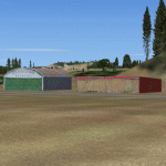
This is the scenery Les Grandes Bergeronnes (CTH3), which represents the reality. Les Grandes Bergeronnes is a small village located on Northern bank of the St-Laurent river of Quebec at Canada. This scenery is designed with FSDS and it accepts Mesh of Gilles Gauthier. This scenery functions for both FS-2004 and FS-X.
| Filename: | CTH3_Canada_Quebec_Les_GrandesBergeronnes.zip |
| License: | Freeware |
| Added: | 2nd January 2010, 19:29:43 |
| Downloads: | 375 |
| Author: | Regis Dassylva |
| Size: | 2.32 MB |
| Category: Flight Simulator 2004 - Scenery | |
| Alaska Scenery Ellamar IZ9 and Tatitlek 7KA |
|
File Description:
2 small sceneries made using Lago's FS Enhancer 2004 (best if used with FSGenesis Alaska-Yukon mesh or some objects may be floating or sunk in terrain).
These are sceneries for two very close spots in Alaska ... They are Ellamar (IZ9), a floatplane dock and scattered houses and Tatitlek (7KA), a small gravel strip with more scattered houses.
| Filename: | Alaska_Scenery_Ellamar_IZ9_and_Tatitlek_7KA.zip |
| License: | Freeware |
| Added: | 6th July 2004, 22:46:45 |
| Downloads: | 1,742 |
| Author: | David King |
| Size: | 60.22 KB |


© 2001-2026 AVSIM Online
All Rights Reserved
Privacy Policy |