
Where Flight Simulation Enthusiasts Gather from Around the World!
AVSIM Library - Search Results

| Category: Flight Simulator 2004 - Scenery | |
| Fort Nelson CYYE in British Columbia, Canada |

|
Images related to this file:
File Description:
Fort Nelson is close to the Peace River in the northeast corner of British Columbia, around 70 miles from the northern border, 90 from the eastern border, and 80 miles east of the Rockies. The wartime construction of the Alaska Highway actually started from Fort Nelson, as there was already a road from Fort St John (which is close to Dawson Creek) north to Fort Nelson. The airfield was part of this construction effort and after the wartime ferrying of planes to Russia it was used by the US Army Air Force and then by the Canadian Air Force. Fort Nelson flourished with the oil and gas exploration of the 1950's and the following years, and this continued to grow until the collapse of the oil price in 2014.
The town of Fort Nelson became the capital of the Northern Rockies Regional District when it was founded in 2009, and as a result the official name of the Fort Nelson airport is the Northern Rockies Regional Airport. The date for this scenery is around 2016, by which time the economic fortunes of the town were in decline. Five times per day flights by Central Mountain Air were starting to be reduced in number to the current (in 2022) one per day and none on Sunday; in the AI included here there are two flights per day. The main resident users of the airport are four helicopter companies, the helicopters presumably used for maintenance trips to whatever parts of the oil and gas fields that are still in use in the surrounding area.
There are two runways, the main one is aligned 03-21, 6,400 feet long and 200 feet wide, with ILS at the southern end and PAPI at the northern. The second runway (a narrower rebuild on a previously existing runway) is aligned 07-25 and 77 feet wide, and is without any lights. These are the alignments as per the original build of FS9 and not as per the approximate 2016 date of the buildings; I had a problem at a very late stage in making this scenery which prevented me from continuing with some final details.
On YouTube there is a series of posts by Angle of Attack showing the preparation and then the flight of an old Cessna 172 from Homer to Oshkosh for the installation of modern instruments. Interesting for me as they visit or fly over airfields I have made (Homer, Merrill, Tok Junction, Burwash, Silver City, Haines Junction, Watson Lake, Fort Nelson, and Grande Prairie) but in the winter so it all looks very different.
| Filename: | Fort_Nelson_CYYE_in_British_Columbia_Canada.zip |
| License: | Freeware, limited distribution |
| Added: | 23rd January 2022, 20:11:18 |
| Downloads: | 186 |
| Author: | Roger Wensley |
| Size: | 28.35 MB |
| Category: Flight Simulator 2004 - Scenery | |
| Wakefield riverfront in Quebec Canada |
|
Images related to this file:
File Description:
The village of Wakefield is 18 miles northwest of Ottawa on the west shore of the Gatineau River, and I seem to have been flying north up that river from Rock cliffe for years, past the village in a bend of the river just a few miles north of Cascades float base. It is where the tourist steam train goes through, and by "through" I mean that literally as the tracks are at the side of the main street, and one of the things it goes past is the Black Sheep Inn which hosts Canadian musical groups and individuals at the weekends. Though the radio in Ottawa uses the name in English it is actually and visibly called "Mouton Noir" on the sign. There is no airfield, and no float base. There aren't even all the buildings that are on the riverfront as it stretches further south and north. There is a public dock where you can tie up. Apart from the fact that the idea caught my fancy one afternoon outside the Mouton Noir I really can't think why I made this.
| Filename: | Wakefield_riverfront_in_Quebec_Canada.zip |
| License: | Freeware, limited distribution |
| Added: | 1st May 2010, 00:39:24 |
| Downloads: | 406 |
| Author: | Roger Wensley |
| Size: | 11.23 MB |
| Category: Flight Simulator 2004 - Scenery | |
| WIOO Pontianak/Supadio, Kalimantan, Indonesia |
|
Images related to this file:
File Description:
Googly scenery for WIOO Pontianak/Supadio, Kalimantan, Indonesia. In Flight Simulator
2004 only a general aviation parking is provided at this important Indonesian domestic
airport, but in the real world it is served over fifteen times
a day by jets and smaller aircraft of Adam Air, Airfast Service, Batavia Air, Deraya
Air Taxi, Indonesia Air Transport, Sriwijaya Air and Tri-MG Intra Asia Airlines. These
scenery files add aprons, taxiways, buildings and other airport features to Flight
Simulator's limited representation and allow "AI" traffic to land, taxi, park and
take off in a realistic manner.
The scenery does not purport to be ultra-accurate. Based on high-detail satellite
imagery from Google Earth, the layout is proportionally correct but the added
airport features, such as buildings, are built from default Microsoft objects
and add-on libraries so will not look like the real thing.
You are not obliged to download and install any additional scenery libraries,
but to enjoy this scenery in its entirety, you may wish to. It will work fine,
with or without.
[File re-uploaded at request of AVSIM]
| Filename: | WIOO_PontianakSupadio_Kalimantan_Indonesia.zip |
| License: | Freeware |
| Added: | 15th May 2010, 01:10:01 |
| Downloads: | 1,962 |
| Author: | John Hinson |
| Size: | 64.96 KB |
| Category: Flight Simulator 2004 - Scenery | |
| MRE Mara Serena, Kenya |
|
File Description:
Googly scenery for Mara Serena, Kenya, a small airfield serving the Mara Serena
Safari Lodge in the Masai Mara National park. The original metalled runway has
fallen into disuse and these days a rough dirt runway alongside it is used by
the twice daily flights of Air Kenya Express to and from Nairobi and the
occasional light aircraft.
Flight Simulator 2004 has made no provision for traffic with only a runway
provided and this scenery seeks to redress the situation. The airport has no
ICAO code (MRE is the IATA code) but Microsoft Flight Simulator has created an
unofficial ICAO of HK0A.
The scenery does not purport to be ultra-accurate. Based on high quality
satellite imagery from Google Earth, the layout is proportionally correct but the
added airport features, such as buildings, are built from default Microsoft objects
and add-on libraries so will not look exactly like the real thing.
You are not obliged to download and install any additional scenery libraries,
but to enjoy this scenery in its entirety, you may wish to. It will work fine,
with or without.
| Filename: | MRE_Mara_Serena_Kenya.zip |
| License: | Freeware |
| Added: | 16th April 2008, 19:19:33 |
| Downloads: | 988 |
| Author: | John Hinson |
| Size: | 68.01 KB |
| Category: Flight Simulator 2004 - Scenery | |
| YEVD Evans Head Memorial, Australia |
|
File Description:
Googly scenery for YEVD Evans Head Memorial, a former RAAF Training base in
New South Wales, Australia, now reduced to a single runway and small apron.
In its heyday it was home to the RAAF No 1 Bombing and Gunnery and the RAAF No 1
Air Observers Schools and it was said to be the largest training base in the
southern hemisphere - at that time it had four runways.
Flight Simulator 2004 has made no provision for traffic with only a runway
provided and this scenery seeks to redress the situation so that you and your
"AI" traffic can use the airport.
The scenery does not purport to be ultra-accurate. Based on high quality
satellite imagery from Google Earth, the layout is proportionally correct but the
added airport features, such as buildings, are built from default Microsoft objects
and add-on libraries so will not look exactly like the real thing.
You are not obliged to download and install any additional scenery libraries,
but to enjoy this scenery in its entirety, you may wish to. It will work fine,
with or without.
| Filename: | YEVD_Evans_Head_Memorial_Australia.zip |
| License: | Freeware |
| Added: | 19th April 2008, 10:23:02 |
| Downloads: | 544 |
| Author: | John Hinson |
| Size: | 71.78 KB |
| Category: Flight Simulator 2004 - Scenery | |
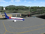
| Terrace CYXT in BC Canada Updated |
|
Images related to this file:
File Description:
This version of Terrace has night textures that work, good news for the 319 downloaders who did not tell the author that the ones already posted did not work. Why? Terrace is fifteen miles east and inland from Prince Rupert, which is 500 miles north of Vancouver up the BC coast. It is at the point in the mountains where two fjords meet, one coming from Prince Rupert and the other from Kitimat. There are two runways, the main one is a recently-extended 7,500 feet long and lighted 33/15 and the second is 5,373 feet of unlit 03/21. The apron has been enlarged to be able to accomodate a Boeing 737; though I don't think there is an airline using a 737 for flights to Terrace I have parked an Air Canada jet and the pics show the planes that do fly to Terrace, Air Canada and Hawk Air Dash 8-300's. The aircraft and the textures are down-loadable and and can be used for AI.
| Filename: | Terrace_CYXT_in_BC_Canada_Updated.zip |
| License: | Freeware, limited distribution |
| Added: | 3rd July 2010, 03:28:31 |
| Downloads: | 1,064 |
| Author: | Roger Wensley |
| Size: | 3.72 MB |
| Category: Flight Simulator 2004 - Scenery | |
| Terrace CYXT in British Columbia, Canada - REVISED |
|
Images related to this file:
File Description:
This version includes the correct Piper Cub texture, unreported by all but one downloader (why?).
Terrace is fifteen miles east and inland from Prince Rupert, which is 500 miles north of Vancouver up the BC coast. It is at the point in the mountains where two fjords meet, one coming from Prince Rupert and the other from Kitimat. The airport is a couple of miles south of the town and on the south side of the Skeene River. There are two runways, and the main one is a recently-extended 7,500 feet long and lighted 33/15. The second is 5,373 feet of unlit 03/21. The apron has been enlarged to be able to accommodate a Boeing 737 so I have parked an Air Canada jet there, but the pics show the planes that do fly to Terrace, and these are Air Canada and Hawk Air Dash 8-300's. The original aircraft and the textures are down-loadable and and can be used for AI.
| Filename: | Terrace_CYXT_in_British_Columbia_Canada__REVISED.zip |
| License: | Freeware, limited distribution |
| Added: | 21st February 2010, 16:25:38 |
| Downloads: | 1,109 |
| Author: | Roger Wensley |
| Size: | 3.39 MB |
| Category: Flight Simulator 2004 - Scenery | |
| CYYN Swift Current Municipal Airport |
|
File Description:
Swift Current Municipal airport is situated approximately 8 km east of the City of Swift Current. It is one of those tiny airports where the default flightsim scenery has no resemblance to the real world airport. CYYN was constructed using GMAX and represents the airport as it was in the Summer of 2007. It includes nearly all the buildings at the airport, runway signs, the addition of fencing, and a rotating beacon. CYYN also includes a landclass file to better represent the terrain around the airport, at least as far as the limits of the default landscape will allow. The airport has a long history, being built in 1937, as one of the hundred-mile airports on the Trans Canada airway. It was greatly expanded as an RCAF / RAF station during world war II. Many of the wartime structures still exist but many are in poor shape. Two of the original three runways remain in service. The airfield is often used by 15 Wing aircraft of CFB Moose Jaw to practice approaches.
| Filename: | CYYN_Swift_Current_Municipal_Airport.zip |
| License: | Freeware |
| Added: | 30th August 2008, 03:25:36 |
| Downloads: | 1,342 |
| Author: | Gregory Putz |
| Size: | 5.28 MB |
| Category: Flight Simulator 2004 - Scenery | |
| Sigonella AB - Sicily, Italy |
|
Images related to this file:
File Description:

Naval Air Station Sigonella, "The Hub of the Med", is a U.S. Navy installation at NATO Base Sigonella and an Italian Air Force base in Sicily, Italy. Although a tenant of the Italian Air Force, NAS Sigonella acts as landlord to more than 40 other U.S. commands and activities. It is located 15 km west and 11 km south of the city of Catania. Sigonella also serves as an Italian base for the 41º Stormo Antisom (41st Antisubmarine Warfare Wing). Among the aircraft that fly from this island base are U.S. Air Force C-130, C-17 and C-5 airlifters as well as KC refueling aircraft and a rotating squadron of forward-deployed U.S. Navy P-3 Orions. The Italian Air Force also fields the venerable Breguet Atlantic patrol aircraft. It is one of the most frequently used stops for U.S. airlift aircraft bound from the continental United States to Southwest Asia and the Indian Ocean. Scenery contains all new 3D models and AI aircraft. Package is stand-alone but additional downloads may be helpful (see docs for details).
| Filename: | Sigonella_AB__Sicily_Italy.zip |
| License: | Freeware, limited distribution |
| Added: | 3rd June 2014, 06:25:24 |
| Downloads: | 2,099 |
| Author: | John Stinstrom |
| Size: | 4 MB |
| Category: Flight Simulator 2004 - Scenery | |
| Kimmirut CYLC on Baffin Island in Nunavut, Canada |
|
Images related to this file:
File Description:
Kimmirut is a village of some 400 folks at the southern end of the southwest-facing coast of Baffin Island, 75 miles southwest of Iqaluit. It is on the northern side of the Hudson Strait between Baffin Island and Quebec, opposite Kangiqsujuaq on the Quebec shore. The airfield is served by two flights per week, one on Monday and another on Friday, only half fueled to be able to use the 1,899' of gravel 75' wide runway. The terminal building is small and there is a garage building for airport maintenance vehicles (snow clearing). There are some nearby buildings that I have included. The village is "represented" (not "modeled") with approximately the right shape and road layout. Take enough fuel so that you can leave again, as fuel is no longer for sale here. The Cape Dyer bgls are to make a small correction, it is explained in the text. I will not be posting new sceneries in the future and this is the last one for Avsim; it completes Baffin Island.
| Filename: | Kimmirut_CYLC_on_Baffin_Island_in_Nunavut_Canada.zip |
| License: | Freeware, limited distribution |
| Added: | 25th July 2011, 17:36:57 |
| Downloads: | 534 |
| Author: | Roger Wensley |
| Size: | 2.53 MB |
© 2001-2026 AVSIM Online
All Rights Reserved
Privacy Policy |