
Where Flight Simulation Enthusiasts Gather from Around the World!
AVSIM Library - Search Results

| Category: Flight Simulator 2004 - Scenery | |
| KGEG - Spokane Intl Airport - Washington, USA |

|
Images related to this file:
File Description:

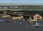
Spokane International Airport (KGEG) is a medium size regional airport in the North of the United States (Washington State). It is serviced daily by Southwest Airlines, Alaska Airlines, American Airlines, Delta Airlines and United Airlines. This scenery included the new build terminal C and its parking area. It is a further development of the great work of William Morgan (Frame-Raste-Friendly-Studio '©), so many thanks for his work founding this new creation of Spokane Intl Airport.
| Filename: | KGEG__Spokane_Intl_Airport__Washington_USA.zip |
| License: | Freeware |
| Added: | 1st May 2016, 21:02:48 |
| Downloads: | 1,409 |
| Author: | David Kolas |
| Size: | 22.82 MB |
| Category: Flight Simulator 2004 - Scenery | |
| Gallatin Field - Bozeman, MT |
|
Images related to this file:
File Description:
Scenery for Gallatin Field in Bozeman, Montana. Scenery was created for FS9, but should work in FSX. It was created completely in Gmax and separately compiled, so no other libraries are needed. Also included is a landclass file to create the town of Belgrade immediately southwest of the airport, which didn't even exist in the default scenery. Landclass was also updated to change the areas north of the airport to it's actual agricultural use rather than the small forests depicted in the default.
| Filename: | Gallatin_Field__Bozeman_MT.zip |
| License: | Freeware, limited distribution |
| Added: | 28th December 2009, 11:35:54 |
| Downloads: | 2,927 |
| Author: | Gary Widup |
| Size: | 1.28 MB |
| Category: Flight Simulator 2004 - Scenery | |
| 4AK6 - Wolf Lake - Anchorage, Alaska - USA |
|
Images related to this file:
File Description:
Wolf Lake 4AK6 is in Alaska, some 10 miles northeast of Wasilla, on the north side of Knik Arm. It is an airpark, with houses and hangars adjacent to a runway that is 3,800 feet of asphalt aligned 06-24. The runway is lit but the taxiways are not. There is a second runway that is around 2,500 feet long and aligned 36-18, which is grass and unlit. The C-130 is permanently parked, and seeing it land would have been interesting.
| Filename: | 4AK6__Wolf_Lake__Anchorage_Alaska__USA.zip |
| License: | Freeware, limited distribution |
| Added: | 15th October 2014, 13:38:39 |
| Downloads: | 372 |
| Author: | Roger Wensley |
| Size: | 7.32 MB |
| Category: Flight Simulator 2004 - Aircraft Repaints, Textures and Modifications | |
| Italian Air Force, North American F-86E/Canadair CL-13 MkIV, "Frecce Tricolori" (Final livery) |
|
File Description:
Textures only for an aircraft belonged to "Frecce Tricolori" Aerobatic Team (313Grp., Rivolto, Italy 1961).
These textures require the FREEWARE original aircraft package by Kirk Olsson (sabrejet.zip). Installation instructions are included.
| Filename: | Italian_Air_Force_North_American_F86ECanadair_CL13.zip |
| License: | Freeware |
| Added: | 8th May 2006, 19:32:13 |
| Downloads: | 333 |
| Author: | Manuele Villa |
| Size: | 2.77 MB |
| Category: Flight Simulator 2004 - Panels | |
| North American F-86 Sabre panel enhancement for F-86 Sabre "Hard wing" model PATCH |
|
File Description:
patch for the FS9 F-86 Sabre panel enhancement for the F-86 Sabre "Hard wing" model.Gauges from lots of brilliant and helpfull designers File F-86.zip required
| Filename: | North_American_F86_Sabre_panel_enhancement_for__F8.zip |
| License: | Freeware |
| Added: | 13th May 2006, 20:45:43 |
| Downloads: | 3,164 |
| Author: | Luis da Costa Pereira & Fabio Bonoldi |
| Size: | 45.32 KB |
| Category: Flight Simulator 2004 - Aircraft Repaints, Textures and Modifications | |
| French Air Force North American Aviation T-6G Texan/Harvard EALA 11/72 Algeria 1957 |
|
File Description:
This is a repaint of the payware Alphasim North American T-6 Harvard/Texan in the markings of a T-6G (s/n (52-8227) operated by the French Air Force (Escadrille d'Avions Legers d'Appui EALA 11/72) during the the Summer of 1957. Textures only. This particular machine is one of three that briefly sported these colorful cowl markings during the Summer of 1957. In the event this comic strip character was not accepted as the official unit marking and aircraft of EALA 11/72 were adorned with a more conventional badge located on the rudder tip instead.
| Filename: | French_Air_Force_North_American_Aviation_T6G_Texan.zip |
| License: | Freeware |
| Added: | 14th April 2007, 18:43:20 |
| Downloads: | 460 |
| Author: | Michel Gerard |
| Size: | 844.45 KB |
| Category: Flight Simulator 2004 - Scenery | |
| Kivitoo, Paulatuk, Qikiqtarjuak, Rowley Island, & West Baffin, adapted for FSGenesis 76m North Canada Terrain Mesh |
|
Images related to this file:
File Description:
These are replacement bgl's to convert five northern Canada fields for use with the FSGenesis 76m terrain mesh for northern Canada. The five are Kivitoo CWFK, Paulatuk CYPC, Qikiqtarjuak CYVM, Rowley Island CWFR, and West Baffin CWFW. These are not stand-alone, and the presumption is that you have already downloaded and installed the previously posted sceneries. This installation consists solely of replacing the existing scenery bgl's with the new. This is the last post of adapted northern airfields (unless more are discovered needing revision) and observations regarding and any further corrections that are required would be welcomed.
| Filename: | Kivitoo_Paulatuk_Qikiqtarjuak_Rowley_Island__West_.zip |
| License: | Freeware, limited distribution |
| Added: | 18th September 2017, 22:28:33 |
| Downloads: | 87 |
| Author: | Roger Wensley |
| Size: | 3.02 MB |
| Category: Flight Simulator 2004 - Scenery | |
| Frozen Canadian & USA Rivers & Lakes Revision |
|
Images related to this file:
File Description:
This "freezes" all lakes and rivers for winter flying and means they can be landed on with skis or wheels; it is meant for low level flying rather than high level jet flights. This edition is complete in itself and now really covers all of Canada and parts of the USA along the border, including large parts of Michigan, Wisconsin, Minnesota, North Dakota, and Montana. It is reversible with an "untick" in the FS scenery library. The revision is the addition of frozen sea in the area of Baffin Island (where I and Sid & Pete have recently posted all of the Baffin Island airfields) as I missed this area last time. Sorry about that. I have spent some time making sure that the sea and the inlets along the coast in the south do not get frozen too, and also some of the lakes that are close to the coast and rarely get cold enough to freeze over. The Great Lakes do not usually totally freeze, but this is an either ON or OFF modification and partial freezing cannot be convincingly simulated, so I went for total ice. Along the north shore I went for the peak of the winter with sea ice all the way to the permanent polar cap; this is not totally realistic as there is usually a partially open lead along the coast, but as with the Great Lakes...... It will work without Ultimate Terrain, but as UT is what gets all the lakes and rivers there and in the right place (except in the far north) it is obviously much improved with UT. The pics show Rockcliffe in the winter with the frozen Ottawa River for real and in FS for comparison; without UT the river would not be in the right place.
| Filename: | Frozen_Canadian__USA_Rivers__Lakes_Revision.zip |
| License: | Freeware, limited distribution |
| Added: | 6th September 2011, 00:42:43 |
| Downloads: | 622 |
| Author: | Roger Wensley |
| Size: | 1.2 MB |
| Category: Flight Simulator 2004 - Scenery | |
| Dervio scenery - Como lake Italy |
|
Images related to this file:
File Description:
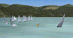
Scenery homage to a beautifull little town in north of Como lake of Italy; builded-up mainly with some existing objects and some buildings sintax made. It DOES NOT INCLUDE any airport, but represents only some pictures of Dervio town, reachable from Como Idroscalo floating airport or Samolaco or Sondrio Caiolo airports (closest ones); this is one of the moorings of Navigazione del Lago di Como. Informations: Dervio is one of the beautiful towns on north east area of Como lake, on a handland created by Varrone river. North and closed to the town, you can find Corenno Plinio old castle and in the opposite side of the lake the S. Bernardo church; you can also have some fireworks, obviously suggested with the night. Contents:
Mooring pier at snack bar, with awning and tables; Ferryboat in the lake with some sailbots in race between two buoys; Walk alongside the shore of the lake, with benches and some fisher piers; Main church with related church house and footbal soil; Several buildings, parking area, factories, bar and restaurant with tables chairs and gazebos, gas station and cars; Rail station with a small train and road gates; Sailbots on ground inside Centro Vela Dervio area and slipway with dinghy; Little marina with boats; Public park with entering gate, covered stand and tables; Residence La Boldona bloks with buildings, swimmin pool and tennis facilities, fenced; Campsite with campers, roulottes and tents; Corenno Plinio castle with tower and S. Bernardo little church; Spread of trees in all the scenery; (night scenery)two floating platforms wiht fireworks; six wood bonfires on shore of lake and on the mountains; One big ship with some other sailboats and speedboats
| Filename: | Dervio_scenery__Como_lake_Italy.zip |
| License: | Freeware |
| Added: | 22nd February 2011, 22:59:46 |
| Downloads: | 950 |
| Author: | Aldo Della Vedova |
| Size: | 12.71 MB |
| Category: Flight Simulator 2004 - Scenery | |
| Brevoort CWOB and BAF-3 radar plus Cartwright LAB-6 radar Canada |
|
Images related to this file:
File Description:
Brevoort airstrip and the BAF-3 radar it serves is on Brevoort Island, off one of the southeastern tips of Baffin Island and 140 miles east of Iqaluit. This scenery includes the BAF-3 buildings on the hilltop and those on the airstrip below, plus the roads connecting them and down to the beach landing area on the rocky coast. This scenery is made for the FSGenesis 76m terrain mesh for northern Canada, and there will be a repost of all my northern Canada airfields to suit this; I cannot think now why I never installed this mesh before. The AI reflects the use of civil airlines for resupply and transportation of personnel. Given the terrain the wind should be from the north so that ai lands using the 02 runway. Landing from the north will involve a terrain clash while take off towards the north will not as the climb out clears the hilltop. The video shows the 600 foot cliff at the runway threshold and an Air Tindi plane on the apron. Cartwright CYCA is on the Labrador coast and has been posted by Flight Ontario as part of their Goose Bay and Labrador Regional Airports sceneries. The nearby LAB-6 radar site is included here, connected to CYCA by an extended road. The site uses the same buildings as Brevoort and Saglek (posted recently) and although I have included them here as separate sceneries the contents can be placed in the same folders as Saglek with a saving in duplicated textures. The textures here are more accurate than Saglek so say yes to over-write; a downloader with personal experience of Brevoort noted that in reality they are lighter.
| Filename: | Brevoort_CWOB_and_BAF3_radar_plus_Cartwright_LAB6_.zip |
| License: | Freeware, limited distribution |
| Added: | 20th August 2017, 15:46:36 |
| Downloads: | 176 |
| Author: | Roger Wensley |
| Size: | 4.37 MB |


© 2001-2026 AVSIM Online
All Rights Reserved
Privacy Policy |