
Where Flight Simulation Enthusiasts Gather from Around the World!
AVSIM Library - Search Results

| Category: Flight Simulator 2004 - Scenery | |
| Bella Coola CYBD in British Columbia, Canada |

|
Images related to this file:
File Description:
Bella Coola is in one of the deep east-west fjords amid the Coastal Range on the coast of BC, approximately mid way between Vancouver and the Alaskan border and some 70 miles inland from the open ocean. The town of Bella Coola has a small population of around 150, while the population of the whole Bella Coola Valley is around 2,000. The valley is warmer in both summer and winter than the surrounding area, and tourism flourishes along with forestry, fishing, and local government administration. Although there is road access, the ferry service is the main connection to larger coastal towns or cities such as Vancouver. The airport, 7 miles east of the town, is connected by daily Pacific Coastal flights to Vancouver and Anahim Lake (to the east). The asphalt runway is 4,200 feet long and aligned 04-22 in FS9 (by 2010 this had changed to 05-23 in reality) and is without lighting of any sort, so it is restricted to daylight hours only. At the eastern end is the terminal building and in the middle the West Coast Helicopter hangar, which has a large fenced paddock-like enclosure in front of it. The helicopters hop over the three feet high fence as they "taxi" to the apron in front of the hanger (but not in FS9!). Between the two there are four other company hangars spread out along the roadway beside the fence. I have never seen the airfield in Summer, and I have not attempted to replicate the apron as it now shows in Google Earth. The screenshots show the main and overwhelming feature of Bella Coola, the large valley amid the steep mountains. This terrain has an inevitable effect on the ai, in that you will never see a plane land as it hits solid rock before it makes it to the runway. You will, however, see them take off. Pacific Coastal currently flies Beechcraft 1900's to Bella Coola; I have used the Saab 340 which I have seen there some years ago and which I prefer.
| Filename: | Bella_Coola_CYBD_in_British_Columbia_Canada.zip |
| License: | Freeware, limited distribution |
| Added: | 25th October 2018, 17:57:06 |
| Downloads: | 286 |
| Author: | Roger Wensley |
| Size: | 14.57 MB |
| Category: Flight Simulator 2004 - Scenery | |
| Prince George CYXS in British Columbia, Canada |
|
File Description:
Prince George is centrally located in British Columbia, mid way between the border with the USA in the south and the northern border with the Northern Territories, and around 100 miles west of the eastern border with Alberta. The town now has a population of around 74,000 and is regarded as the province's northern capital. It is at the meeting point of the Fraser and Nechako rivers and the crossroads of highways 16 and 97. It started out as Fort George in the early 1800's when a trading post was established by the Northwest Company,serviced by paddle boats on the rivers. The railway arrived in the area in 1914 and growth continued, albeit slowly due to wars and the financial collapse of the 1930's. Timber and timber products were and still are the mainstay of the area, along with a military and governmental presence.
The date for this scenery is around 2010. I have made some new buildings from memory and the available information online. They are not totally accurate reproductions; for instance I know that the terminal building is brick faced and also has parts that are stone (or metal?) faced, but where? So I used brick everywhere. The control tower is also brick faced, but is not exactly the right shape. The airport management team have continued to grow the activity and services provided with the result that flights and passenger numbers continue to increase. The 15-33 runway was lengthened to the south, (in the period 2003 to 2005) from the original FS9 scenery 7,400 feet to my updated 11,450 feet with central lighting and ILS at the northern end. This made it the third longest runway in Canada. At the same time a loading/unloading cargo area was created with professionally run storage and also a large scale refueling storage. If DHL want to refuel their 737 then they can do so without making prior arrangements.
The AI included here is for Air Canada Jazz and an Air Canada 737, Westjet 737 and Dash8, a helicopter company that is based there, Pacific Coastal, Central Mountain Air, and GA. The range of airlines and planes reflects the "northern capital" status of the town.
| Filename: | Prince_George_CYXS_in_British_Columbia_Canada.zip |
| License: | Freeware, limited distribution |
| Added: | 11th November 2022, 23:10:19 |
| Downloads: | 161 |
| Author: | Roger Wensley |
| Size: | 28.04 MB |
| Category: Flight Simulator 2004 - AFCAD Files | |
| Birmingham International Airport, Birmingham, Alabama (KBHM) |
|
File Description:
An extremely accurate rendition of the KBHM airport with appropriate gate, cargo and general aviation parkin. I've decided to make it a habit to do airports that one doesn't really see much on FS. Everyone does 300 AFCADs of KORD and there's nothing wrong with that it's a great airport but I figured I didn't need to add another KORD or KLAX to the pile unless I'd be providing something the others lack and I can't seem to find it. So, again, I'll be continuing to do AFCADs I feel are lacking or unavailable or not done well. The BHM airport is definetely not a bustling international port of call and it only receives mainline service from a few carriers but it has a decent amount of traffic and I thought it would be good to represent the airport. Thankfully this time MS did a reasonably good job with terminal space and I was able to include every gate in the two concourses. The great BHM website made my job a breeze by indicating which airlines park at which specific gate(s). Every airline is exactly where they should be as is cargo. A ramp for you VFR general aviation buffs is also available. The only time you might notice some craziness is if you start your flight super early in the morning and you have traffic at 95% +. It seems MS doesn't really "turn" planes in a realistic manner so you end up having more planes parked at the gate in the early morning hours then would be there in real life if they adheared to real world turn around times. Nothing I can do about that. Hope you enjoy your virtual trips in and out of the Birmingham International Airport.
| Filename: | Birmingham_International_Airport_Birmingham_Alabam.zip |
| License: | Freeware |
| Added: | 29th June 2004, 19:31:34 |
| Downloads: | 2,317 |
| Author: | Jason Diaz |
| Size: | 137.07 KB |
| Category: Flight Simulator 2004 - Scenery | |
| Frozen Canadian & USA Rivers & Lakes Revision |
|
Images related to this file:
File Description:
This "freezes" all lakes and rivers for winter flying and means they can be landed on with skis or wheels; it is meant for low level flying rather than high level jet flights. This edition is complete in itself and now really covers all of Canada and parts of the USA along the border, including large parts of Michigan, Wisconsin, Minnesota, North Dakota, and Montana. It is reversible with an "untick" in the FS scenery library. The revision is the addition of frozen sea in the area of Baffin Island (where I and Sid & Pete have recently posted all of the Baffin Island airfields) as I missed this area last time. Sorry about that. I have spent some time making sure that the sea and the inlets along the coast in the south do not get frozen too, and also some of the lakes that are close to the coast and rarely get cold enough to freeze over. The Great Lakes do not usually totally freeze, but this is an either ON or OFF modification and partial freezing cannot be convincingly simulated, so I went for total ice. Along the north shore I went for the peak of the winter with sea ice all the way to the permanent polar cap; this is not totally realistic as there is usually a partially open lead along the coast, but as with the Great Lakes...... It will work without Ultimate Terrain, but as UT is what gets all the lakes and rivers there and in the right place (except in the far north) it is obviously much improved with UT. The pics show Rockcliffe in the winter with the frozen Ottawa River for real and in FS for comparison; without UT the river would not be in the right place.
| Filename: | Frozen_Canadian__USA_Rivers__Lakes_Revision.zip |
| License: | Freeware, limited distribution |
| Added: | 6th September 2011, 00:42:43 |
| Downloads: | 623 |
| Author: | Roger Wensley |
| Size: | 1.2 MB |
| Category: Flight Simulator 2004 - Scenery | |
| MNPC Puerto Cabezas, Nicaragua |
|
Images related to this file:
File Description:
Googly scenery for MNPC Puerto Cabezas - a small international
airport in Nicaragua for which no facilities are provided in Microsoft Flight
Simulator 2004. These scenery files create the airport and add taxiways, aprons,
buildings and other airport features, so that you and your "AI" traffic can land,
taxi, park and take off in a realistic manner.
The airport, with its new Rigoberto Cabezas terminal opened in 2000, serves the
city of Puerto Cabezas and is surrounded by beautiful beaches and lush scenery.
Unfortunately, the country of Nicaragua has been embroiled in civil unrest almost
continuously since it became an independent republic in 1838, most of which is funded and fuelled by other countries seeking to interfere with Nicaragua's politics. For this reason, the country has no national airline or international flights of its own - the major powers refuse to accept its currency - and commercial traffic is confined to local flights operated by small craft from adjoining countries like those of Atlantic Airlines de Honduras and TACA Regional.
Fortunately, in Flight Simulator you do not need to worry about world politics
and you will be assured of a "virtual" welcome when you call in here. Please
say a small prayer for world peace when you do.
The scenery does not purport to be ultra-accurate. Based on high-detail satellite
imagery from Google Earth, the layout is proportionally correct but the added
airport features, such as buildings, are built from default Microsoft objects
and add-on libraries so will not look exactly like the real thing.
You are not obliged to download and install any additional scenery libraries,
but to enjoy this scenery in its entirety, you may wish to. It will work fine,
with or without. [File re-uploaded at request of AVSIM]
| Filename: | MNPC_Puerto_Cabezas_Nicaragua.zip |
| License: | Freeware |
| Added: | 28th May 2010, 20:36:10 |
| Downloads: | 1,149 |
| Author: | John Hinson |
| Size: | 67.63 KB |
| Category: Flight Simulator 2004 - Scenery | |
| Mielec EPML 2009 |
|
Images related to this file:
File Description:
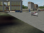
This is third version of EPML airport scenery. Main features of the scenery are: Airport ground high resolution textures - (four seasons + night textures); Highly detailed 3D objects, all photo textured; Detailed autogen and photorealistic trees. For more details please look at the README file attached to the scenery file.
EPML is home base of PZL-Mielec (Polskie Zaklady Lotnicze - Polish Aviation Works), formerly WSK-Mielec and WSK "PZL-Mielec" is the Polish aerospace manufacturer, based inMielec. It has been the biggest Polish post-war aerospace manufacturer. In 2007 it was acquired by Sikorsky Aircraft Corporation, retaining the brand.Starting from 1950, the factory developed much and became the biggest Polish aircraft producer. It was a licensed producer of the Soviet jet fighters MiG-15 (produced as Lim-1), MiG-15bis (Lim-2), MiG-17 (Lim-5) and its Polish attack variant, Lim-6. The first Lim-1s were manufactured of Soviet parts in 1952, a full-scale production started in 1953. About 1500 Lims were built by 1964. In 1957-1960 there were also produced 250 Polish-designed piston trainers TS-8 Bies. From 1963 there was produced Polish-designed jet trainer TS-11 Iskra, being a basic trainer in the Polish military aviation. Its successor, designed with a part of PZL-Mielec, the PZL I-22 Iryda, appeared however a failure for different reasons, mostly lack of proper funding, and only a small series was built.
The most numerous plane built in Mielec was the licensed Soviet Antonov An-2 utility biplane, produced from 1960 in different variants. Over 13,000 of these aircraft were manufactured by 1991, mostly on the Soviet order, but also used in Poland and exported to other countries. From 1984 PZL-Mielec manufactured Soviet STOL transport planes Antonov An-28, as its only producer in the world. The plane was subsequently developed in Mielec and in a modernized variant PZL M-28 Skytruck/Bryza is offered for the Polish Army, Polish Navy and services abroad, with some success.
| Filename: | Mielec_EPML_2009.zip |
| License: | Freeware |
| Added: | 15th May 2010, 09:47:41 |
| Downloads: | 3,780 |
| Author: | Marcin Bobro, Kuba Paczek |
| Size: | 56.33 MB |
| Category: Flight Simulator 2004 - Scenery | |
| EPGO Goraszka 2010 - The Airshow Challenge |
|
Images related to this file:
File Description:
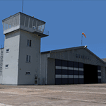
EPGO Goraszka 2010 - The Airshow Challenge is a freeware, extremely detailed scenery of a general aviation airport located 12nm (20km) south-east of Warsaw downtown and Warsaw Frederic Chopin International Airport, Poland. EPGO Goraszka airfield was built in 1994 and currently belongs to a General Aviation company, which offers aero-taxi flights, air transport and special flights (air photo, patrol) and airport services. The airport has a 800m-long runway and a lightened helipad, which can be used by helicopters of up to 5700kg weight. General Aviation's fleet includes Antonov AN-2, PZL-104 Wilga 80, Bell 407 and 427. Since 1996 the International Air Picnic Goraszka is organized every year by the "Polish Eagles" foundation created on initiative of Zbigniew Niemczycki.
The scenery is equipped with an automatic installer. Currently we support a safe, manual way of adding new sceneries to the Scenery Library in Flight Simulator. This is just one thing users need to do for themselves. Detailed instructions will be given during the installation process.
Scenery features:
-Compatible with FS2004 only
-Highest level of accuracy in geographic positioning, modeling and texturing
-Incredibly high quality photoreal textures of all airport buildings. Textures are based on over 300 real world -photographs made for this project.
-Hundreds of 3D objects like tents, exhibitions, airport buildings and surrounding buildings
-Life in the airport: people and cars will enhance your feelings
-AI traffic, animations and effects, designed specifically for FS2004
-Some buildings include interior (control tower)
-High quality aerial photos of the airport surroundings (5 seasons + night) with autogen and water mask
-Ultra high quality aerial photos of the airport (with seasons)
-Plain airport scenery with no airshow objects available too (details in the manual)
-Product includes manual and airport charts in PDF format
EPGO Goraszka 2010 - The Airshow Challenge scenery is compatible with almost every payware add-on, including Ultimate Terrain Eastern Europe and Warsaw Photo Scenery by Simdesign.
Scenery by Drzewiecki Design - www.drzewiecki-design.net
| Filename: | EPGO_Goraszka_2010__The_Airshow_Challenge.zip |
| License: | Freeware |
| Added: | 14th July 2010, 09:49:07 |
| Downloads: | 3,755 |
| Author: | Drzewiecki Design - Stanislaw Drzewiecki, Jakub Paczek |
| Size: | 132.03 MB |
| Category: Flight Simulator 2004 - AFCAD Files | |
| Savannah/Hilton Head International Airport, Savannah, Georgia (KSAV) |
|
File Description:
This is a AFCAD2 file for the Savannah/Hilton Head International Airport. I tried to make the airport as realistic as possable with what is given to me with FS9. Gates 1 and 3 is Delta Connection from Cincinnatti, New York-LGA, and Dallas/Ft. Worth. Gates 5 and 7 are Delta from Atlanta, Gate 2 &2a are Continental Express (Expressjet) From Houston-Bush, and Newark, Gate 4 is Northwest (Mesaba and Pinnacle) from Detroit, Memphis, and Minneapolis, Gate 6 is Independence Air flights from Washington-Dulles (Make sure you have your Independence Air planes coded to BLR. That is what I have the gate coded to which is correct in real life.). Gate 8 is AirTran flights from Atlanta (I also have TRSX AirTran Jet Connect. They no longer fly, but I have them on my AI so I left it in.). Gates 9 and 11 are USAir (Gate 9 being USAir mainline and CRJ-200 flights from Charlotte, Philly and Pittsburgh and Gate 11 being CRJ-200 flights and Dash 8 flights Charlotte, Boston and New York-LGA.). And finally Gate 10 is United Express (Air Wisconsin) flights from Washington-Dulles and Chicago-O'Hare. At the old terminal I have the FedEx, and Airbourne Express/DHL areas, as well as the GA "terminal". North of that is the 165th Airlift Wing National Guard area with parking for their C130's, F-16's, F15's, and their F-18's. I do not have the jetways on yet, however they are done except for the Delta gates....look for them soon. I hope this is a better representation of the airport. I believe it is. All lights on the Taxiways, Runways, as well as landing lights are REAL TO LIFE. They are taken from the airport digrams themselfs as well as from the website www.fltplan.com. Please, let me know what you think as I am using you as an unofficial beta tester for this file.
| Filename: | SavannahHilton_Head_International_Airport_Savannah.zip |
| License: | Freeware |
| Added: | 6th January 2005, 15:12:51 |
| Downloads: | 1,616 |
| Author: | Jason Landuyt |
| Size: | 6.63 KB |
| Category: Flight Simulator 2004 - Aircraft Repaints, Textures and Modifications | |
| Royal Hellenic Air Force Supermarine Spitfire Collection |
|
File Description:
This package includes all the Hellenic Spitfires expect the Spitfire pr Mk.XI witch appeared in one unit and pr Mk.XIII in three units. You can fly the spitfire mk.Vb/c, Spitfire mk.IXe LF/HF and Spitfire Mk.XVIe LF. Greece in 9/23/1938 ordered 12 Spitfires and 12 Anson. During the June of 1939 it was signed the order of 24 Spitfires which cost 9335 pounds each. When Hitler attacked to Poland, England used all the aircrafts that were under construction and of course the Greek were some of them. On 10/12/1943, the 336th Olympus Squadron received the first Spitfire and followed the 335th Tiger Squadron. The Spitfire mk.Vb/c replaced the Hurricane mk.IIb/c. When the two greek Squadrons were at North Africa, their Spitfires wore the
| Filename: | Royal_Hellenic_Air_Force_Supermarine_Spitfire_Coll.zip |
| License: | Freeware, limited distribution |
| Added: | 2nd December 2005, 19:59:29 |
| Downloads: | 3,885 |
| Author: | Delizisis Thanasis, Delizisis Panagiotis, Ken Harrison (Merlin66) |
| Size: | 19.6 MB |
| Category: Flight Simulator 2004 - Scenery | |
| Alaska South Slope 7; Kobuk OBU & Dahl Creek DCK |
|
Images related to this file:
File Description:
There are four main northwestern Alaska towns which are serviced by Alaska Airlines, and from which local flights spread out. The northernmost is Barrow. Southwest of Barrow is Kotzebue, then Nome, and the furthest south is Bethel (not yet made). This is a continuation of the series for the flights from Kotzebue, 170 miles to the east where Kobuk is on the bank of the Kobuk River, and Dahl Creek is 2 miles to the north. Kobuk is a small village on the Kobuk River, like Ambler and Shungnak, but with a population of only around 150. The river is the reason for the existance of the villages as it served (and still does) as both a source of food and a transport route. The airfield is just beside the village, with a runway around 4,500 feet of lit gravel and aligned 09-27, with PAPI on both ends. There are scheduled flights by Era (now renamed Ravn) and by Bering Air, both of them originating in Kotzebue and routing east to Ambler, Shungnak, Kobuk, and then back again. The AI includes these flights along with Everts Air and GA. The FS9 airfield has been relocated by approximately a mile to the correct position, and the elevation accordingly adjusted. The Dahl Creek strip is publicly owned, with no maintenance and a deteriorating gravel runway that has not long to survive. This probably does not work properly without Ultimate Terrain Alaska Canada as the village is now on the river bank. I am presuming that you have downloaded and installed Nome PAOM, along with the instructions on how to adjust Ultimate Terrain Alaska Canada to get the most realistic results. If you are not making the UT adjustments then you may be seeing duplicated roads, as I am including new local dirt or gravel roads to connect village to airfield etc to get the best overall result; I will not be making alternate versions.
| Filename: | Alaska_South_Slope_7_Kobuk_OBU__Dahl_Creek_DCK.zip |
| License: | Freeware, limited distribution |
| Added: | 13th October 2016, 18:10:08 |
| Downloads: | 233 |
| Author: | Roger Wensley |
| Size: | 2.94 MB |


© 2001-2026 AVSIM Online
All Rights Reserved
Privacy Policy |