
Where Flight Simulation Enthusiasts Gather from Around the World!
AVSIM Library - Search Results

| Category: Flight Simulator 2004 - Panels | |
| F16 |

|
File Description:
FS2004 Panel, F16 Air Show Tour. The panel of this jet fighter has been designed for cross country flying to events worldwide. The 2D cockpit is packed with new gauges that complement this high performance, yet docile aircraft. All gauges, lights, etc. are functional, easy to read, and are panel installed except GPS 500. For long distance flights, the panel contains on-demand refueling capabilities for both ground and air operations. A few of the new gauges are; 180-degree scan navigational radar, triple mode interceptor-refueling-terrain radar, refueling gauge with command screen, fuel center with time/distance remaining computer, new Descentometer for Mach-plus aircraft, analog engine gauges including thrust and fuel efficiency, plus a hangar full of warning and indicator lights. The intercept mode of the ai-radar feeds info to the autopilot to assist in the rendezvous with tanker to allow all-weather, day or night air refueling. Digital data for AP, radio, altimeter, timer, and Descentometer is input via a central keypad. Acknowledge ATC instructions using joystick. Designed for use with Kirk Olsson's F16 Viper. Includes 15 page illustrated instructions plus Intercept and Refueling tutorial. By Glenn Copeland
| Filename: | F16.zip |
| License: | Freeware |
| Added: | 12th January 2007, 03:00:43 |
| Downloads: | 5,781 |
| Author: | Glenn Copeland |
| Size: | 1.83 MB |
| Category: Flight Simulator 2004 - Original Aircraft | |
| Druine Turbulent |
|
File Description:
A 'generic' Turbulent, representing no particular aircraft, this is a relatively basic AF99 model, (no animations), dusted down and re-polished for FS2004, and fitted out with a custom set of xml gauges on an aluminium panel. This is definitely an aircraft to be sat in and flown, not examined in detail from the outside, the features just aren't there. An old favourite of mine, first designed "way back when" in A&AF for FS4, now dragged back out of the hanger and used as an ideal "lo & slo" aircraft with photographic VFR scenery and/or a good terrain package, the small panel allowing a much better view in flight than many other aircraft. With a cruise speed of 80kts you'll not be in a hurry to get anywhere, but with a landing speed of around 30kts and a take-off roll of "not a lot" you can operate into and out of any farmstrip. These slow speeds, combined with the relatively good visibility from the cockpit, also make this an ideal aircraft for "tailwheel conversion" ... great if you have problems landing the Extra 300 or possibly even the Cub.
| Filename: | Druine_Turbulent.zip |
| License: | Freeware, limited distribution |
| Added: | 29th May 2006, 12:37:45 |
| Downloads: | 829 |
| Author: | Chris Eve |
| Size: | 1.43 MB |
| Category: Flight Simulator X - Scenery | |
| EKKL-Kalundborg Airport X VFR Photo Scenery |
|
File Description:
Kalundborg Airport – named Kaldred is a small regional field in a comfortable distance from my other FOTOREAL airport EKRK-Copenhagen Airport Roskilde. In the period 1964-76, airfield operations was yearly 15.000-20.000, and in 1976 the heavier aircrafts with retractable gear made it necessary to change the Runway surface from grass to asphalt. In 1981, the closure of Skovlunde Airfield in the Greater Copenhagen Area moved traffic to other locations like EKRK-Roskilde, and investments was made to improve service and facilities at EKKL to attract new customers, being a the perfect hub for aircraft operations to many of the small Danish islands. For many years post and News papers were daily transported by road from print in Copenhagen to Kaldred and flown to EKSS-Samsø (my last released airport).
Today six Air companies reside in Kaldred, together with Kalundborg Flyveklub. Visit Kaldred, and be sure you will get a warm welcome, and as they say in Kalundborg Flying Club, there are always coffee in the clubhouse. Included in the zip file is a version for Ultimate Terrain Europe and Dan-Vfr plus the Default scenery. Enjoy.
| Filename: | EKKLKalundborg_Airport__X__VFR_Photo_Scenery.zip |
| License: | Freeware |
| Added: | 22nd May 2008, 09:17:33 |
| Downloads: | 2,057 |
| Author: | Jens Peter Bruun-Hansen |
| Size: | 22.54 MB |
| Category: Flight Simulator X - Scenery | |
| Ireland VFR Small Airports part 4 |
|
File Description:
Ireland VFR Small Airports Part 4.
Three new airports for FSX, consisting of EI50 Limetree, EI55 Eyne and EICN Coonagh. Limetree and Eyne are 70km southwest of EIDW Dublin. Coonagh is 16km East of EINN Shannon. These airports have been built from scratch, are standalone, and designed to sit on the default terrain. The scenery features custom runways and textures together with full custom models and textures based on real photographs. The scenery has been tested and authenticated by real local pilots. More realistic landclass, autogen rivers and roads have been added to the areas around the airports. It also features many HD textures, AI aircraft and road traffic. The scenery uses seperate elements which can be switched on or off according to the users preference and hardware.
This scenery is real flying 'by the seat of your pants'. There are no lights, navaids, or ILS and runway markings are eaten by the sheep.
Full installation instructions, settings, credits, hints and tips can be found in the README file.
Please enjoy and I hope you like the airports as much as I enjoyed making them.
| Filename: | Ireland_VFR_Small_Airports_part_4.zip |
| License: | Freeware, limited distribution |
| Added: | 15th October 2013, 05:28:25 |
| Downloads: | 2,150 |
| Author: | George Keogh |
| Size: | 164.6 MB |
| Category: Flight Simulator X - Scenery | |
| LGSK - Skiathos Airport, Greece |
|
Images related to this file:
File Description:
LGSK Skiathos Airport Greece.
Skiathos Island lies off the east coast of mainland Greece and is often referred to as 'Europe's St. Maarten' with landing aircraft skimming the beach and the nearby harbour. At 5341feet the runway is short and narrow and usually only captains are allowed to perform landings. Seasonal taffic includes Munich, Gatwick, Rome, Oslo and Stockholm, with scheduled flights to Athens.
This scenery has been designed to sit on the excellent photoreal scenery by Angelo Tassoglou, available here on Avsim, just search for 'Skiathos.zip'. Please note, it will not work with the default terrain. It also uses many objects from my LGKF Kefallinia scenery, also available here at Avsim.
The scenery features added vegetation, detailed airport buildings based on real photographs, animated windsocks, flags, road traffic, people, trees, waves, birds and air traffic. All the scenery files have been divided so they can be switched on or off according to user preference. It has been designed for and tested in DX9 and FSXA only.
Please enjoy and I hope you like my scenery as much as I enjoyed building it.
Required files:
skiathos.zip by Angelo Tassoglou
LGKF Kefallinia by George Keogh
| Filename: | LGSK__Skiathos_Airport_Greece.zip |
| License: | Freeware, limited distribution |
| Added: | 28th January 2013, 00:13:54 |
| Downloads: | 16,016 |
| Author: | George Keogh |
| Size: | 20.47 MB |
| Category: Flight Simulator 2004 - Scenery | |
| St Lawrence Island AK: Gambell PAGM, Savoonga PASA, and Northeast Cape |
|
Images related to this file:
File Description:
St Lawrence Island is in Alaska, but "in" is slightly misleading as it is in fact in the Barents Sea and 120 miles from the Alaska mainland, and only 40 miles offshore of Russia. The island is around 100 miles long, with two villages and at the eastern end an old air force radar base that was cleared away some 25 years ago. Gambell is one of the two villages and is at the far western end of the island, with a population of around 700 living mainly from the sea. This northern airfield is unusual in that it has an asphalt runway and apron, the lit runway being aligned 16-34 and just over 4,500 feet long. The reason for the asphalt becomes apparent if you try walking in the vicinity, as underfoot there are rounded pebbles down to varying depths, and they are quite small and eventually slippery enough to trip you up. To base a flexible gravel runway on top of this would have been difficult, and when it was originally built it was for an air force base (closed long ago). The village is also fairly unique among northern settlements in that it has wind turbines and also solar panels. The second village is Savoonga and is around 40 miles east of Gambell with a similar population. The runway here is lit gravel aligned 5-23 and 4,900 feet long. This village also has wind turbines and solar panels. There are no vehicles (cars, pickups, trucks etc) on the island, mainly because there is nowhere far to go to and in the case of Gambell because roads as such would be difficult to create. ATV's are the standard way to go, along with small boats for fishing and whaling. At the eastern and of the island the remaining traces of the air force radar base are just the gravel runway and aprons, included with the Savoonga scenery. The AI included here is for daily flights from Nome by ERA and Bering Air, along with some GA. Also included here is the EZ library that includes the wind turbines, to save you looking for it. Installing this will also mean that a wind farm in my Cyprus scenery wii now be visible to the north of Larnaca, and there are other libraries in the series that include useful objects. The Lens_EZ_Animated library could go into your static objects folders, which is where I have it; up to you.
| Filename: | St_Lawrence_Island_AK_Gambell_PAGM_Savoonga_PASA_a.zip |
| License: | Freeware, limited distribution |
| Added: | 29th February 2020, 00:09:36 |
| Downloads: | 222 |
| Author: | Roger Wensley |
| Size: | 11.59 MB |
| Category: Flight Simulator X - Scenery | |
| Iguassu Falls - Save The Planet |
|
Images related to this file:
File Description:
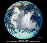
The Iguassu Falls, Itaipu Hydroelectric Power Plant, Foz do Iguassu City and Land Class Package for FSX
Save The Planet is my version of the Iguassu Falls, Itaipu Dam, bridges and landclass scenery for FSX.
Differently from my other version for MSFS 2004, I created a mesh of 5 meter resolution for Iguassu Falls area
to give me some idea how I could proceed. So, I decided to use on this addon
an image background avaliable at server (VirtualEarthSatellite). Thanks Microsoft.
Non-Airport Scenery - ICAO (SBFI). coming soon at www.Terra-Brasilis.org
Portuguese: Cataratas do Iguassu,
Spanish: Cataratas del Iguazu are waterfalls of the Iguassu River located on the border of the Brazilian state of Parana (in the Southern
Region) and the Argentinian Province of Misiones.
The Falls are shared between the Iguazu National Park (Argentina) and Iguacu
National Park (Brazil). The parks were designated UNESCO World Heritage Sites.
The Itaipu Hydroelectric Power Plant is located in the Parana River, in the stretch of the frontier between Brazil and Paraguay, 14 km north of the Friendship Bridge.
The area of the project extends from Foz do Iguassu, in Brazil, and Ciudad del Este, in Paraguay, in the south, up to Guaira (Brazil) and the Guaira Falls (Paraguay), in the north.
Enjoy FSX Iguassu Falls Scenery!
| Filename: | Iguassu_Falls__Save_The_Planet.zip |
| License: | Freeware |
| Added: | 9th December 2010, 01:57:00 |
| Downloads: | 2,849 |
| Author: | Cicero Costa |
| Size: | 31.71 MB |
| Category: Prepar3D V1-4 - Scenery | |
| TNCA - Queen Beatrix International Airport - Aruba |
|
File Description:
The scenery was made using the Airport Design Editor, ModelConverterX, FSEarthTiles, SketchUp 2017 an others.
Queen Beatrix International Airport (Dutch: Internationale luchthaven Koningin Beatrix; Papiamento: Aeropuerto Internacional Reina Beatrix), colloquially known as Aruba Airport (IATA: AUA, ICAO: TNCA), is an international airport located in Oranjestad, Aruba. It has flight services to the United States, several countries in the Caribbean, the northern coastal countries of South America, Canada, as well as some parts of Europe, notably the Netherlands.
It is named after Beatrix of the Netherlands, who was Queen of the Netherlands from 1980 to 2013.
The airport offers United States border preclearance facilities. A terminal for private aircraft opened in 2007. The airport used to serve as the hub for bankrupt airline Air Aruba, which was for many years an international airline. Before Aruba's separation from the Netherlands Antilles in 1986 it was also one of three hubs for ALM Antillean Airlines as well as a home base for Tiara Air until 2016.
This scenario was only tested on P3Dv4.5.
History - fron Wikipedia.com
| Filename: | TNCA__Queen_Beatrix_International_Airport__Aruba.zip |
| License: | Freeware |
| Added: | 8th May 2021, 17:39:28 |
| Downloads: | 678 |
| Author: | Eduardo Puelker |
| Size: | 3.78 MB |
| Category: Prepar3D V1-4 - Scenery | |
| Piarco International Airport - TTPP V1.2 |
|
File Description:
TTPP v1.2 - In this version, problems with markings in tax lanes have been fixed. The textures of the taxi stands have also been redone. More vehicles and vegetation were included.
Piarco International Airport (IATA: POS, ICAO: TTPP) is an international airport serving the island of Trinidad and is one of two international airports in Trinidad and Tobago. The airport is located 30 km (19 mi) east of Downtown Port of Spain, located in the adjacent town of Piarco. It is the seventh busiest airport in the Caribbean in terms of passengers served[6] and third busiest in the English-speaking Caribbean, after Sangster International Airport and Lynden Pindling International Airport. The airport is also the primary hub and operating base for the country's national airline, as well as the Caribbean's largest airline, Caribbean Airlines.
Piarco International Airport has direct scheduled service to destinations in the United States, Canada, Central America, South America and Europe. It is also a significant transit hub for the Southern Caribbean and serves as the primary connection point for many passengers travelling from Guyana.
| Filename: | Piarco_International_Airport__TTPP_V12.zip |
| License: | Freeware |
| Added: | 4th February 2022, 03:49:10 |
| Downloads: | 561 |
| Author: | Eduardo Puelker |
| Size: | 53.65 MB |
| Category: Flight Simulator 2004 - Original Aircraft | |
| de Havilland Chipmunk |
|
Images related to this file:
File Description:

Re-upload following Avsim hack. The Chipmunk first flew in 1946. There were numerous variations built in both Canada and Great Britain as a trainer aircraft to replace the Tiger Moth biplane. More than 500 Chipmunks remain airworthy throughout the world today. This aircraft has has been constructed using Gmax v1.2. The aircraft is constructed with as few polygons as possible and with a single texture file to ensure the absolute minimum impact on your framerates. The model has six LODs with the main model having just 2522 polygons (faces/triangles).I would like to especially thank Ray Blake who has kindly made all ten high quality textures for this package.
It is also quite fun to fly as a normal aircraft, but was originally designed specifically to enhance the AI aircraft population and to use with the marvellous GA-Traffic programme by Markus Brunner . The file for GA-Traffic can be found at Avsim: "ga-traffic_setup.zip".
The paintkit is being posted as a separate zip file.
Further information on the DHC Chipmunk can be found at Wikipedia: http://en.wikipedia.org/wiki/De_Havilland_Canada_Chipmunk
| Filename: | de_Havilland_Chipmunk.zip |
| License: | Freeware, limited distribution |
| Added: | 31st August 2010, 23:46:57 |
| Downloads: | 3,151 |
| Author: | Mike Cronin model and paintkit, Ray Blake textures |
| Size: | 2.4 MB |


© 2001-2026 AVSIM Online
All Rights Reserved
Privacy Policy |