
Where Flight Simulation Enthusiasts Gather from Around the World!
AVSIM Library - Search Results

| Category: Flight Simulator X - AFCAD Files | |
| KFLL - Fort Lauderdale-Hollywood Intl. - Florida, USA |

|
Images related to this file:
File Description:
KFLL has undergone over a billion dollar renovation in the past several years and construction continues. This release features new runways, taxiways, and aprons, FBOs, fire station, POL facilities, FedEx facility, access roads, enhanced scenery and terrain masks, and parking,(including hangar parking) for 185 aircraft. Since this release shows the airport as of 2014-12-15 - the most recent Google earth image, I suggest you review the readme notes before downloading.
| Filename: | KFLL__Fort_LauderdaleHollywood_Intl__Florida_USA.zip |
| License: | Freeware |
| Added: | 10th October 2015, 11:33:00 |
| Downloads: | 2,277 |
| Author: | Allen Laughmiller |
| Size: | 53.17 KB |
| Category: Flight Simulator 2004 - AFCAD Files | |
| Ipswich Airport, United Kingdom (IPW) |
|
File Description:
This is a modified AFCAD for the now closed airport at Nacton/Ipswich in Suffolk UK. It has been designed to work in Just flight�s VFR photographic scenery and terrain. ICAO code I believe is IPW.
AI parking is based upon actual photographs but may not be exact
Hope you enjoy it, use as you will.
Thanks to all those designers of VFR and AFCAD more making flight simming more enjoyable
| Filename: | Ipswich_Airport_United_Kingdom_IPW.zip |
| License: | Freeware |
| Added: | 27th May 2005, 12:54:11 |
| Downloads: | 334 |
| Author: | Timothy Mayhew |
| Size: | 2.82 KB |
| Category: Flight Simulator 2002 - Scenery Design | |
| TDFCalc3 |
|
File Description:
This package is for FS2002 and CFS2 TDF scenery designers.
TDFCalc3 is a utility that will derive all the necessary Cell, Area, and Point information needed to create TDF polyons and lines, as outlined in the FS2002 Terrain SDK. It also gives latitude, longitude and ground elevation. All this is done automatically, through the use of FSUIPC.
FSUIPC must be installed as a module to FS2002, or CFS2, in order for this utility to work.
| Filename: | TDFCalc3.zip |
| License: | Freeware |
| Added: | 16th October 2002, 20:12:57 |
| Downloads: | 642 |
| Author: | Richard Ludowise |
| Size: | 206.44 KB |
| Category: Flight Simulator 2002 - Scenery Design | |
| LandCalc2 |
|
File Description:
This package is for FS2002 and CFS2 LandClass and photoreal scenery designers.
LandCalc2 is a utility that will derive all the necessary information needed to create LandClass BGLs using CUSTOM textures, as outlined in the FS2002 Terrain SDK. It also gives latitude, longitude and ground elevation. All this is done automatically, through the use of FSUIPC.
FSUIPC must be installed as a module to FS2002, or CFS2, in order for this utility to work.
| Filename: | LandCalc2.zip |
| License: | Freeware |
| Added: | 22nd October 2002, 21:48:58 |
| Downloads: | 1,196 |
| Author: | Richard Ludowise |
| Size: | 233.2 KB |
| Category: Flight Simulator 2002 - Scenery | |
| Lower Chahalis River Valley |
|
File Description:
The Chahalis river is seen flowing past my recent scenery called Elma Municipal Airport. (elma2k2.zip) It empties into Gray's harbor right next to Bowerman Field, still another of my uploads. (bman2k2.zip) This scenery provides photo-real terrain connecting these two projects. You'll be able to follow the river and freeways all the way from Elma to the coast, and see the towns of Montesano, Aberdeen, and Hoquiam along the way.
| Filename: | Lower_Chahalis_River_Valley.zip |
| License: | Freeware |
| Added: | 18th February 2003, 13:37:07 |
| Downloads: | 928 |
| Author: | Bob Bernstein |
| Size: | 6.97 MB |
| Category: Miscellaneous Files - General Utilities | |
| Image Tool |
|
File Description:
This handy utility will resize and resample your images using a variety of top-of-the-line filters so as to obtain the best result.
Useful for those making custom terrain (photo-real ground textures) for Microsoft Flight Simulator.
Also quite handy for resizing screenshots to AvSim Forum limits without losing quality.
Elrond has kindly consented to have this tool placed in the AvSim library.
| Filename: | Image_Tool.zip |
| License: | Freeware |
| Added: | 21st September 2003, 18:43:12 |
| Downloads: | 2,478 |
| Author: | Elrond Elvish |
| Size: | 327.23 KB |
| Category: Flight Simulator X - Scenery | |
| Puerto Ordaz (SVPR) - Venezuela |
|
File Description:
The International Airport Manuel Carlos Piar, is the sixth airport
in importance inside Venezuela and the principal air terminal of the
south of the country. Puerto Ordaz is a planned city in southern Venezuela.
Founded in 1952 as a mining export port on the banks of the Caroni River.
Photo-terrain area improved with Autogen files.
Only compatible with versions to FSX, P3Dv1.x or P3Dv2.x.
Also includes a friendly Auto-Install.
| Filename: | Puerto_Ordaz_SVPR__Venezuela.zip |
| License: | Freeware |
| Added: | 17th March 2014, 05:33:05 |
| Downloads: | 2,238 |
| Author: | David Maldonado |
| Size: | 104.69 MB |
| Category: Flight Simulator 2004 - Scenery | |
| Gatwick International Airport |
|
File Description:
UK2000 Scenery has introduced a new range of good quality add-ons that are totally FREE, these are designed for users on a budget, a slower PC or just what a basic scenery that is still miles better than the MSFS default. This is Gatwick for FS9. It includes AFCAD taxiways and aprons, remodelled airfield terrain, dozens of objects, detailed airport buildings and more. For extra high detail, visit UK2000 Scenery for 'Gatwick Xtreme'.
| Filename: | Gatwick_International_Airport.zip |
| License: | Freeware |
| Added: | 8th March 2008, 17:50:18 |
| Downloads: | 11,448 |
| Author: | Gary Summons - UK2000 Scenery |
| Size: | 21.91 MB |
| Category: Flight Simulator X - AFCAD Files | |
| NAS Jacksonville - Jacksonville, FL (KNIP) |
|
File Description:
By request, here is an improved version of the stock NAS Jacksonville. I added many Military_Cargo and Military_Combat parking spaces plus GA parking spots at the flying club. Replaced the fire station and added fire trucks, added hangar to the flying club, added static fork trucks, humvees, parking lots with cars and light poles. Added, removed, or adjusted taxiways and aprons. Bonus file included for Ultimate Terrain USA users, see readme for details.
| Filename: | NAS_Jacksonville__Jacksonville_FL_KNIP.zip |
| License: | Freeware |
| Added: | 18th May 2008, 01:25:18 |
| Downloads: | 1,231 |
| Author: | Jim Cook |
| Size: | 17.91 KB |
| Category: Flight Simulator 2004 - Scenery | |
| EDGA Ailertchen v1.0 |
|
Images related to this file:
File Description:
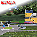
This is a detailed representation auf the Ailertchen airfield, ICAO code EDGA, located 20km east from my last EDRW Dierdorf-Wienau scenery. Includes landclass in the immediate vincinity of the airfield, AFCAD, example AI Traffc.
The scenery can by used with the standard FS2004, but it is also compatible with Ultimate Terrain Europe and Scenery Germany. To get the full Ailertchen experience the important Flightport GMAX Library is needed (download link included in the manual).
| Filename: | EDGA_Ailertchen_v10.zip |
| License: | Check within download |
| Added: | 13th December 2016, 15:28:44 |
| Downloads: | 950 |
| Author: | Bodo L. van Laak |
| Size: | 14.78 MB |


© 2001-2026 AVSIM Online
All Rights Reserved
Privacy Policy |