
Where Flight Simulation Enthusiasts Gather from Around the World!
AVSIM Library - Search Results

| Category: Flight Simulator X - Aircraft Repaints, Textures and Modifications | |
| "Bluebonnet Belle" Douglas C-47 (DC-3) |

|
Images related to this file:
File Description:
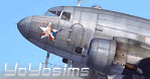
The real repaint (textures only) for Manfred Jahn's (+ the Team) model of Douglas C-47/DC-3 (Skytrain/Dakota). You need to have this great model of Douglas_C-47_V3 (V3 Beta). Textures tested in P3Dv3. The repaint of C-47B 43-49942 - N47HL, Commemorative Air Force. This C-47 was built in 1944 and was flown to Canada where it was transferred to the UK under the lend-lease program. In Britain it was assigned to the 435th Transport Squadron, a Canadian unit. It served in the China/Burma/India theater until the end of WW2. After the war the aircraft returned to Canada and in the mid-1990s the aircraft returned to the USA. The CAF acquired the aircraft in 2002 and spent 2 years on the restoration of the aircraft.
| Filename: | Bluebonnet_Belle_Douglas_C47_DC3.zip |
| License: | Freeware, limited distribution |
| Added: | 11th August 2016, 22:40:04 |
| Downloads: | 807 |
| Author: | Rafal Stankiewicz / yoyosims |
| Size: | 15.89 MB |
| Category: Flight Simulator 2004 - Scenery | |
| Komakuk Beach & Storm Hills DEW sites in Yukon and Northwest Territories, Canada |
|
Images related to this file:
File Description:
These are DEW line sites in northern mainland Canada, to the west of Tuktoyaktuk.
Komakuk Beach CWKB is not included in FS9 and is in the Yukon, only 20 miles from the Alaska border. It is, as the name suggests, close to the sea, and the gravel runway 3,600' by 125' has its western end almost on the beach.
There is no lighting and no signage and the airfield is officially listed as closed, but in fact is used during the annual maintenance and refuelling of the automated NWS (North Warning Station) close by and for any unscheduled servicing. This replaced the previous much older DEW station that was manned year round and had a lot more buildings.
Storm Hills CWSH is in the Northwest Territories, 43 miles south-southwest of Tuktoyaktuk, up on higher land at 810 feet ASL. The NWS (there was no previous DEW station at this site) is serviced by helicopter from Tuktoyaktuk and has a gravel landing pad on the north side of the station. It will show on a gps and it is 5 miles west of the distinctively shaped and large Parsons Lake. This too was not in FS9.
| Filename: | Komakuk_Beach__Storm_Hills_DEW_sites_in_Yukon_and_.zip |
| License: | Freeware, limited distribution |
| Added: | 16th July 2012, 18:56:09 |
| Downloads: | 306 |
| Author: | Roger Wensley |
| Size: | 1.68 MB |
| Category: Flight Simulator 2002 - Scenery Design | |
| TDFCalc3 |
|
File Description:
This package is for FS2002 and CFS2 TDF scenery designers.
TDFCalc3 is a utility that will derive all the necessary Cell, Area, and Point information needed to create TDF polyons and lines, as outlined in the FS2002 Terrain SDK. It also gives latitude, longitude and ground elevation. All this is done automatically, through the use of FSUIPC.
FSUIPC must be installed as a module to FS2002, or CFS2, in order for this utility to work.
| Filename: | TDFCalc3.zip |
| License: | Freeware |
| Added: | 16th October 2002, 20:12:57 |
| Downloads: | 642 |
| Author: | Richard Ludowise |
| Size: | 206.44 KB |
| Category: Flight Simulator 2002 - Scenery Design | |
| LandCalc2 |
|
File Description:
This package is for FS2002 and CFS2 LandClass and photoreal scenery designers.
LandCalc2 is a utility that will derive all the necessary information needed to create LandClass BGLs using CUSTOM textures, as outlined in the FS2002 Terrain SDK. It also gives latitude, longitude and ground elevation. All this is done automatically, through the use of FSUIPC.
FSUIPC must be installed as a module to FS2002, or CFS2, in order for this utility to work.
| Filename: | LandCalc2.zip |
| License: | Freeware |
| Added: | 22nd October 2002, 21:48:58 |
| Downloads: | 1,196 |
| Author: | Richard Ludowise |
| Size: | 233.2 KB |
| Category: Flight Simulator 2002 - Scenery | |
| Lower Chahalis River Valley |
|
File Description:
The Chahalis river is seen flowing past my recent scenery called Elma Municipal Airport. (elma2k2.zip) It empties into Gray's harbor right next to Bowerman Field, still another of my uploads. (bman2k2.zip) This scenery provides photo-real terrain connecting these two projects. You'll be able to follow the river and freeways all the way from Elma to the coast, and see the towns of Montesano, Aberdeen, and Hoquiam along the way.
| Filename: | Lower_Chahalis_River_Valley.zip |
| License: | Freeware |
| Added: | 18th February 2003, 13:37:07 |
| Downloads: | 928 |
| Author: | Bob Bernstein |
| Size: | 6.97 MB |
| Category: Miscellaneous Files - General Utilities | |
| Image Tool |
|
File Description:
This handy utility will resize and resample your images using a variety of top-of-the-line filters so as to obtain the best result.
Useful for those making custom terrain (photo-real ground textures) for Microsoft Flight Simulator.
Also quite handy for resizing screenshots to AvSim Forum limits without losing quality.
Elrond has kindly consented to have this tool placed in the AvSim library.
| Filename: | Image_Tool.zip |
| License: | Freeware |
| Added: | 21st September 2003, 18:43:12 |
| Downloads: | 2,478 |
| Author: | Elrond Elvish |
| Size: | 327.23 KB |
| Category: Flight Simulator 2004 - AFCAD Files | |
| Ipswich Airport, United Kingdom (IPW) |
|
File Description:
This is a modified AFCAD for the now closed airport at Nacton/Ipswich in Suffolk UK. It has been designed to work in Just flight�s VFR photographic scenery and terrain. ICAO code I believe is IPW.
AI parking is based upon actual photographs but may not be exact
Hope you enjoy it, use as you will.
Thanks to all those designers of VFR and AFCAD more making flight simming more enjoyable
| Filename: | Ipswich_Airport_United_Kingdom_IPW.zip |
| License: | Freeware |
| Added: | 27th May 2005, 12:54:11 |
| Downloads: | 334 |
| Author: | Timothy Mayhew |
| Size: | 2.82 KB |
| Category: Miscellaneous Files - Miscellaneous Files | |
| Al Pelletier's Round Robins - Medevac to Chattanooga |
|
File Description:
This Round Robin adventure takes place in the State of Tennessee, USA. It was flown with Microsoft FS2000\FS2002 but can be flown with any Flight Sim that has the required Airports and Navaids included in its own database. Scenery Microsoft Default FS2000 or FS2002. I also used the United States Base Terrain Upgrade from FSGENESIS (http://www.fsgenesis.com). The Great Smokey Mountains were just fantastic with this addon. I strongly recommend it.
| Filename: | Al_Pelletiers_Round_Robins__Medevac_to_Chattanooga.zip |
| License: | Freeware, limited distribution |
| Added: | 11th December 2006, 23:35:16 |
| Downloads: | 538 |
| Author: | Al Pelletier |
| Size: | 5.97 MB |
| Category: Flight Simulator X - Scenery | |
| FS X modified terrain.cfg |
|
File Description:
Everyone should install this file. Flight Simulator X terrain is defined in the terrain.cfg file. During testing, we have determined a certain number of modifications to this file that will correct some problems with the FS world and also provide more options for scenery designers. For example, in some places, water bodies display rocky areas - this file fixes that. Please read the detailed explanation that is included, and then install this modified file.
| Filename: | FS_X_modified_terraincfg.zip |
| License: | Freeware |
| Added: | 7th November 2006, 00:46:33 |
| Downloads: | 70,512 |
| Author: | Microsoft, Richard Ludowise, Luis Féliz-Tirado |
| Size: | 317.55 KB |
| Category: Flight Simulator 2004 - Scenery | |
| Gatwick International Airport |
|
File Description:
UK2000 Scenery has introduced a new range of good quality add-ons that are totally FREE, these are designed for users on a budget, a slower PC or just what a basic scenery that is still miles better than the MSFS default. This is Gatwick for FS9. It includes AFCAD taxiways and aprons, remodelled airfield terrain, dozens of objects, detailed airport buildings and more. For extra high detail, visit UK2000 Scenery for 'Gatwick Xtreme'.
| Filename: | Gatwick_International_Airport.zip |
| License: | Freeware |
| Added: | 8th March 2008, 17:50:18 |
| Downloads: | 11,445 |
| Author: | Gary Summons - UK2000 Scenery |
| Size: | 21.91 MB |


© 2001-2026 AVSIM Online
All Rights Reserved
Privacy Policy |