
Where Flight Simulation Enthusiasts Gather from Around the World!
AVSIM Library - Search Results

| Category: Flight Simulator X - Scenery | |
| FS X modified terrain.cfg |

|
File Description:
Everyone should install this file. Flight Simulator X terrain is defined in the terrain.cfg file. During testing, we have determined a certain number of modifications to this file that will correct some problems with the FS world and also provide more options for scenery designers. For example, in some places, water bodies display rocky areas - this file fixes that. Please read the detailed explanation that is included, and then install this modified file.
| Filename: | FS_X_modified_terraincfg.zip |
| License: | Freeware |
| Added: | 7th November 2006, 00:46:33 |
| Downloads: | 70,516 |
| Author: | Microsoft, Richard Ludowise, Luis Féliz-Tirado |
| Size: | 317.55 KB |
| Category: Flight Simulator 2004 - Scenery | |
| The Real Colombo |
|
Images related to this file:
File Description:
This is the complete & high detailed scenery of Colombo Municipal area
for Microsoft Flight Simulator 2004. If you are a Sri Lankan flightsimmer or like to fly
around Sri Lanka in Flight Simulator 2004, then this is a must for you!.
Features* -: Accurate building placements.
Some of city's icon buildings.
Custom G-max buildings and other objects.
High quality Satellite terrain.
High detailed Autogen data.
Animated road traffic at night.
Specially high detailed colombo harbour.
| Filename: | The_Real_Colombo.zip |
| License: | Freeware, limited distribution |
| Added: | 10th July 2011, 15:44:14 |
| Downloads: | 1,114 |
| Author: | Gayan Liyanaarachchi |
| Size: | 14.29 MB |
| Category: Flight Simulator X - Scenery | |
| SVBS - Base Sucre - Venezuela |
|
Images related to this file:
File Description:
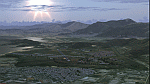
Mariscal Sucre Air Base or the Tacariguas Airport is a commercial national airport
and military air base, which serves to Maracay's city, State Aragua, Venezuela.
It was opened for the civil population in November, 2010.
With photo-terrain scenery from satellite imagery of Google Earth.
Not compatible with versions prior to FSX.
This scenery requires SP1, SP2, or the Acceleration
expansion pack in order to be displayed correctly.
Also includes a friendly Auto-Install.
| Filename: | SVBS__Base_Sucre__Venezuela.zip |
| License: | Freeware |
| Added: | 6th September 2013, 15:51:14 |
| Downloads: | 1,677 |
| Author: | David Maldonado |
| Size: | 76.81 MB |
| Category: Flight Simulator X - AFCAD Files | |
| Vliet Airport (6NJ1), NJ |
|
File Description:
Located 02 miles SE of Washington, New Jersey, Vliet Airport is a private turf field. Trees border the runway on three sides, and a dirt mound and semi-truck are also obstacles to watch out for at the end of Runway 06 if you land long. At 1300' feet, it is a very short runway so make sure you check the capabilities of your aircraft before attempting to either land or take off here! Don't forget that in order to clear trees, usable runway space is closer to only 1000'. This airport has no lighting so daytime VFR operations only are recommended. Take note that there is also no wind sock, so be sure you are aware of the weather conditions prior to arriving/departing. There is also no hard-surfaced runway and you will be landing on terrain so it's suggested you have your mesh resolution slider as high as possible.
Scenery constructed with use of satellite images/streetview/aerial photos - the author has not been there in person.
This scenery is meant to be used in conjunction with MegaScenery Earth New York 007. It is not required, but apron use is minimized to allow satellite scenery to show through as much as possible, and objects are placed based on the MSE textures - lack of it may make scenery look out of place.
| Filename: | Vliet_Airport_6NJ1_NJ.zip |
| License: | Freeware |
| Added: | 8th February 2011, 23:20:47 |
| Downloads: | 182 |
| Author: | Drew Sikora |
| Size: | 375.28 KB |
| Category: Flight Simulator 2004 - Scenery | |
| Union Island TVSU in the Grenadines, eastern Caribbean Version 1.1 |
|
Images related to this file:
File Description:
This is a self-contained version 1.1 that modifies the terrain flattens around the airport. I found that suddenly, and for no apparent reason, the Lesser Antilles mesh and my flattens were at war and creating hills within the airport boundary. If you are not having problems then you do not need this.
Union Island is in the southern tail of the chain of islands known as St Vincent and the Grenadines, between Canouan and Carriacou. Union is another small island, 3.5 miles long and at its widest 1.5 miles wide; the resident population is around 3,000, mostly in the two towns Clifton and Ashton. The airport is at the eastern end of the island, and has been extended into the sea on landfill. The runway is now around 2,480 feet long, aligned 08 (and with the southeast trade winds it is unlikely that you will find yourself using 26) and with a displaced threshold of 530 feet due to the hill to the west. The terminal is adjacent to a rather small apron; there is parking on the grass north of the taxiway. There are connecting flights by SVG to Barbados and the other islands and these are reflected in the AI. The airport has no lighting, and flights are obliged to land and depart in daylight hours only, outside of which the airport is closed.
| Filename: | Union_Island_TVSU_in_the_Grenadines_eastern_Caribb.zip |
| License: | Freeware, limited distribution |
| Added: | 16th June 2013, 18:46:33 |
| Downloads: | 532 |
| Author: | Roger Wensley |
| Size: | 2.02 MB |
| Category: Flight Simulator X - Scenery | |
| British and US Virgin Islands |
|
File Description:
British and US Virgin Islands,including the correct redefinition of coasts islands and landscape.
Includes 3 airports:
-The Cyril E. King airport at St. Thomas located on the southwestern side of St Thomas US Virgin Isl (TIST)
-Terrance B Lettsome Intl Airport Information. Located in Tortola, Virgin Isl (br) : TUPJ
-Virgin Gorda Airport located in Virgin Gorda, Virgin Islands,(br): TUPW and MESH in LOD 10 (30 m) of Virgins islands arc
| Filename: | British_and_US_Virgin_Islands.zip |
| License: | Freeware |
| Added: | 23rd May 2014, 22:32:37 |
| Downloads: | 2,886 |
| Author: | Valladier Jean Louis |
| Size: | 14.36 MB |
| Category: Flight Simulator X - Aircraft Repaints, Textures and Modifications | |
| Eurowings Airbus A320 (D-AIZS) |
|
Images related to this file:
File Description:
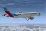
Repaint of the 2015 restructured Lufthansa Low Cost Airline "Eurowings", Registration D-AIZS.
The original aircraft is an A320neo with sharklets, but due to the feelThere / Wilco mesh this repaint contains the older triangular winglets. I am sorry for this bug...
Also added you will find my sound file for the thrust lever positions to replace the feelThere sound.
You need to have the feelThere Wilco Airbus Series Vol1 or Evolution software installed, tested in Flight Simulator X only!
| Filename: | Eurowings_Airbus_A320_DAIZS.zip |
| License: | Freeware |
| Added: | 15th October 2015, 17:53:55 |
| Downloads: | 1,215 |
| Author: | Bernd Schaefer |
| Size: | 12.59 MB |
| Category: Flight Simulator X - Scenery | |
| Chitral Airport - OPCH |
|
File Description:
Chitral Airport (IATA: CJL, ICAO: OPCH) is a small domestic airport situated 2 NM (3.7 km) north of the city centre of Chitral, in Khyber-Pakhtunkhwa province of Pakistan. It is a VFR airport which only operates in daylight and has domestic flights to and from Peshawar and Islamabad.
* 3D modeled terminal building and other small objects
* Accurate mesh around the Airport
* Custom ground textures for realism
* Photoreal textures for the Chitral city
* Autogen
Developed By Genysis Sim
| Filename: | Chitral_Airport__OPCH.zip |
| License: | Freeware |
| Added: | 27th December 2016, 00:46:11 |
| Downloads: | 1,099 |
| Author: | Haris Malick and Irfan Kaleem |
| Size: | 35.5 MB |
| Category: Flight Simulator 2004 - Scenery Design | |
| 'Hollywood' |
|
File Description:
Having trouble finding the Hollywood sign which is half buried in the Terrian Mesh, when overflying the Hollywood Hills area of BurbankLos Angeles, well not any longer. I have made a flatten BGL file so that the HOLLYWOOD Sign is now raised up and fully exposed. Also, I have added a NDB to the Burbank airport AFCAD file which puts an NDB right beside the Hollywood sign so now you can find the sign from any direction.
| Filename: | Hollywood.zip |
| License: | Freeware |
| Added: | 7th April 2004, 02:32:27 |
| Downloads: | 4,258 |
| Author: | Clive Ryan |
| Size: | 65.69 KB |
| Category: Flight Simulator 2004 - Scenery | |
| El Jadida GMMJ Sassane Island Airbase Artificial Base Fictional |
|
File Description:
Hi,
I am always working hard to create a fictional air base of the OTAN. But, my purpose
is always for childrens which believe in extraterrestrials kinds. This is a hard boring work with an inclusion of ils and many many kinds of things.
I am very like to increase my work for terrabuilding and mesh or scenery. But this is simply freeware to enter in this domain creating for play and fictional scenery or aircraft.
| Filename: | El_Jadida_GMMJ_Sassane_Island_Airbase_Artificial_B.zip |
| License: | Freeware |
| Added: | 2nd December 2005, 04:32:45 |
| Downloads: | 227 |
| Author: | DOUKKALI HASSAN |
| Size: | 953.14 KB |


© 2001-2026 AVSIM Online
All Rights Reserved
Privacy Policy |