
Where Flight Simulation Enthusiasts Gather from Around the World!
AVSIM Library - Search Results

| Category: Flight Simulator 2004 - Aircraft Repaints, Textures and Modifications | |
| Air Canada "New Livery-2017" Airbus A321 |

|
Images related to this file:
File Description:
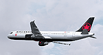
This is a repaint of Air Canada's revised corporate livery A321-211 Registration C-FLKX
Textures only - Requires Freeware Project Airbus A321-211 Model
Textures working in FSX
| Filename: | Air_Canada_New_Livery2017_Airbus_A321.zip |
| License: | Freeware, limited distribution |
| Added: | 12th July 2017, 21:49:37 |
| Downloads: | 1,039 |
| Author: | Liam Donaldson |
| Size: | 9.36 MB |
| Category: Flight Simulator 2004 - Scenery | |
| Saglek CYSV in northern Labrador, Newfoundland Canada |
|
Images related to this file:
File Description:
Kangiqsualujjuaq is in northern Quebec on the east side of Ungava Bay, and the rocky coastline stretches north from there for 130 miles before turning sharply to head south as the Atlantic shore of Labrador. On this shore and 120 miles almost due east of Kangiqsualujjuaq is Saglek, once a US radar base as part of the DEW line, and then a Canadian base with a Long Range Radar sited 1,200 feet above the airstrip on the top of the vertical cliff. The airstrip is still in use today as an access to the Torngat Mountains Canadian National Park area further north, with organised summer camps and walks etc and helicopter relays from airstrip to campsites. Saglek closes the gap between my post of Kangiqsualujjuaq and the string of airfields further south on the Labrador coast, such as Nain, Davis Inlet, Hopedale, Makkovik, and Postville etc. These have all been made by Flight Ontario and posted along with the Goose Bay Air Base, which also functions as a civil airport.
| Filename: | Saglek_CYSV_in_northern_Labrador_Newfoundland_Cana.zip |
| License: | Freeware, limited distribution |
| Added: | 17th August 2017, 17:11:29 |
| Downloads: | 166 |
| Author: | Roger Wensley |
| Size: | 3.86 MB |
| Category: Flight Simulator 2004 - Scenery | |
| Dolbeau-St-Felicien CYDO in Quebec Canada |
|
Images related to this file:
File Description:
This is the fourth of five sceneries around Lac Saint-Jean in Quebec, Canada. Saint-Felicien is a village on a small river at the western end of Lac Saint-Jean, and the airfield is just under 10 miles to the northeast. At the same distance further to the northeast of the airfield and on a slightly larger river is the village called Dolbeau. The village of Sainte-Methode is closer than either of the other villages but presumably lacked influence. The airfield effectively has one runway aligned 11-29 and just under 5,000 feet long, with approach lights on 11. There is, or was, a second runway aligned north-south but this has badly deteriorated without maintenance and has loose stones that threaten propellor damage. The taxiway that runs east-west is in a similar condition and all planes operate as if there is no taxiway. There is a clubhouse and a maintenance facility along with a line of old hangars that remain in full use, plus planes parked in the open. The landclass has been modified along with the grassed area of the airfield, and in the AI (included with the post of CYRC) there are scheduled flights by Max Aviation, and GA flights etc. It is a really typical airfield in northern(ish) rural Canada with a lot more activity than one might expect.
| Filename: | DolbeauStFelicien_CYDO_in_Quebec_Canada.zip |
| License: | Freeware, limited distribution |
| Added: | 19th November 2017, 15:52:32 |
| Downloads: | 169 |
| Author: | Roger Wensley |
| Size: | 4.17 MB |
| Category: Flight Simulator X - Aircraft Repaints, Textures and Modifications | |
| Air Canada '2017 Colors' Airbus A330-300 |
|
Images related to this file:
File Description:
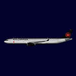
Textures only. Model available at simmarket.
| Filename: | Air_Canada_2017_Colors_Airbus_A330300.zip |
| License: | Freeware, limited distribution |
| Added: | 24th November 2017, 17:18:00 |
| Downloads: | 258 |
| Author: | Matthias Rauh |
| Size: | 944.04 KB |
| Category: Flight Simulator X - Aircraft Repaints, Textures and Modifications | |
| Air Canada '2017 Colors' Boeing 777-200LR |
|
Images related to this file:
File Description:
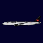
Textures only. Model available at simmarket.
| Filename: | Air_Canada_2017_Colors_Boeing_777200LR.zip |
| License: | Freeware, limited distribution |
| Added: | 24th November 2017, 17:18:26 |
| Downloads: | 371 |
| Author: | Matthias Rauh |
| Size: | 996.9 KB |
| Category: Flight Simulator X - Aircraft Repaints, Textures and Modifications | |
| Air Canada Boeing 777-200LR (C-FNNH) |
|
Images related to this file:
File Description:

Air Canada C-FNNH "New Colours" for the payware Overland/Simmer Sky B777-200LR model. This package is painted in 32-bit textures, and is compatible with FSX and FS9. Textures only! Base aircraft model and textures by Overland/Simmer Sky, Repaint by Torsten Märtke. Visit me on Facebook https://www.facebook.com/martke.torsten.3
| Filename: | Air_Canada_Boeing_777200LR_CFNNH.zip |
| License: | Freeware |
| Added: | 10th December 2017, 18:01:03 |
| Downloads: | 502 |
| Author: | Torsten Märtke |
| Size: | 3.87 MB |
| Category: Flight Simulator 2004 - Scenery | |
| Bella Coola CYBD in British Columbia, Canada |
|
Images related to this file:
File Description:
Bella Coola is in one of the deep east-west fjords amid the Coastal Range on the coast of BC, approximately mid way between Vancouver and the Alaskan border and some 70 miles inland from the open ocean. The town of Bella Coola has a small population of around 150, while the population of the whole Bella Coola Valley is around 2,000. The valley is warmer in both summer and winter than the surrounding area, and tourism flourishes along with forestry, fishing, and local government administration. Although there is road access, the ferry service is the main connection to larger coastal towns or cities such as Vancouver. The airport, 7 miles east of the town, is connected by daily Pacific Coastal flights to Vancouver and Anahim Lake (to the east). The asphalt runway is 4,200 feet long and aligned 04-22 in FS9 (by 2010 this had changed to 05-23 in reality) and is without lighting of any sort, so it is restricted to daylight hours only. At the eastern end is the terminal building and in the middle the West Coast Helicopter hangar, which has a large fenced paddock-like enclosure in front of it. The helicopters hop over the three feet high fence as they "taxi" to the apron in front of the hanger (but not in FS9!). Between the two there are four other company hangars spread out along the roadway beside the fence. I have never seen the airfield in Summer, and I have not attempted to replicate the apron as it now shows in Google Earth. The screenshots show the main and overwhelming feature of Bella Coola, the large valley amid the steep mountains. This terrain has an inevitable effect on the ai, in that you will never see a plane land as it hits solid rock before it makes it to the runway. You will, however, see them take off. Pacific Coastal currently flies Beechcraft 1900's to Bella Coola; I have used the Saab 340 which I have seen there some years ago and which I prefer.
| Filename: | Bella_Coola_CYBD_in_British_Columbia_Canada.zip |
| License: | Freeware, limited distribution |
| Added: | 25th October 2018, 17:57:06 |
| Downloads: | 286 |
| Author: | Roger Wensley |
| Size: | 14.57 MB |
| Category: Flight Simulator 2004 - Scenery | |
| Port McNeill CAT5 in British Columbia, Canada |
|
Images related to this file:
File Description:
Port McNeill is at the northern end of Vancouver Island, on the coast and around 20 miles east of Port Hardy. The town population is just over 2,000 and the main industry is logging, followed by sand and gravel quarrying and exporting for the construction industry. Tourism rates third.
The airport, a mile or so east of the town, provides a swift connection for nearby islands and the surrounding area to the rest of the west coast, and serves as the HQ main base for West Coast Helicopters. Their newly built large hangar and office accommodation is next to their older hangar to one side of the central public parking area, opposite the club house cum terminal and hangars. There are two runways: 06-24 which is asphalt, 2,400 feet long, and lit; and 11-29 of gravel, 3,650 feet long and also lit. There is some taxiway lighting, but not, for instance, for the connection between runways, which is in real life a ramp up to the gravel runway which is 15 feet higher. There are no regularly scheduled flights and traffic consists mainly of the West Coast helicopters, plus GA and irregular charters, the latter being mostly from Port Hardy.
| Filename: | Port_McNeill_CAT5_in_British_Columbia_Canada.zip |
| License: | Freeware, limited distribution |
| Added: | 18th November 2018, 05:49:13 |
| Downloads: | 138 |
| Author: | Roger Wensley |
| Size: | 13.29 MB |
| Category: Flight Simulator 2004 - Scenery | |
| Alert Bay CYAL in British Columbia, Canada |
|
Images related to this file:
File Description:
Alert Bay is a small village on the small Cormorant Island, offshore from Port McNeill near the northern end of Vancouver Island. There is an airfield at the eastern end of the island with an asphalt runway 2,900 feet long aligned 09-27, without lights. Two houses have access with hangars at the edge of the field and at the end of their gardens. Nothing special about it but it completes the local scenery around Port McNeill.
| Filename: | Alert_Bay_CYAL_in_British_Columbia_Canada.zip |
| License: | Freeware, limited distribution |
| Added: | 25th November 2018, 00:35:01 |
| Downloads: | 156 |
| Author: | Roger Wensley |
| Size: | 4.19 MB |
| Category: Flight Simulator 2004 - Scenery | |
| Surge Narrows CAG9 in British Columbia, Canada |
|
Images related to this file:
File Description:
Surge Narrows is a float base serving a small village on Read Island, one of the many islands squeezed between Vancouver Island and the mainland at this northern end. At this island passengers are delivered by amphibious Grumman Goose from Port Hardy, the main airport of the northern half of Vancouver Island with daily scheduled flights onward to and from Vancouver International. The AI was included with the post of Port Hardy. Regrettably, the amphibious Goose behaves as if it is on land and moves on the water with it's wheels extended; there is no way around this. This scenery is a modification of a post made some years ago that did nor support AI.
| Filename: | Surge_Narrows_CAG9_in_British_Columbia_Canada.zip |
| License: | Freeware, limited distribution |
| Added: | 28th November 2018, 22:43:57 |
| Downloads: | 104 |
| Author: | Roger Wensley |
| Size: | 931.04 KB |


© 2001-2026 AVSIM Online
All Rights Reserved
Privacy Policy |