
Where Flight Simulation Enthusiasts Gather from Around the World!
AVSIM Library - Search Results

| Category: Flight Simulator X - Scenery | |
| FSX_MeSA_H05 |

|
File Description:
FSX Mesh South America Project:
This terrain mesh file is a part of a whole project covering all the Continent
of South America and some islands, divided in tiles identified in a map by its
column (letters) and rows (numbers).
Those files were multi-LOD compiled from 90m SRTM2 source data, reprocessed
with 3DEM to remove voids and spikes, providing a 76.4m (LOD9) horizontal
resolution topography intended for use only in FSX updated with SP1.
Although not well documented, to improve performance, the updated FSX loads DEM
files in threads and only the closer terrain (about 5-10 NM from the point of view)
is rendered in high detail, while at far distances FSX shows up its default low
resolution mesh, when there is not a third part terrain mesh compiled in all
others intermediate level of details (multi-LOD).
THIS FILE:
FSX_MeSA_H05 (Column H x Row 05)
covers the area inside the boundaries:
N = 5º 37.5' S; S = 11º 15' S;
W = 37º 30' W; E = 30º 0' W;
AUTHORS:
Hely Heck Junior - Magrao ( [email protected] )
and Jose Lobo ( [email protected] )
| Filename: | FSX_MeSA_H05.zip |
| License: | Freeware |
| Added: | 15th June 2007, 15:08:10 |
| Downloads: | 945 |
| Author: | Hely Heck Jr. and José Lôbo |
| Size: | 22.93 MB |
| Category: Flight Simulator X - Scenery | |
| FSX_MeSA_G08 |
|
File Description:
FSX Mesh South America Project:
This terrain mesh file is a part of a whole project covering all the Continent
of South America and some islands, divided in tiles identified in a map by its
column (letters) and rows (numbers).
Those files were multi-LOD compiled from 90m SRTM2 source data, reprocessed
with 3DEM to remove voids and spikes, providing a 76.4m (LOD9) horizontal
resolution topography intended for use only in FSX updated with SP1.
Although not well documented, to improve performance, the updated FSX loads DEM
files in threads and only the closer terrain (about 5-10 NM from the point of view)
is rendered in high detail, while at far distances FSX shows up its default low
resolution mesh, when there is not a third part terrain mesh compiled in all
others intermediate level of details (multi-LOD).
THIS FILE:
FSX_MeSA_G08 (Column G x Row 08)
covers the area inside the boundaries:
N = 22º 30' S; S = 28º 7.5' S;
W = 45º 0' W; E = 37º 30' W;
AUTHORS:
Hely Heck Junior - Magrao ( [email protected] )
and Jose Lobo ( [email protected] )
| Filename: | FSX_MeSA_G08.zip |
| License: | Freeware |
| Added: | 15th June 2007, 15:04:47 |
| Downloads: | 1,135 |
| Author: | Hely Heck Jr. and José Lôbo |
| Size: | 12 MB |
| Category: Flight Simulator X - Scenery | |
| FSX_MeSA_H04 |
|
File Description:
FSX Mesh South America Project:
This terrain mesh file is a part of a whole project covering all the Continent
of South America and some islands, divided in tiles identified in a map by its
column (letters) and rows (numbers).
Those files were multi-LOD compiled from 90m SRTM2 source data, reprocessed
with 3DEM to remove voids and spikes, providing a 76.4m (LOD9) horizontal
resolution topography intended for use only in FSX updated with SP1.
Although not well documented, to improve performance, the updated FSX loads DEM
files in threads and only the closer terrain (about 5-10 NM from the point of view)
is rendered in high detail, while at far distances FSX shows up its default low
resolution mesh, when there is not a third part terrain mesh compiled in all
others intermediate level of details (multi-LOD).
THIS FILE:
FSX_MeSA_H04 (Column H x Row 04)
covers the area inside the boundaries:
N = 0º 0' S; S = 5º 37.5' S;
W = 37º 30' W; E = 30º 0' W;
AUTHORS:
Hely Heck Junior - Magrao ( [email protected] )
and Jose Lobo ( [email protected] )
| Filename: | FSX_MeSA_H04.zip |
| License: | Freeware |
| Added: | 15th June 2007, 15:07:51 |
| Downloads: | 946 |
| Author: | Hely Heck Jr. and José Lôbo |
| Size: | 3.56 MB |
| Category: Flight Simulator X - Scenery | |
| Mesh South America / MeSA E03 |
|
File Description:
FSX Mesh South America Project:
This terrain mesh file is a part of a whole project covering all the Continent
of South America and some islands, divided in tiles identified in a map by its
column (letters) and rows (numbers).
Those files were multi-LOD compiled from 90m SRTM2 source data, reprocessed
with 3DEM to remove voids and spikes, providing a 76.4m (LOD9) horizontal
resolution topography intended for use only in FSX updated with SP1.
Although not well documented, to improve performance, the updated FSX loads DEM
files in threads and only the closer terrain (about 5-10 NM from the point of view)
is rendered in high detail, while at far distances FSX shows up its default low
resolution mesh, when there is not a third part terrain mesh compiled in all
others intermediate level of details (multi-LOD).
THIS FILE:
FSX_MeSA_E03 (Column E x Row 03)
covers the area inside the boundaries:
N = 5º 37,5' N; S = 0º 0' S;
W = 60º 0' W; E = 52º 30' W;
| Filename: | Mesh_South_America__MeSA_E03.zip |
| License: | Freeware |
| Added: | 13th June 2007, 21:41:26 |
| Downloads: | 1,256 |
| Author: | Hely Heck Jr. and José Lôbo |
| Size: | 83.82 MB |
| Category: Flight Simulator X - Scenery | |
| VTSM - Koh Samui |
|
File Description:
Today, after almost half a year of construction, I am presenting my new airport to
youVTSM- Samui Airport in front of .......
since I was already there myself and again no decent freeware scenerywas to be
found for the FSX,
so building it yourself was once again the trend
I tested the airport on another computer - everything works fine
Traffic works, Ai traffic as well as road traffic and ILS approach works. So
have fun in Koh Samui at the airport and the surrounding area .......
The best way to go on a voyage of discovery is with a small plane or helicopter so
that you can do the same
see many details .........
lands at the airport VTSM with an A319 or a Boing 737 larger planes are not there
then allowed to take a helicopter or a small plane and fly over the island
explores the many details ...............
Installation:
Put the folder VTSM - Samui in the folder FSX Addon Scenery and activate
Him......... !
The steps listed below only if you don't have these add-ons yet! !
to be able to see people unzip the supplied folder 3dpeoble_Lib and put
the unzipped folder in your FSX Addon Scenery and activate it
Support:
If you have any problems or questions, please send an email to
[email protected]
now have fun and good luck on your flight LG Jamaica
Demo video at https://youtu.be/dcIkSi03sfg?t=7
| Filename: | VTSM__Koh_Samui.zip |
| License: | Freeware |
| Added: | 5th February 2021, 19:28:51 |
| Downloads: | 780 |
| Author: | Ewald Wagner |
| Size: | 52.16 MB |
| Category: Flight Simulator 2004 - Scenery | |
| Repulse Bay CYUT in Nunavut Canada |
|
Images related to this file:
File Description:
This is a scenery that I started in 2013, temporarily abandoned when I found there was a fault in the coastline that reduced it all to straight lines, and then totally forgot about. Until now, when I discovered that while I had made the Repulse Bay terminal building I had mysteriously not made the scenery. Investigation revealed the reason why and here it is with a coastline that has been repaired to the extent that the fault allowed. Repulse Bay has a population of around 1,100 and since 2015 has been officially named Naujaat, the traditional Inuit name. It is located exactly on the arctic circle on the northern extension of the western side of Hudson Bay, in a large bay off the northern tip of Southampton Island. Coral Harbour is on the far side of the island, 180 miles to the south. The airfield is alongside the town and the coast, with the runway 3,400 feet of gravel with PAPI at both ends, aligned 161T-341T with "T" standing for true as opposed to the unreliable magnetic bearing this far north. The regular scheduled flights are by Air Baffin (an Air Nunavut subsiduary), connecting to Iqaluit some 550 miles to the east. The helicopters are there in the summer with their own fuel in drums around their own parking apron. They land directly on the apron, which cannot be replicated in AI, so they are present only as parked choppers and not flying ones.
| Filename: | Repulse_Bay_CYUT_in_Nunavut_Canada.zip |
| License: | Freeware, limited distribution |
| Added: | 6th September 2018, 00:34:38 |
| Downloads: | 180 |
| Author: | Roger Wensley |
| Size: | 7.87 MB |
| Category: Flight Simulator 2004 - AI Aircraft | |
| AI Mexicana Link AI Malcontent Bombardier CRJ-200 Fleet Pack |
|
Images related to this file:
File Description:
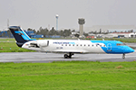
This is the Third Oldest Airline in the world, the Second Oldest Airline in Latin America, and the First Oldest Airline in Mexico, Mexicana Airlines (Mexicana de Aviacion), this is the Airbus A318-111 for now the pack have the Last New Livery (2010) and the Old Livery (2005), more later will upload the Older Liveries, the Old Livery but with the Thin Logo and No Wingtips Logos, and the mos popular and old Mexicana´s livery, (1997-2005). For the 100th Anniversary I´ll upload all the fleet, since 1940´s with the DC-2 to the last fleet that had when it flies, the Mark and Airline still exists, BUT It doesn´t fly since 2011. In this case this is the MexicanaLink, a subsidiary of Mexicana based in Guadalajara International Airport, was the feeder airline for Mexicana and MexicanaClick, operating in markets that did not justify the use of larger aircraft, as they were considered thin routes. This airline was the regional operator, while MexicanaClick was the domestic low-price airline that competed with Interjet, Volaris and Viva Aerobus.
The airline's presentation to the media was made on March 10, 2009.The fleet consisted in 2010 in Bombardier Canadair Regional Jet CRJ-200. I´ll upload very soon the other Model Raven FS Labs (RFSL/RAI) Bombardier CRJ-200, with the same fleet pack than this model.
The model is AI Malcontent (AIM) Bombardier CRJ-200 Basepack. I hope enjoy it!.
| Filename: | AI_Mexicana_Link_AI_Malcontent_Bombardier_CRJ200_F.zip |
| License: | Freeware |
| Added: | 19th November 2021, 17:28:32 |
| Downloads: | 58 |
| Author: | Jesús Gibran Soriano Solleiro |
| Size: | 166.47 MB |
| Category: Flight Simulator X - AI Aircraft | |
| AI Mexicana Link Raven FS Labs Bombardier CRJ-200 Fleet Pack |
|
Images related to this file:
File Description:
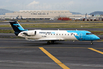
This is the Third Oldest Airline in the world, the Second Oldest Airline in Latin America, and the First Oldest Airline in Mexico, Mexicana Airlines (Mexicana de Aviacion), this is the Airbus A318-111 for now the pack have the Last New Livery (2010) and the Old Livery (2005), more later will upload the Older Liveries, the Old Livery but with the Thin Logo and No Wingtips Logos, and the mos popular and old Mexicana´s livery, (1997-2005). For the 100th Anniversary I´ll upload all the fleet, since 1940´s with the DC-2 to the last fleet that had when it flies, the Mark and Airline still exists, BUT It doesn´t fly since 2011. In this case this is the MexicanaLink, a subsidiary of Mexicana based in Guadalajara International Airport, was the feeder airline for Mexicana and MexicanaClick, operating in markets that did not justify the use of larger aircraft, as they were considered thin routes. This airline was the regional operator, while MexicanaClick was the domestic low-price airline that competed with Interjet, Volaris and Viva Aerobus. The airline's presentation to the media was made on March 10, 2009.The fleet consisted in 2010 in Bombardier Canadair Regional Jet CRJ-200. I´ll upload very soon the other Model AI Malcontent (AIM) Bombardier CRJ-200, with the same fleet pack than this model. The model is Raven FS Labs (RFSL/RAI) Bombardier CRJ-200 Basepack. I hope enjoy it!.
| Filename: | AI_Mexicana_Link_Raven_FS_Labs_Bombardier_CRJ200_F.zip |
| License: | Freeware |
| Added: | 2nd December 2021, 02:11:40 |
| Downloads: | 70 |
| Author: | Jesús Gibran Soriano Solleiro |
| Size: | 97.19 MB |
| Category: Flight Simulator 2004 - AI Aircraft | |
| AI Mexicana Link Raven FS Labs Bombardier CRJ-200 Fleet Pack |
|
Images related to this file:
File Description:
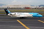
This is the Third Oldest Airline in the world, the Second Oldest Airline in Latin America, and the First Oldest Airline in Mexico, Mexicana Airlines (Mexicana de Aviacion), this is the Airbus A318-111 for now the pack have the Last New Livery (2010) and the Old Livery (2005), more later will upload the Older Liveries, the Old Livery but with the Thin Logo and No Wingtips Logos, and the mos popular and old Mexicana´s livery, (1997-2005). For the 100th Anniversary I´ll upload all the fleet, since 1940´s with the DC-2 to the last fleet that had when it flies, the Mark and Airline still exists, BUT It doesn´t fly since 2011. In this case this is the MexicanaLink, a subsidiary of Mexicana based in Guadalajara International Airport, was the feeder airline for Mexicana and MexicanaClick, operating in markets that did not justify the use of larger aircraft, as they were considered thin routes. This airline was the regional operator, while MexicanaClick was the domestic low-price airline that competed with Interjet, Volaris and Viva Aerobus. The airline's presentation to the media was made on March 10, 2009.The fleet consisted in 2010 in Bombardier Canadair Regional Jet CRJ-200. I´ll upload very soon the other Model AI Malcontent (AIM) Bombardier CRJ-200, with the same fleet pack than this model. The model is Raven FS Labs (RFSL/RAI) Bombardier CRJ-200 Basepack. I hope enjoy it!.
| Filename: | AI_Mexicana_Link_Raven_FS_Labs_Bombardier_CRJ200_F.zip |
| License: | Freeware |
| Added: | 2nd December 2021, 02:11:48 |
| Downloads: | 61 |
| Author: | Jesús Gibran Soriano Solleiro |
| Size: | 97.19 MB |
| Category: Flight Simulator 2004 - Scenery | |
| Kugaaruk CYBB and DEW Pelly Bay CWPB in Nunavut, Canada |
|
Images related to this file:
File Description:
Kugaaruk is on the coast of northern mainland Canada on the Boothia Peninsula, 60 miles into a deep north-south fjord-like inlet called Pelly Bay. The name was changed from Pelly Bay in 1999, and the population is around 800. Gjoa Haven is 150 miles to the west, and Hall Beach just over 200 miles to the east. Six miles south of the village, and connected by a gravel road, there is a NWS station and what remains of a DEW Auxiliary Site; the DEW site was closed in 1992, a year after the NWS station became operational. There is also a 3,350 feet long gravel runway beside Barrow Lake 2 miles east of the site, Pelly Bay CWPB. Kugaaruk airfield is adjacent to the village and the 5,000 feet of 100 feet wide gravel runway is aligned 049T/229T where T stands for "true" as opposed to magnetic. There are flights by First Air and Canadian North and the AI includes a daily flight of each from Yellowknife via Gjoa Haven (as per real life) plus a cargo visit by Buffalo. Although the runway is long enough to accomodate a 737 it is not licensed for regular scheduled jet flights; the reason for this is that the approach lighting is "inadequate". Included here is a new .bgl for Gjoa Haven which will remove the small hold short line from the gravel; my mistake.
| Filename: | Kugaaruk_CYBB_and_DEW_Pelly_Bay_CWPB_in_Nunavut_Ca.zip |
| License: | Freeware, limited distribution |
| Added: | 25th November 2012, 00:43:07 |
| Downloads: | 429 |
| Author: | Roger Wensley |
| Size: | 6.1 MB |


© 2001-2026 AVSIM Online
All Rights Reserved
Privacy Policy |