
Where Flight Simulation Enthusiasts Gather from Around the World!
AVSIM Library - Search Results

| Category: Flight Simulator 2004 - Original Aircraft | |
| On Mark A-26 Marksman |

|
File Description:
Utilizing the WWII A-26 airframe, the On Mark comapny of Van Nuys, California began converting Invaders to executive transports following WWII with their first examples designated the Marketeer. The epitome of comfort for the executive air traveller was found however in the further developed Marksman. The Marksman featured a significantly re-manufactured fuselage incorporating full pressurisation and a radical modification allowing a substantial increase in internal cabin space. All Marksmans featured the addition of wing tip fuel tanks as well as increased tail surface dimensions to compensate for the higher power engines offered in various models. Out of approximately sixty Invader airframes modified for civilian use by On Mark, only about a dozen were full Marksman conversions.
For all effects, gauges, and the excellent A-26 sound package by David Copley, the original SOH A-26 Invader is required to be installed before installation of this aircraft. Included in this package: model by Milton Shupe with Marksman modifications by John Terrell, textures by John Terrell, 2D panel and gauges by Rich Murray, flight dynamics by Jerry Beckwith and Tom Falley, pilot figures by Jan Visser.
| Filename: | On_Mark_A26_Marksman.zip |
| License: | Freeware |
| Added: | 27th April 2007, 04:15:36 |
| Downloads: | 3,771 |
| Author: | John Terrell |
| Size: | 10.4 MB |
| Category: Flight Simulator X - Scenery | |
| Mesh South America / MeSA E03 |
|
File Description:
FSX Mesh South America Project:
This terrain mesh file is a part of a whole project covering all the Continent
of South America and some islands, divided in tiles identified in a map by its
column (letters) and rows (numbers).
Those files were multi-LOD compiled from 90m SRTM2 source data, reprocessed
with 3DEM to remove voids and spikes, providing a 76.4m (LOD9) horizontal
resolution topography intended for use only in FSX updated with SP1.
Although not well documented, to improve performance, the updated FSX loads DEM
files in threads and only the closer terrain (about 5-10 NM from the point of view)
is rendered in high detail, while at far distances FSX shows up its default low
resolution mesh, when there is not a third part terrain mesh compiled in all
others intermediate level of details (multi-LOD).
THIS FILE:
FSX_MeSA_E03 (Column E x Row 03)
covers the area inside the boundaries:
N = 5º 37,5' N; S = 0º 0' S;
W = 60º 0' W; E = 52º 30' W;
| Filename: | Mesh_South_America__MeSA_E03.zip |
| License: | Freeware |
| Added: | 13th June 2007, 21:41:26 |
| Downloads: | 1,256 |
| Author: | Hely Heck Jr. and José Lôbo |
| Size: | 83.82 MB |
| Category: Flight Simulator X - Scenery | |
| FSX_MeSA_G08 |
|
File Description:
FSX Mesh South America Project:
This terrain mesh file is a part of a whole project covering all the Continent
of South America and some islands, divided in tiles identified in a map by its
column (letters) and rows (numbers).
Those files were multi-LOD compiled from 90m SRTM2 source data, reprocessed
with 3DEM to remove voids and spikes, providing a 76.4m (LOD9) horizontal
resolution topography intended for use only in FSX updated with SP1.
Although not well documented, to improve performance, the updated FSX loads DEM
files in threads and only the closer terrain (about 5-10 NM from the point of view)
is rendered in high detail, while at far distances FSX shows up its default low
resolution mesh, when there is not a third part terrain mesh compiled in all
others intermediate level of details (multi-LOD).
THIS FILE:
FSX_MeSA_G08 (Column G x Row 08)
covers the area inside the boundaries:
N = 22º 30' S; S = 28º 7.5' S;
W = 45º 0' W; E = 37º 30' W;
AUTHORS:
Hely Heck Junior - Magrao ( [email protected] )
and Jose Lobo ( [email protected] )
| Filename: | FSX_MeSA_G08.zip |
| License: | Freeware |
| Added: | 15th June 2007, 15:04:47 |
| Downloads: | 1,138 |
| Author: | Hely Heck Jr. and José Lôbo |
| Size: | 12 MB |
| Category: Flight Simulator X - Scenery | |
| FSX_MeSA_H04 |
|
File Description:
FSX Mesh South America Project:
This terrain mesh file is a part of a whole project covering all the Continent
of South America and some islands, divided in tiles identified in a map by its
column (letters) and rows (numbers).
Those files were multi-LOD compiled from 90m SRTM2 source data, reprocessed
with 3DEM to remove voids and spikes, providing a 76.4m (LOD9) horizontal
resolution topography intended for use only in FSX updated with SP1.
Although not well documented, to improve performance, the updated FSX loads DEM
files in threads and only the closer terrain (about 5-10 NM from the point of view)
is rendered in high detail, while at far distances FSX shows up its default low
resolution mesh, when there is not a third part terrain mesh compiled in all
others intermediate level of details (multi-LOD).
THIS FILE:
FSX_MeSA_H04 (Column H x Row 04)
covers the area inside the boundaries:
N = 0º 0' S; S = 5º 37.5' S;
W = 37º 30' W; E = 30º 0' W;
AUTHORS:
Hely Heck Junior - Magrao ( [email protected] )
and Jose Lobo ( [email protected] )
| Filename: | FSX_MeSA_H04.zip |
| License: | Freeware |
| Added: | 15th June 2007, 15:07:51 |
| Downloads: | 946 |
| Author: | Hely Heck Jr. and José Lôbo |
| Size: | 3.56 MB |
| Category: Flight Simulator X - Scenery | |
| FSX_MeSA_H05 |
|
File Description:
FSX Mesh South America Project:
This terrain mesh file is a part of a whole project covering all the Continent
of South America and some islands, divided in tiles identified in a map by its
column (letters) and rows (numbers).
Those files were multi-LOD compiled from 90m SRTM2 source data, reprocessed
with 3DEM to remove voids and spikes, providing a 76.4m (LOD9) horizontal
resolution topography intended for use only in FSX updated with SP1.
Although not well documented, to improve performance, the updated FSX loads DEM
files in threads and only the closer terrain (about 5-10 NM from the point of view)
is rendered in high detail, while at far distances FSX shows up its default low
resolution mesh, when there is not a third part terrain mesh compiled in all
others intermediate level of details (multi-LOD).
THIS FILE:
FSX_MeSA_H05 (Column H x Row 05)
covers the area inside the boundaries:
N = 5º 37.5' S; S = 11º 15' S;
W = 37º 30' W; E = 30º 0' W;
AUTHORS:
Hely Heck Junior - Magrao ( [email protected] )
and Jose Lobo ( [email protected] )
| Filename: | FSX_MeSA_H05.zip |
| License: | Freeware |
| Added: | 15th June 2007, 15:08:10 |
| Downloads: | 945 |
| Author: | Hely Heck Jr. and José Lôbo |
| Size: | 22.93 MB |
| Category: Flight Simulator X - Scenery | |
| FSX_MeSA_H06 |
|
File Description:
FSX Mesh South America Project:
This terrain mesh file is a part of a whole project covering all the Continent
of South America and some islands, divided in tiles identified in a map by its
column (letters) and rows (numbers).
Those files were multi-LOD compiled from 90m SRTM2 source data, reprocessed
with 3DEM to remove voids and spikes, providing a 76.4m (LOD9) horizontal
resolution topography intended for use only in FSX updated with SP1.
Although not well documented, to improve performance, the updated FSX loads DEM
files in threads and only the closer terrain (about 5-10 NM from the point of view)
is rendered in high detail, while at far distances FSX shows up its default low
resolution mesh, when there is not a third part terrain mesh compiled in all
others intermediate level of details (multi-LOD).
THIS FILE:
FSX_MeSA_H06 (Column H x Row 06)
covers the area inside the boundaries:
N = 11º 15' S; S = 16º 52.5' S;
W = 37º 30' W; E = 30º 0' W;
AUTHORS:
Hely Heck Junior - Magrao ( [email protected] )
and Jose Lobo ( [email protected] )
| Filename: | FSX_MeSA_H06.zip |
| License: | Freeware |
| Added: | 15th June 2007, 15:19:51 |
| Downloads: | 998 |
| Author: | Hely Heck Jr. and José Lôbo |
| Size: | 1.61 MB |
| Category: Flight Simulator X - Scenery | |
| VYMM Mawlamyine Intl Airport V2.0 with Traffic-Pack 2 |
|
File Description:
Mawlamyine International Airport in Burma, Myanmar, include Traffic-Pack 2. Traffic-Pack 1 comes with vyyy4tp1.zip. Traffic-Pack 3 comes soon too. This scenery was produced based of suppositions, stories and voices. It is therefore pure speculation. Whether this airport is ever increased, the God know. If the planned Asean-Highway leads at it past, this airport should gain importance very quickly. Version 2.0 with new docks, jetways, already extended runway, taxiways and new taxisigns. First of all we corrected the airport location to the real one. With Myanmar Air Force area, Helipads and even more parkings for civilian airplanes. You need mai321x.zip, mai738x.zip and mai744x.zip to use with this. Many Thanks go to Harald Nehring and Frank Weiss,
Robert Versluys, Mike Stone and the teams of HOUSE-RP in Burma, FSX Planner, SceneGenX, SBuilder X, Open Ports Scanner, AFXBgDownloader, FSUIPC, Google Earth and AI Flight Planner. This scenery is pure fiction and for FSX only, for FS2004 please download newVYMMfs9.zip and newVYMMup.zip. By HOUSE-RP, Switzerland and Burma
| Filename: | VYMM_Mawlamyine_Intl_Airport_V20_with_TrafficPack_.zip |
| License: | Freeware, limited distribution |
| Added: | 6th June 2008, 15:34:08 |
| Downloads: | 672 |
| Author: | HOUSE-RP, Robby Pauletto |
| Size: | 3.42 MB |
| Category: Flight Simulator X - Scenery | |
| Branson Airport KBBG--New Airport, Scenery, and Flight Plans |
|
Images related to this file:
File Description:
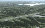
This project adds a new, detailed Branson Airport KBBG (Missouri) to FSX, which opened in May 2009, and is a privately developed commercial airport. The construction of the airport, which involved the flattening of several Ozark Mountains, is claimed to be the largest earthmoving project in Missouri history. As a result, the airport actually sits on a manmade plateau, surrounded by rolling hills. The airport uses the ICAO identifier BBG, however, the airlines use the IATA code BKG. The airport is served by AirTran, Frontier, and ExpressJet (Branson AirExpress), and is located in hilly terrain. Aircraft equipped with a terrain avoidance warning system may experience system activation on final approach. Birds are in the vicinity of the airport. AFCAD with sloping terrain created using Airport Design Editor X v1.47.07, and the hilltops were cleared and flattened and roads were added using SBuilderX 3.13. The terminal, hangar, FBO, and cars were added and modified from stock FSX scenery, using the FSX Object Tool, to resemble as closely as possible the actual airport.
| Filename: | Branson_Airport_KBBGNew_Airport_Scenery_and_Flight.zip |
| License: | Freeware |
| Added: | 5th August 2010, 01:08:33 |
| Downloads: | 2,005 |
| Author: | Carlyle Sharpe |
| Size: | 6.02 MB |
| Category: Flight Simulator X - Scenery | |
| TTCPx Patch Ver. 1.2 ( Rev. 8 ) |
|
Images related to this file:
File Description:
Unofficial LatinVFR Tobago TTCP for FSX Expansion Pack. This freeware patch contents: New photoreal scenery with seasons to airport area ( day and night for winter/fall and summer/spring seasons ); New ADE with correction of the NDB TAB 323 and park positions, activation of the RWY's 11 and 29, and other minor fixes; Addition of fuel-repair trigger points to the airport ( JetA to Gates 1-4 area, JetA1 to Gates 5-6 area, and AV100 to Gate 7 area ); New land and water classiffication in the entire island of Tobago; Correction of the entire island terrain including a better flatten around the airport area; More buildings, objects, vegetation and life around on the island of Tobago ( FSX default fictitious objects ); More road traffic over the photoreal area; Full set of the TTCP airport charts ( Use for Virtual Flight Only ); Other fixes. It's not a cumulative patch, so remove any previous version to install. System Requirements: LatinVFR Tobago TTCP v1.1 for FSX and Microsoft Flight Simulator X SP2 or Acceleration.
| Filename: | TTCPx_Patch_Ver_12__Rev_8_.zip |
| License: | Freeware |
| Added: | 22nd August 2010, 08:59:46 |
| Downloads: | 2,429 |
| Author: | Gladson Moreira |
| Size: | 32.76 MB |
| Category: Flight Simulator 2004 - Sounds | |
| AIG Alpha India Group Tower Package Release 7 |
|
Images related to this file:
File Description: UPDATE FOUND HERE:

This is the seventh release package of 33 EditVoicepack files for FS2004/FSX by the Alpha India Tower Group. This package includes all previously released files since Package Release 6. Our goal is to provide accurate ATC calls in order to provide Microsoft Flight Simulator traffic with quality ATC. These sounds are the best that we have been able to compile and are accurate as of release date and to the extent that our data and the limitations of the EditVoicepack allow. Included in this package release are AEROLIMOUSINE, ALBASTAR, AN28, AN3, AN32, AN8, AZAMAT, BRICKYARD, CENTRAL AMERICAN, COLUMBA AIR, CYLD, CZECH HOLIDAYS, DREAM TEAM, EM-EXPRESS, FLYING CENTER, GALILEO, HILO, JET EXECUTIVE, LUZAVIA, MCCALL, NAFT, NAKLAO, OPERA JET, SPECAIR, TAG ESPANA, TAIMYR, TAXI JET, TIBET, TIME AIR, TU154, TUNISIAN AIRFORCE, and Y7. Visit us at www.alpha-india.net for more information.
| Filename: | AIG_Alpha_India_Group_Tower_Package_Release_7.zip |
| License: | Freeware, limited distribution |
| Added: | 2nd September 2011, 22:43:25 |
| Downloads: | 3,242 |
| Author: | Alpha India Group |
| Size: | 26.38 KB |


© 2001-2026 AVSIM Online
All Rights Reserved
Privacy Policy |