
Where Flight Simulation Enthusiasts Gather from Around the World!
AVSIM Library - Search Results

| Category: Flight Simulator X - Aircraft Repaints, Textures and Modifications | |
| Transglobe Airways Canadair CL-44 1968 |

|
Images related to this file:
File Description:
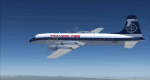
This is a repaint of the Canadair CL-44 in Transglobe Airways colors. You need the freeware Canadair CL-44 by Mike Stone. In 1967 Transglobe petitioned the ATLB for scheduled licenses to North America but were turned down, but in April 1968 they got their wish and were granted wide charter privileges. They consequently received their first CL-44 then, followed by two more soon after in readiness for the summer season. However disaster struck when Bolton steamship, which held 42% of the airlines shares, and the Liverpool based shipping group, Ocean Steamship, which invested 200,000 pounds in the carrier and held 11.6% of the shares, both pulled out, forcing the carrier to collapse on November 28, 1968. Textures are 32bit dds. This aircraft was tested on FSX-SE. It should work on FSX and FS2004.
Textures are 32bit bmp. This aircraft was tested on FSX-SE. It should work on FSX and FS2004.
*This is strictly an FS2004 model. However, I used it on FSX-SE by replacing the FS2004 panel and gauges with an FSX 2D panel, and it worked well. I have included two internet links for users of FSX, who wish to fly the aircraft, with easy instructions on how to go about replacing the FS2004 panels with FSX ones.
| Filename: | Transglobe_Airways_Canadair_CL44_1968.zip |
| License: | Freeware |
| Added: | 24th January 2019, 05:08:12 |
| Downloads: | 53 |
| Author: | Ted Giana |
| Size: | 890.33 KB |
| Category: Flight Simulator 2004 - Scenery | |
| Qikiqtarjuaq CYVM (Broughton) and DEW FOX-5 in Nunavut, Canada |
|
Images related to this file:
File Description:
Qikiqtarjuaq is an airfield on the northeast coast of Baffin Island, just over 100 miles north of Pangnirtung. The airfield is the closest Canadian airfield to Greenland and is used for ferry flights from Canada to Europe for small planes, though there is normally only JetA1 fuel available. The airfield is at only 18 feet ASL next to the sea with the village to the north; it was previously (before 1998) called Broughton Island. The runway is 3,800' of 100' wide gravel and is lighted; as it is in the Northern Domestic Airspace the runway is signed as 033T-213T, using "true" bearings instead of magnetic. There is a terminal and a small maintenance building on the apron and these have been modeled specifically for this scenery. There are AI parking spots; the AI visiting aircraft are a Canadian North Dash 8 and a First Air 42-300. Qikiqtarjuaq village is just north of the airfield and has a population of around 520; it is approximately the right size and shape but no buildings were specifically modeled for the village. There is also a North Warning System site called Fox-5 to the northeast, and this too is included. You will need Ultimate Terrain Alaska Canada.
| Filename: | Qikiqtarjuaq_CYVM_Broughton_and_DEW_FOX5_in_Nunavu.zip |
| License: | Freeware, limited distribution |
| Added: | 14th June 2011, 02:04:26 |
| Downloads: | 559 |
| Author: | Roger Wensley |
| Size: | 1.85 MB |
| Category: Flight Simulator 2004 - Scenery | |
| Cape Dyer CWFD in Nunavut, Canada |
|
Images related to this file:
File Description:
Cape Dyer is on the southeast corner of Baffin Island, around 120 miles east of Pangnirtung at approximately N66 45 W61 30. There is a fine view north up the Davis Strait between Baffin Island and Greenland, and this is the whole reason for the airfield's existance as it was built to support the construction and operation of a DEW line radar station, which has now been updated to a North Warning System site. There are two camps; the upper camp is on the east side of the Cape and is where the radars are located, linked by a gravel road to the lower camp, which is on the west and more sheltered side of the Cape on the clifs above Sunneshine Fjord. The runway is 5,000' of 150' wide gravel, and it is lighted and at 1,320' feet ASL. Cape Dyer is now listed as abandoned in the Canada Flight Supplement. It is, however, still there and presumably is still used for access to the North Warning System equipment, which is automated and generally unmanned. The buildings were modeled for this scenery and include a hanagar large enough to accommodate a C-130. Ultimate Terrain is not required as it does not cover northern Canada.
| Filename: | Cape_Dyer_CWFD_in_Nunavut_Canada.zip |
| License: | Freeware, limited distribution |
| Added: | 21st June 2011, 19:30:07 |
| Downloads: | 491 |
| Author: | Roger Wensley |
| Size: | 1.9 MB |
| Category: Flight Simulator 2004 - Scenery | |
| Trail CAD4 in British Columbia, Canada |
|
Images related to this file:
File Description:
Trail is in the valley carved out by the Columbia River, around 7 miles north of the Canada-US border and on both banks of the river. The town has a population of just under 8,000 and the main industry is mining. The airport is around 3 miles south-east of the town and on the east bank, with the runway parallel to the river and aligned 16-34, 75 feet wide and asphalt. There are currently no runway or taxiway lights, though there is an overall improvement programme in place to cope with increasing passenger demand. A new terminal building was recently completed, along with alterations to road access and parking; as I have no information regarding these road changes I have left the original "terminal" building in place and in use by Pacific Coastal, the only airline to fly to Trail. There is a Youtube video which gives a very good idea of the basic facilities, and of the surrounding hilly terrain which is similar to that at Bella Cooola at the far side of Pacific Coastal's coverage area. The original position of the airport in FS9 before I corrected it was best described as "in a hole". The hole remains nearby as there is no easy way to deal with it.
| Filename: | Trail_CAD4_in_British_Columbia_Canada.zip |
| License: | Freeware, limited distribution |
| Added: | 23rd December 2018, 17:27:38 |
| Downloads: | 142 |
| Author: | Roger Wensley |
| Size: | 12.3 MB |
| Category: Flight Simulator 2004 - Scenery | |
| Medicine Hat CYXH in Alberta Canada |
|
Images related to this file:
File Description:
Medicine Hat is a town in south Alberta, beside the South Saskatchewan River, and around 180 miles southeast of Calgary. Originally a railroad town, and in fact still served by the railway and now also by the Trans-Canada Highway, it is currently mainly known for the large natural gas fields in the area. As Rudyard Kipling said, Medicine Hat has "all hell for a basement". The name of the city is a translation of the Blackfoot tribal name for the eagle tail feather headdress worn by tribal medicine men, and it was curiosity about the name that first got my attention.
The date of this scenery is not 2010, as is usual for my scenery; it is more like 2015. The terminal building has been extended and improved, the apron around the two large southern hangars and the large rental hangars behind them is still visibly new, and the tie-down parking places on the grass accessed off one side of the old taxiway are in place and in use. The airport is now (2015) not in the busy usage that it experienced in the second half of the 1900's and old taxiways and a runway have been left to decay and large old hangars have been demolished. Hence the visible remains. The current runways were rebuilt (on top of the existing as foundations) and are 03-21 with 4,990 feet of lit asphalt 150 feet wide with PAPI at both ends, and 09-27 with 2,885 feet of lit asphalt 100 feet wide.
The two newish hangars to the south are a helicopter operating and maintenance company with a flight training school based in the adjoining offices (light grey buildings) and an FBO in hangar and offices (dark grey). Further buildings have been erected since then, and some existing ones have been reclad (eg. light grey now, in 2021, has a light blue roof).
I have cheated in one respect. In reality, the edges of the airport have been gradually utilised for various purposes, such as workshops, storage sheds, factories, etc, with access from the surrounding urban roads. As I have almost no information regarding their appearance I decided to leave the airport area as it was originally built, rather than incorporating buildings that I know are false. I admit that this was also the laziest solution.
The scenery includes a grass strip 3 miles to the south of Medicine Hat, namely Schlenker CFZ3. It is the only airfield I have come across where the fences are not around the edge of the airfield, they are instead around the runways and apron. I presume this is so animals can be left to feed off the grass in summer.
The AI includes flights by Air Canada Jazz.
| Filename: | Medicine_Hat_CYXH_in_Alberta_Canada.zip |
| License: | Freeware, limited distribution |
| Added: | 23rd January 2022, 20:11:10 |
| Downloads: | 143 |
| Author: | Roger Wensley |
| Size: | 19.15 MB |
| Category: Flight Simulator X - Utilities | |
| NpC - Numpad Control for FSX v2.2.1 |
|
File Description:
NpC v2.21 - some small changes from v2.2 including a script you can use to switch autopilot input from Nav to GPS and instructions on moving and re-sizing and re-positioning the NpC message window.
NumPad Control (NpC) is a program for entering Com, Nav and ADF radio frequencies, Transponder codes, VOR OBS/CRS settings, Auto-throttle airspeed, and Autopilot altitude, vertical speed, and heading values in FSX using the keyboard number-pad instead of mouse click spots. NpC is programmed primarily for aircraft with default FSX avionics (radios, transponders, and autopilots that were developed within standard FSX programming guidelines). However, this updated version of NpC also supports a number of third party add-on aircraft such as the PMDG 737NGX / B777, Flight1 King Air B200 and the A2A Cherokee 180. NpC is a set of Lua scripts and thus requires a registered copy of FSUIPC4 to work.
An installation and configuration manual is also included in the file set.
For a video that gives an overview of NpC function see: https://www.youtube.com/watch?v=P2p6CHxMOl8&list=PL_NnG_PN8zwnEI59uGxlhgp11rJQbQ_gJ&index=2
| Filename: | NpC__Numpad_Control_for_FSX_v221.zip |
| License: | Freeware |
| Added: | 4th December 2015, 20:03:34 |
| Downloads: | 699 |
| Author: | Al Klayton, Dan Sullivan |
| Size: | 801.63 KB |
| Category: Flight Simulator 2004 - Scenery | |
| Peace River CYPE in northwest Alberta, Canada UPDATED |
|
Images related to this file:
File Description:
This is an updated version of the original post (from 2014) made in November 2018. It provides missing textures, and deals properly with an ai problem that I thought I had already fixed. It also adds extra objects to the apron area and adds a third gate. It is complete in itself and can be installed as-is if you do not have the original post. The Peace River flows east from the Rockies, joining up with the Slave River to empty into Great Slave Lake. The town is on both banks close to a bend where the Peace turns to the north, 245 miles northwest of Edmonton. The population is 7,000 and the surrounding area is either farmland or forest. The airport is just over 3 miles west of the town. The runway is 5,000 feet of wide asphalt (150 feet) aligned 04/22, lit, and with PAPI. There is a second runway to the south of the main runway, 1,900 feet of grass and aligned 08/26. The apron is to the north of the runway at the eastern end and is large; there is a purpose-built terminal building, plus other hangar buildings along taxiway C that extends westward from the apron. The airport is experiencing an increase in scheduled and GA flights in the last few years.
| Filename: | Peace_River_CYPE_in_northwest_Alberta_Canada_UPDAT.zip |
| License: | Freeware, limited distribution |
| Added: | 10th December 2018, 17:33:25 |
| Downloads: | 128 |
| Author: | Roger Wensley |
| Size: | 24.27 MB |
| Category: Flight Simulator X - Scenery | |
| NZGA- Galatea Aerodrome (VectorLandClass, New Zealand) |
|
Images related to this file:
File Description:
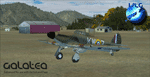
Welcome to Galatea (ICAO: NZGA), a gateway to exploring the Urewera ranges and the east coast of New Zealand. Galatea is a small and basic airstrip with only one old hanger, a public toilet and a small clubhouse on a wide plain surrounded by native bush and pine plantation near Murupara in the Bay of Plenty of New Zealand. It is a grass strip of 1025m length and 60m width and aligned 01/19 with a group rating of 8. No night lighting or fuel is available.
The FSX model includes custom textures and models placed on an aerial image. It makes extensive use of items from the free VLC object libraries which are required to be installed (download from www.vectorlandclass.co.nz downloads menu). This scenery and the VLC libraries have been funded
by sales of VectorLandClass and although you do not need VLC to use it, your purchase helps further development.
To the south west of Murupara township and sawmill is the LakeLand Helicopters base which just fits onto the photo-real coverage. Library objects have been placed here although they may not be accurate as the site was not visited when taking reference photos. This airfield makes a great stop over when flying between Rotorua, Mount Tarawera, Whakatane or Gisborne.
We hope you enjoy exploring the area!
| Filename: | NZGA_Galatea_Aerodrome_VectorLandClass_New_Zealand.zip |
| License: | Freeware, limited distribution |
| Added: | 15th November 2012, 23:35:42 |
| Downloads: | 1,127 |
| Author: | Tim Barnes / VectorLandClass |
| Size: | 45.7 MB |
| Category: Flight Simulator 2004 - Scenery | |
| Mustique TVSM in the Grenadines |
|
Images related to this file:
File Description:
Mustique island is one of the northernmost of the group of islands known as the Grenadines, just south of Bequia. Mustique is a small island, less than 3 miles long and even at its widest less than a mile wide; as a result the resident population is less than 500. The island is unique in that it is owned by a company. The company is owned, in its turn, by the owners of the 100 or so private villas on the island. The Queen of England is one owner; her participation is balanced out by Jeremy Clarkson.
The airport is at the northern end of the island; the runway is around 3,240 feet long, aligned 09 (and with the southeast trade winds it is most unlikely that you will ever find yourself using 27) and with a steep and displaced threshold of over 900 feet. The displaced threshold is shown but unfortunately FS9 is not capable of coping with anything other than a prefectly flat airport. The terminal is a steel-framed shed with cladding, but is "quaintly" transformed with a palm frond roof etc. There are connecting flights by SVG to Barbados and the other islands and these are reflected in the AI. The airport has no lighting, and flights are obliged to land and depart in daylight hours only, outside of which the airport is closed.
| Filename: | Mustique_TVSM_in_the_Grenadines.zip |
| License: | Freeware, limited distribution |
| Added: | 11th June 2013, 22:57:37 |
| Downloads: | 512 |
| Author: | Roger Wensley |
| Size: | 2.07 MB |
| Category: Flight Simulator 2004 - Scenery | |
| Z19O - Hamat Airbase - Batroun, Lebanon |
|
Images related to this file:
File Description:
Hamat is a village near the coast of Lebanon, around 25 miles north of Beirut. The airport runway was built during the civil war to the west of Hamat in the late 1970's, between Hamat and another village called Wuajh Al Hajar. The intention was have an alternative to Beirut airport, which could be (and often was) closed by shell fire from any or all of the sides involved in the civil war, or by bombing by those who were not directly part of the civil war but occasionally joined in. It has been used for drag racing, occasional freefall parachuting (this may continue) and is now an army base with mostly helicopter use. The runway is around 5,600 feet of asphalt, 90 feet wide and aligned 02/20. There is no lighting. The apron is set well back from the runway and has hangars at each end; one set is four hangars long, and at the other end of the apron there are three hangars. There are also the remains of some radar to the west of the apron, bombed (in 1982?). The runway has been repositioned and the surrounding landclass modified to reduce one village to it's approximate actual size and to create a second village which was missing entirely. An intrusive road has been deleted, and the airfield grass area also modified.
| Filename: | Z19O__Hamat_Airbase__Batroun_Lebanon.zip |
| License: | Freeware, limited distribution |
| Added: | 23rd May 2015, 10:03:10 |
| Downloads: | 224 |
| Author: | Roger Wensley |
| Size: | 8.53 MB |


© 2001-2026 AVSIM Online
All Rights Reserved
Privacy Policy |