
Where Flight Simulation Enthusiasts Gather from Around the World!
AVSIM Library - Search Results

| Category: Flight Simulator 2004 - Scenery | |
| Zion National Park North, Cedar Breaks National Monument, Cedar City (KCDC), Utah, Photo-Scenery (FS9 & FSX) |

|
Images related to this file:
File Description:
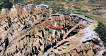
Cedar Breaks National Monument is a large amphitheater cliff in bright colors of red, orange and purple.
It lies east of Cedar City in the northern region of the scenery. The cliff was formed by erosion thru wind,
water and ice. Today erosion continues with a pace of about 2 inches every 5 years. Although it is called
Cedar Breaks, there are no cedars growing there but juniper trees. For a scenic flight to Cedar Breaks
National Monument best depart from Cedar City Regional Airport (KCDC) and head east. The scenery extends
south to Zion National Park and covers a large part of Zion Canyon and the Kolob Canyons area.
Zion National Park is another place where erosion of the Colorado Plateau formed the most beautiful colorful
stone formations of unique and wonderful shapes. There are nine different layers of stone visible in the park.
Most of them consist of sandstone. But there is also limestone, gypsum, siltstone, shale, clay and mudstone.
The Virgin River cut a spectacular and famous canyon thru Zion Park that is as narrow as 20ft and up to 2000ft tall.
High resolution versions of this scenery for FS9 and FSX (much sharper, but larger and multiple downloads)
are available at www.blueskyscenery.com/CNY_South2West5.html . The screenies are taken from the high-res versions,
so expect this version to be slightly more blurry.
Thanks to Joop Mak for providing a custom AFCADs that correct airport layouts so that they align with the photo-textures!
They are available here: www.blueskyscenery.com/AFCADs.html . YourDonation@Work: Dedicated to Richard, P.J. and Felix.
| Filename: | Zion_National_Park_North_Cedar_Breaks_National_Mon.zip |
| License: | Freeware, limited distribution |
| Added: | 14th March 2010, 00:30:28 |
| Downloads: | 1,566 |
| Author: | Gottfried Razek - blueskyscenery.com |
| Size: | 97.13 MB |
| Category: Flight Simulator X - Scenery | |
| Honduras Islands v3 |
|
Images related to this file:
File Description:
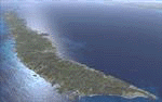
Version 3 includes all previous patches and updates. This version also restructures the file system to be fully compatible with the ORBX "FTX Global openLC North America" product as well as adding functionality for default FSX users. Additionally, water class scenery is updated to appear more realistic, MHRO is updated to reflect the newly expanded apron, and SRTMGL1 (30m) mesh is included. All landclass polygons and coastlines were meticulously hand-drawn directly from satellite imagery to provide the most detailed and accurate scenery available for this region.
This project rebuilds the islands of Roatán, Barbareta, Guanaja, and Utila, and adds Cayos Cochinos and the numerous cays associated with the "Islas de la Bahia" (Islands of the Bay). Roatán (MHRO), Guanaja (GJAJ/MHNJ) and Puerto Lempira (MHPL) are completely overhauled and positioning is corrected. New and fully functioning AI airports are added for Utila (MHUT), Fort Cay (MHFC) and Cochino Pequeño (MHCP) of the Cayos Cochinos chain, and La Ceiba (MHLC) is modified to accommodate more AI traffic. Accurate coastlines, lakes, road and river data, as well as corrected landclass are provided based on the latest available satellite imagery. GA flight plans are provided to add or enhance service to the smaller islands. Updates were created or rebuilt in a manner which carefully aligned airport data with current satellite imagery, when available. Scenery was created using Airport Design Editor X v1.70.6042, SBuilderX 3.13, and the FSX Object Placement Tool. Scenery objects were added and modified from stock FSX scenery to resemble as closely as possible the actual airports.
| Filename: | Honduras_Islands_v3.zip |
| License: | Freeware |
| Added: | 23rd December 2016, 08:17:26 |
| Downloads: | 1,614 |
| Author: | Carlyle Sharpe |
| Size: | 17.35 MB |
| Category: X-Plane - Original Aircraft | |
| Black Cat Catalina PBY5/5Av1.1 for x-plane |
|
File Description:
This update includes improvements to the fuselage shape, addition of retractable wing floats using wheel farings, an improved but not custom panel, improved prop efficiency and more. The PBY Catalina is probably the best known flying boat with over 4000 produced by Consolidated aircraft and licensees. The Black Cat squadrons all done in flat black played havoc particularly for the Japanese in the Pacific. Fitted with radar, with a 15 hour endurance and 2800 mile range they hunted Japanese naval ships by night and bombed or torpedoed them by the hundreds up. There are 6 engine nacelles used in the model, 2 represent the 1200 HP radial engines driving the props, the others are jets with 5 lbs of thrust, 1 is used for the rear fuselage section, 1 is used for the wing pylon, 1 is used for the flare from the fuselage to the vertical stabilizer and the last is used for the forward observation and gunner space. Two are not used. Wing sections are taken up by the main wing and the support spars so there you go. The fuel tanks are used for the side gunner pods since these can be decorated separately. The plane flies very well and is stable as a rock. Takeoffs from water are quite easy as long as you don't dip a wing tip (no floats remember). The Black Cat squadron logo used in the paint scheme is courtesy of http://www.daveswarbirds.com/blackcat/logos.htm and is from the VP-71 Black Cat squadron.
| Filename: | Black_Cat_Catalina_PBY55Av11_for_xplane.zip |
| License: | Freeware, limited distribution |
| Added: | 9th March 2003, 22:48:18 |
| Downloads: | 1,219 |
| Author: | Robert App |
| Size: | 136.75 KB |
| Category: Flight Simulator 2004 - Scenery | |
| OSM World: South America |
|
Images related to this file:
File Description:
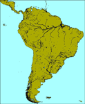
OSM World is a community project! If you wish to help, check the documentation and contact the author!
Welcome to OSM Wold: South America! This is a vector data scenery package covering the South American area. Coastlines, Rivers, lakes, roads, railways, and power lines with detail never before seen! All in an autogen-compatible density! You can see roundabouts, train terminals, harbor areas in a resolution of a point every 10 meters. At this same resolution a vectorial city class places residential (in small and big building variations, depending on surface area) and industrial areas exactly where they are supposed to be. This gives the city areas a resolution far superior to the capacity of FS-2004 default landclass bitmaps, limited to approximately 1 Km x 1 Km squares. OSM World: South America will even give you small roads leading to small towns (even a few houses across)! From big highway intersections, including ramps, to the tiniest rural pathways covering the entire South american area! Wherever in South America you fly, there is something to see!
You can enjoy this scenery near coastlines too! harbor areas and extremely detailed coastal topology (try the southern Chile). This scenery makes sure that the ocean is always flat, you can forget about the climbing water often found around photo-sceneries! This scenery is best paired with a good set of terrain meshes (like the freeware global SRTM mesh by Stephen Rothlisberger , available here: http://simviation.com/1/fs2004terrainmesh).
| Filename: | OSM_World_South_America.zip |
| License: | Freeware |
| Added: | 5th August 2015, 02:31:08 |
| Downloads: | 3,108 |
| Author: | Mario Noriega, Luis Miguel Hernandez |
| Size: | 64.37 MB |
| Category: Flight Simulator X - Scenery | |
| Quebec CYQB |
|
File Description:
All pilots have used or heard the word "Quebec" during their radio communication but not many pilots actually landed at Quebec International airport (CYQB). A great number of Head of States, VIPs, tourists came to Quebec City for summits, special occasions or to visit the city declared a World Heritage Site by UNESCO in 1985. Quebec airport is also hosting a great airshow and this year in June, to celebrate the 400th anniversary of Quebec City, five of the world best aerobatic squadrons will perform simultaneously over Quebec: the British "Red Arrows", the French "La Patrouille de France", the US Navy "Blue Angels", the USAF "Thunderbirds" and the Canadian "Snowbirds". It will be quite a sight.
This very accurate scenery will give you the opportunity to visit CYQB with your simulator. Months of effort were devoted to make this scenery as real as possible. This package includes more that 25 highly detailed hangars and buildings all having night textures, some of them have windows with specular effect. Light poles provide aprons lighting. The adjacent mount Belair have communication towers with strobe lights visible for over 12nm which provides a good visual reference coming into the airport. Exceltech, a maintenance facility has static aircrafts parked in front. A second publication will include the new terminal which is presently under construction.
| Filename: | Quebec_CYQB.zip |
| License: | Freeware |
| Added: | 20th February 2008, 22:13:36 |
| Downloads: | 8,241 |
| Author: | Gilles Boily |
| Size: | 6.21 MB |
| Category: Flight Simulator 2004 - Scenery | |
| New Night Textures - Newark Liberty Intl (KEWR) |
|
Images related to this file:
File Description:
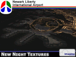
Some time ago, I purchased the Newark Liberty Intl (KEWR) by ImagineSim, but the night textures did not seem realistic. I set out to try to make them more so. This is the result of that work. Many of the scenery's night textures have been updated. The cargo areas for FedEx, UPS and UNITED Cargo now look much more realistic. The Marriott Hotel, the centerpiece of the airport and this scenery, looks considerably more realistic, as well as the terminals and the Continental Hanger and maintenance area. One of the nice unexpected results of this change is the light splash effect around the terminals; it definitely outlines the terminal area well. For those who own this scenery, I hope this enhances your flight experiences in and out of KEWR. For those who do not yet own this, but enjoy or would like to fly in and out of KEWR, it is now considered a legacy product by ImagineSim. As a result, the price was cut considerably and for a few shillings and this update, you'll have a nice addition to the airports in your FS2004 environment. I dedicate this work to all the controllers of VATSIM NYARTCC. I hope this brings more traffic your way. I want to thank ImagineSim for giving me permission to release these textures. See Readme.txt for installation instructions.
| Filename: | New_Night_Textures__Newark_Liberty_Intl_KEWR.zip |
| License: | Freeware, limited distribution |
| Added: | 27th October 2012, 03:48:59 |
| Downloads: | 2,293 |
| Author: | Jeffrey S. Bryner, Imagine Simulation |
| Size: | 1.97 MB |
| Category: Flight Simulator 2004 - AI Flight Plans | |
| Chilean Transports and Tankers Complete AI Package |
|
Images related to this file:
File Description:

The members of Military AI Works are proud to bring you this freeware AI package, produced by Mike Guenthner in conjunction with Military AI Works and adds the three recently acquired KC-135E aircraft of the Chilean Air Force (FACh) as well as their C-130B aircraft to your FS9 skies.
This package is the first release of the MGAI KC-135E model which is based on the original MAIW KC-135R AI model and shares the same animations and features as its newer cousin. The Henry Tomkiewicz C-130 AI models round out the included military aircraft in this package.
These three Hercules AI aircraft were originally released in 2007 as part of the "MAIW Exotic Alberts" package. If you have previously installed the "Exotic Alberts Chile" package, you should remove all contents from that package prior to installing this package. We have updated the textures for these C-130B aircraft as well as made some other minor changes to them which reflect the changes that have occurred since 2007.
Credits:
Models by Mike Guenthner and Henry Tomkiewicz;
FDE/Effect by Mike MacIntyre and Henry Tomkiewicz;
Repaints by Graham King and Mark Walsh;
Flightplans by Desmond Burrell and Barry Taylor;
VCPs by Stewart Pearson;
Scenery Libraries and Placement by John Stinstrom and Mark Campbell
| Filename: | Chilean_Transports_and_Tankers_Complete_AI_Package.zip |
| License: | Freeware |
| Added: | 9th December 2012, 19:20:59 |
| Downloads: | 664 |
| Author: | Mike Guenthner, Military AI Works (MAIW) |
| Size: | 7.87 MB |
| Category: Flight Simulator X - Miscellaneous Files | |
| Metal GUI V.1.2 |
|
Images related to this file:
File Description:
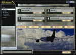
I designed this for myself to darken the default User Interface for 2 reasons. I have bad eyes that are sensitive to bright objects on the screen, and I like to fly the simulator in the evening hours with the lights turned off in the room. I hope you like my end result. I also added 2 bonus features. Instead of hearing the Windows/Internet Explorer click sound when you mouse click on a menu item, you now will hear the "Fasten Seatbelts" sound effect. Be sure to back up the original sound "checkc" in case you find the new sound annoying. Secondly, I have included 4 optional Aircraft Viewer images that give the selected aircraft a more airborne look. I will make switching these simple by adding them to the Generic Mod Enabler(JSGME) that I will include in the download. The look is created using Diamond Plate and Polished Aluminum textures, and modifying the buttons with some more color. This is Freeware, and I am giving permission to anyone that wants to create their own and upload to any site they wish. I do not wish that you have to mention my name in any credits.
Generic Mod Enabler(JSGME) can be found at JoneSoft http://www.users.on.net/~jscones/software/
This utility is freeware created by JoneSoft (Copyright© 1998-2010 JÃsen Jones)
| Filename: | Metal_GUI_V12.zip |
| License: | Freeware |
| Added: | 20th November 2011, 04:39:38 |
| Downloads: | 414 |
| Author: | Todd McCuistion |
| Size: | 7.63 MB |
| Category: Flight Simulator 2004 - Scenery | |
| Airstrips of Central Germany |
|
Images related to this file:
File Description:
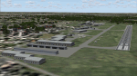
Another selection in my Airstrips of Western Europe project, herewith 80+ small airfields in central Germany, each enhanced with taxiways, parking spaces, buildings etc. and aprons as appropriate, to further facilitate the generation of lightweight AI traffic in the area, without overloading the more major airfields.
Again, there's no photo-realism here, just a selection of basic 'generic' buildings, more or less accurately sized and placed to reflect the airfield layout as seen on on-line satellite imagery and aerial photography. These buildings have minimal effect on frame-rates, so are ideal for this kind of job. The airfields are aligned as well as possible with the roads etc. in UT Europe and the Genesis Europe mesh, but should mostly be fine in a default installation or other configuration.
As before, the files for each airfield can be easily identified by the ICAO code, even if the airfield names vary slightly, so you can pick and choose and mix and match to suit any sceneries you already have, should you so wish. There is no requirement for any other download. Each airfield will exist as a stand-alone entity should you only want a few of them.
Please read the rest of this "blurb" in the included text file. There may be some details of note or interest.
| Filename: | Airstrips_of_Central_Germany.zip |
| License: | Freeware |
| Added: | 26th February 2025, 19:22:06 |
| Downloads: | 117 |
| Author: | Chris Eve |
| Size: | 1.14 MB |
| Category: Flight Simulator 2004 - Scenery | |
| Sproat Lake CAA9 on Vancouver Island in British Columbia, Canada |
|
Images related to this file:
File Description:
Sproat Lake is in the middle of southern Vancouver Island, 6 miles west of the town of Port Alberni and 30 miles directly south of Comox Valley Airport. It is some 14 miles long and around the eastern shores has a large number of houses with docks and boats. Plus, in the offshoot called Upper Sproat Lake, it has the Sproat Lake Tankerbase CAA9, home to two rather large Martin Mars firefighting planes. Their history is interesting, and their capacity for carrying water for dousing forest fires during the summer months has kept them in use since their construction in the 1940's. They have finally been retired from fighting fires in 2013, having been first retired from military service in 1958. This scenery is made for use with Ultimate Terrain; there was another version made several years ago which either predated or ignored UT. This scenery is for the month when a Mars was being repainted before retiring to a museum as a military plane, date unkown but perhaps 2013? If it is a time when there were three in existance then it is sometime in the 1960's; take your pick. Because of hills adjacent to the lake the landing of the AI Mars may or may not take place, depending on wind direction and whether or not it flies into rock before landing. Take off and departure seem to be more reliable than landing on a daily basis. The Mars flies to Vancouver Harbour, but only in theory; it does not land and park as there is no parking available for such a large aircraft. The AI follows in the second post.
| Filename: | Sproat_Lake_CAA9_on_Vancouver_Island_in_British_Co.zip |
| License: | Freeware, limited distribution |
| Added: | 11th December 2016, 06:44:50 |
| Downloads: | 262 |
| Author: | Roger Wensley |
| Size: | 14.88 MB |


© 2001-2026 AVSIM Online
All Rights Reserved
Privacy Policy |