
Where Flight Simulation Enthusiasts Gather from Around the World!
AVSIM Library - Search Results

| Category: Flight Simulator X - Scenery | |
| Frankfurt Main Airport (EDDF) v7 - auto install |

|
Images related to this file:
File Description:
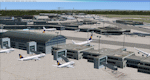
This major update represents EDDF in the December 2012 timeframe.
With the increasing development of the proposed Terminal 3 area now in use as extended apron parking, this update provides operational ramps for G and H gates including ramp parking for both airline and cargo aircraft, helicopter parking at gates H8 and H12, apron night lighting, vehicular traffic etc. In addition this update features a new Gmax custom fuel tank farm along with custom Frankfurt logos, the recently opened A-plus terminal (7 new gates including 4 A380 gates) in October 2012, a new Air Rail Center model and a new set of cargo offices/buildings that have been placed in the South Cargo area as well as the replacement of the standard FSX blast fences with a new Gmax fence model which adds even further realism to this scenery.
Also, a first time feature for this scenery, it now supports GSX (Ground Services for FSX). The G and H aprons have been customized to support GSX functionality with the correct positioning of the ground service vehicles and pushback operations based on scenery topology. The associated airport .ini file is supplied in this package.
Default FSX scenery is required. See readme/help file for more details.
| Filename: | Frankfurt_Main_Airport_EDDF_v7__auto_install.zip |
| License: | Freeware |
| Added: | 23rd December 2012, 22:28:57 |
| Downloads: | 12,701 |
| Author: | Mark Aldridge |
| Size: | 13.43 MB |
| Category: Flight Simulator X - Scenery | |
| AI Ship Traffic Mexican Gulf and Caribbean Sea |
|
Images related to this file:
File Description:
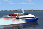
This package adds AI ship traffic to the Mexican Gulf including traffic related to the off shore oil industry but it also puts additional ship traffic in the Caribbean Sea including cruise ships and on the Hudson River in New York.
This package contains AI traffic files to be used with my packages "63 AI Ships and AI Ship Traffic for Europe and South America", "75 AI Ships and AI Ship Traffic" and "130 AI Ships and AI Ship Traffic" as well as couple of new models of typical American tugs and barges used on rivers and channels. With all this installed you will have 272 ship models available for AI traffic as well as an almost global AI Ship traffic following realistic shipping routes.
The ships visit among other places Coatzacoalcos, Veracruz, Tampico, Corpus Christi, Freeport, Galveston, Houston, Texas City, Port Arthur, New Orleans, Mobile, Panama City, Tampa, Miami, Havana, Santo Domingo, Punta Cana, San Juan, Charlotte Amalie, Road Town, Saint Martin, Pointe-a-Pitre, Roseau, Fort-de-France, Caracas, Puerto Cortes, Belize City, Playa del Carmen, Cancun, Cozumel, Isla Mujeres, and Kingston - in addition to this a few routes are placed on the Hudson River in New York.
| Filename: | AI_Ship_Traffic_Mexican_Gulf_and_Caribbean_Sea.zip |
| License: | Freeware |
| Added: | 24th March 2014, 08:14:18 |
| Downloads: | 7,611 |
| Author: | Henrik Nielsen |
| Size: | 2.67 MB |
| Category: Flight Simulator X - Miscellaneous Files | |
| FeelThere Map screens megapack |
|
File Description:
This package looks to be my final release of its' kind. Here are over 250 different screens for use with FeelThere Map; an amalgamation of my prior work into one package. You must have the payware add-on, FeelThere Map installed. These screens will work in FS9 and FSX, but were not tested in other sims. They should work in any sim that works with FeelThere Map (i.e. compatible versions of P3D). Many more complete airline sets are found here, along with a few sensible national groupings, a new bizjet operator grouping, and the addition of luxury brand advertisements for our high-end GA cockpit interiors, or to perhaps complete a set for an airline that might only have 2 or 3 screens of its' own. Lots of retro carriers, and some of the complete sets draw from historic timetable art, and/or bring type specificity. There are other packages from different authors available on the internet that would enable the construction of several more complete airline sets, for the dedicated VA pilot. Speaking of VAs, there's a few VA-specific groupings herein, as well. There's literally something here for every Map-enabled aircraft and flight context in your hangar. Enjoy your flights.
| Filename: | FeelThere_Map_screens_megapack.zip |
| License: | Freeware |
| Added: | 25th April 2026, 17:13:15 |
| Downloads: | 29 |
| Author: | Henry Douglas |
| Size: | 18.38 MB |
| Category: Flight Simulator X - Scenery | |
| Carrier CVN75_V2 North Sea |
|
File Description:
This is a update version of my scenery DL_CVN75.zip.
Changes in Version 2 of the cenery:
1.The Carrier model is now a private object and no longer part of the standard FSX object lib..
This allows the installation and registration in FSX scenery setting to be done like any
other addon objects.
The registration of the scenery in FSX below " Global, Generic & Vehicle Libraries" is no
longer required !!!!
2.Version 2 has more stuff on deck of the carrier.
3.The Number 75 is more accurate according to the real carrier.
4.The ILS frequencies ( e.g. GS) is more accurat adjusted in relation to the cable zone.
Scenery: Carrier Group North sea. Close to the Island of Sylt The Scenery includes: - The USS Carrier Harry Truman, CVN 75 with full function as an Airport with ILS approach capability.
F18-Fighters and a Navy-Heli on the Carrier. - 2 flying Helicopters over the Carrier. - 4 Navy-Destroyers escorting the Carrier. In addition to the Carrier-Group: - A Oilrig about 30 nm northwest from the Carrier. The Heli-Pat is a landable Platform !! - 2 moving Destroyer based on a "Boats Traffic Plan" which are moving around the group according to the time schedule in the plan.
| Filename: | Carrier_CVN75_V2__North_Sea.zip |
| License: | Freeware |
| Added: | 26th December 2008, 10:44:37 |
| Downloads: | 3,486 |
| Author: | Dietmar Loleit |
| Size: | 4.83 MB |
| Category: Flight Simulator X - Gauges | |
| Advanced Radar System (ARS) |
|
Images related to this file:
File Description:
This Advanced Radar System (ARS) Version 1.0 displays AI traffic of FSX in a range of
5, 10, 20, and 40 miles.The ARS contains an AI tracking function, which allows you
to follow a selected AI automatically in terms of course and speed. In this mode
the ARS is coupled with the autopilot of your aircraft. The ARS feeds the
autopilot with the AI heading and speed data. The tracking mode can be
switched on or off.
An air fuel gauge is included in the ARS package also, which allows you to
perform an air re-fuel procedure for your aircraft. A air refueling can be done
from each AI aircraft if you have decided to use it as your tanker. The decision
will be done via a select function from the ARS panel and in addition via a
dedicated activation on the air fuel panel.For installation, look at the ARS_DOC folder.
(the folder is now included in the zip !!!!!!!!!! It was not in the previous upload. Sorry!)
COPYRIGHTS
This gauge is freeware. All rights are reserved and no part of the package may
be duplicated or distributed without the expressed, written permission of the
author.
CREDIT goes to: Bob Familton for his review of the documentation and testing
for SP1 FSX.
| Filename: | Advanced_Radar_System_ARS.zip |
| License: | Freeware |
| Added: | 2nd February 2011, 20:33:29 |
| Downloads: | 2,886 |
| Author: | Dietmar Loleit |
| Size: | 1.05 MB |
| Category: Flight Simulator X - Scenery Design | |
| (Version 2.0) KEFD -Ellington 2025 Refresh FSX (Circa 2006-2010)- Johnson Space Center Houston |
|
Images related to this file:
File Description:
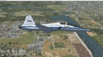
Version 2.0 covers landclass across the entire greater Houston area, with a large increase in LOD. This version significantly tightens up and improves the landclass from version 1.0, and adds a vast amount of scenery objects that brings the Bay Area-KEFD area into the modern era. This improves and adds a highly accurate runway 17 approach with accurate placement of buildings and scenery around the year 2011-modern day. In addition, includes several new files including a new airport/helipad via Houston Clear lake regional airport, T41 La Porte Municipal and surrounding shipping ports, Kemah Boardwalk, and a giant improvement to Johnson Space Center Houston. Rundway 35 and Runway 22 landclass is significantly increased, and more accurate as well. You can fly an accurate VFR approach or set up an ILS for any one of KEFD's runways with ease with this improvement.List of Version 2.0 additions and changes: - I added a ton of scenery objects and tightened up the landclass at Johnson Space Center Houston- NASA Control Center--- Added Talon Park with T38s (via static objects)--- Added Gemeni V rocket and 747 for the shuttle transporter--- And a whole bunch of vegetation, new buildings, and tour buses.- Added Kemah boardwalk and several boat docks- Removed a TON of highrise textures and replaced with medium and large city suburb landclass.- Added Clear Lake regional Hospital with helipad and surrounding scenery by Walter Reed Park- Added El Jardin or "Bayport Container port" with several scenery objects and significantly tightened up landclass.-- Looks great when setting up ILS approach for RWY 22- Tightened up Bay Area BLVD landclass, "adding" University of Houston Clear Lake"-- UHCL was semi already present, just made it more pronounced.- Made Red Bluff road landclass super recognizable!-- Red Bluff road is used to set up VFR approach and or field break for RWY 22 and RWY 17 R.----- Its common to see private jets and the USAF doing a break along Red Bluff road.- Added First Baptist Church, and water tower to Pasadena Convention center- Made Fairmont Parkway pronounced with landclass- Added Houston Port Authority at Morgan's Point--- Another Landmark for the RWY 22 ILS approach, NASA religiously uses this to line up the 10 mile ILS.- Tightened up landclass at Village Grove East and along Fairmont Parkway- Added a TON of scenery objects and landclass corrections for approach of RWY 17 L and 17 R.---- Added Home Depot, Lowes, Walmart Super center, Guitar center etc.---- added South Main Baptist Church--- Bondy Jr High, Turner Elementary, and Pasadena Memorial High School--- Added Saint Luke's Hospital--- Added Hampton Inn Suites and HCA rehab hospital--- Added a ton to the container facility behind best buy and storage facility--- Added smaller churches on RWY 17 approach--- Added a ton of scenery at the base of RWY 17 R, i.e., concrete plant, containers, trucks-- Added gas stations on the corner of beltway 8 and genoa red bluff-- Significantly changed and tightened up landclass at the base of RWY 22 and RWY 17 L and 17 R-- Made several roads and Beltway pronounced------ This decision looks AWESOME at night, really adds demarcation to the roads.**All of this makes the RWY 17 approach super recognizable** RWY 22 approach landclass is much more accurate.- Significantly changed and tightened up landclass near southbelt ellington and interstate 45.- Added Grace Church-- I wanted to do San Jacinto College south, but seemed over kill at that point.- SIGNIFICANTLY tightened up landclass for RWY 35 approach and near baybrook mall.-- Along I45- Added TDECU stadium at the University of Houston Main Campus---- So you can practice flybys for Cougar games!- Added the Battleship at San Jacinto Monument- I also "borrowed" T41 La Porte Municipal's tower camera to make a SWEET view of KEFD.- I included landclass for Sealy Texas this time, as well as my significant enhancements of Austin, Texas greater area as well (optional, but recommended!)---------------------------------------------------------------------------Version 1.0 originally added:- Added the Johnson Space Center Houston, which is now greatly enhanced and blended.- San Jacinto Community College-Central- Pasadena Convention Center- Pasadena Water Treatment Facility- NASA Bouncy Lab- Pasadena Shopping center, now greatly enhanced and blended.- Baybrook Mall and other shopping spots.- Significant Landclass improvements across the entire greater Houston Area File also includes landclass and scenery improvements for the greater Austin, Texas Area (optional), KIAH, KDWH, and Sealy, Texas. Each of these projects combined covers roughly 15,000 square miles of landclass improvement. Allowing you to fly entirely from Houston to Austin, or Houston to San Antonio in accurate landclass. -Enjoy!DJN
| Filename: | Version_20_KEFD_Ellington_2025_Refresh_FSX_Circa_2.zip |
| License: | Freeware |
| Added: | 12th October 2025, 16:15:47 |
| Downloads: | 72 |
| Author: | Dan Nelson |
| Size: | 277.28 MB |
| Category: Flight Simulator 2004 - Scenery | |
| CD KnettishallFS9 |
|
Images related to this file:
File Description:
Description:
From June 1943 to August 1945, the 560th, 561st, 562nd and 563rd Bombardment Squadrons of the 388th Bombardment Group with B-17's, flew 331 missions (including 19 Aphrodite missions from Fersfeld) losing 179 B-17s. On 6 September 1943, the 388th lost 11 B-17's on a mission to Stuttgart including all the aircraft of the 563rd BS. The airfield was not used again and sold off in 1957.
This add-on is not compatible with VFR scenery. Sorry for that.
Included in the download is an AI traffic BGL file that makes this base come to life. To get this file working, you must have the Wings of Power Heavy Bombers and Jets add on installed. You must also have downloaded the two repaint set for the B-17 done by my friend Chuck Lawsen. This last file can be found here at Avsim, it�s called: wop_388_b17.zip This project is as always dedicated to all the brave young men that contributed to the effort of getting Europe out of the claws of a dark, perhaps the darkest period in modern history, but this time it is especially dedicated to 1st Lt. Ralph M. Reese, co-pilot 562nd Sqd., and of course all the brave men of the 388th.
Enjoy!
Cees Donker
| Filename: | CD_KnettishallFS9.zip |
| License: | Freeware |
| Added: | 10th May 2010, 05:26:25 |
| Downloads: | 426 |
| Author: | Cees Donker |
| Size: | 1.12 MB |
| Category: Flight Simulator X - Panels | |
| General Dynamics F-111 "Aardvark" PIG HUD Project (Upgrade, Revison 7) |
|
Images related to this file:
File Description:
FSX F-111 PIG HUD PROJECT - Navigation/Situation awareness cockpit.
REVISION 7.UPGRADE. MUST already have fxpiggb5.zip installed.
Unique STAND OFF capability has been added to both Pave Tack and Radar.
This is a stunning feature not previously implemented in FSX. Radar contours
now sea level to 17,000'and radar can view any airport worldwide from its
current position. Flt Pln leg toggle SW can set radar view. Pave Tack now
provides sharp detail close up views in steps to 20NM and has full 1 degree
increments with freedom of panning. Approx 5 pages added to current 56 page
Flight Manual, other minor improvements covered in the comprehensive notes.
Adds to what is already an extreme capability panel and package packed
with custom instruments and concepts not available in other aircraft.
All instruments and text are sized to be clearly and easily readable.
Includes enhanced HUD, multiple radars, GPS units, MFDs, and effects, TFR,
autopilot/autothrottle, is Carrier and Air to Air capable, ICAO entry and
day/night/IFR/VFR navigation with constant current position awareness.
HUD available in all views including the 10 Camera views. This package sets
the benchmark for the amount, type of data provided and its presentation.
Possibly the best pilot friendly military aircraft available.
This is the complete panel with simple installation procedure.
By Karol Chlebowski.
| Filename: | General_Dynamics_F111_Aardvark_PIG_HUD_Project_Upg.zip |
| License: | Check within download |
| Added: | 8th February 2011, 23:13:23 |
| Downloads: | 566 |
| Author: | Karol Chlebowski |
| Size: | 16.06 MB |
| Category: Flight Simulator X - AFCAD Files | |
| Vliet Airport (6NJ1), NJ |
|
File Description:
Located 02 miles SE of Washington, New Jersey, Vliet Airport is a private turf field. Trees border the runway on three sides, and a dirt mound and semi-truck are also obstacles to watch out for at the end of Runway 06 if you land long. At 1300' feet, it is a very short runway so make sure you check the capabilities of your aircraft before attempting to either land or take off here! Don't forget that in order to clear trees, usable runway space is closer to only 1000'. This airport has no lighting so daytime VFR operations only are recommended. Take note that there is also no wind sock, so be sure you are aware of the weather conditions prior to arriving/departing. There is also no hard-surfaced runway and you will be landing on terrain so it's suggested you have your mesh resolution slider as high as possible.
Scenery constructed with use of satellite images/streetview/aerial photos - the author has not been there in person.
This scenery is meant to be used in conjunction with MegaScenery Earth New York 007. It is not required, but apron use is minimized to allow satellite scenery to show through as much as possible, and objects are placed based on the MSE textures - lack of it may make scenery look out of place.
| Filename: | Vliet_Airport_6NJ1_NJ.zip |
| License: | Freeware |
| Added: | 8th February 2011, 23:20:47 |
| Downloads: | 182 |
| Author: | Drew Sikora |
| Size: | 375.28 KB |
| Category: Flight Simulator X - AFCAD Files | |
| Wide Sky Airpark Airport (JY31), NJ |
|
File Description:
Located 03 miles NW of Bridgeton, New Jersey on 23 acres of land, Wide Sky Airpark Airport is a private turf field 2550' in length. There is no fuel available, but there is tiedown space by the main hangar in the middle of the field to the west. You can start in the parking spot there if you have a plane with 40' or less wingspan (collision with static aircraft is disabled so you can put a bigger plane there if you wish with no trouble). The windsock is not lit at night and is located atop the south end of then main hangar's roof. The field is hedged in to the east with bushes but they do not cause aircraft collisions. The runway is lit for night VFR operations. There is no hard surfaced runway so set your terrain mesh settings as high as possible to enjoy rolling around on bare bumpy terrain.
Scenery constructed with use of satellite images/streetview/aerial photos - the author has not been there in person.
This scenery is meant to be used in conjunction with MegaScenery Earth New Jersey/Delaware 004. It is not required, but apron use is minimized to allow satellite scenery to show through as much as possible, and objects are placed based on the MSE textures - lack of it may make scenery look out of place.
| Filename: | Wide_Sky_Airpark_Airport_JY31_NJ.zip |
| License: | Freeware |
| Added: | 10th May 2011, 13:40:36 |
| Downloads: | 157 |
| Author: | Drew Sikora |
| Size: | 1.27 MB |


© 2001-2026 AVSIM Online
All Rights Reserved
Privacy Policy |