
Where Flight Simulation Enthusiasts Gather from Around the World!
AVSIM Library - Search Results

| Category: Flight Simulator 2002 - Scenery | |
| Cornish Windfarms |

|
File Description:
This freeware demo is part of Nick Ryall SW England Landmark Scenery available from http://www.visualflight.co.uk/nickryall.
This scenery represents 7 Cornish windfarms in Cornwall UK, Goonhilly downs, Four Burrows, Carland cross,
Bears down, St Breock downs, Delabole and Cold Nortcott
The scenery has been designed primarily for use with addon VFR photographic scenery from Visual Flight and mesh terrain Lago's Terramesh for the UK.
It is part of a package which contains more than 50 VFR scenery Landmarks for the SW UK and is available for purchase at the Visual Flight website It does however work with Microsoft's default mesh terrain.
| Filename: | Cornish_Windfarms.zip |
| License: | Freeware |
| Added: | 10th March 2003, 16:12:55 |
| Downloads: | 1,668 |
| Author: | Nick Ryall |
| Size: | 2.28 MB |
| Category: Flight Simulator 2004 - Scenery | |
| UK FarmStrips nonVFR |
|
File Description:
This mod removes the autogen scenery from the UK FARMSTRIPS runways if not using VFR PHOTO SCENERY.
These files serve only to compliment Gerry Winskill's work, not alter or modify it in any way.
It misses the point of Gerry's work really as it flattens the runways a bit, but there's nothing we can do about that... it just allows you to fly with regular autogen on maximum. Because of this though, elevations may differ slightly to those using VFR scenery and the default UK FARMSTRIPS...in online multiplayer for example.Requires UK FARMSTRIPS vol 1 to 3 by Gerry Winskill
| Filename: | UK_FarmStrips_nonVFR.zip |
| License: | Freeware |
| Added: | 8th April 2009, 12:36:01 |
| Downloads: | 251 |
| Author: | Paul Leaver |
| Size: | 836.68 KB |
| Category: Prepar3D V1-4 - Scenery | |
| Terracina Italy N41.17.13 E13.15.20 |
|
Images related to this file:
File Description:
Terracina Italy N41.17.13 E13.15.20 The city is located in the agro-pontine at the southern edge of the plain itself, south of the Circeo promontory, near the mouth of the Amaseno river, on the Tyrrhenian coast (Gulf of Gaeta); the city develops from a branwhere lies the historical center, up to the Circe promenade. In mythological tales, the city was identified
with the landing of Ulysses and with the sorceress Circe on temple of Giove. Important VFR point for approaching airport Latina LIRL. Within the downloaded package you will find readme files for scenery installation. Good fly VFR. Pasquale Marrulli.
| Filename: | Terracina_Italy_N411713_E131520.zip |
| License: | Freeware |
| Added: | 7th December 2017, 07:19:50 |
| Downloads: | 226 |
| Author: | Pasquale Marrulli |
| Size: | 2.54 KB |
| Category: Flight Simulator 2004 - Scenery | |
| FMEE Roland Garros Airport for FS2004 |
|
Images related to this file:
File Description:
Roland Garros Airport (ICAO: FMEE) is the principal airport on the French Overseas Region of Reunion Island. This scenery is a representation of the airport for FS2004 and was designed to fit onto the France VFR photoscenery for Reunion Island. This scenery will work with the default FS2004 Reunion Island but only those who own France VFR La Reunion will enjoy the full immersion benefits of FMEE in its proper setting. With permission, the starting point of this scenery is the FS2002 FMEE scenery by Yannick Mille. Static aircraft in this scenery are courtesy of David Rawlins.
| Filename: | FMEE_Roland_Garros_Airport_for_FS2004.zip |
| License: | Freeware, limited distribution |
| Added: | 12th July 2022, 18:23:25 |
| Downloads: | 648 |
| Author: | Gregory Putz |
| Size: | 46.29 MB |
| Category: Flight Simulator 2004 - Scenery | |
| Argentina Villa Rumipal/Rio Tercero |
|
Images related to this file:
File Description:
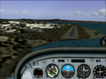
This scenery was requested by Federico Malfu Sanchez, who also did all the legwork to find images and data, and as well did the complete Beta testing.
The area surrounding has been edited to help VFR pilots find their way. The whole LOD 8 tile the scenery is on has been resampled with SRTM3 data at LOD 13 level. The Rio Tercero lake has been configured to satellite images and rivers and roads follow their actual mapped courses.
Additionally the Rio Tercero dam and hydro electric plant, as well as other VFR relevant landmarks, have been included.
| Filename: | Argentina_Villa_RumipalRio_Tercero.zip |
| License: | Freeware, limited distribution |
| Added: | 12th May 2010, 00:19:55 |
| Downloads: | 316 |
| Author: | Alf B. Meier |
| Size: | 1.62 MB |
| Category: Flight Simulator 2004 - Scenery Design | |
| Update of Turbigo's Power Station - VFR LIMC Malpensa, Italy |
|
Images related to this file:
File Description:

This scenery has been revised with complete new ground that solves the previous flickering problems; some objects, buildings and trees have been added. It DOES NOT INCLUDE any airport. Scenery requests Tree_v3 library; a special re-mesh file has been included, for users of special meshes (i/e Ragot Alps or Lod11)
Infos: the Turbigo's power station is placed approx 8 miles South LIMC Malpensa international airport of Milan, on the usual approach way for runways 35L and 35R.
content: new complete image of the ground; power station blocks 1, 2 & 3 with related 4 stacks with lights & smokes; boilers, esp, some ductworks & pipes, oil tanks, water treatment basins, bridges, some buildings and trees
| Filename: | Update_of_Turbigos_Power_Station__VFR_LIMC_Malpensa_Italy.zip |
| License: | Freeware |
| Added: | 25th September 2011, 14:39:16 |
| Downloads: | 1,798 |
| Author: | Aldo Della Vedova & Daniele Lanfranchi |
| Size: | 3.05 MB |
| Category: Flight Simulator X - Flight Plans | |
| Set of three VFR Low Altitude FSX Flight Plans |
|
Images related to this file:
File Description:
Set of three VFR Low Altitude Flight Plans in Florida, Australia, and South Korea. Installation and Usage instructions are inside each individual folder. These are great routes for B-52, F-111, B-1B, B-2 A6, A4, Vulcan and any fighter or bomber enthusiasts. Of course you can fly the routes with any aircraft of your choice. Included in this package are two spectacular gauges by Karol Chlebowski for TFR flying and Pave Tack which includes many advanced features for bombing, navigation and reconnaissance. These two gauges will greatly enhance your ability to fly these challenging routes and are a great companion of the flight plans. Another option to download Version 2.1
of my mini panel which has all this functionality and more.
| Filename: | Set_of_three_VFR_Low_Altitude_FSX_Flight_Plans.zip |
| License: | Freeware |
| Added: | 1st August 2011, 08:32:24 |
| Downloads: | 329 |
| Author: | Bill McClellan |
| Size: | 4.77 MB |
| Category: Flight Simulator X - Missions | |
| Western Cape VFR, South Africa, Flight 1 and 2 |
|
File Description:
You are the chief pilot of the South African Air Force Caravan 41 Squadron, based on
AFB Swartkops in Pretoria. You have been given the task by the Chief of the Air Force (CAF) to assist in a public relations exercise with the US Navy, who have an aircraft carrier docked just outside Saldanha Bay in the Western Cape, South Africa. The admiral on board with a few high ranking officers are to be entertained during their visit at Naval Base Saldanha. You are cleared to fly to AFB Langebaanweg and plan a VFR flight to show off our beautiful Western Cape country side, you are cleared to fly at any altitude you feel necessary. After consulting with the local pilots on the base you have planned the following low level route, over 2 days, which was approved by the CAF.
| Filename: | Western_Cape_VFR_South_Africa_Flight_1_and_2.zip |
| License: | Freeware |
| Added: | 12th August 2010, 00:36:02 |
| Downloads: | 870 |
| Author: | Robbie Albers |
| Size: | 4.39 MB |
| Category: Flight Simulator 2004 - Scenery | |
| VFR of Lario, Area E2 - Como Lake, Italy (Update) |
|
Images related to this file:
File Description:
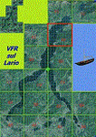
This 8th scenery covers approximately an area of 7.5x6 km, from S.Gregorio/Dongo (NW) to Colico (NE), and S.Siro (SW) to Tremenico/Aveno (SE) and includes six NLC piers: Dervio, Piona, Colico, Dongo, Musso, Pianello del Lario, in addition to the disused Cremia's one; a lot of dedicated buildings are included, as S.Tommaso of Canterbury church and fortification (Corenno), Cistercian abbey (Piona), pier and dock (Colico), S.Stefano church, factory buildings and airpollution control machinery (Dongo), Rezzonico's castle (S.Siro).
This VFR on Lario scenery includes several Dervio's details, and fully revises the previous Dervio scenery; Are included: Boldona's park office and stand, railway station, NLC shiphard, Pontile piers with Concordia steamer, dock bay with small floating pier and compass of the lake, S. Peter and Paul church and houses front of lake, hydro power station, Municipality and some other buildings, Castello's tower, windsurf school, windsurfers and kitesurfers on the lake, cross and Madonna on top of Legnoncino mountain. There are also included two viaducts between the tunnels of the freeway 36, with moted traffic. Catamarans Citta di Como and Tivano at Colico/Dongo piers together with other minor boats and docks alongside the lake coast; a moted regata with catamarans is placed in the lake between Pianello and Dervio.
This scenery SUPERSEDES AND CANCELS the previous "dervio_v2a" one, removed from the library. This is the eighth scenery of the "VFR of Lario" project, made with photorealistic terrain (multiseason & night) and with some 3D GMax realistic objects.
| Filename: | VFR_of_Lario_Area_E2__Como_Lake_Italy_Update.zip |
| License: | Freeware |
| Added: | 25th November 2012, 20:54:39 |
| Downloads: | 1,665 |
| Author: | Aldo Della Vedova, Daniele Lanfranchi, Gian Mario Verga |
| Size: | 39.39 MB |
| Category: Flight Simulator 2004 - Miscellaneous Files | |
| The Fleet of VFR of Lario - Como Lake, Italy |
|
Images related to this file:
File Description:

First release of Navigazione Lago di Como "navigable fleet", including 14 boats: three old Steamers as Concordia, Plinio and Bisbino (the last two for their memory), two light Motorboats as Giglio and Ninfea, three heavy Motorboats as Manzoni, Volta, Orione, two Hydrofoils as Marconi and Freccia delle Valli, three Catamarans as Citta di Como, Citta di Lecco and Tivano, one Ferry as Adda.
All the above vessels are GMax made, already included in the sceneries of VFR on Lario project in static way, but those new ones are fully "flyable" on the lake surface. Enjoy your sailing on Como's lake!
Check videos available here: http://youtu.be/6OR1mpdk2DU
http://youtu.be/v3AB6OCAeSY
http://youtu.be/cbM8CNTPCEE
| Filename: | The_Fleet_of_VFR_of_Lario__Como_Lake_Italy.zip |
| License: | Freeware |
| Added: | 31st January 2014, 12:21:56 |
| Downloads: | 578 |
| Author: | Aldo Della Vedova, Daniele Lanfranchi, Gian Mario Verga |
| Size: | 29.8 MB |


© 2001-2026 AVSIM Online
All Rights Reserved
Privacy Policy |