
Where Flight Simulation Enthusiasts Gather from Around the World!
AVSIM Library - Search Results

| Category: Flight Simulator 2004 - AFCAD Files | |
| Southwestern British Columbia Airport Corrections |

|
File Description:
As shorelines, water bodies, roads, railways and other features become more accurate in addon scenery, inaccuracies in airport placement become apparent. Although Microsoft did an excellent job of using published data to place airports, the published information is not always accurate. Some airports in the area of interest were misplaced by as much as 850m, thus conflicting with water and/or roadways. This release corrects Canadian airports in South-western British Columbia, in LOD5 cell 15x14 (915140). This area covers a portion of Vancouver Island from Duncan to Victoria, and the BC Mainland as far east as Douglas Lake and north of Pemberton. In this region CAK3, CAL3, CBT6, CYHE, CYLY, and CYPS are corrected, and Bruce Ellison has kindly modified his CAM3 for inclusion; see separate readme document for details. All these airports have been activated for AI use. A few buildings that may conflict from roads have been removed from CYNJ. The unrealistically large flatten and airport polygon at CYYJ is reduced in size. Airport features that end up in the water have been removed from CYVR and the overly large flatten there reduced. Some Rwy12 goodies have been tossed in as well, but if these are not important to the user, it is not necessary to have Rwy12 installed. Ultimate Terrain or similar accurate hydrology and roads recommended. FSGenesis 38m mesh or other high quality terrain mesh recommended.
| Filename: | Southwestern_British_Columbia_Airport_Corrections.zip |
| License: | Check within download |
| Added: | 30th May 2005, 07:31:45 |
| Downloads: | 3,001 |
| Author: | Jon Patch, Bruce Ellison |
| Size: | 1.53 MB |
| Category: Flight Simulator X - Scenery | |
| Columbia SC (KCAE) |
|
Images related to this file:
File Description:
The Columbia Metropolitan Airport Authority has provided substantial information about KCAE online, making it possible to pretty accurately model this airport. The taxiway signs have been placed according to exhibits in the airport's certification manual, and taxiway designations have been revised in accordance with upgrades to be effective mid-Novemer 2012. Most buildings have been custom modeled in accordance with information available on the internet, including Microsoft Bing birdseye views. The airport layout and landclass changes are in accordance with Google Earth imagery.
If you have Jim Dhaenens' lightobj.bgl installed, apron lighting will be included, and if you have
KB_static_aircraft_FSX installed (available at www.kb-sim.com/screens_static_aircraft.html),
additional parked aircraft will be visible. The layout of scenery is optimized for use with
Ultimate Terrain X-USA. FSX runs smoothly with this scenery on my computer, but it has not been
tested on a low-end system. Sometime after starting this project, it came to my attention that a
good scenery for KCAE was already available (but not listed at www.freewarescenery.com) from Jim
Hill that is another option as well as adjusting scenery complexity.
The new taxiway designations are not yet shown in the latest observed FAA airport diagram. An airfield sketch provided to pilots by the Columbia Metropolitan Airport is included in the package to show the taxiway designation changes.
| Filename: | Columbia_SC_KCAE.zip |
| License: | Freeware |
| Added: | 14th December 2012, 01:28:23 |
| Downloads: | 1,694 |
| Author: | Art Poole |
| Size: | 3.43 MB |
| Category: Flight Simulator 2004 - Scenery | |
| Backcountry airfields for 19m terrain mesh in Idaho USA |
|
Images related to this file:
File Description:
These four backcountry fields are for use with the FSGenesis 19m mesh of Idaho, and are Big Creek, Johnson Creek, Dixie, and Sulphur Creek Ranch. They have been revised to fit and almost certainly do not work without the 19m mesh; a quick comparison with Big Creek before and after demonstrates the difference. I also have Ultimate Terrain installed. The three ingredients of terrain mesh, UT main roads, and UT streams, along with their individual margins of error, very often create conficts of space that make a grass runway impossible to site with it's correct length. Given the choice of turning off roads or streams (the terrain mesh cannot be turned off, obviously) I chose streams; the roads are less obviously incorrect, plus it matters not if roads go uphill while a climbing stream is to be avoided. On that basis the original series is reissued here for use with the 19m terrain mesh, on the presumption that you have already downloaded the original series. There are no textures or AI included as they remain the same as the originals, and the new scenery bgl's replace the originals to get the runways and grass etc in the right positions. There will be follow-on fields that are new, and all of the new ones will be only for the 19m mesh.
| Filename: | Backcountry_airfields_for_19m_terrain_mesh_in_Idah.zip |
| License: | Freeware, limited distribution |
| Added: | 29th May 2017, 04:19:43 |
| Downloads: | 124 |
| Author: | Roger Wensley |
| Size: | 2.22 MB |
| Category: Flight Simulator X - AFCAD Files | |
| Atlantic City International Airport (KACY), NJ |
|
File Description:
Located 09 miles NW of Atlantic City, New Jersey on 5000 acres of land, Atlantic City International Airport is a major airport serving the southern portion of New Jersey. It is also one of the main gateways for tourists looking to vacation in nearby Atlantic City, famous for its boardwalks and casinos. This airport has been very heavily modeled with many surrounding buildings and all aprons properly placed. Gates are all properly located and labeled according to the terminal chart (there are, however, no jetways like in the default scenery). General Aviation parking is available in its proper area � all aircraft in the parking area (middle of the tarmac) have collision disabled. If you select Military Cargo parking you will start on one of the helipads in the Coast Guard section. If you select Military Combat parking you will start next to the line of F-16s on ready-alert over on the Air National Guard tarmac. You can also start on a helipad north of the airport. This airport also features completely custom taxiway line and edge lighting. Because this airport uses ATC, it suffers the same bug as my KEWR airport, which is that you cannot receive taxi in directions from ATC � to gate, parking or fuel. Almost all arriving AI aircraft will also disappear from the taxiway after radioing in to ATC and failing to receive taxi instructions to the gate/parking. All traffic and instructions taxiing out works fine. All gate parking spaces have fuel, as well as the military parking and north helipad. GA aircraft can get fuel by taxiing over to the fuel station north of the GA tarmac. Taxiing onto a closed runway (marked with an �X�) will cause a crash. Broken-down taxiways are not good for your undercarriage!
Scenery constructed with use of satellite images/streetview/aerial photos - the author has not been there in person.
This scenery is meant to be used in conjunction with MegaScenery Earth New Jersey/Delaware 003. It is not required, but apron use is minimized to allow satellite scenery to show through as much as possible, and objects are placed based on the MSE textures - lack of it may make scenery look out of place.
| Filename: | Atlantic_City_International_Airport_KACY_NJ.zip |
| License: | Freeware |
| Added: | 1st February 2011, 10:28:53 |
| Downloads: | 1,355 |
| Author: | Drew Sikora |
| Size: | 5.12 MB |
| Category: Flight Simulator X - Scenery | |
| Honduras Islands v3 |
|
Images related to this file:
File Description:

Version 3 includes all previous patches and updates. This version also restructures the file system to be fully compatible with the ORBX "FTX Global openLC North America" product as well as adding functionality for default FSX users. Additionally, water class scenery is updated to appear more realistic, MHRO is updated to reflect the newly expanded apron, and SRTMGL1 (30m) mesh is included. All landclass polygons and coastlines were meticulously hand-drawn directly from satellite imagery to provide the most detailed and accurate scenery available for this region.
This project rebuilds the islands of Roatán, Barbareta, Guanaja, and Utila, and adds Cayos Cochinos and the numerous cays associated with the "Islas de la Bahia" (Islands of the Bay). Roatán (MHRO), Guanaja (GJAJ/MHNJ) and Puerto Lempira (MHPL) are completely overhauled and positioning is corrected. New and fully functioning AI airports are added for Utila (MHUT), Fort Cay (MHFC) and Cochino Pequeño (MHCP) of the Cayos Cochinos chain, and La Ceiba (MHLC) is modified to accommodate more AI traffic. Accurate coastlines, lakes, road and river data, as well as corrected landclass are provided based on the latest available satellite imagery. GA flight plans are provided to add or enhance service to the smaller islands. Updates were created or rebuilt in a manner which carefully aligned airport data with current satellite imagery, when available. Scenery was created using Airport Design Editor X v1.70.6042, SBuilderX 3.13, and the FSX Object Placement Tool. Scenery objects were added and modified from stock FSX scenery to resemble as closely as possible the actual airports.
| Filename: | Honduras_Islands_v3.zip |
| License: | Freeware |
| Added: | 23rd December 2016, 08:17:26 |
| Downloads: | 1,606 |
| Author: | Carlyle Sharpe |
| Size: | 17.35 MB |
| Category: Flight Simulator 2004 - Scenery | |
| OSM World: South America |
|
Images related to this file:
File Description:

OSM World is a community project! If you wish to help, check the documentation and contact the author!
Welcome to OSM Wold: South America! This is a vector data scenery package covering the South American area. Coastlines, Rivers, lakes, roads, railways, and power lines with detail never before seen! All in an autogen-compatible density! You can see roundabouts, train terminals, harbor areas in a resolution of a point every 10 meters. At this same resolution a vectorial city class places residential (in small and big building variations, depending on surface area) and industrial areas exactly where they are supposed to be. This gives the city areas a resolution far superior to the capacity of FS-2004 default landclass bitmaps, limited to approximately 1 Km x 1 Km squares. OSM World: South America will even give you small roads leading to small towns (even a few houses across)! From big highway intersections, including ramps, to the tiniest rural pathways covering the entire South american area! Wherever in South America you fly, there is something to see!
You can enjoy this scenery near coastlines too! harbor areas and extremely detailed coastal topology (try the southern Chile). This scenery makes sure that the ocean is always flat, you can forget about the climbing water often found around photo-sceneries! This scenery is best paired with a good set of terrain meshes (like the freeware global SRTM mesh by Stephen Rothlisberger , available here: http://simviation.com/1/fs2004terrainmesh).
| Filename: | OSM_World_South_America.zip |
| License: | Freeware |
| Added: | 5th August 2015, 02:31:08 |
| Downloads: | 3,090 |
| Author: | Mario Noriega, Luis Miguel Hernandez |
| Size: | 64.37 MB |
| Category: Prepar3D V1-4 - Aircraft Repaints, Textures and Modifications | |
| Pan Am "Clipper Undaunted" L049 Constellation (N88855) |
|
Images related to this file:
File Description:

PAA Clipper Undaunted. N88855, Lockheed L-049 Constellation, Clipper Invincible, notes: C/n 2055, delivered to Pan Am on 22 April 1946. This Connie also carried the title Clipper Undaunted. TEXTURES ONLY. You need a legal copy of the WOS_L049 by A2A. "Pan American World Airways, known from its founding until 1950 as Pan American Airways[1] and commonly known as Pan Am, was the principal and largest international air carrier in the United States from 1927 until its collapse on December 4, 1991. Founded in 1927 as a scheduled air mail and passenger service operating between Key West, Florida, and Havana, Cuba, the airline became a major company credited with many innovations that shaped the international airline industry, including the widespread use of jet aircraft, jumbo jets, and computerized reservation systems. It was also a founding member of the International Air Transport Association (IATA), the global airline industry association.[3] Identified by its blue globe logo ("The Blue Meatball"), the use of the word "Clipper" in aircraft names and call signs, and the white pilot uniform caps, the airline was a cultural icon of the 20th century. In an era dominated by flag carriers that were wholly or majority government-owned, it was also the unofficial overseas flag carrier of the United States. During most of the jet era, Pan Am's flagship terminal was the Worldport located at John F. Kennedy International Airport in New York City."(Source: Wikipedia)
All logos and texts had to be recreated, since there was nothing usable on the net.
| Filename: | Pan_Am_Clipper_Undaunted_L049_Constellation_N88855.zip |
| License: | Freeware, limited distribution |
| Added: | 17th January 2017, 19:13:40 |
| Downloads: | 1,160 |
| Author: | Eberhard Haberkorn / A2A |
| Size: | 79.32 MB |
| Category: Flight Simulator 2004 - Scenery | |
| Campbell River floats CAE3 in BC Canada |
|
Images related to this file:
File Description:
Campbell River is a medium sized town on Vancouver Island, some 50 miles north of Vancouver. The base is just north and west of the town on Spit Road. And Ultimate Terrain is required for the cost to be in the right place. The docks are on the south side of the spit, on the (relatively) sheltered river side, though take offs and landings are requested to take place outside the harbour if conditions permit. The base is noted as used and run by Corilair, though in fact there is also another company based there, Vancouver Island Air, who like Coril Air also have two docks, one for boarding passengers and one for maintenance and refuelling tie-ups. At the river mouth there is a small marina, run by the same folks who run the trailer park, and next to that a dock for visiting float planes. There is a seventh dock at the end furthest from the river mouth; I don't know what that is used for but it is next to Vancouver Island Air and might be theirs. At low tide there are numerous sandbanks (and more permanent islands with bushes and trees) in the mouth of the Campbell River and I decided to ignore installing these with all the problems they would cause me. The main buildings and most of the others are modeled specifically for this scenery; minor items like parked cars are RWY12.
| Filename: | Campbell_River_floats_CAE3_in_BC_Canada.zip |
| License: | Freeware, limited distribution |
| Added: | 12th February 2010, 18:45:00 |
| Downloads: | 880 |
| Author: | Roger Wensley |
| Size: | 5.3 MB |
| Category: Flight Simulator 2004 - Miscellaneous Files | |
| Nick's LightFix |
|
File Description:
The concept and the base textures for this package are from Mark Poole and his original light replacement releases. Mark's original Nav Light package has a really good concept and uses light textures which create sharp lens flairs or bursts. I found the lens flair in his packages to be a bit too large and out of scale for my display and taste. Also, I wanted to have an easy way to replace all the FS9 lights in one shot with little or no configuration file editing. With that in mind, this package was created. This release will automatically replace ALL the Flight Simulator aircraft and airport lights with more realistic ones along with better distance visuals of slower flashing radio tower/smoke stack and ground beacons. It also includes replacement lights in scale for the PMDG 737, 747 and for all Project Opensky aircraft offered on their site. It works automatically with Ultimate Traffic and other AI add-ons which use the default Microsoft aircraft lights. I added a diffused halo effect to Mark's original airport_lighting_v2 texture which gives a more realistic look in cloudy or weather conditions and enhances the dynamic directional brightness of the lights. In addition to the navigation lights, I have also created aircraft beacons and strobes which will also install automatically . A restore package is included allowing to you to revert back to default FS9 texture and FX files.
ENJOY!
From Nick Needham
[email protected]
| Filename: | Nicks_LightFix.zip |
| License: | Freeware, limited distribution |
| Added: | 4th April 2006, 21:47:56 |
| Downloads: | 19,321 |
| Author: | Nick Needham |
| Size: | 1.55 MB |
| Category: Flight Simulator X - Scenery | |
| Frankfurt Main Airport (EDDF) v8 - Auto installer |
|
Images related to this file:
File Description:
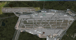
This major update represents EDDF in the July 2015 timeframe.
This version includes further expansion of the Terminal 3 area now in use as extended apron parking, with new J and K ramps for airline, general aviation and cargo aircraft, new apron night lighting, vehicular traffic/roadways as well as support for 70+ airlines coded for AI traffic.
In addition, this update features some brand new taxiways and updated airport navaids including use of the secondary 3.2 degree ILS approach paths for the Northwest runway.
For visual improvements, a new sound wall for the northern perimeter is included along with improvements in landclass to match Orbx FTX Global and inclusion of an optional 200Mb ground photo scenery layer providing even more realism.
Extended compatibility is also provided for P3D and GSX v1.9 (Ground Services for FSX) with the latter providing customized service vehicle parking for each parking position across the whole airport and in some cases, custom GSX pushback operations have been introduced at selected gates. The associated GSX airport .ini file is supplied in this package.
Last of all, more flexibility is delivered. This new scenery now comes supplied with 3 separate .BGL files - the standard .BGL AFCAD file together with the exclusions file ( _CVX) and the separate airport objects file ( _OBJ) so that the airport AFCAD can continue to be updated independently from the airport objects and exclusion files by users wishing to modify the airport layout to their own needs.
Default FSX scenery is required.
Please consult the readme and the comprehensive help manual prior to installation and for more information.
| Filename: | Frankfurt_Main_Airport_EDDF_v8__Auto_installer.zip |
| License: | Freeware |
| Added: | 5th August 2015, 18:50:05 |
| Downloads: | 15,648 |
| Author: | Mark Aldridge |
| Size: | 232.05 MB |
© 2001-2026 AVSIM Online
All Rights Reserved
Privacy Policy |