
Where Flight Simulation Enthusiasts Gather from Around the World!
AVSIM Library - Search Results

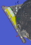
| Category: Flight Simulator 2004 - Scenery | |
| Opa's Campground on Lake Texoma. |

|
Images related to this file:
File Description:
Opa's Campground. A ficticious campground located on the shores of beatiful Lake Texoma on the Texas-Oklahoma border. Created with the EZ and RWY12 Object placing programs, the scenery is packed with eye candy and some unusual features including AI Helicopter rides, an AI Windsurfer and AI boats moving about the lake plus fireworks on the 4th of July. There is a landing strip at the campground for those who arrive by air and start locations for seaplanes and automobiles. Lago sound files are included for those who have the Lago FSE program (optional). The scenery is designed to be used with the default FS2004 setup - it is not compatible with Ultimate Terrain - USA. If you are seeking a great place to "get away" for some fun, this is it. Please unzip (using folders option) to a temporary folder and follow the simple installation directions.
| Filename: | Opas_Campground_on_Lake_Texoma.zip |
| License: | Freeware |
| Added: | 10th December 2009, 14:58:21 |
| Downloads: | 776 |
| Author: | David "Opa" Marshall |
| Size: | 2.06 MB |
| Category: Flight Simulator X - Miscellaneous Files | |
| Final Strike |
|
File Description:
In the early of 1945 the Black Army was being destroyed by the Red Army. Thus, the Black Army Intelligence sent a group of the best available scientists and engineers to a secret base established in the Southwest of Finland to develop a new and ultimate weapon to win the WWII. The engineers deployed the equipments and built a new facility and the scientists began the project but they have never done it!
Nowadays. Some old typewritten papers were found in Helsinki. These papers were talking about ����The Project: Final Strike���� including part of specifications and facility location. So, Finland government sent these documents to United Nations. Now, United Nations have assembled a search and rescue squad including engineers, soldiers, scientists and an archaeologist to find the ruins of this facility.
| Filename: | Final_Strike.zip |
| License: | Freeware |
| Added: | 17th April 2012, 21:25:53 |
| Downloads: | 165 |
| Author: | Sergio Ambrus |
| Size: | 3.24 MB |
| Category: Flight Simulator 2004 - Scenery | |
| UPDATE - Islip Long Island MacArthur Airport (KISP) Main Terminal |
|
File Description:
Flight Simulator 2004 Main terminal scenery for Islip Long Island MacArthur Airport (KISP). I have tried to as accurately recreate the main terminal at KISP according to my personal experience working there for a number of years, and from images I was able to find on the web. This is just a starting point, and anyone who wants to take my GMAX source to the next level PLEASE DO SO! I am not an expert in GMAX, and I believe it would be great to add animation to the gates for realism. Please also check out my AFCAD file that accurately represents the current and historical gate assignments as well. This update corrects some of the jetway positions to better fit with the new AFCAD for KISP. It makes the ramp better able to handle the traffic with the Ultimate Traffic add-on for FS2004. The AFCAD filename is 'AF2_KISP2.zip'.
| Filename: | UPDATE__Islip_Long_Island_MacArthur_Airport_KISP_M.zip |
| License: | Freeware, limited distribution |
| Added: | 23rd November 2003, 23:18:17 |
| Downloads: | 2,299 |
| Author: | Phil Perlman |
| Size: | 417.3 KB |
| Category: Flight Simulator 2004 - AI Flight Plans | |
| Sioux Falls Aviation Spring 2010 |
|
File Description:
Sioux Falls Aviation (Daedalus Inc) operates out of the Encore FBO at Sioux Falls - Joe Foss Field in South Dakota to destinations throughout South Dakota, North Dakota, Nebraska, Wisconsin, and Minnesota as a feeder service for both DHL and UPS. They operate 22 aircraft including 10 Fairchild Metroliners, 8 Cessna 402Bs, 2 Cessna 414As, one Cessna 404, and one C90. Flights taken from FlightAware for the week of 11-17 April, 2010. DHL flights are NOT included as they are included in the AIG DHL package. Note: If you are using either the Ultimate GA Cessna 402 or World of AI Cessna 402 package, you must decompile the bgl file and remove the flightplans for N1048, N402BP (Sold as salvage on 3-31-10 after crash), N780MB, N3796C, N402SS, N3813, N3729C, N624CA, & N76MD. These aircraft are depicted using "Generic" liveries in the UGA and WoAI packages.
| Filename: | Sioux_Falls_Aviation_Spring_2010.zip |
| License: | Freeware |
| Added: | 13th May 2010, 21:07:38 |
| Downloads: | 537 |
| Author: | Steve Lewis |
| Size: | 3.56 KB |
| Category: Flight Simulator 2004 - Scenery | |
| Armstrong Ontario; one airfield and two float bases |
|
File Description:
Armstrong CYYW airfield is 70 miles northeast of Thunder Bay, and close to Lake Nipigon. There isn't much of interest at the airfield by way of buildings (as there aren't many buildings!) and the only plane I saw was a fire fighting Canadaair CL 415. A basic airfield with one runway with lights and one without, and no maintenance. There is fuel, but it is locked up and not for sale.
The two float bases are 5 miles west (CJF6) and 10 miles southwest (CKN6) of Armstrong airfield. Lake Mackenzie is home to two companies, Armstrong Outposts (two Beavers) and Huron Air & Outfitters (an Otter and a Beaver) who both run fishing and hunting lodges. Wilderness North are further south on Lake Waweig, and I think they fly two Otters and a Beaver to their outpost camps. You need Ultimate Terrain, or there won't be any lakes!
| Filename: | Armstrong_Ontario_one_airfield_and_two_float_bases.zip |
| License: | Freeware |
| Added: | 24th February 2009, 00:51:42 |
| Downloads: | 892 |
| Author: | Roger Wensley |
| Size: | 7.03 MB |
| Category: Flight Simulator 2004 - Scenery | |
| Inuvik CYXT in the Northwest Territories, Canada |
|
Images related to this file:
File Description:
Inuvik is a town of 3,500 or so inhabitants at N68 18 W133 29, which puts it 120 miles inside the Arctic Circle on the east side of the Mackenzie River delta and around 90 miles from where the Mackenzie meets the Beaufort Sea. There is a Canadian Forces base at the eastern end of the field, with shelters for six F18 fighters; the base in one form or another has been there for a while and is the reason for the generous length of asphalt runway.
Inuvik was established in the early 1960's as a replacement regional center for Aklavik which is 40 miles to the west across the delta and which flooded on a regular and inconvenient basis. This probably works without Ultimate Terrain but I haven't tested it. I also haven't tested it in FSX but I was told it works there too.
| Filename: | Inuvik_CYXT_in_the_Northwest_Territories_Canada.zip |
| License: | Freeware, limited distribution |
| Added: | 6th October 2010, 13:22:04 |
| Downloads: | 942 |
| Author: | Roger Wensley |
| Size: | 4.12 MB |
| Category: Flight Simulator X - AFCAD Files | |
| PASD - Sand Point, Alaska |
|
Images related to this file:
File Description:
The airport of Sand Point (PASD) has been extended since Microsoft has modeled it and even after the upgrade through Scenery Solution's Ultimate Terrain X Alaska has been produced. This AFCAD is built on the UTX version of the airport and is intended to be used in this environment only.
The file considers the extended runway, VASI4 at both ends with 3.6 deg glideslope and the necessary new water-polygon. Due to the specific coastline bitmaps used by UTX I had to change to Microsoft's default ones being accessible through the wonderful tool Airport Design Editor X. Some additional landclass in the airport's vicinity and three (default) buildings close to the apron are completing the changes. I did not touch the easterly landing stage (or whatever it could have been) even if Google suggests that it disappeared meanwhile except some remaining piles in the water - it's just looking nice. ;-)
| Filename: | PASD__Sand_Point_Alaska.zip |
| License: | Freeware |
| Added: | 17th October 2013, 18:55:00 |
| Downloads: | 377 |
| Author: | Axel Birsul |
| Size: | 646.25 KB |
| Category: Flight Simulator 2004 - Scenery | |
| Diavik Diamond Mine CDK2 |
|
Images related to this file:
File Description:
The Diavik Diamond Mine is located about 200 miles NE of Yellowknife in Canada's Northwest Territory. It a relatively new facility, having been begun production in 2003. The only means of access are by air or ice road. (If you are a James Bondian super villian plotting world domination, Diavik would be a great place for your secret underground headquarters.) This scenery is completely scratch built. In addition to the airstrip itself, I used Google Earth pics to create a photo ground texture of the adjoining facility. The buildings of the main processing complex are very simply modeled, as is the large open pit mine.
This scenery was designed for use with Ultimate Terrain and was not tested in the default scenery. (As far as I can tell, Ulimate Terrain does not affect the area around Diavik, so it should work OK.) It may or may not work in FSX.
| Filename: | Diavik_Diamond_Mine_CDK2.zip |
| License: | Freeware |
| Added: | 4th February 2011, 18:07:48 |
| Downloads: | 580 |
| Author: | Sidney Schwartz & Peter Ham |
| Size: | 994.9 KB |
| Category: Flight Simulator 2004 - Scenery | |
| Point Ellis cannery V1, for Holger Sandmann's Tongass Fjord scenery |
|
Images related to this file:
File Description:
This is a revised version of Point Ellis cannery, originally posted in 2007. It is unsurprisingly just east of Point Ellis, on the east side of the southern end of Chatham Strait in southern Alaska. It is marked on the chart of the area, and if you are chartless then there is a piece of the chart here. This scenery is designed specifically for use in the Tongass Fjord scenery, and probably doesn't work with just Ultimate Terrain. The cannery has an identifying code so it will show up on a gps as "PECA". There is no interaction with atc as there are no designated water runways, so the "PECA" on the gps just acts as a waypoint. There will be further posts for use with Tongass Fjords, Misty Fjords, and Glacier Bay, and I still find these scenery areas by Holger and his crew the most satisfying in FS9.
| Filename: | Point_Ellis_cannery_V1_for_Holger_Sandmanns_Tongas.zip |
| License: | Freeware, limited distribution |
| Added: | 6th November 2014, 21:55:48 |
| Downloads: | 237 |
| Author: | Roger Wensley |
| Size: | 3.86 MB |
| Category: Flight Simulator X - Scenery | |
| San Diego Extras |
|
Images related to this file:
File Description:

Many extras around the San Diego area including carriers, cargo ships, criuse liners, destroyers, power and sail boats, various cranes, shoreline buildings and a strange but unique helipad built on huge rocks on the shoreline to the north on the coast. I thought there were too many open spots around the area so I filled most of them. Designed with a clean install of FSX so if you have addons such as Ultimate terrain, objects may appear where they were not intended to be. designed to enhance your FS world.
I'm keeping track of the number of downloads as to these "clean install" sceneries which will help me decide later in purchasing some addons to make my sceneries viewable to a larger number of users. An email would be appreciated regarding the success of you seeing the scenery properly.
Hope you do see the objects and thanks............enjoy!........savageale
| Filename: | San_Diego_Extras.zip |
| License: | Freeware |
| Added: | 11th July 2010, 09:40:52 |
| Downloads: | 2,499 |
| Author: | Tim Durham |
| Size: | 1 MB |
© 2001-2026 AVSIM Online
All Rights Reserved
Privacy Policy |