
Where Flight Simulation Enthusiasts Gather from Around the World!
AVSIM Library - Search Results

| Category: Flight Simulator X - Scenery | |
| British Columbia Floatbases |

|
Images related to this file:
File Description:
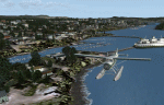
This is a collection of floatbases around the coast of British Columbia made with default scenery objects, and derived from Google Earth and the Canada Waterdrome Supplement. This scenery is designed to complement the work of others and therefore doesn't include waterdromes made by others such as Sidney Schwartz's CYYJ, Ganges Harbour and BCPNW Float Bases which covers an area around the Gulf Islands. You must have Ultimate Terrain Canada for these sceneries to work and in areas away from the immediate coast (Fraser River), a SRTM mesh for the correct elevations.
| Filename: | British_Columbia_Floatbases.zip |
| License: | Freeware |
| Added: | 16th May 2012, 14:02:09 |
| Downloads: | 1,541 |
| Author: | Chris Peschke |
| Size: | 183.32 KB |
| Category: Flight Simulator X - Scenery | |
| EPMO Modlin Airport - Modlin, Poland (2012) V1.0 |
|
Images related to this file:
File Description:
EPMO_2012 X v1.0
FSX Warszawa Modlin Airport scenery (EPMO) New airport for the Polish capital, with low cost airlines aiming to provide a cheap alternative to services from Warsaw's Chopin International Airport. Modlin Airport, located 35 kilometres north of the city centre, was erected on a former military airfield and it is hoped that 3 million customers will make use of the airport each year.
Ultimate Traffic 2 powerpack files included for Ryanair and Wizzair ready to export to UT2.
Terminal model shared by the Robert J. http://www.scenery3d.strefa.pl/
| Filename: | EPMO_Modlin_Airport__Modlin_Poland__2012___V10.zip |
| License: | Freeware |
| Added: | 18th September 2012, 13:00:35 |
| Downloads: | 1,909 |
| Author: | Marcin Palasek |
| Size: | 5.25 MB |
| Category: Flight Simulator X - Panels | |
| Defaultimate737 |
|
Images related to this file:
File Description:
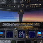
The ultimate virtual cockpit enhancement for Microsoft Flight Simulator X 737-800.
This enhancement includes improved cabin lighting, switchable display units with adjustable brightness, engine starter switches now include FLT & CONT settings, taxi and landing light ground splash effects are decoupled, independent left and right wiper animations, max autopilot bank angle bezel, strobe and navigation lights controlled independently, functional autobrake knob, functional fuel pump switch and cross feed knob, vast majority of switches and knobs animated (although largely non-functional) and various gauge and poly fixes.
| Filename: | Defaultimate737.zip |
| License: | Freeware |
| Added: | 12th September 2026, 20:20:04 |
| Downloads: | 177 |
| Author: | Trent Bennett |
| Size: | 9.63 MB |
| Category: Flight Simulator 2004 - Scenery | |
| Guelph Air Park CNC4 |
|
File Description:
This is another "must Have" for the General Aviation VFR flyer in Ontario, Canada. Guelph Air Park CNC4 is a Pilot Tranining airport and situated close to Kitchener-Waterloo(CYKF), Toronto Pearson(CYYZ) and Hamilton International(CYHM).
Guelph is also the home of the "TIGER BOYS", vintage aircraft restorers and pilots. A great history document by resident pilot Glenn Norman is included in the download.
This scenery is set to line up with Ultimate Terrain Canada/Alaska or Joel's Roads but neither of these is an absolute necessity.
| Filename: | Guelph_Air_Park_CNC4.zip |
| License: | Freeware, limited distribution |
| Added: | 20th January 2006, 05:31:02 |
| Downloads: | 4,104 |
| Author: | Al Gay - Flight Ontario |
| Size: | 12.65 MB |
| Category: Flight Simulator 2004 - Aircraft Repaints, Textures and Modifications | |
| Air France Airbus A320-214 (F-HEPE) |
|
Images related to this file:
File Description:

Air France, is the French flag carrier headquartered in Tremblay-en-France, (north of Paris). It is a subsidiary of the Air France-KLM Group and a founding member of the SkyTeam global airline alliance. As of 2013 Air France serves 35 destinations in France and operates worldwide scheduled passenger and cargo services to 164 destinations in 93 countries. The airline's global hub is at Paris Charles de Gaulle Airport, with Paris Orly Airport, Lyon-Saint Exupery Airport, Marseille Provence Airport, Toulouse Blagnac Airport, and Nice Cote d'Azur Airport serving as secondary hubs.
Air France livery is painted on Project Airbus's Airbus A320-214 model (included). The textures are saved in 32bit format for quality graphics. Textures are also characterized by HD (High Definition). Its features are idle-reverser animation, animated pack vents and pressurisation outflow valve, detailed textures, accurate paint, dynamic shine & effects, dynamic flexing wings that respond to turbulence, fully independent suspension, trim animation, gear steering, accurate flight dynamics, spoiler animation, reflective cockpit windows, improved wingflex code with input from several new parameters including ground spoilers, fuel load, and angle of attack, transparent navigation light lenses and many more. Visit my facebook page "Aviation Art Paintings by Giacomo Tomasini" for news, updates and previews on my future repaint projects: https://www.facebook.com/AviationArtPaintings . Thanks for downloading & Happy flying.
| Filename: | Air_France_Airbus_A320214_FHEPE.zip |
| License: | Freeware |
| Added: | 18th July 2013, 23:55:07 |
| Downloads: | 1,790 |
| Author: | Giacomo Tomasini |
| Size: | 18.57 MB |
| Category: Flight Simulator X - Scenery | |
| USCG Air Station Sitka PASI Scenery Package with AI Aircraft |
|
Images related to this file:
File Description:

Thanks to Airport Design Editor(ADE), Military AI Works (MAIW) scenery and aircraft, along with AI Flight Planner3 (AIFP3), I did my best to re-create USCG Air Station Sitka for FSX. Creating this airport scenery (along with Kodiak PADQ) was my first attempt at a BIG (for me) scenery project in ADE, but thanks to MAIW and their Global Scenery Library Objects, I think I've succeeded in re-creating the airbase. You'll need to go to MAIW's website and download that "Global Scenery" file for any of this to work, so I've copied that website link below (in STEP 1). I also added Sitka markings to all the AI helicopters for added realism.
And just for fun, I placed a USCG Cutter and a "fishing boat in distress" (complete with green smoke) out in the harbor as a "Practice Rescue Scenario". The Cutter has a "hard deck" to land on and I've also illuminated both it and the Fishing boat for DUSK and NIGHT practice.
*SPECIAL NOTE* THE AI C-130 in the pictures is from my Kodiak scenery package, there are only Helicopters based at Sitka...but I have it "fly in" from my Kodiak scenery package. So if you're interested in that, you can find the "USGC Air Station Kodiak AK PADQ Scenery Package with AI Aircraft" on AVSIM as well.
| Filename: | USCG_Air_Station_Sitka_PASI_Scenery_Package_with_A.zip |
| License: | Freeware |
| Added: | 31st January 2021, 06:43:13 |
| Downloads: | 1,107 |
| Author: | Daniel W Gregory |
| Size: | 16.58 MB |
| Category: Flight Simulator 2004 - Scenery | |
| KGFL - Glens Falls, Floyd Bennett Memorial (v2.2) |
|
Images related to this file:
File Description:
KGFL - Glens Falls, Floyd Bennett Memorial v2.2, located in the foothills of the Adirondack Mountains in upstate NY USA, this facility is owned by Warren County and run by RichAir. Although it has a 5000 ft main rwy, KGFL is a Non-controlled airfield catering to small engine a/c up to a few private jet daily traffic serving 'The Northcountry' New York. KGFL recently received several upgrades including 4 new GA hangars large enough to accommodate the needs of business jets.
All Objects fully designed and completely redone in GMAX using high resolution custom photo-real 32bit textures. Optional DXT textures included. Also includes new AFCAD file, more accurate airport grounds perimeter, satellite photo-real grounds, custom taxiways, taxi-signs and taxi lights, area roads, animated hangar doors, and near area landclass. No AI traffic tracks included with this release, but afcad designed to support several AI. Rwy12 objects required for a few static a/c and parking lot cars. v2.2 Includes mipmapped textures, reduced trees for better performance, and increased, more accurate taxiway light density. This v2.2 package is a full-install.
| Filename: | KGFL__Glens_Falls_Floyd_Bennett_Memorial_v22.zip |
| License: | Freeware, limited distribution |
| Added: | 5th February 2010, 16:52:44 |
| Downloads: | 2,350 |
| Author: | Ed 'Geneer' Cox |
| Size: | 74.81 MB |
| Category: Flight Simulator 2004 - Gauges | |
| Simulated Aircraft Bubble Sextant Chart (addon) |
|
File Description:
This is an add-on to the "dc3_bbsx.zip" Simulated Aircraft Bubble Sextant Gauge. While the simulated sextant determines the elevation to the star, it requires drawing lines of position on a chart to ascertain the latitude and longitude of the fix. The Global Navigation Charts (GNC) at scale 5,000,000:1 are suitable but not generally available for this purpose. This gauge simulates small sections of the proper chart, and automatically places the LOP from the sextant on the chart in the proper orientation. It includes installation and operating instructions, and an example flight description. Install the "dc3_bbsx.zip" first, if it hasn't been installed already.
| Filename: | Simulated_Aircraft_Bubble_Sextant_Chart_addon.zip |
| License: | Freeware, limited distribution |
| Added: | 17th March 2008, 04:15:43 |
| Downloads: | 1,185 |
| Author: | Dave Bitzer, Mark Beaumont |
| Size: | 907.27 KB |
| Category: Fly! II - TerraScene | |
| Parkersburg (Ohio Project) TerraScene Project Pack |
|
File Description:
This is a TerraScene 2.1 Project pack for southeastern Ohio and portions of adjoining states. It covers all of global tile 198,158 with Parkersburg, WV in the west and Clarksburg (Benedum) in the east. The Ohio portion is in the NE area of the tile, above the Ohio River, including rolling hills, small towns like Marietta and a, number of small county airports. This pack includes updated Tiger Census (2000) shapefile data, adding new water areas, new highways, and other details. All scenery data files are included: USGS data, shapefiles, and a complete water mask. Requires TerraScene 2.1 and Fly!II patched to v230 or later.
| Filename: | Parkersburg_Ohio_Project_TerraScene_Project_Pack.zip |
| License: | Freeware |
| Added: | 11th May 2010, 00:52:03 |
| Downloads: | 312 |
| Author: | Randall Rocke |
| Size: | 62.89 MB |
| Category: Fly! II - TerraScene | |
| Cape Hatteras (Carolinas Project) TerraScene Project Pack |
|
Images related to this file:
File Description:
Re-upload. This TerraScene 2.1 Project pack covers all of global tile 201,154 and the western half of 202,154. Picking up the NC coastline at Atlantic Beach, it continues north through Morehead City, New Bern, Bayboro, Cherry Point and the Pamlico River. To the east, it continues out over Pamlico sound to Cape Lookout, then proceeds north to Cape Hatteras, including Ocracoke, Buxton, and Avon. This pack includes updated Tiger Census (2000) shapefile data, adding new water areas, new highways, and other details. All scenery data files are included: USGS data, shapefiles, and complete custom water masks. Requires TerraScene 2.1 and Fly!II patched to v230 or later.
| Filename: | Cape_Hatteras_Carolinas_Project_TerraScene_Project.zip |
| License: | Freeware |
| Added: | 21st May 2010, 02:35:26 |
| Downloads: | 261 |
| Author: | Randall Rocke |
| Size: | 44.67 MB |


© 2001-2026 AVSIM Online
All Rights Reserved
Privacy Policy |