
Where Flight Simulation Enthusiasts Gather from Around the World!
AVSIM Library - Search Results

| Category: Flight Simulator X - AFCAD Files | |
| MYGF - Grand Bahama International Airport / Freeport, Bahamas |

|
Images related to this file:
File Description:
Features:
*Accurate parking apron
*Main terminal building with parking area for commercial traffic
*Domestic terminal building
*Cargo ramp
*Separate parking area for GA traffic
*Misc airport buildings added
*Airport vehicles and objects throughout the airport
*Parking lot with vehicles
*Properly placed control tower
*Fire station
*Fuel tanks and trucks
*Rental car building with static rental vehicles
*Birds flying near runway (beware)
*Palm trees/vegetation added near terminal
(For more information on Endeavourai please visit our site at endeavourai.com or our forums at http://endeavourai.boards.net/)
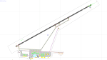
This airport update was made with the latest version of ADE (Airport Design Editor) and made for FSX as a replacement for the stock (default) airport. I've made several changes to the airport which are listed below. All these enhancements are as close to the real airport as I can get with stock library objects. I've used satellite images, terminal photos and maps throughout the whole process so building locations are as accurate as possible. Happy landings in the tropical Bahamas!
| Filename: | MYGF__Grand_Bahama_International_Airport__Freeport.zip |
| License: | Freeware |
| Added: | 12th August 2012, 05:15:17 |
| Downloads: | 953 |
| Author: | Jaison Diaz / Endeavour AI |
| Size: | 107.42 KB |
| Category: Flight Simulator 2004 - Scenery | |
| KGFL - Glens Falls, Floyd Bennett Memorial (v2.2) |
|
Images related to this file:
File Description:
KGFL - Glens Falls, Floyd Bennett Memorial v2.2, located in the foothills of the Adirondack Mountains in upstate NY USA, this facility is owned by Warren County and run by RichAir. Although it has a 5000 ft main rwy, KGFL is a Non-controlled airfield catering to small engine a/c up to a few private jet daily traffic serving 'The Northcountry' New York. KGFL recently received several upgrades including 4 new GA hangars large enough to accommodate the needs of business jets.
All Objects fully designed and completely redone in GMAX using high resolution custom photo-real 32bit textures. Optional DXT textures included. Also includes new AFCAD file, more accurate airport grounds perimeter, satellite photo-real grounds, custom taxiways, taxi-signs and taxi lights, area roads, animated hangar doors, and near area landclass. No AI traffic tracks included with this release, but afcad designed to support several AI. Rwy12 objects required for a few static a/c and parking lot cars. v2.2 Includes mipmapped textures, reduced trees for better performance, and increased, more accurate taxiway light density. This v2.2 package is a full-install.
| Filename: | KGFL__Glens_Falls_Floyd_Bennett_Memorial_v22.zip |
| License: | Freeware, limited distribution |
| Added: | 5th February 2010, 16:52:44 |
| Downloads: | 2,350 |
| Author: | Ed 'Geneer' Cox |
| Size: | 74.81 MB |
| Category: Prepar3D V1-4 - Scenery | |
| KLVN - Airlake Airport - Lakeville, MN, USA |
|
File Description:
KLVN - Airlake Airport beta version .4 - by Jason Boche
This is an update of the default P3Dv4.5 KLVN airport. Aside from the original 12/30 runway, everything else at this airport has been completely ripped and replaced.
Enhancements include:
-Extended runway on each end to depict current configuration
-Accurate taxiways including Hamburg Ave. and buildings representing the current general aviation hangars
-Added navigational equipment on the field
-Added a few asphault and dirt service roads
-Added FBO and other buildings as close as I could match them
-Added some general aviation aircraft, civilians, vehicles at the FBO and hangars, and two fuel trucks
-Moved fuel station to where I believe it is currently according to Google maps with 100LL fuel trigger functional
-Moved the windsock to accurate location
-Moved the beacon to accurate location
-Moved GA parking spots
-Added trees around FBO and beacon
-Added utility poles
-Added a few square miles of Lakeville city, farm, and residential land class and autogen according to Google maps. This is probably the biggest improvement. It now looks like people live, work, and shop north/northwest of KLVN.
-Reworked the runway 12/30 blast pads to what I believe is the "proper" method. Instead of freehand polygon asphault, they are now actual runway extensions on both ends with yellow chevron markings
-Reworked the land class on the southwest end of the airport where I believe hangar expansion is intended. Prior to this, there was a sharp contrast between where the KLVN airport boundary ended and where generic farm landclass began which was right in the middle of the southwest taxiways and it looked bad. Now that whole region is grass and looks to be part of the airport parcel.
-Minor building adjustments west of the FBO to better match actual placement.
-Fixed a gap on the southeast end of Hamburg ave taxiway where it rounds the corner for the rwy 30 hold short line
-Randomized the directional facing of some of the cars parked at GA hangars
-Renumbered the parking spots 1-4 with #5 being the refueling spot
-Reversed the start direction of parking spots 1-3.
-Pulled the refueling parking "start" spot back because on start the engine cowling & prop were too far forward inside the fuel pump equipment
-Added an autogen exclusion to the rwy 12 short final due to trees popping up on short final path.
-KLVN tower viewpoint 25 meters above FBO.
-Removed the perimeter fence around the entire field
| Filename: | KLVN__Airlake_Airport__Lakeville_MN_USA.zip |
| License: | Freeware |
| Added: | 13th May 2020, 17:18:40 |
| Downloads: | 84 |
| Author: | Jason Boche |
| Size: | 14.81 KB |
| Category: Flight Simulator X - AFCAD Files | |
| KLVN - Airlake Airport - Lakeville, MN, USA |
|
File Description:
KLVN - Airlake Airport beta version .3 - by Jason Boche
This is an update of the default FSX KLVN airport. Aside from the original 12/30 runway, everything else at this airport has been completely ripped and replaced.
Enhancements include:
-Extended runway on each end to depict current configuration
-Accurate taxiways including Hamburg Ave. and buildings representing the current general aviation hangars
-Added navigational equipment on the field
-Added a few asphault and dirt service roads
-Added FBO and other buildings as close as I could match them
-Added some general aviation aircraft, civilians, vehicles at the FBO and hangars, and two fuel trucks
-Moved fuel station to where I believe it is currently according to Google maps with 100LL fuel trigger functional
-Moved the windsock to accurate location
-Moved the beacon to accurate location
-Moved GA parking spots
-Added trees around FBO and beacon
-Added utility poles
-Added a few square miles of Lakeville city, farm, and residential land class and autogen according to Google maps. This is probably the biggest improvement. It now looks like people live, work, and shop north/northwest of KLVN.
-Reworked the runway 12/30 blast pads to what I believe is the "proper" method. Instead of freehand polygon asphault, they are now actual runway extensions on both ends with yellow chevron markings
-Reworked the land class on the southwest end of the airport where I believe hangar expansion is intended. Prior to this, there was a sharp contrast between where the KLVN airport boundary ended and where generic farm landclass began which was right in the middle of the southwest taxiways and it looked bad. Now that whole region is grass and looks to be part of the airport parcel.
-Minor building adjustments west of the FBO to better match actual placement. Will only be shown on high scenery detail.
-Fixed a gap on the southeast end of Hamburg ave taxiway where it rounds the corner for the rwy 30 hold short line
-Randomized the directional facing of some of the cars parked at GA hangars
-Renumbered the parking spots 1-4 with #5 being the refueling spot
-Reversed the start direction of parking spots 1-3.
-Pulled the refueling parking "start" spot back because on start the engine cowling & prop were too far forward inside the fuel pump equipment
-Added an autogen exclusion to the rwy 12 short final due to trees popping up on short final path.
-KLVN tower viewpoint 25 meters above FBO.
-Removed the perimeter fence around the entire field
| Filename: | KLVN__Airlake_Airport__Lakeville_MN_USA.zip |
| License: | Freeware |
| Added: | 22nd November 2013, 23:26:10 |
| Downloads: | 225 |
| Author: | Jason Boche |
| Size: | 446.33 KB |
| Category: Flight Simulator X - AFCAD Files | |
| Alexandria Airport (N85), NJ |
|
File Description:
Located 02 miles W of Pittstown, New Jersey on 75 acres of land, Alexandria Airport handles small and medium GA craft as well as helicopters. The main parking area is at the southwest of the airport between the yellow lines - static aircraft are there to show you the parking arrangment. Collision with the three static aircraft in the parking area is disabled to make it easier to park next to them should you wish. AI will spawn in this area only. Craft with wingspans greater than 40 feet should not park here. There is additional space to park on the grass north of the airport and two open hangars are also available at the north tarmac. You can get fuel by stopping anywhere around the fuel tank on the east tarmac. Trees are summer ONLY.
Scenery constructed with use of satellite images/streetview, the author has not been there in person.
This scenery is meant to be used in conjunction with MegaScenery Earth New Jersey/Delaware 001. It is not required, but apron use is minimized to allow satellite scenery to show through as much as possible, and objects are placed based on the MSE textures - lack of it may make scenery look out of place.
| Filename: | Alexandria_Airport_N85_NJ.zip |
| License: | Freeware |
| Added: | 21st October 2010, 04:11:13 |
| Downloads: | 281 |
| Author: | Drew Sikora |
| Size: | 395.96 KB |
| Category: Flight Simulator X - AFCAD Files | |
| Flying W Airport (N14), NJ |
|
File Description:
Located 01 miles SW of Lumberton, New Jersey on 170 acres of land, Flying W Airport services small to medium GA aircraft as well as helicopters. Transient storage are tie downs only. There are plenty of places to park. The main parking area in on the west side of the airport on the south end of the north tarmac and can handle wingspans of up to 50 feet. You can also park slightly north among the static aircraft or east of the runway on the grass. Collisions are disabled with static craft in these areas to assist with parking. Both 100LL and Jet-A are available by stopping at the south tarmac next to the fuel tank or the north tarmac by the fuel trucks in front of the terminal. Trees are summertime ONLY.
Scenery constructed with use of satellite images/streetview, the author has not been there in person.
This scenery is meant to be used in conjunction with MegaScenery Earth New Jersey/Delaware 002. It is not required, but apron use is minimized to allow satellite scenery to show through as much as possible, and objects are placed based on the MSE textures - lack of it may make scenery look out of place.
| Filename: | Flying_W_Airport_N14_NJ.zip |
| License: | Freeware |
| Added: | 24th October 2010, 18:53:47 |
| Downloads: | 217 |
| Author: | Drew Sikora |
| Size: | 805.7 KB |
| Category: Flight Simulator X - AFCAD Files | |
| Red Lion Airport (N73), NJ |
|
File Description:
Located 02 miles S of Vincentown, New Jersey on 92 acres of land, Red Lion is a public airfield with a single asphalt runway 2880' in length. Tie downs are available at the Runway 23 end of the airport with South parking being the main tie down area. North parking is on the grass off the main taxiways and East parking is behind the main hangar near the parking lot. All parking is for aircraft with wingspans of 40' or less. Fuel is available by stopping near the tank next to the main hangar near Runway 23. PAPI for Runway 23 is out of service indefinitely, which is why you will see the PAPI boxes but no lights. All static objects and trees adjacent to the taxiways and parking spots have collision disabled.
Scenery constructed with use of satellite images/streetview/aerial photos - the author has not been there in person.
This scenery is meant to be used in conjunction with MegaScenery Earth New Jersey/Delaware 002. It is not required, but apron use is minimized to allow satellite scenery to show through as much as possible, and objects are placed based on the MSE textures - lack of it may make scenery look out of place.
| Filename: | Red_Lion_Airport_N73_NJ.zip |
| License: | Freeware |
| Added: | 9th December 2011, 14:20:51 |
| Downloads: | 171 |
| Author: | Drew Sikora |
| Size: | 1.06 MB |
| Category: Flight Simulator X - AFCAD Files | |
| Thomas Browne Airpark Airport (61NJ), NJ |
|
File Description:
Located 02 miles W of Glassboro, New Jersey, Thomas Browne Airpark Airport is a private turf strip 2000��80 feet. There is no hard-surfaced runway, which means you will be landing on terrain so it is recommended you set your mesh resolution as high as possible. Watch out for trees and buildings alongside and at opposite ends of the runway. Crop fields are planted to the south of the runway and border the runway. You won't crash if you run into them but it certainly won't put you in good favor with the field owners! Take caution to avoid the transmission line towers as they are not lit at night! Neither is the runway, for that matter, so daytime VFR operations only are recommended for this airfield.
Scenery constructed with use of satellite images/streetview/aerial photos - the author has not been there in person.
This scenery is meant to be used in conjunction with MegaScenery Earth New Jersey/Delaware 004. It is not required, but apron use is minimized to allow satellite scenery to show through as much as possible, and objects are placed based on the MSE textures - lack of it may make scenery look out of place.
| Filename: | Thomas_Browne_Airpark_Airport_61NJ_NJ.zip |
| License: | Freeware |
| Added: | 4th February 2011, 02:47:24 |
| Downloads: | 166 |
| Author: | Drew Sikora |
| Size: | 1.41 MB |
| Category: Flight Simulator X - AFCAD Files | |
| Hackettstown Airport (N05), NJ |
|
File Description:
Located 03 miles SW of Hackettstown, New Jersey on 65 acres of land, Hackettstown Airport is a public asphalt strip 2200' in length. Fuel, tiedowns and hangars are all available for transient aircraft. For fuel, stop on the concrete pad next to the fuel tank northeast of the runway - 100LL only. Tiedowns are available both east and west of the runway - note that west parking faces the trees and if you start in one of the West Parking spots you will either need to pushback or slew to give yourself room to turn out - static aircraft collisions are off but vegetation is not. The one hangar north of the airport is open for parking, you can start there with the DOCK type parking location. This airport is not lit so daytime VFR operations only are recommended.
Scenery constructed with use of satellite images/streetview/aerial photos - the author has not been there in person.
This scenery is meant to be used in conjunction with MegaScenery Earth New York 007. It is not required, but apron use is minimized to allow satellite scenery to show through as much as possible, and objects are placed based on the MSE textures - lack of it may make scenery look out of place.
| Filename: | Hackettstown_Airport_N05_NJ.zip |
| License: | Freeware |
| Added: | 13th May 2011, 09:16:30 |
| Downloads: | 208 |
| Author: | Drew Sikora |
| Size: | 557.98 KB |
| Category: Flight Simulator X - AFCAD Files | |
| Halka Nurseries Airport (9NJ6), NJ |
|
File Description:
Located 02 miles W of Fairton, New Jersey on 150 acres of land, Halka Nurseries Airport is a private turf strip 2400' in length. The airspace has been analyzed and deemed suitable for aircraft up to a light twin. Take caution on the Runway 18 approach as power lines are strung up along the street opposite the runway. There is no hard surfaced runway so have your terrain mesh set as high as possible to experience bumpy terrain. There is no windsock, so be sure to know your weather before arriving or departing - the winds in this area are predominantly out of the west and this runway is north/south. Trees and bushes are close to some areas of the runway and can pose a danger in high crosswinds. There are no services for transient aircraft.
Scenery constructed with use of satellite images/streetview/aerial photos - the author has not been there in person.
This scenery is meant to be used in conjunction with MegaScenery Earth New Jersey/Delaware 005. It is not required, but apron use is minimized to allow satellite scenery to show through as much as possible, and objects are placed based on the MSE textures - lack of it may make scenery look out of place.
| Filename: | Halka_Nurseries_Airport_9NJ6_NJ.zip |
| License: | Freeware |
| Added: | 6th April 2011, 03:27:56 |
| Downloads: | 207 |
| Author: | Drew Sikora |
| Size: | 829.12 KB |


© 2001-2026 AVSIM Online
All Rights Reserved
Privacy Policy |