
Where Flight Simulation Enthusiasts Gather from Around the World!
AVSIM Library - Search Results

| Category: Flight Simulator 2004 - Aircraft Repaints, Textures and Modifications | |
| Pilatus PC-21 Repaints and Panel |

|
File Description:
The PC-21 is the new and very promising member of the already very successful family of Pilatus training aircraft. Currently only two prototypes are flying (the black HB-HZA featured in the original FS2004-model (pc-21.zip) by Tim Conrad and the silver HB-HZB featured here).
My repaints for the PC-21 show the second, silvergray prototype plus three fictional schemes for the Swiss Air Force - hopefully the launching customer for the PC-21: one is a red/white trainer painted similar as the now retired Hawks of the Air Force, one gray "Air Superiority" scheme and one gray/green ground attack scheme.
Also included is my version of a panel for the PC-21 with actually multifunctional MFD's and improved access to radios, autopilot and similar. TEXTURES ONLY: "pc-21.zip" needed!
| Filename: | Pilatus_PC21_Repaints_and_Panel.zip |
| License: | Freeware |
| Added: | 16th September 2004, 14:55:36 |
| Downloads: | 2,409 |
| Author: | Markus Schindler |
| Size: | 5.02 MB |
| Category: Flight Simulator 2004 - AFCAD Files | |
| Dublin Airport Tower |
|
File Description:
For use with IFSD Dublin scenery only.
Over the last year I have constantly moved my tower view in FS at EIDW for positions in and around the airport I normally spot at. This AFCAD2 file now has the tower at the right spot and right height in the IFSD scenery so when you watch the planes taxi to runway 2-8, you will actually get the feeling of looking out of the control tower due to seeing the actual window frames from the IFSD scenery in the tower.
I have also added parking for the American 767 that now flies into Dublin to O'Hare and dedicated parking for any Virgin Heavies at the back of the FLS Aerospace Hangers. Also I have added medium size gates to Pier A where sometime 767's and A330's park.
| Filename: | Dublin_Airport_Tower.zip |
| License: | Freeware |
| Added: | 4th May 2005, 12:53:18 |
| Downloads: | 2,084 |
| Author: | René Bruun, Project Shamrock |
| Size: | 9.5 KB |
| Category: Flight Simulator X - Gauges | |
| Multiple Moving Map Gauge |
|
Images related to this file:
File Description:
This Multiple Moving Map ( MMMap) provides a excellent and generic orientation and navigation gauge for any aircraft in FSX. The gauge will be implemented as a separate window in the panel.cfg ( for installation see pdf doc in this ZIP file).
The gauge allows the user to select different terrain presentations e.g. desert areas on the globe ( north of Africa for example ), or areas in the north of Europe/America .
In addition, the user can select a camera lookalike view. This is a dedicated view which allows the user to have a top view from the aircraft to the real FSX terrain.
Control buttons are available to insert into the map displays for airports, flight plans,VOR etc.. The gauge includes a commercial version ( MMMap_Com) and a military version (MMMap_mil). The difference is the gauge body only.
| Filename: | Multiple_Moving_Map_Gauge.zip |
| License: | Freeware |
| Added: | 18th December 2009, 23:34:50 |
| Downloads: | 2,508 |
| Author: | Dietmar Loleit |
| Size: | 2.36 MB |
| Category: Flight Simulator X - Scenery | |
| Bartlett Village Alaska |
|
Images related to this file:
File Description:
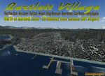
Bartlett Village is just north of Bartlett Cove and created to make your flights to Bartlett Cove more fun. the water runway at Bartlett Cove points north directly at the Village float plane dock. There is also a helipad at the docks along with the Bartlett Village Inn. There are room rentals, cabin rentals, a small store near the docks for food, beverage and fishing supplies. The ACA, Alaska Conservation agency has a work camp on the island and there are two private residences, a light house on the SW end and other candies around the island. Gustavus has several new additions but no changes to the default configuration of the airport. If you fly around on the south west area of the island you may see a whale or two. Come by and visit. Read the readme and enjoy.
created by savageagle.
| Filename: | Bartlett_Village_Alaska.zip |
| License: | Freeware |
| Added: | 7th February 2010, 11:15:59 |
| Downloads: | 1,735 |
| Author: | Tim Durham |
| Size: | 640.35 KB |
| Category: Flight Simulator 2004 - Scenery | |
| Rockcliffe CYRO update in Ontario, Canada |
|
Images related to this file:
File Description:
This is Rockcliffe in late 2011, on the day before the old clubhouse was demolished. It is based on the original scenery by Flight Ontario and follows on from my previous updates, but this is a new version rather than an update and REPLACES the previous versions. The difference is in the bespoke detail: runway and taxiway lighting (the taxiway lighting is limited, as in real life, to taxiway C); signage throughout including runways, taxiways, refuelling, and parking; refuelling tanks and pumps; fence visibility strips; updated ground markings for the Rockcliffe Flying Club apron and the runway; revised apron texture in front of the new hangar; smaller items such as trash cans and external electrical distribution box for heating cables. There are also, from previous updates, the new clubhouse, the new maintenance hangar, and from the original scenery the Museum complex.
| Filename: | Rockcliffe_CYRO_update_in_Ontario_Canada.zip |
| License: | Freeware, limited distribution |
| Added: | 28th February 2012, 13:13:33 |
| Downloads: | 564 |
| Author: | Roger Wensley |
| Size: | 5.01 MB |
| Category: Flight Simulator 2004 - Scenery | |
| LOWS 2006, Designator Patch |
|
File Description:
Since the deployment of the freeware "W.A. Mozart Airport in Salzburg/Austria" (LOWS 2006) by Johannes Kimla the magnetic deviation has changed significantly. Thus, in the real world, it was decided to change the designators for the runways accordingly. Since a few weeks the runways have been renamed: the former RW34 is now named "RW33", and corresponding to this the former RW16 is named "RW15" now.
For those flight simulation enthusiasts who want to fly in a simulated world close to reality we are offering a small patch which take account of these changes: the new designators are now visible on the runways, the taxiway signs should lead to the correct runways. In addition a small file is included which controls the proper approaches on RW15. Please note that this patch is only working with Microsoft Flight Simulator 2004!!!
| Filename: | LOWS_2006_Designator_Patch.zip |
| License: | Freeware |
| Added: | 30th September 2012, 21:33:41 |
| Downloads: | 4,303 |
| Author: | Johannes Kimla |
| Size: | 143.2 KB |
| Category: Flight Simulator 2004 - Scenery | |
| Eastmain River CZEM in northern Quebec, Canada |
|
Images related to this file:
File Description:
Eastmain River is on the south bank of the river of the same name, close to the eastern shore of James Bay at it's southern end. Moosonee is around 110 miles to the southwest, and Waskaganish (my post October 2010) just 50 miles to the south. The town has a population of around 770 who are mostly Cree speakers. The airport is just to the south of the town with a gravel runway just over 3,500 feet long and aligned 02/20; there is no PAPI and there is no fuel available, unless there is some in drums. There are flights by Air Creebec and Wasaya; their textures are available for download on Flightsim and the planes are as listed in the AI folder. The AI bgl is for both CYAT and CZEM; don't think I have included the wrong one.
| Filename: | Eastmain_River_CZEM_in_northern_Quebec_Canada.zip |
| License: | Freeware, limited distribution |
| Added: | 10th January 2013, 22:00:34 |
| Downloads: | 252 |
| Author: | Roger Wensley |
| Size: | 2.14 MB |
| Category: Flight Simulator X - Aircraft Repaints, Textures and Modifications | |
| Myanmar Airways Int'l "SEAGames" Airbus A319 |
|
File Description:
When 27th Southeast Asian Games is around the corner,MAI and its domestic wing,Air KBZ, start to adopt a giant-yellow "Official Main Sponsor" tagline on some of their aircraft. Being the main supporter for the Games and the flag carrier of the host nation, MAI gets one of its A320s (XY-AGO) and an A319(XY-AGR) in this special scheme to mark the another prestigious milestone in the country's history. It will be the third time that Myanmar will host the Games after 44 years.
Thus,it is an opportunity,not to be missed,to witness the movements of the special scheme on flag carrier's metal and see it soaring boastfully high above the skies.
Thought my airport also deserved this moment too and hence led me into the creation of the repaint.
| Filename: | Myanmar_Airways_Intl_SEAGames_Airbus_A319.zip |
| License: | Freeware |
| Added: | 10th November 2013, 23:42:39 |
| Downloads: | 91 |
| Author: | Phyo Pyae Sone |
| Size: | 4.23 MB |
| Category: Flight Simulator 2004 - Scenery | |
| "Caiolo" Sondrio Airport, Valtellina, North Italy |
|
Images related to this file:
File Description:
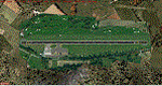
In this airport reside AvioValtellina and VolaValtellina, as well as the operational base of the Health Service 118 and Mountain Rescue. It also base of the Aeroclub Sondrio with its Flight School VDS. Site at the beginning of the Valtellina, in Caiolo municipality (N46 09.0 E09 48.0), has an asphalt runway from 1050x23 mts, ground communication frequency 129.50; ICAO code: LILO. It is also enclosed the base of INAER Aviation, located in Colico-Piantedo (N46 08.18 E09 24.19 - code LIEI), that operates in Medical Emergency, rescue operations in the mountains and off-shore. Scenery realized on the real cooordinates of the airport (except for elevation) including the scenery of the heliport INAER Colico. Requires the use of the libraries' dva51 "and the system of vegetations "TreePlanter".
Enjoy!
A presentation video is available here.
| Filename: | Caiolo_Sondrio_Airport_Valtellina_North_Italy.zip |
| License: | Freeware |
| Added: | 25th October 2014, 11:52:25 |
| Downloads: | 857 |
| Author: | Aldo Della Vedova |
| Size: | 29.5 MB |
| Category: Flight Simulator 2004 - Scenery | |
| Alaska North Slope 3: Atqasuk (PATQ) |
|
Images related to this file:
File Description:
The town of Barrow is in the far north of Alaska, and these are coastal villages or radar installations to the west and south of Barrow. There will be further additions. Atqasuk PATQ is 55 miles south of Barrow and is unusual in that it is one of the few settlements of the North Slope that is not on the coast. It is, however, on a narrow winding river that reaches the sea to the east of Barrow and seemingly provides fish in abundance. There could well be other good reasons for the village to be where it is, but they are unknown to me. The population is around 250. The airfield is to the south of the village and the runway is 4,900 feet of gravel aligned 06-24, lit, and with PAPI at each end.
| Filename: | Alaska_North_Slope_3_Atqasuk_PATQ.zip |
| License: | Freeware, limited distribution |
| Added: | 17th June 2016, 08:54:55 |
| Downloads: | 234 |
| Author: | Roger Wensley |
| Size: | 2.35 MB |


© 2001-2026 AVSIM Online
All Rights Reserved
Privacy Policy |