
Where Flight Simulation Enthusiasts Gather from Around the World!
AVSIM Library - Search Results

| Category: Flight Simulator 2004 - Aircraft Repaints, Textures and Modifications | |
| T-45C Goshawk - Fictional paint scheme based on the (F-4K) Phantom FG.1 - Royal Navy No. 767 Naval Air Squadron (1970s) |

|
Images related to this file:
File Description:
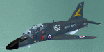
T-45C Goshawk - Fictional paint scheme based on the (F-4K) Phantom FG.1 - Royal Navy No. 767 Naval Air Squadron (1970s), textures only for the IRIS/DSB T-45 Goshawk, Repaint by Hartwig Ullrich
| Filename: | T45C_Goshawk___Fictional_paint_scheme_based_on_the.zip |
| License: | Freeware |
| Added: | 5th April 2012, 19:11:39 |
| Downloads: | 112 |
| Author: | Hartwig Ullrich |
| Size: | 2.3 MB |
| Category: Flight Simulator 2004 - Panels | |
| AN-124 PANEL |
|
File Description:
Hello to all you flightsimmers,...After I've been profiting for years downloading stuff made by others [and enjoying it very much] I thought it was about time to create something myself. For about two or three years ago there was an Antonov AN-124 parked at the Dutch airport of Beek near the city of Maastricht. Just before the aircraft was to be sold on an auction there was the opportunity to take some pictures of the in and outside of the plane. An opportunity I gladly took. Here are the results. I hope I did not offend anyone using their gauges because it's quite impossible to ask every individual permission for all the 210 gauges I used, but I would gladly take the opportunity here of thanking them for the use of them..........Please NOTE:I did not create any of the gauges used for this panel myself and therefore do not earn any credit for them or whatsoever...........Half of them for instance are of MICROSOFT [Copyright]....I tried to stay as close to the original design of the AN-124 cockpitt, however in some cases I had to alter some things due to the lack of available ID light gauges. Furthermore it was not always possible to see whàt instrument it was that I saw on the photopicture. Anyway ENJOY!!!!.
| Filename: | AN124_PANEL.zip |
| License: | Freeware |
| Added: | 12th May 2008, 01:55:57 |
| Downloads: | 3,940 |
| Author: | Jean Louis Bekkers |
| Size: | 16.68 MB |
| Category: Flight Simulator X - Scenery | |
| YCDN Corunna Downs Station and Old Corunna Downs RAAF (Closed) |
|
File Description:
Corunna Downs heritage listed RAAF Base was a secret airfield located in scrub and spinifex country, about 16 kms south west of Marble Bar, the hottest part of the "The Pilbara" area of Western Australia. Not a very ideal place to have a tent city. Today there are very few reminders of the once busy airfield. One can see some crumbling foundations and half filled post holes. 73 OBU operated the Corunna Downs airfield which comprised two intersecting bitumen runways, now regressed and graded occasionally. One ran approximately north-south, 5,000 feet in length while the other ran approximately east-west, 7,000 feet in length. Both runways were approximately 150 feet wide. A 50 foot wide taxiway linked the northern end of the north-south runway to the western end of the east-west runway. Approximately 20 camouflaged revetments to disperse aircraft to minimise bomb damage were constructed at Corunna Downs. Permission is required for landing and there may be vegetation on the strip if not graded recently. No cones or windsock so be careful. Corunna Downs Homestead is also heritage listed and consists of graded strips and homestead complex. Start points are at the homestead and the RAAF base is to the west. REQUIRES Blencowe_LibraryKit.zip
REQUIRES blencowe_librarykit_309494.zip (Available HERE)
| Filename: | YCDN_Corunna_Downs_Station_and_Old_Corunna_Downs_R.zip |
| License: | Freeware |
| Added: | 25th February 2013, 08:59:42 |
| Downloads: | 281 |
| Author: | Alan Blencowe |
| Size: | 4.92 MB |
| Category: Microsoft Flight Simulator (2020) - AI Aircraft | |
| AIA_B737-800-Flybondi |
|
Images related to this file:
File Description:
Flybondi (iata code FO) is an Argentine airline that operates domestic flights and regional flights and is based in the airport of the city of Buenos Aires, ARG (Aeroparque iata code AEP).
As of June 2022, it has six B737-800 WL aircraft, two with Scimitars.
Textures and model of AIA B737-800 for Argentine company FLYBONDI Airline for use in artificial traffic plane in its two versions with wingletst(WL) and Scimitars winglets(SWL). These are the textures as of June /22.
The model and paintkit is authored by AI-Aardvark by David Rawlins and can be obtained from the author's page www.ai-aardvark.com. OR file model aia_738w.zip (AVSIM) and file paintkit aia738pk.zip (AVSIM)
The package is composed of:
a) aircraft with Scimitar winglets (SWL)
AIA B737-800 SWL registration LV-KAH
AIA B737-800 SWL registration LV-KAY
b) aircraft with winglets (WL)
AIA B737-800 WL registration LV-HKN
AIA B737-800 WL registration LV-KCD
AIA B737-800 WL registration LV-KCE
AIA B737-800 WL registration LV-KDR
AI AARDVARK 737-800
MODEL & PAINTKIT: DAVID RAWLINS
Modelo Aardvark "aia_738w.zip" (AVSIM) and painkit "aia738pk.zip" (AVSIM) by David Rawlins :: www.ai-aardvark.com
PAINT by :: @2022 JORGE E. GRANA
| Filename: | AIA_B737800Flybondi.zip |
| License: | Freeware |
| Added: | 12th July 2022, 18:21:32 |
| Downloads: | 220 |
| Author: | JORGE EDUARDO GRANA |
| Size: | 2.53 MB |
| Category: Flight Simulator 2004 - Scenery | |
| FTTN Am-Timan, Chad |
|
File Description:
Googly scenery for Am-Timan (ICAO: FTTN, ICAO: ANC), also known as Am
Timan, Am Timane, Am Timmane, Umm Timman - take your pick! It is a small
airport serving a small city of the same name in South-Eastern Chad,
almost exactly centred in the continent of Africa.
The airport was upgraded in 1971 by the French Foreign Legion to allow
military transport craft to land, but it still retains a sand/dirt
strip. The airport is served today by a couple of flights a week using
Fokker Fellowship jets of Toumai Air Tchad.
The entire area is very dry and sandy but for some reason it is depicted
in Flight Simulator as green and lush. Microsoft have only provided a runway
at this airport and this scenery seeks to redress the situation so that you
and your "AI" traffic can use the airport realistically.
The scenery does not purport to be ultra-accurate. Based on high quality
satellite imagery from Google Earth, the layout is proportionally correct but the
added airport features, such as buildings, are built from default Microsoft objects
and add-on libraries so will not look exactly like the real thing.
You are not obliged to download and install any additional scenery libraries,
but to enjoy this scenery in its entirety, you may wish to. It will work fine,
with or without.
| Filename: | FTTN_AmTiman_Chad.zip |
| License: | Freeware |
| Added: | 24th December 2008, 13:31:36 |
| Downloads: | 883 |
| Author: | John Hinson |
| Size: | 83.66 KB |
| Category: Flight Simulator X - AFCAD Files | |
| KOPF - Opa Locka - Miami, Florida 2013 |
|
File Description:
Opa-locka Airport (IATA: OPF, ICAO: KOPF, FAA LID: OPF), also known as Opa-locka Executive Airport, is a general aviation airport and joint civil-military airfield 10 miles (16 km) north of Downtown Miami, primarily in metropolitan
Miami, Florida, United States, with a portion within the city proper of Opa-locka.
The airport's control tower is manned from 7:00 AM to 9:00 PM. The airport has four fixed base operators. It is owned by Miami-Dade County and operated by the Miami-Dade Aviation Department.
The tenant military activity is Coast Guard Air Station Miami, operating HU-25 Guardian jet aircraft, the HC-144 Ocean Sentry[4] turboprop aircraft and HH-65 Dolphin helicopters for coastal patrol and air-sea rescue operations.
Much of CGAS Miami's facilities were originally built during World War II as part of the former Naval Air Station Miami.
DayJet previously provided an on-demand jet air taxi service from this airport to 44 airports in 5 states. The company filed for Chapter 7 bankruptcy liquidation in 2008.
The airport is currently served by several cargo and charter airlines who use the U.S. customs facility. Maintenance and modification of airliners up to Boeing 747 size are carried out by several aviation firms
This file has the right coordenates, apron and characteristics of the airport, airport vehicles and buildings, Airport charts included.
| Filename: | KOPF__Opa_Locka__Miami_Florida_2013.zip |
| License: | Freeware |
| Added: | 6th January 2013, 11:39:28 |
| Downloads: | 770 |
| Author: | anwar gonzalez |
| Size: | 3.96 MB |
| Category: Prepar3D V1-4 - Scenery | |
| POLISH AIRPORTS VOL. 3 X DEMO |
|
Images related to this file:
File Description:
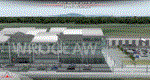
POLISH AIRPORTS VOL. 3 X DEMO is a package of detailed sceneries of EPPO Poznan, EPWR Wroclaw, EPBY Bydgoszcz and EPSY Olsztyn-Mazury airports in Poland, fully compatible with FSX, FSX:SE and P3D (v1,v2,v3,v4).
This product is a fully functional DEMO version of the commercial payware product that features simplified airports with main buildings but with low resolution textures, non-animated jetways and generally much less details. Using this free demo ensures no problems with online (VATSIM, IVAO, multiplayer etc.) flying in case some users use the payware scenery and some don't.
Poznan-Lawica Henryk Wieniawski Airport (POZ/EPPO), built in 1913, is one of the oldest airports in Poland. Bydgoszcz Ignacy Jan Paderewski Airport (BZG/EPBY) is a Polish regional airport in the city of Bydgoszcz. Wroclaw Copernicus Airport (WRO/EPWR) is an international commercial airport in Wroclaw in southwestern Poland, the 4th largest airport in Poland. Olsztyn-Mazury Airport (SZY/EPSY) is an international passenger airport in the North-East of Poland, branded as the gateway to the Masurian Lake District.
The product is equipped with an automatic installer, which means that the scenery will be automatically added to the Flight Simulator Scenery Library. Please uninstall all previous versions of this airport you may have installed before. Please make also sure that no duplicated AFCAD files are installed.
Enjoy your virtual flying with Drzewiecki Design!
| Filename: | POLISH_AIRPORTS_VOL_3_X_DEMO.zip |
| License: | Freeware, limited distribution |
| Added: | 27th July 2018, 00:06:20 |
| Downloads: | 341 |
| Author: | Drzewiecki Design |
| Size: | 20.81 MB |
| Category: Flight Simulator 2004 - Scenery | |
| SKMD Medellin/Enrique Olaya Herrera, Colombia |
|
File Description:
Googly scenery for Medellin/Enrique Olaya Herrera (ICAO: SKMD, IATA: EOH). This
centrally located airport, named after the 1930 president of Colombia, was once
the only airport for the city of Medellin but most international flights are now
concentrated on the new international airport inconveniently situated 24 miles
away. Nevertheless the airport is very busy with domestic, charter and private
traffic and is regularly served by scheduled services of Aerolínea de Antioquia,
AIRES, Easyfly and SATENA. There are many charter operators based or serving
serving this airport, including Aexpa, Heliandes, Sarpa, Helicol and TAC; these
are mostly smaller aircraft or helicopter operations.
Remarkably for such an important airport, Microsoft have only provided a runway
at this airport in Flight Simulator 2004 and this scenery seeks to redress the
situation so that you and your "AI" traffic can use the airport realistically.
The scenery does not purport to be ultra-accurate. Based on high quality
satellite imagery from Google Earth, the layout is proportionally correct but the
added airport features, such as buildings, are built from default Microsoft objects
and add-on libraries so will not look exactly like the real thing.
You are not obliged to download and install any additional scenery libraries,
but to enjoy this scenery in its entirety, you may wish to. It will work fine,
with or without.
| Filename: | SKMD_MedellinEnrique_Olaya_Herrera_Colombia.zip |
| License: | Freeware |
| Added: | 6th December 2008, 10:22:40 |
| Downloads: | 2,564 |
| Author: | John Hinson |
| Size: | 388 KB |
| Category: Flight Simulator 2004 - Scenery | |
| Denver (KDEN), Colorado, Photo-Scenery |
|
Images related to this file:
File Description:

Denver (KDEN), Colorado, Photo-Scenery for FS9 & FSX.
This package covers Denver, the capital of Colorado which is also nicknamed Mile-High City because its elevation is one mile (5.280 ft). The sixth RW (16R/34L) of Denver Int'l. Airport (KDEN) is the longest commercial RW in the US with a length of 16.000ft. This allows fully loaded B747's to take off in Denvers mile-high altitude during hot summer days, when density altitudes can approach 9.000(!) ft.
KDEN is a major hub for United Airlines and the headquarters for Frontier Airlines. The airports distinctive white tent-like fabric roof is designed to be reminiscent of the snow-covered peaks of the Rocky Mountains which you can see on approach or departure.
Other important airports covered by this region are Centennial Airport (KAPA), Buckley AFB (KBKF) and Rocky Mountain Metropolitan Airport (KBJC). Extends my Mt.Evans/Georgetown package to the east and provides another 3.500 sq km in 4.7m/pix quality.
High resolution versions for FS9 and FSX (much sharper, but larger and multiple downloads) are available at www.blueskyscenery.com/GNB_SouthEast.html
. The screenies are taken from the high-res versions, so expect this version to be slightly more blurry. YourDonation@Work: Dedicated to Mark and Charles. Thanks!
| Filename: | Denver_KDEN_Colorado_PhotoScenery.zip |
| License: | Freeware, limited distribution |
| Added: | 31st October 2009, 11:24:39 |
| Downloads: | 7,278 |
| Author: | Gottfried Razek, blueskyscenery.com |
| Size: | 95.21 MB |
| Category: Flight Simulator X - Scenery | |
| POLISH AIRPORTS VOL. 3 X DEMO |
|
Images related to this file:
File Description:
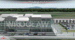
POLISH AIRPORTS VOL. 3 X DEMO is a package of detailed sceneries of EPPO Poznan, EPWR Wroclaw, EPBY Bydgoszcz and EPSY Olsztyn-Mazury airports in Poland, fully compatible with FSX, FSX:SE and P3D (v1,v2,v3,v4).
This product is a fully functional DEMO version of the commercial payware product that features simplified airports with main buildings but with low resolution textures, non-animated jetways and generally much less details. Using this free demo ensures no problems with online (VATSIM, IVAO, multiplayer etc.) flying in case some users use the payware scenery and some don't.
Poznan-Lawica Henryk Wieniawski Airport (POZ/EPPO), built in 1913, is one of the oldest airports in Poland. Bydgoszcz Ignacy Jan Paderewski Airport (BZG/EPBY) is a Polish regional airport in the city of Bydgoszcz. Wroclaw Copernicus Airport (WRO/EPWR) is an international commercial airport in Wroclaw in southwestern Poland, the 4th largest airport in Poland. Olsztyn-Mazury Airport (SZY/EPSY) is an international passenger airport in the North-East of Poland, branded as the gateway to the Masurian Lake District.
The product is equipped with an automatic installer, which means that the scenery will be automatically added to the Flight Simulator Scenery Library. Please uninstall all previous versions of this airport you may have installed before. Please make also sure that no duplicated AFCAD files are installed.
Enjoy your virtual flying with Drzewiecki Design!
| Filename: | POLISH_AIRPORTS_VOL_3_X_DEMO.zip |
| License: | Freeware, limited distribution |
| Added: | 27th July 2018, 00:08:14 |
| Downloads: | 2,444 |
| Author: | Drzewiecki Design |
| Size: | 20.81 MB |


© 2001-2026 AVSIM Online
All Rights Reserved
Privacy Policy |