
Where Flight Simulation Enthusiasts Gather from Around the World!
AVSIM Library - Search Results

| Category: Flight Simulator X - Scenery | |
| LGSK - Skiathos Airport, Greece |

|
Images related to this file:
File Description:
LGSK Skiathos Airport Greece.
Skiathos Island lies off the east coast of mainland Greece and is often referred to as 'Europe's St. Maarten' with landing aircraft skimming the beach and the nearby harbour. At 5341feet the runway is short and narrow and usually only captains are allowed to perform landings. Seasonal taffic includes Munich, Gatwick, Rome, Oslo and Stockholm, with scheduled flights to Athens.
This scenery has been designed to sit on the excellent photoreal scenery by Angelo Tassoglou, available here on Avsim, just search for 'Skiathos.zip'. Please note, it will not work with the default terrain. It also uses many objects from my LGKF Kefallinia scenery, also available here at Avsim.
The scenery features added vegetation, detailed airport buildings based on real photographs, animated windsocks, flags, road traffic, people, trees, waves, birds and air traffic. All the scenery files have been divided so they can be switched on or off according to user preference. It has been designed for and tested in DX9 and FSXA only.
Please enjoy and I hope you like my scenery as much as I enjoyed building it.
Required files:
skiathos.zip by Angelo Tassoglou
LGKF Kefallinia by George Keogh
| Filename: | LGSK__Skiathos_Airport_Greece.zip |
| License: | Freeware, limited distribution |
| Added: | 28th January 2013, 00:13:54 |
| Downloads: | 16,006 |
| Author: | George Keogh |
| Size: | 20.47 MB |
| Category: Flight Simulator X - Scenery | |
| Ireland VFR Small Airports part 4 |
|
File Description:
Ireland VFR Small Airports Part 4.
Three new airports for FSX, consisting of EI50 Limetree, EI55 Eyne and EICN Coonagh. Limetree and Eyne are 70km southwest of EIDW Dublin. Coonagh is 16km East of EINN Shannon. These airports have been built from scratch, are standalone, and designed to sit on the default terrain. The scenery features custom runways and textures together with full custom models and textures based on real photographs. The scenery has been tested and authenticated by real local pilots. More realistic landclass, autogen rivers and roads have been added to the areas around the airports. It also features many HD textures, AI aircraft and road traffic. The scenery uses seperate elements which can be switched on or off according to the users preference and hardware.
This scenery is real flying 'by the seat of your pants'. There are no lights, navaids, or ILS and runway markings are eaten by the sheep.
Full installation instructions, settings, credits, hints and tips can be found in the README file.
Please enjoy and I hope you like the airports as much as I enjoyed making them.
| Filename: | Ireland_VFR_Small_Airports_part_4.zip |
| License: | Freeware, limited distribution |
| Added: | 15th October 2013, 05:28:25 |
| Downloads: | 2,148 |
| Author: | George Keogh |
| Size: | 164.6 MB |
| Category: Flight Simulator X - Gauges | |
| Flypad Gauge V2.0 |
|
Images related to this file:
File Description:
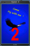
FSX, Flypad Gauge Version 2.0
This gauge has been developed on Win7 for FSX Flight Simulator SP2 or SP1.It should also work with Acceleration, but this is not guaranteed by the author. The gauge is a little extra addon based on the design of a smart phone and provides 9 different displays which are different from all of the standard gauge displays on a regular aircraft panel. It is mainly helpful for the user flying small propeller aircraft, and old timer aircraft.
However, the displays are as well attractive for sim pilots flying modern jet aircraft. Use it as if you just grabbed to your smart phone during a flight and check on the status of your aircraft, or how the terrain awareness situation looks like, how the AI traffic on the radar is, while you proceed with your flight plan. Enjoy the new design of a simple aircraft attitude display during an ILS approach. A new screen for LAT/LON coordination control and distance/bearing calculation has been added to this version in addition with a number of improvements.For credits look at the pdf documentation inside the zip file. By Dietmar Loleit
| Filename: | Flypad_Gauge_V20.zip |
| License: | Freeware |
| Added: | 2nd August 2014, 17:50:45 |
| Downloads: | 778 |
| Author: | Dietmar Loleit |
| Size: | 4 MB |
| Category: Flight Simulator X - Scenery | |
| RAF Scorton |
|
File Description:
RAF Scorton was opened in October 1939 as part of 13 Group Fighter Command and a satellite station of RAF Catterick. It was located near the village of Scorton in North Yorkshire. It was used by the Royal Air Force, the Royal Canadian Air Force, and the United States Army Air Forces Ninth Air Force during the war.
The location was chosen for its flat terrain and its situation close to the now disbanded Eryholme-Richmond branch line that had a sub branch line to Catterick Garrison and RAF Catterick.
The famous No. 56 Squadron RAF flew Spitfires from Scorton during the Second World War. Also the USAAF 422d and 425th Night Fighter Squadrons were stationed at Scorton flying the Northrup P-61 "Black Widow" fighter.
The Aerodrome closed in 1945 and most of the concreted areas have been extensively quarried away for sand and gravel extraction. Most of what was the airfield is now under a lake or a quarry. There are a few military pre-fab buildings remaining in the area – they were dismantled after the war and moved to local farms to be used as agricultural buildings.
Source:Wikipedia
| Filename: | RAF_Scorton.zip |
| License: | Freeware |
| Added: | 26th February 2017, 07:30:57 |
| Downloads: | 86 |
| Author: | Terry Boissel |
| Size: | 2.52 MB |
| Category: Flight Simulator 2004 - Scenery | |
| Colville Lake CEB3 in Northwest Territories Canada |
|
Images related to this file:
File Description:
Colville Lake is a small village of around 150 Dene, located to the northwest of the Great Bear Lake and east of the Mackenzie River, 120 miles north of Norman Wells. The village and the airfield are next to each other and to the lake shore. I recently discovered which of the standard terminal buildings had been used there and this, along with information I already had, enabled me to now make the scenery, which is based on an approximate 2010 date. The gravel runway is lit and around 2,800 feet long, aligned 10-28. North Wright Air serves the village from it's headquarters at Norman Wells with daily flights by de Havilland Twin Otters, or "twotters" as they were quickly named among the northern Canadian airline personnel when they were first produced. The approximate time of this scenery is 2010. While testing this scenery I discovered that Tulita (previously called Fort Norman) which is another Mackenzie River airfield to the south of Norman Wells, needs to be reposted due to a terrain fault. If you find an error here then email me please, and note that my email address has been changed to rogwens at Gmail dot com.
| Filename: | Colville_Lake_CEB3_in_Northwest_Territories_Canada.zip |
| License: | Freeware, limited distribution |
| Added: | 31st July 2021, 18:23:48 |
| Downloads: | 69 |
| Author: | Roger Wensley |
| Size: | 4.51 MB |
| Category: Microsoft Flight Simulator (2020) - Utilities | |
| FBWA320_LINDA_Module_ByJujunet_v0.2 |
|
File Description:
This module allow to control hidden controls of the FBW A320, using LINDA software and FSUIPC
Require : FSUIPC ver 7 full licence, Microsoft Flight Simulator
Installation :
Uncompress archive in any place.
Move A32nx.evt file to your FSUIPC root folder.
Move A320.hvar on \Community\fsuipc-lvar-module\modules
On LINDA software :
Click on "Maintenance", on top, select "--aircrafts--".
Click on "Select Source Folder", below "Import Aircraft Module", browse to the folder FBWA320, click on "Import", or "Overwrite" if updating
This module for Linda freeware allows to bind :
-Landing and Nose light independently
-Seat-belt
-No Smoking
-Mode and zoom on ND
-Display function ARPT, VOR, WPT, NDB... on ND
-Terrain on ND
-Eicam pages, with an encoder
-ILS
-Barometer increment and decrement with automatic detection of position (HPA or inHg)
-Toggle between HPA and inHg
-Toggle between QNH setting and STD
-Autobrake Cycle
-Full compatibility for Managed/Selected on SPD, HDG, ALT and Selected mode on VS
To create your own module, or customize this one, go to my Youtube Tutorial :
My channel : https://www.youtube.com/channel/UCVgdlnaAk2Q4EOSCICW_0iA
Changelog :
Version 0.1 : Initial Release
Version 0.2 : Update to working with FBWA320 v0.8.0
| Filename: | FBWA320_LINDA_Module_ByJujunet_v02.zip |
| License: | Freeware |
| Added: | 12th July 2022, 18:21:02 |
| Downloads: | 47 |
| Author: | Julien GICQUIAUD |
| Size: | 17.55 KB |
| Category: Microsoft Flight Simulator (2020) - Utilities | |
| WorkingTitleCJ4_LINDA_Module_ByJujunet_v0.2 |
|
File Description:
This module allows to use hidden controls of the default MSFS CJ4, using FSUIPC and LINDA software. Require : FSUIPC ver 7 full licence, Microsoft Flight Simulator and LINDA software. Installation : Uncompress archive in any place. Move CJ4.hvar on \Community\fsuipc-lvar-module\modules On LINDA software : Click on "Maintenance", on top, select "--aircrafts--". Click on "Select Source Folder", below "Import Aircraft Module", browse to the folder CJ4, click on "Import", or "Overwrite" if updating. This module for Linda freeware allows to bind : - Menu choice, menu inc/dec and puch : bind a key to browse to all screen menus, and scroll with an encoder to move up and down inside the menus. Push a key to validate. - Map zoom in/out - Terrain/WX - PFD functions (FRMT/TFC/NAV) - Seatbelt light - Safety light - Baro inc/dec - Baro std - AP modes : FLC, HDG, ALT, VS, APPR and Toga button. To create your own module, or customize this one, go to my Youtube Tutorial : My channel : https://www.youtube.com/channel/UCVgdlnaAk2Q4EOSCICW_0iA Changelog : Version 0.2 : Correction to working with the default CJ4 since AAU1 update, the Working title mod no longer exist.
| Filename: | WorkingTitleCJ4_LINDA_Module_ByJujunet_v02.zip |
| License: | Freeware |
| Added: | 16th January 2024, 14:29:33 |
| Downloads: | 37 |
| Author: | Julien GICQUIAUD |
| Size: | 6.35 KB |
| Category: Flight Simulator X - Scenery | |
| Iguassu Falls - Save The Planet |
|
Images related to this file:
File Description:
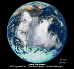
The Iguassu Falls, Itaipu Hydroelectric Power Plant, Foz do Iguassu City and Land Class Package for FSX
Save The Planet is my version of the Iguassu Falls, Itaipu Dam, bridges and landclass scenery for FSX.
Differently from my other version for MSFS 2004, I created a mesh of 5 meter resolution for Iguassu Falls area
to give me some idea how I could proceed. So, I decided to use on this addon
an image background avaliable at server (VirtualEarthSatellite). Thanks Microsoft.
Non-Airport Scenery - ICAO (SBFI). coming soon at www.Terra-Brasilis.org
Portuguese: Cataratas do Iguassu,
Spanish: Cataratas del Iguazu are waterfalls of the Iguassu River located on the border of the Brazilian state of Parana (in the Southern
Region) and the Argentinian Province of Misiones.
The Falls are shared between the Iguazu National Park (Argentina) and Iguacu
National Park (Brazil). The parks were designated UNESCO World Heritage Sites.
The Itaipu Hydroelectric Power Plant is located in the Parana River, in the stretch of the frontier between Brazil and Paraguay, 14 km north of the Friendship Bridge.
The area of the project extends from Foz do Iguassu, in Brazil, and Ciudad del Este, in Paraguay, in the south, up to Guaira (Brazil) and the Guaira Falls (Paraguay), in the north.
Enjoy FSX Iguassu Falls Scenery!
| Filename: | Iguassu_Falls__Save_The_Planet.zip |
| License: | Freeware |
| Added: | 9th December 2010, 01:57:00 |
| Downloads: | 2,848 |
| Author: | Cicero Costa |
| Size: | 31.71 MB |
| Category: Flight Simulator 2002 - Scenery | |
| Victorian Airfields - Australia |
|
File Description:
This add-on scenery pack for FS 2002 adds 115 airfields to Victoria plus a few to NSW and South Australia,
totalling to over 120 in all. The 36 airfields listed below include full detail including accurately placed and sized
trees and buildings, static aircraft, fences, cars, roads with cars and streetlights and a variety of other
'eye candy'. The remaining airfields are mostly small minor/private strips and all include runway markers and
a windsock but you'll find a few buildings and other scenery at some of them. Rotorheads will also enjoy flying to the 10 included helipads scattered across the area around Melbourne. This scenery is a 'must have' for anyone who enjoys flying 'Downunder'!
The Following airfields are included in this package in full detail:
LILYDALE, COLDSTREAM, TOORADIN, PAKENHAM, TYABB, SUNBURY , WALLAN, MELTON, BACCHUS MARSH, GEELONG, TORQUAY, CORIO, BARWON HEADS, PORT FAIRY, LAKES ENTRANCE, APOLLO BAY, KYNETON, PHILIP ISLAND, LOCKSLEY, LETHBRIDGE, CERES, BENDIGO GLIDING CLUB, GRAMPIANS AIRFIELD, MILAWA, WENTWORTH, YARRAM, ORBOST, MALLACOOTA, MT BEAUTY, MOONGARA, WERRIBEE AIRSTRIP, BOORT, COBDEN, MEREDITH, WOODVALE, RIDDELLS CREEK
Using this scenery pack will make your flights around these airfields so much more exciting and enjoyable. No more boring old
unpopulated terrain around Victoria, you've got 115 new airfields available to fly from!
| Filename: | Victorian_Airfields__Australia.zip |
| License: | Freeware |
| Added: | 15th August 2003, 19:47:02 |
| Downloads: | 807 |
| Author: | Sebastian Szalai |
| Size: | 10.53 MB |
| Category: Flight Simulator X - AFCAD Files | |
| Active ILS Innsbruck, Austria (LOWI) |
|
File Description:
This FSX Airport is more then just a AFX style Airport. As most know the Approach and Final (VMC) for AI Traffic in FSX is a straight in type landing and does not always consider high terrain at airports. This is due to the way that the coding is written in FSX and it puts limits on IFR arriving aircraft. At certain airports the AI Traffic will fly directly through a mountain once it is established on Final for a runway. What you will see with my files is a different type approach used for both the way I control AI and User Airplane Traffic in FSX. No longer do the AI Planes use a straight in approach when landing at LOWI. My AI Aircraft Approach coding for FSX uses a visual offset approach so AI Traffic does not fly through the mountains. The Innsbruck Control Tower will clear all AI Traffic (IFR FP) landing either on RWY 08 or 26 as a straight in landing even though the offset to final is 30 degrees from the runway center line. Read the text file for all the enhancements added to the FSX LOWI Airport along with a full understanding of how the new Approaches work *** Full set of Freeware Approach Charts included ***
| Filename: | Active_ILS_Innsbruck_Austria_LOWI.zip |
| License: | Freeware, limited distribution |
| Added: | 21st July 2007, 13:04:43 |
| Downloads: | 6,072 |
| Author: | Jim Vile |
| Size: | 799.84 KB |


© 2001-2026 AVSIM Online
All Rights Reserved
Privacy Policy |