
Where Flight Simulation Enthusiasts Gather from Around the World!
AVSIM Library - Search Results

| Category: Flight Simulator 2004 - Aircraft Repaints, Textures and Modifications | |
| Tassili Airlines, Pilatus PC-6 Porter |

|
Images related to this file:
File Description:

The PC-6 is noted for its Short Take-off and Landing (STOL) performance on almost any type of terrain - it can take off within a distance of 195 m and land within a distance of 130 m while carrying a payload of 1,500 kg, that's why it's the natural choice for Tassili Airlines wish operate in desert areas, repaint for the FSD PC6 Porter model.
| Filename: | Tassili_Airlines_Pilatus_PC6_Porter.zip |
| License: | Freeware, limited distribution |
| Added: | 2nd April 2011, 21:55:28 |
| Downloads: | 390 |
| Author: | HABA Zine el abidine |
| Size: | 9.21 MB |
| Category: Flight Simulator X - Scenery | |
| San Felipe Airport (SVSP) - Venezuela |
|
Images related to this file:
File Description:
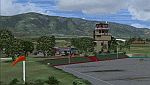
Regional airport located to the west of San Felipe city. Used for both military and civilian aircraft, works only for private flights and small-scale aircraft.
FSX Scenery with photo-terrain from satellite imagery of Yahoo Satellite. Includes terminal building and hangars with realistic textures from images obtained from Internet.
Also includes a friendly Auto-Install.
Not compatible with versions prior to FSX.
| Filename: | San_Felipe_Airport_SVSP__Venezuela.zip |
| License: | Freeware |
| Added: | 14th April 2012, 13:44:51 |
| Downloads: | 1,300 |
| Author: | David Maldonado |
| Size: | 45.41 MB |
| Category: Flight Simulator X - Scenery | |
| OLBAX V1.0 (Rafik Hariri / Beirut International Airport) |
|
Images related to this file:
File Description:

OLBAX V1.0 is the latest edition of Rafik Hariri International Airport, Beirut / Lebanon for FSX by Lebor Simulations. OLBAX V1.0 features a photorealistic ground layout courtesy of Bureau Stephan, detailed and accurate terminal, buildings and hangars as well as static 3D objects. Jad Abizeid worked on this scenery for almost 4 years.
This scenery requires: Lebanon Terrain X v1.5 by Lebor Simulations
| Filename: | OLBAX_V10_Rafik_Hariri__Beirut_International_Airpo.zip |
| License: | Freeware |
| Added: | 4th February 2013, 02:37:56 |
| Downloads: | 15,529 |
| Author: | Lebor Simulations (Jad Abizeid, Michel Karam) |
| Size: | 130.93 MB |
| Category: Flight Simulator X - AFCAD Files | |
| KNOG - Naval Auxiliary Landing Field Orange Grove - Orange Grove, Texas - USA |
|
Images related to this file:
File Description:
NALF Orange Grove is an important support airfield for NAS Kingsville which provides primary jet training (and carrier qualification) for new Navy, Marine, and selected foreign pilots. This is a complete airport rebuild with new runways, new taxiways, ramps, signage, and tower and administration buildings. It features a fire station, POL facility, access roads, new terrain masks, and parking,(including covered parking) for 15 transient aircraft.
| Filename: | KNOG__Naval_Auxiliary_Landing_Field_Orange_Grove__Orange_Grove_Texas__USA.zip |
| License: | Freeware |
| Added: | 4th July 2015, 02:31:38 |
| Downloads: | 340 |
| Author: | Allen Laughmiller |
| Size: | 14.13 KB |
| Category: Flight Simulator X - Scenery | |
| USA Landclass Vegetation Part I ** UPDATE ** |
|
Images related to this file:
File Description:
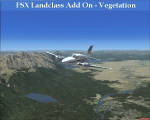
UPDATE:
Some small Cities, the Area around KAOC, Uinta Mountains.
Landclass Improvements for the USA, specialy the western Part of the USA:
Colorado, Yellow Stone, Little Part of Idaho, Montana and from LA to Seattle, also some Testscenery's for the eastern Part of the USA.
Compatible with Ultimate Terrain.
The LC Scenery's are for further devolpment, including the *.inf & *raw files of the folder USA_SBX1.
| Filename: | USA_Landclass_Vegetation_Part_I____UPDATE_.zip |
| License: | Freeware |
| Added: | 13th February 2015, 10:02:54 |
| Downloads: | 613 |
| Author: | Markus Balz |
| Size: | 4.56 MB |
| Category: Flight Simulator X - Scenery | |
| SVCB - Ciudad Bolivar Airport - Venezuela |
|
Images related to this file:
File Description:
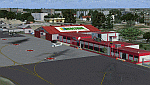
The National Airport "Tomas de Heres", located in the city of Ciudad BoliÃ�ÂÂvar, to the south of Venezuela, near the Orinoco River. is one of the airports with more domestic and tourist traffic, due to his geographical position. Photo-terrain area improved with Autogen files.
Only compatible with versions of FSX, P3Dv1.x or P3Dv2.x. Also includes a friendly Auto-Install.
| Filename: | SVCB__Ciudad_Bolivar_Airport__Venezuela.zip |
| License: | Freeware |
| Added: | 27th July 2014, 18:03:14 |
| Downloads: | 2,178 |
| Author: | David Maldonado |
| Size: | 84.7 MB |
| Category: Flight Simulator 2004 - Scenery | |
| Webster OFL (KNUI) for UT/USA |
|
File Description:
Webster Field is an outlying airport realted to PAX Naval Air Test Center in Maryland. According to what I have read, they use the airport mainly to test unmanned aircraft.
In a support note I saw an image of this airfield in Ultimate Terrain showing its runways extending out into the water. So I fixed it. I couldn't find much more info on it other than that on www.AirNav.com, so I've just kept the default layout for the most part. I did have to rotate the runways a bit to match the satellite photo about 10 degrees for 14/32. I kept the runway labels, however as that is how they are listed in Airnav and show up in the satellite photo. If anyone has any further info I'd be happy to add to it.
This version is meant for use with Ultimate Terrain USA.
| Filename: | Webster_OFL_KNUI_for_UTUSA.zip |
| License: | Freeware |
| Added: | 23rd February 2006, 05:20:49 |
| Downloads: | 377 |
| Author: | Thomas Perry |
| Size: | 218.88 KB |
| Category: Flight Simulator 2004 - Scenery | |
| Snowden Farm CF39, in Ontario Canada |
|
Images related to this file:
File Description:
Another airfield close to Highway 11, further south towards Lake Simcoe. Snowden Farm is a bit over five miles south of Huntsville and east of of highway 11. The grass runway 12/30 is just over 2,000 feel long and sandwiched between Penfold Lake to the north, and on the south side a large pond with a creek that connects to the much larger Mary Lake to the east. There is a hangar and a shed at the eastern end of the runway. There is one airfield scenery file, and two landclass files to provide the grassed area and the large pond and creek. I presume that the pond was just a little too small to register with Ultimate Terrain. The scenery might work without Ultimate Terrain but I haven't tested it, and for sure without it Penfold Lake and probably Mary Lake won't appear.
| Filename: | Snowden_Farm_CF39_in_Ontario_Canada.zip |
| License: | Freeware, limited distribution |
| Added: | 5th February 2010, 03:51:07 |
| Downloads: | 296 |
| Author: | Roger Wensley |
| Size: | 837.43 KB |
| Category: Flight Simulator 2004 - Scenery | |
| Diavik Diamond Mine CDK2 |
|
Images related to this file:
File Description:
The Diavik Diamond Mine is located about 200 miles NE of Yellowknife in Canada's Northwest Territory. It a relatively new facility, having been begun production in 2003. The only means of access are by air or ice road. (If you are a James Bondian super villian plotting world domination, Diavik would be a great place for your secret underground headquarters.) This scenery is completely scratch built. In addition to the airstrip itself, I used Google Earth pics to create a photo ground texture of the adjoining facility. The buildings of the main processing complex are very simply modeled, as is the large open pit mine.
This scenery was designed for use with Ultimate Terrain and was not tested in the default scenery. (As far as I can tell, Ulimate Terrain does not affect the area around Diavik, so it should work OK.) It may or may not work in FSX.
| Filename: | Diavik_Diamond_Mine_CDK2.zip |
| License: | Freeware |
| Added: | 4th February 2011, 18:07:48 |
| Downloads: | 581 |
| Author: | Sidney Schwartz & Peter Ham |
| Size: | 994.9 KB |
| Category: Flight Simulator X - Scenery | |
| CYQQ (2010) Version 2 for FS9, FSX and Prepar3D |
|
Images related to this file:
File Description:
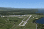
CYQQ (2010) portrays Canadian Forces Base Comox (Vancouver Island, British Columbia, Canada) (CYQQ), the Comox Valley Air Terminal and surrounding area. It is fully compatible with Ultimate Terrain Canada/Alaska for FS2004, Ultimate Terrain X - Canada for FSX and ORBX's FTX NA Blue. CYQQ (2010) includes over 100 "hand-crafted" buildings and other structures and 10 different vintage aircraft on static display, as well as aircraft and traffic files for a realistic AI scenario that causes a variety of military aircraft that come and go. (Use BC Regional AI - also available from this file library - for scheduled traffic.) Civilian AI is now routed so as not to transit military aprons.
Aside from the new approach lighting, generally, this new version is visually identical to its predecessor - even though quite different internally. As well, to the extent possible, it is compatible with Prepar3Dv2.
| Filename: | CYQQ_2010_Version_2_for_FS9_FSX_and_Prepar3D.zip |
| License: | Freeware, limited distribution |
| Added: | 20th June 2014, 11:39:47 |
| Downloads: | 11,039 |
| Author: | Don Grovestine |
| Size: | 33.19 MB |


© 2001-2026 AVSIM Online
All Rights Reserved
Privacy Policy |