
Where Flight Simulation Enthusiasts Gather from Around the World!
AVSIM Library - Search Results

| Category: Flight Simulator 2004 - Scenery | |
| Cambridge Bay CYCB |

|
Images related to this file:
File Description:
Cambridge Bay is an important transportation center on Canada's Northwest Passage. Access is by air only. This scenery is a complete and extensive remake of the default airport and surrounding area. The coastline has been redone, and the nearby town and NORAD facility added. Most of the buildings are photo textured. Should work OK without Ultimate Terrain. Thermal underwear recommended.
| Filename: | Cambridge_Bay_CYCB.zip |
| License: | Freeware |
| Added: | 27th April 2011, 20:51:31 |
| Downloads: | 1,285 |
| Author: | Sidney Schwartz & Peter Ham |
| Size: | 2.27 MB |
| Category: Flight Simulator X - Miscellaneous Files | |
| HD Moon Texture v3.0 |
|
Images related to this file:
File Description:
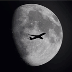
This update will replace all previous textures from version 2.0 - complete new rendering with new normal & bump map applied for better lunar terrain effect and converted to Extended 32-Bit Bitmap. Additionally it's now possible to use 2048x2048 instead of 1024x1024 or 512x512 resolved textures. This means a plus of 3200 % in terms of resolution compared with the default 64x64 textures.
| Filename: | HD_Moon_Texture_v30.zip |
| License: | Freeware |
| Added: | 17th September 2011, 10:20:25 |
| Downloads: | 5,025 |
| Author: | Marco Fischbach |
| Size: | 34.23 MB |
| Category: Flight Simulator 2004 - Scenery | |
| Atouguia da Baleia (Peniche) ULM Airfield v1 |
|
Images related to this file:
File Description:
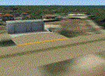
Atouguia da Baleia airfield, near Peniche.
This scenery is ONLY compatible with freeware Portugal Terrain from PTSIM (http://www.ptsim.com) and is based on digital pictures taken at the place, accurate real measures by Aerodromos de Portugal (http://www.pelicano.com.pt/zmapa.html). Although certified for ULM, this airfield have no ICAO so I gave it the fake LPAB. Freeware. For Microsoft FS2004. NOT tested for FSX.
| Filename: | Atouguia_da_Baleia_Peniche_ULM_Airfield_v1.zip |
| License: | Freeware |
| Added: | 20th September 2011, 23:29:36 |
| Downloads: | 330 |
| Author: | Joao A. Graca Ferreira |
| Size: | 1.33 MB |
| Category: Flight Simulator X - Scenery | |
| McKenzie Valley Run |
|
Images related to this file:
File Description:
This is the airports as seen in the TV show Ice Pilots NWT: http://www.icepilots.com/ It includes Deline, Tulita, Norman Wells and Fort Good Hope Custom made models, textures and made to work with or without Ultimate terrain Canada. Completely redesigned from scratch. FSX Acceleration will give the best results (Also SP2 compatible). Acceleration users will have more eye candy!
| Filename: | McKenzie_Valley_Run.zip |
| License: | Freeware |
| Added: | 27th January 2012, 18:37:48 |
| Downloads: | 2,148 |
| Author: | Frits Beyer, Jacques Botha |
| Size: | 2.88 MB |
| Category: Flight Simulator X - Scenery | |
| Santa Elena de Uairen, Venezuela (SVSE) |
|
Images related to this file:
File Description:
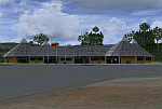
Located to south of Venezuela, to few kilometers from the border with Brazil.
The airport design, reflects the Pemon indigenous culture.
With photo-terrain scenery from satellite imagery of Google Earth.
Not compatible with versions prior to FSX.
This scenery requires SP1, SP2, or the Acceleration
expansion pack in order to be displayed correctly.
Also includes a friendly Auto-Install.
| Filename: | Santa_Elena_de_Uairen_Venezuela_SVSE.zip |
| License: | Freeware |
| Added: | 3rd August 2013, 17:34:22 |
| Downloads: | 1,415 |
| Author: | David Maldonado |
| Size: | 76.57 MB |
| Category: Flight Simulator X - AFCAD Files | |
| KNQI - Naval Air Station Kingsville - Kingsville, Texas, USA |
|
Images related to this file:
File Description:
Along with NAS Meridian, NAS Kingsville provides primary jet training (and carrier qualification) for new Navy, Marine, and selected foreign pilots. This is a complete airport rebuild with enhanced runways, new taxiways, ramps, signage, and tower and administration buildings. It features a fire station, POL facility, access roads, new terrain masks, and parking,(including covered parking) for over 130 aircraft.
| Filename: | KNQI__Naval_Air_Station_Kingsville__Kingsville_Tex.zip |
| License: | Freeware |
| Added: | 21st June 2015, 15:11:06 |
| Downloads: | 622 |
| Author: | Allen Laughmiller |
| Size: | 27.17 KB |
| Category: Prepar3D V1-4 - Scenery | |
| LTCG - Trabzon Airport - Turkey |
|
Images related to this file:
File Description:
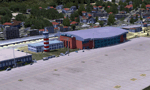
Detailed and realistically depicted scenery of Trabzon (LTCG) Airport in the eastern Black Sea region of Turkey, for Prepar3D/FSX.
Created mainly by FSDS 3.5.1, the scenery includes many accurate and detailed airport buildings including the new domestic terminal, afd file, various objects, detailed surroundings and some photo real terrain textures. Updated for Prepar3D compatibility and apron modifications. By Sunay KILIC.
| Filename: | LTCG__Trabzon_Airport__Turkey.zip |
| License: | Freeware, limited distribution |
| Added: | 10th February 2017, 11:34:57 |
| Downloads: | 2,294 |
| Author: | Sunay KILIC |
| Size: | 123.31 MB |
| Category: Microsoft Flight Simulator (2020) - Scenery | |
| Missouri River Flattening - St. Louis to Hermann, Missouri |
|
Images related to this file:
File Description:
In the default MFS2020 simulator, the Missouri River is raised some 300-400 feet higher than the surrounding terrain at the confluence with the Mississippi River near downtown St. Louis, Missouri westward almost to Kansas City, Missouri.
This addon scenery file flattens the Missouri River from the confluence with the Mississippi River to a point 8-10 miles west of Hermann, Missouri
| Filename: | Missouri_River_Flattening__St_Louis_to_Hermann_Mis.zip |
| License: | Freeware |
| Added: | 12th September 2020, 23:00:45 |
| Downloads: | 216 |
| Author: | Chuck Ford |
| Size: | 3.36 MB |
| Category: Flight Simulator 2004 - Scenery | |
| Juneau, Alaska |
|
File Description:
A complete redesign of the airport for Juneau, Alaska (JNU, PAJN).
Version 1.0
This is a GPS position accurate layout of the runways (land and water), taxiways and signs, ramp, roads, buildings and nearby navaids.
The buildings are very close to accurate scale with close to accurate color.
There's parking spaces for small, medium and large general aviation aircraft, military cargo aircraft (Coast Guard C-130's and AK-NG aircraft park here), parking at the terminal for 737 and MD80 size aircraft and helicopter landing pads.
Also included is a terrain BGL for the immediate area. This is by far the largest file in the download, but is critical to accurately depict the surrounding terrain (see EORold and EORnew for a comparison).
Many details are yet to be added, but this is a good starting point.
| Filename: | Juneau_Alaska.zip |
| License: | Freeware, limited distribution |
| Added: | 17th August 2006, 13:48:08 |
| Downloads: | 6,030 |
| Author: | Russ Pagenkopf |
| Size: | 2.98 MB |
| Category: Flight Simulator X - Gauges | |
| Multiple Moving Map Gauge |
|
Images related to this file:
File Description:
This Multiple Moving Map ( MMMap) provides a excellent and generic orientation and navigation gauge for any aircraft in FSX. The gauge will be implemented as a separate window in the panel.cfg ( for installation see pdf doc in this ZIP file).
The gauge allows the user to select different terrain presentations e.g. desert areas on the globe ( north of Africa for example ), or areas in the north of Europe/America .
In addition, the user can select a camera lookalike view. This is a dedicated view which allows the user to have a top view from the aircraft to the real FSX terrain.
Control buttons are available to insert into the map displays for airports, flight plans,VOR etc.. The gauge includes a commercial version ( MMMap_Com) and a military version (MMMap_mil). The difference is the gauge body only.
| Filename: | Multiple_Moving_Map_Gauge.zip |
| License: | Freeware |
| Added: | 18th December 2009, 23:34:50 |
| Downloads: | 2,508 |
| Author: | Dietmar Loleit |
| Size: | 2.36 MB |


© 2001-2026 AVSIM Online
All Rights Reserved
Privacy Policy |