
Where Flight Simulation Enthusiasts Gather from Around the World!
AVSIM Library - Search Results

| Category: Flight Simulator 2004 - Scenery | |
| Trail CAD4 in British Columbia, Canada |

|
Images related to this file:
File Description:
Trail is in the valley carved out by the Columbia River, around 7 miles north of the Canada-US border and on both banks of the river. The town has a population of just under 8,000 and the main industry is mining. The airport is around 3 miles south-east of the town and on the east bank, with the runway parallel to the river and aligned 16-34, 75 feet wide and asphalt. There are currently no runway or taxiway lights, though there is an overall improvement programme in place to cope with increasing passenger demand. A new terminal building was recently completed, along with alterations to road access and parking; as I have no information regarding these road changes I have left the original "terminal" building in place and in use by Pacific Coastal, the only airline to fly to Trail. There is a Youtube video which gives a very good idea of the basic facilities, and of the surrounding hilly terrain which is similar to that at Bella Cooola at the far side of Pacific Coastal's coverage area. The original position of the airport in FS9 before I corrected it was best described as "in a hole". The hole remains nearby as there is no easy way to deal with it.
| Filename: | Trail_CAD4_in_British_Columbia_Canada.zip |
| License: | Freeware, limited distribution |
| Added: | 23rd December 2018, 17:27:38 |
| Downloads: | 140 |
| Author: | Roger Wensley |
| Size: | 12.3 MB |
| Category: Flight Simulator 2004 - Scenery | |
| Port McNeill CAT5 in British Columbia, Canada |
|
Images related to this file:
File Description:
Port McNeill is at the northern end of Vancouver Island, on the coast and around 20 miles east of Port Hardy. The town population is just over 2,000 and the main industry is logging, followed by sand and gravel quarrying and exporting for the construction industry. Tourism rates third.
The airport, a mile or so east of the town, provides a swift connection for nearby islands and the surrounding area to the rest of the west coast, and serves as the HQ main base for West Coast Helicopters. Their newly built large hangar and office accommodation is next to their older hangar to one side of the central public parking area, opposite the club house cum terminal and hangars. There are two runways: 06-24 which is asphalt, 2,400 feet long, and lit; and 11-29 of gravel, 3,650 feet long and also lit. There is some taxiway lighting, but not, for instance, for the connection between runways, which is in real life a ramp up to the gravel runway which is 15 feet higher. There are no regularly scheduled flights and traffic consists mainly of the West Coast helicopters, plus GA and irregular charters, the latter being mostly from Port Hardy.
| Filename: | Port_McNeill_CAT5_in_British_Columbia_Canada.zip |
| License: | Freeware, limited distribution |
| Added: | 18th November 2018, 05:49:13 |
| Downloads: | 137 |
| Author: | Roger Wensley |
| Size: | 13.29 MB |
| Category: Flight Simulator 2004 - AFCAD Files | |
| Metro Oakland with Active Crosswind Runways |
|
File Description:
A high spec AFCAD2 for the FS2004 Metro Oakland Int'l Airport (KOAK) scenery by the Mach-1 Design Group. This afcad has been built using FAA Charts, various aerial photographs and information from the Airport Website. All taxiways are named and all aprons are reworked to be as real as possible according to photos. All gates are named and have airlines assigned to them. As per real life, only Southwest Airlines will use Terminal 2, all other airlines being allocated to Terminal 1. The Fedex and UPS aprons are represented and can accomodate many cargo aircraft. The final parking area is random GA parking to the north of the airport. Overflow parking is also available for rush hour periods. This airport features a tower view and also night and approach lighting. Finally, by using the crosswind runway technique, runways 9L/27R, 9R/27L and 11/29 can all be used simultaniously for take-off and landing. Runway 15/33 is closed as it is not used in real life. An extra taxiway "Zulu" has been added (not real life) to avoid AI conflicts when using runway 29 for Takeoffs and landings. Enjoy!! Requires that you install m1dg_oak2007.zip from this site.
| Filename: | Metro_Oakland_with_Active_Crosswind_Runways.zip |
| License: | Freeware |
| Added: | 1st June 2007, 17:44:02 |
| Downloads: | 1,461 |
| Author: | Lee Brompton |
| Size: | 203.67 KB |
| Category: Flight Simulator 2004 - Aircraft Repaints, Textures and Modifications | |
| Air Canada Boeing 767-233 early 90's livery (C-GAUP) |
|
Images related to this file:
File Description:

I was contacted some time back by some Canadian simmers looking for a rendition of an Air Canada Boeing 767-200 in the "Maple Leaf" 2 red cheat line livery of the early 1990's. I had been wanting a reason to repaint the Project Opensky Boeing 767 V4 model, so this was my chance. Sadly, Air Canada retired the last 767-200 from service in 2008. This particular airframe, the 5th 767 delivered to Air Canada, was retired around 2002.
This is a detailed repaint with custom textures. All windows are custom, hand-painted, 3D with window shades. The night textures are custom as well. The stewardess is a former Miss Canada, the interior exit signs are in French (SORTIE) and the pushback tug even bears the old Air Canada logos. The repainted textures in this package are 32-bit with no mipmaps for best clarity and quality. I hope you enjoy flying this wonderful aircraft as much as I did creating it. A special thanks to Lorne Jordan who suggested this repaint and supported me on getting it 'just right.' This is a complete install and contains all Project Opensky provided files current to Version 2004.8.0. The sound is from the default B737.
(This is a reupload of a work from April 2009 that was lost as a result of the AVSIM site compromise.)
| Filename: | Air_Canada_Boeing_767233_early_90s_livery_CGAUP.zip |
| License: | Freeware, limited distribution |
| Added: | 24th January 2010, 10:46:04 |
| Downloads: | 1,069 |
| Author: | Project Opensky, Jeffrey S. Bryner |
| Size: | 13.3 MB |
| Category: Flight Simulator 2004 - Aircraft Repaints, Textures and Modifications | |
| AeroSur Boeing 767-284/ER "Sharko" (CP-2659) |
|
Images related to this file:
File Description:

I am quite proud to present this very detailed and accurate repaint of Aerosur's Boeing 767-284/ER logojet named "Sharko", in the Project Opensky B762 V4 model. This logojet of Aerosur of Bolivia turns heads wherever she goes. She joins a rather large group of other AeroSur logojets, forming a total complement of 8. This aircraft flies into Miami (KMIA) and Dulles (KIAD) in the USA.
This repaint is almost 100% hand painted. All artwork is hand rendered except the AeroSur Eagle logo. Custom textures included in this repaint are; hand-painted realistic 3D windows with window shades, custom tires, custom night textures (and alpha), custom fuselage shading, tug with AeroSur logo, stewardess is a an actual AeroSur stewardess in AeroSur uniform, interior exit signs in Spanish (SALIDA), custom fuselage shading and many others. The screen shots included with this package showcase this detailed repaint and the outstanding Miami International Airport (KMIA) scenery recently released by LatinVFR. Fuselage, engine, wing and tail textures are 32-bit with no mips for best clarity and quality. As this has been one of the most enjoyable and challenging repaints for me, I hope you enjoy flying this wonderful aircraft as much as I did creating it. This is a complete install and contains all Project Opensky provided files current to Version 2004.8.0. The sound is from the default B737.
| Filename: | AeroSur_Boeing_767284ER__Sharko_CP2659.zip |
| License: | Freeware, limited distribution |
| Added: | 4th March 2012, 06:52:06 |
| Downloads: | 679 |
| Author: | Jeffrey S. Bryner, Project Opensky |
| Size: | 13.9 MB |
| Category: Flight Simulator X - Scenery | |
| Airport update for Chicago O'Hare Intl Airport (KORD), Illinois, USA |
|
Images related to this file:
File Description:
This updated version reflects the changes taking place at the airport with two optional files and made only for FSX users, not made or suitable for use in P3D: There is one version with the Crosswind runways operating where all 8 runways will be used for takeoff/landing and one version as the default airport runway operation: Runway 9C/27C and its taxiways now added with ILS approaches included for it, runway 9R/27L now at its new extended length and the ILS approaches corrected for it, the runway reconfiguration is now complete, the new extension and gates added to terminal 5, all aprons, taxiways and taxi signs updated to the latest charts, assigned parking as per their website where possible with extra parking including 2 gates for the A380 (gates M9 and M19), extra fuel trucks, support vehicle roads rebuilt and many other scenery improvements and objects added, airport views are from inside the central control tower (when in tower view), there is also a file for the nearby airport Chicago Executive formally Palwaukee Municipal (KPWK) which uses the same frequency as the KORD ILS for rwy 9C/27C, this bgl file for KPWK has the ILS frequency for Rwy 16 corrected to 109.75, so as not to cause a conflict at KORD, please view the readme before installation.
| Filename: | Airport_update_for_Chicago_OHare_Intl_Airport_KORD.zip |
| License: | Freeware, limited distribution |
| Added: | 22nd January 2022, 01:59:01 |
| Downloads: | 52,755 |
| Author: | Ray Smith |
| Size: | 5.95 MB |
| Category: Prepar3D V1-4 - AI Aircraft | |
| AI Pan American World Airlines AIG Boeing 757-23N Winglets RR TF-FIC |
|
Images related to this file:
File Description:

This is one of the oldest US Airlines that ceased operations but reburned 3rd times, this is the 4th time that this airline reborn as a charter airline called "Pan American World Airlines" known as "PanAm", the fleet only consists in 1 Boeing 757-23N Winglets with the registrations TF-FIC, operated by the Iceland airline "Icelandair". Pan American World Airways was an airline that was the principal and largest international air carrier and unofficial overseas flag carrier of the United States of America for much of the 20th century. The first airline to fly worldwide, it pioneered innovations such as jumbo jets and computerized reservation systems and introduced the first American Airline in 1958. Until its dissolution on December 4, 1991, Pan Am "epitomized the luxury and glamour of intercontinental travel", and it remains a cultural icon of the 20th century, identified by its blue globe logo ("The Blue Meatball"), the use of the word "Clipper" in its aircraft names and call signs, and the white uniform caps of its pilots.The model is Alpha India Group (AIG) Boeing 757-200 RR Basepack. This is my website: https://el-mundo-de-los-aviones-ai-traffic.jimdosite.com. I you hope you enjoy it!
| Filename: | AI_Pan_American_World_Airlines_AIG_Boeing_75723N_W.zip |
| License: | Freeware |
| Added: | 19th June 2025, 11:43:22 |
| Downloads: | 63 |
| Author: | Jesus Gibran Soriano Solleiro |
| Size: | 7.28 MB |
| Category: Flight Simulator X - Scenery | |
| Pichlingersee - LOW1 |
|
Images related to this file:
File Description:
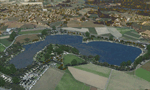
The Pichlingersee (LOW1) is a quarry pond near Linz (LOWL) in Austria (Upperaustria). The ILS approach to the runway 27 cross this lake. The helipad is in possession of Water Rescue Department and was not build on land. It was build "in water".
For the implementation of this area about 500 objects were set by hand from myself. Including not only trees and shrubs, but also signs, park benches, emergency call boxes (gernerated in gmax) etc at there right place. At night it was dark in real, so I does not create night texture. The scenery has 1.5 km ground imagery at 20cm per pixel and vary (hope) with the seasons.
Der Pichlingersee ist ein Baggersee in der Nhe von Linz (LOWL) in sterreich (Obersterreich). Der ILS Anflug auf die Landebahn 27 fhrt genau ber diesen See. Die Hubschrauberplattform gehrt der dortigen Wasserrettung und wurde nicht auf dem Land, sondern in den See hinein gebaut.
Fr die Umsetzung des Areals wurden von mir ber 500 Objekte von Hand gesetzt. Darunter nicht nur Bume und Strucher, sondern ebenso Schilder, Parkbnke, Notrufsulen (in gmax generiert) usw. an ihrem richtigen Platz. Da es dort in der Realitt nachts stockdunkel ist, habe ich auf Nachttexturen verzichtet. Die Szenerie hat eine 1.5 km Bodentextur mit 20cm/px und wechselt (hoffentlich) mit den Jahreszeiten.
| Filename: | Pichlingersee__LOW1.zip |
| License: | Freeware |
| Added: | 9th January 2013, 00:44:19 |
| Downloads: | 1,999 |
| Author: | Oliver Brandl |
| Size: | 54.71 MB |
| Category: Flight Simulator 2004 - AFCAD Files | |
| KPHX - Phoenix Sky Harbor Airport |
|
File Description:
This is an AFCAD2 for the default Phoenix Sky Harbor airport. My most accurate AFCAD yet. I was able to use the jetway shadows and others objects on the default land mass to accurately place each gate in the exact real life position they were when the photograph was taken. I utilized other satellite images and many photos from airliners.net to help verify exact gate and airline locations. Only difference here unfortuantely is there are no jetways, only jetway shadows. Maybe someone can make some jetways for this KPHX? 99.9% of all gates at the real airport are present in this AFCAD, and properly numbered. I've also included the cargo and military ramp, America West and Southwest maintenance parking, as well as added a few GA gates for you civil flyers. This AFCAD is roughly as of March 2005, so parts of Taxiway Echo near Terminal 4-D are closed and under construction in the AFCAD. I've closed 8/26 for takeoffs and used it with 7R/25L for landings. 7L/25R will be used as the primary takeoff runway. I think that covers everything. If you have time, select the Top-Down view in your sim, and you can see all the jetways from the land mass lined up with each aircraft. Kinda cool, enjoy! :) If there are any errors, let me know. Thanks.
| Filename: | KPHX__Phoenix_Sky_Harbor_Airport.zip |
| License: | Freeware, limited distribution |
| Added: | 12th April 2005, 01:10:49 |
| Downloads: | 3,231 |
| Author: | Jaxan Prier |
| Size: | 18.06 KB |
| Category: Flight Simulator 2004 - AFCAD Files | |
| Presidente Nicolau Lobato International, Dili, East Timor (WPDL) v2 |
|
File Description:
"Euraka!" I cried in the middle of the night. My wife rolled over and mumbled "its not me, it must be the cat". But I was pleased with myself, for I had suddenly thought of a way to eliminate Microsoft's radiused corners where taxiway meets runway. They are a nifty arrangement, when you want them, but at this airport (clearly evidenced by Google Earth) they do not exist on the concrete connections. So here is a revised version of my Googlyafcad for WPDL Dili-Comoro-Komoro-Presidente Nicolau Lobato International or whatever it is called today. I considered calling this version 1.0062A so as to impress but I think you might prefer me to call it it version 2. Unfortunately, Microsoft's perception of this airport in Flight Simulator is a wee bit under scale and the ramp areas provided barely allow the parking of a flea, never mind the Boeing 737s that serve this airport. This A&F Data file allows you and "AI" traffic to land, park and take-off in the proper manner. But there is more . . . the Google Earth picture clearly shows three parked
helocopters, so to give the place a little atmosphere, I've provided an additional file which will place three static helicopters at the airport. They will only show if you have the Rwy12 libraries
installed, but the file won't bite if you don't. (replaces af2_wpdl.zip)
| Filename: | Presidente_Nicolau_Lobato_International_Dili_East_.zip |
| License: | Freeware |
| Added: | 12th February 2007, 13:07:25 |
| Downloads: | 750 |
| Author: | John Hinson |
| Size: | 44.33 KB |


© 2001-2026 AVSIM Online
All Rights Reserved
Privacy Policy |