
Where Flight Simulation Enthusiasts Gather from Around the World!
AVSIM Library - Search Results

| Category: Flight Simulator 2004 - Panels | |
| Boeing 757 Photoreal panel with wingviews and TCAS |

|
File Description:
FS2004-photoreal panel Boeing 757 in 2 modifications:Version A has full internal views and
2 animated wingviews for the wingviews-model B757-200 from Project Opensky and can be used
for any other B757/767 without wingviews.
Version B is the alternative 2D-panel for the virtual-cockpit-model of the a.m. POSKY-aircraft
and shows no wingviews. Both vaiations have additional panel.cfg's for TCASII V7.0 from
Lee Hetherington for optional installation.
See pictures and info in zip-dive
| Filename: | Boeing_757_Photoreal_panel_with_wingviews_and_TCAS.zip |
| License: | Freeware |
| Added: | 7th April 2007, 19:25:09 |
| Downloads: | 13,704 |
| Author: | Horst Paetzold |
| Size: | 5.73 MB |
| Category: Flight Simulator 2004 - Scenery | |
| MESH 2010 SurAmerica - Venezuela, Costa Rica and Panama |
|
Images related to this file:
File Description:
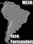
MESH FERMANDOIS 2010 V1.0 / Venezuela, Costa Rica, Panama / index(VE1; VE2) / A highly detailed 30m SRTM mesh for South America (FS2004 and FSX)
| Filename: | MESH_2010_SurAmerica__Venezuela_Costa_Rica_and_Pan.zip |
| License: | Freeware |
| Added: | 2nd December 2009, 04:00:38 |
| Downloads: | 3,473 |
| Author: | Jose Fermandois |
| Size: | 87.06 MB |
| Category: Flight Simulator 2004 - Utilities | |
| FS Earth 5.2 for Google Earth and FS2004 |
|
File Description:
This program acts as a link between Flight Simulator 2004 and Google Earth, letting to follow a flight in real time, over the satellite images generated by Google Earth. Flights can be saved, and many options are available for fine tuning the performance, as well as the map's style (zoom, tilt, orientation). Works on a single computer running FS2004 and Google Earth all together or, for best experience, can be used on two networked computers running respectively FS2004 (master) and Google Earth (slave). AI and Multiplayer traffic is also displayed in Google Earth, with course prediction and other information. Requires Flight Simulator 2004 and Google Earth. The program running in trial mode works only around Anchorage, Alaska, (PANC / ANC) for a maximum of five minutes per flight session. Version 5.2 has new aircraft icons & labels and improves the compatibility with Windows Vista. A version for FSX is available also.
| Filename: | FS_Earth_52_for_Google_Earth_and_FS2004.zip |
| License: | Shareware, time limited |
| Added: | 4th September 2008, 19:11:30 |
| Downloads: | 1,241 |
| Author: | Luciano Napolitano |
| Size: | 3.59 MB |
| Category: Flight Simulator X - Scenery | |
| Laughlin and Bullhead City KIFP 2019 for FSX |
|
Images related to this file:
File Description:
FSX Scenery--Laughlin/Bullhead International Airport. Bullhead City Airport (KIFP), Bullhead, Arizona (AZ), USA. This version adds 5 casinos and is a complete new release for 2019. By Scott Peterson.
| Filename: | Laughlin_and_Bullhead_City_KIFP_2019_for_FSX.zip |
| License: | Check within download |
| Added: | 18th March 2019, 17:55:12 |
| Downloads: | 309 |
| Author: | Scott Peterson |
| Size: | 88.16 MB |
| Category: Prepar3D V5 - AI Aircraft | |
| P3DV4-5 FSPXAI EMB190 and 195 Lufthansa CityLine |
|
Images related to this file:
File Description:
Textures only for FSPXAI A32X ceo payware. Fantastic model and paint kit by Mitsushi Yukata with PBR textures. Four variations: A319 standard and croatia flag, A320 ex air Berlin wifi and standard. I can't paint the D-ANNA as I'm missing to much good pictures. Paint by Joel Branchu for real traffic with the registrations. Sep 2021
| Filename: | P3DV45_FSPXAI_EMB190_and_195_Lufthansa_CityLine.zip |
| License: | Freeware |
| Added: | 24th September 2021, 21:02:11 |
| Downloads: | 159 |
| Author: | P3DV4-5 FSPXAI A32x ceo Air Sundair representative fleet |
| Size: | 4.74 MB |
| Category: Flight Simulator 2004 - Original Aircraft | |
| AI Lockheed Martin F-16C and F-16D |
|
File Description:
Low polygon version Lockheed Martin (General Dynamics) F-16C and F-16D by Henry Tomkiewicz. Features animated landing gear, flaps, air brakes, and LANTIRN navigation pod. Also features conditionally activated canopy and pilot(s) as well as a realistic afterburner effect along with customized lights. This package includes 20 different visual models ranging from 1975 to 3288 polygons (ACM). All models feature 10 levels of detail (LODs) and are designed for AI use. The F-16C has both standard and drag chute tails along with 7 different loadout options: Clean, Normal, Long Range, Air-to-Air, Mk.84, JDAM, and AGM-65. The F-16D has both standard and drag chute tails and 3 loadout options: Clean, Normal, and Long Range. Included textures kindy provided by Graham King. See readme file for more information. Dedicated to all the men and women of the U. S. Armed Forces serving around the world. Thank You!
| Filename: | AI_Lockheed_Martin_F16C_and_F16D.zip |
| License: | Freeware, limited distribution |
| Added: | 28th May 2005, 16:48:30 |
| Downloads: | 20,830 |
| Author: | Henry Tomkiewicz |
| Size: | 5.56 MB |
| Category: Flight Simulator X - Scenery | |
| SEATTLE X DEMO - the City and the Airports |
|
Images related to this file:
File Description:

SEATTLE X DEMO features an extremely detailed scenery of large area of Seattle, USA, fully compatible with FSX, FSX SE, P3D v1/v2/v3/v4 and FSW by Dovetail.
With Seattle X you are free to fly to any of 5 airports: KSEA Tacoma, KPAE Paine Field, KBFI Boeing Field, KRNT Renton, S50 Auburn, admire some of the world-renowned landmarks, bridges, harbours, heliports, seaplane bases, ships, etc.
This Demo version features both - the City and the Airports packages (commercial poducts) and includes some downtown buildings as well as all airports with terminals but with low resolution textures, non-animated jetways and generally much less details. This ensures no problems with online (VATSIM, IVAO and multiplayer) flying in case some users have the payware scenery and some don't.
It's equipped with an automatic installer, which means that the scenery will be automatically added to the Flight Simulator Scenery Library.
Please uninstall all previous versions of the above-mentioned airports you may have installed before. Please make also sure that no duplicated AFCAD files are installed.
Enjoy your virtual flying with Drzewiecki Design!
| Filename: | SEATTLE_X_DEMO__the_City_and_the_Airports.zip |
| License: | Freeware, limited distribution |
| Added: | 1st May 2018, 15:51:33 |
| Downloads: | 3,860 |
| Author: | Drzewiecki Design |
| Size: | 90.12 MB |
| Category: Prepar3D V1-4 - Scenery | |
| Benevento Italy N41.07.46 E14.46.55 and airport Olivola LIRB |
|
File Description:
Benevento Italy N41.07.46 E14.46.55 The foundation of city dates back to far. Founded according to legend by the Greek hero Diomedes, landed in Italy after the destruction and the fires of Troy. The modern city rises on a discreet plateau, known all over the world for its elixir "Strega" produced in liquorice premises. Benevento, also has a modest airmort by name "Olivola" with ICAO "LIRB" airport you will find in the scenery. It was built at the beginning of the 1930s by the troops of Regia Aeronautica as the Italian operating base and Luftwaffe. Since the end of the 1960s, the airport sedan has returned to the civilian democracies and has been abandoned for several years. Today the airport is used as aviosurface The city is an excellent VFR point for approaching airport Benevento LIRB.
Within the downloaded package you will find readme files for scenery installation. Good fly VFR. Pasquale Marrulli.
| Filename: | Benevento_Italy_N410746_E144655_and_airport_Olivol.zip |
| License: | Freeware |
| Added: | 23rd November 2017, 16:20:56 |
| Downloads: | 689 |
| Author: | Pasquale Marrulli |
| Size: | 4.99 KB |
| Category: Flight Simulator X - Scenery | |
| St. Helena, Ascension, and Tristan da Cunha Islands |
|
Images related to this file:
File Description:
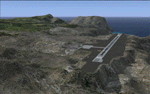
This project was begun to add the new airport (FHSH) to St. Helena Island and eventually was expanded to include a complete remake of Ascension Island (FHAW) and Tristan da Cunha (with an optional airport FHTC) and Gough Island with the actual weather station heliport (FHGH). Tested in both the default FSX/Acceleration and with FTX Global/Vector, accurate coastlines, lakes, road data, and SRTMGL1 (30m) mesh, as well as corrected landclass are provided based on the latest available satellite imagery. Flight plans are provided for the proposed commercial service to St. Helena, and some additional GA and military flights to the island are added as well.
The FSX St. Helena (FHSH) airport was created by aligning master plans for the airport with current satellite data and by studying many of the pictures that have been posted as the airport has taken shape. The official opening of the real airport on May 21, 2016, has been pushed back for more field tests due to challenging crosswinds. The Ascension Island (FHAW) airport was updated after I realized that Ascension could receive commercial service as a result of the new St. Helena airport. The entire airfield is redesigned to allow the volcanic terrain to display properly. The airbase, towns, BBC Atlantic relay station, and numerous satellite dishes, radomes, and wind turbines now appear in their real-world locations. Since I was already in the region, I added the Tristan da Cunha Islands (including Inaccessible, Nightingale and Gough Islands) and the Gough Island weather station maintained by the South African National Antarctic Programme. I also added an optional airport (and flight plans) to Tristan da Cunha (FHTC), which can be easily enabled/disabled. The FHTC airport is placed on the only part of the island that appears to be free of people or farmland, and the area is just long enough to accommodate a pared-down version of the St. Helena airport.
Updates were created or rebuilt in a manner which carefully aligns airport data with current satellite imagery. Scenery was created using Airport Design Editor X v1.67.5684, SBuilderX 3.13, and the FSX Object Placement Tool. Scenery objects were added and modified from stock FSX scenery to resemble as closely as possible the actual airports. The animated flag model is by Dietmar Loleit, the FSX apron lights included are from the set created by Jim Dhaenens, and the animated wind turbines and radomes are from the freeware package by Ray Porter.
| Filename: | St_Helena_Ascension_and_Tristan_da_Cunha_Islands.zip |
| License: | Freeware |
| Added: | 1st May 2016, 11:23:05 |
| Downloads: | 6,078 |
| Author: | Carlyle Sharpe |
| Size: | 10.52 MB |
| Category: Flight Simulator 2004 - Miscellaneous Files | |
| High Quality Snow and Grass Textures ** UPDATED VERSION ** |
|
Images related to this file:
File Description:
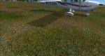
Drzewiecki Design Grass is a freeware, fully automated package of ultra high quality, 4096x4096 pix grass and snow textures for Microsoft Flight Simulator 2004, Microsoft Flight Simulator X, FSX:SE and Lockheed Martin Prepar3D (all currently available versions). It will enhance ground textures in the whole FS.
Microsoft Flight Simulator X and Lockheed Martin Prepar3D have texture resolution limit, which is 1024x1024 pixels. It is possible to select higher resolution by manually editing configuration files but Drzewiecki Design Grass will do that for you automatically!
Default FS9's grass is 128x128pix and with Drzewiecki Design Grass you can admire the 1024x1024 ground texture resolution.
Extra features: Drzewiecki Design Grass will automatically add a HIGHMEMFIX=1 tweak to your FS, which will prevent texture disappearing from aircraft and buildings + snow texture for winter flying.
Enjoy your virtual flying with Drzewiecki Design!
| Filename: | High_Quality_Snow_and_Grass_Textures__UPDATED_VERS.zip |
| License: | Freeware, limited distribution |
| Added: | 25th May 2016, 11:08:44 |
| Downloads: | 1,282 |
| Author: | Drzewiecki Design |
| Size: | 9.21 MB |


© 2001-2026 AVSIM Online
All Rights Reserved
Privacy Policy |