
Where Flight Simulation Enthusiasts Gather from Around the World!
AVSIM Library - Search Results

| Category: Flight Simulator 2004 - Scenery | |
| Koyukuk KYU in Alaska |

|
Images related to this file:
File Description:
Koyukuk is a small village on the northern bank of the Yukon River, around 5 miles east of where the river turns from north-south to east-west, east being upstream towards the distant Fairbanks. The mouth of the Koyukuk River that joins the Yukon is just to the east of the village. The population is now under 100 and living from fishing and the land. During the late 1800's the local population lived off the land and also by the spin off from gold mining in the same way as the nearby Nulato, but when in the early 1900's gold mining activities moved to Nome and Fairbanks local prosperity plunged. In fact, the village only became a permanently inhabited establishment in 1939, when a school was built. The airfield is close by and has a gravel runway aligned 6-24 and 4,000 feet long with PAPI on the approach to 6. There is also a shorter and parallel grass runway that is only used in the winter snows by light planes that are on skis and without wheels. Apart from the airfield itself, and it's buildings, this scenery modifies the local land class, adds village buildings while reducing the village size to reality, and creates a new airfield background. Koyukuk is served by Wright Air from Fairbanks in the east and this is included in the AI provided with the post of Nulato. A note here about my scenery making. This is post number 509 and there will not be many more to follow this as I am almost at the end of the photos I either took or found for scenery purposes. There is a limit to what can be located online and I have already been making use of the little there is; eg Unalakleet. So, if you are near an airport (preferably Canadian or Alaskan) and have a camera..... Let me know.
| Filename: | Koyukuk_KYU_in_Alaska.zip |
| License: | Freeware, limited distribution |
| Added: | 30th August 2019, 18:23:12 |
| Downloads: | 125 |
| Author: | Roger Wensley |
| Size: | 3.26 MB |
| Category: Flight Simulator 2004 - Scenery | |
| Airports Northern Coast Alaska (PALU, PPIZ, PAWI, AK03) |
|
Images related to this file:
File Description:
The town of Barrow is in the far north of Alaska, and these are coastal villages or radar installations to the west of Barrow, and there will be additions. Cape Lisburne is a gravel runway right next to the coast with radar gear and accomodation buildings close by, and what was called "Top Camp" at the end of a long and steep road to the top of a nearby hill, or mountain. The runway is lit, as are most of them in this area of long dark winter nights. Barrow is 270 miles to the northeast. Point Lay PPIZ used to have a radar installation as well as a village, but the old buildings have now been removed and the gravel runway 05-23 has been lengthened to 5,000 feet to serve the village throughout the year. The population is around 270, living mostly traditionally and with an annual beluga whale hunt. Barrow is 180 miles to the northeast.
Wainwright PAWI, some 80 miles southwest of Barrow and on the coast, has a population of around 570. The PAWI runway is just under 5,000 feet long and like PPIZ is aligned 05-23, lit, and with PAPI on each end. The original runway of some 2,000 feet is still visible next to the apron. Three miles to the southeast there is a third runway, at AK03, serving the Wainwright DEW station. It was decided in 2007 to close the station and to remove the buildings both there and at Point Lay because of subsidence, but everything at Wainwright was still in place in 2009 and beyond. The villages have been "sketched" as opposed to replicated exactly. The texture folder includes the missing car textures for Barrow PABR, and the AI is modified PABR to include passenger flights by Ravn and cargo flights by Northern Air Cargo, plus limited GA. There are no flattened grassed areas at these airfields; they are runways and taxiways and aprons on a bed of gravel on permafrost.
| Filename: | Airports_Northern_Coast_Alaska_PALU_PPIZ_PAWI_AK03.zip |
| License: | Freeware, limited distribution |
| Added: | 16th June 2016, 15:59:24 |
| Downloads: | 360 |
| Author: | Roger Wensley |
| Size: | 10.84 MB |
| Category: Flight Simulator 2004 - Aircraft Repaints, Textures and Modifications | |
| Royal Hellenic Air Force Supermarine Spitfire Collection |
|
File Description:
This package includes all the Hellenic Spitfires expect the Spitfire pr Mk.XI witch appeared in one unit and pr Mk.XIII in three units. You can fly the spitfire mk.Vb/c, Spitfire mk.IXe LF/HF and Spitfire Mk.XVIe LF. Greece in 9/23/1938 ordered 12 Spitfires and 12 Anson. During the June of 1939 it was signed the order of 24 Spitfires which cost 9335 pounds each. When Hitler attacked to Poland, England used all the aircrafts that were under construction and of course the Greek were some of them. On 10/12/1943, the 336th Olympus Squadron received the first Spitfire and followed the 335th Tiger Squadron. The Spitfire mk.Vb/c replaced the Hurricane mk.IIb/c. When the two greek Squadrons were at North Africa, their Spitfires wore the
| Filename: | Royal_Hellenic_Air_Force_Supermarine_Spitfire_Coll.zip |
| License: | Freeware, limited distribution |
| Added: | 2nd December 2005, 19:59:29 |
| Downloads: | 3,883 |
| Author: | Delizisis Thanasis, Delizisis Panagiotis, Ken Harrison (Merlin66) |
| Size: | 19.6 MB |
| Category: Flight Simulator X - Scenery | |
| Carnes Farm |
|
Images related to this file:
File Description:
These are the files that I talked about in the Prepar3d forums. I created these objects for Fs9, then upgraded them to the scenery SDK for FSX. They were created 10 years ago in GMAX, and I have used them successfully ever since in Prepared 1.4 as well.
For some reason the individual farmhouse and other objects that I created are not showing up in Prepar3d version 2.0.
That's where you guys come in! These files are free to use in anyway you want as long as proper attribution is given, but, I would like you guys who have both Prepar3d 1.4 and 2.0 to try them out in both and report back to me as to whether you have the same problems that I do. That's your only fee. And I'd like you guys to give it a shot in both, or all four( I am not sure that they will work in FS9 anymore, but try it out. Unfortunately I can't recompile my FSX SDK Files back to FS9 if it doesn't work).
What's included:
1. Photo real scenery of Barbourville, 10 miles to the north west of stinking Creek where we live, and;
2. Photo real scenery of the farm area and stinking Creek, upon which I have placed my GMAX objects;
A. The farm house.Carnes Farm From the Bridge at 500 AGL.jpg
B. The barn, shed and the RV in back of the farmhouse.
C. A two-story long structure the top of which is an apartment but the bottom of which is a re-creation of Mama Carne's store, along with all the real wood floors shelves and original contents.. It is also o n Google earth in 3-D as it is here with further description .
... A little note on Gmax.. Mama Carne's store was one the first structures that I built in Gmax. It was just a box. Later, I added the true architectural features that you see including the steps and rails which took about as long to create as it would have to Saw and fit and hammer the real rails, risers and steps.
D. K-6, my little 2300 foot strip for runways 03 and 21. It has VOR - (117.55), ILS(110.1), and NDB(222).
E. Gerald Bingham's house, 1/4 mile up Warriors Path North from us.( mostly dirt road with gravel topping).
F. Dewitt Baptist Church.
Off property Knox county
G.Escoe's Store and Post Office complete with great prices for gas at the included pumps.
Escoes.jpg
H. Rex allen's killer corner...sheds and farm equipment on the sharpest bend on Stinking Creek...my son went off it with a flat tire, unscathed, but more than several have lost their lives on that curve... there may be several iterations of the sheds...just delete or rename the wrong ones...I was experimenting with ModelConverterX, Arno Gerretsen's wonderful model and object scenery tool.
I. sitting on top of the Barbourville Photo real scenery Barbourville PhotoReal over the shopping center.jpg is the Barbourville P3D Shopping Center2.jpg shopping center all the stores and all the storefronts ... it's on 25 E. as you head into Barbourville.
Recreated, is the entire shopping center with the now outmoded Wal-Mart sign. Probably my magnum opus.
note on the Gmax scenes.
All of the scenery was either directly measured and if not practical for a such a long measuring device, walked off, as in the Stinking Creek Bridge and shopping center. All of the objects were then photographed, in 360° where possible and saved as texture for inclusion in the Gmax model.
Enjoy!
...oh... how do you get there? Wellllll.... situate yourself at Middlesboro (1a6), and tune your Nav radio to K-69's VOR, 117.55, take off and climb to 3500 feet...grinnnnn
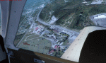
Welcome to Knox County Kentucky!
| Filename: | Carnes_Farm.zip |
| License: | Freeware |
| Added: | 2nd December 2013, 05:34:20 |
| Downloads: | 453 |
| Author: | Chas Honce |
| Size: | 91.13 MB |
| Category: Flight Simulator 2004 - Scenery | |
| Bethel PABE in southwest Alaska |
|
Images related to this file:
File Description:
There are four main northwestern Alaska towns which have good airports and are serviced by Alaska Airlines. From these airports local flights connect to nearby villages, "nearby" in Alaska meaning up to 200 miles away. The northernmost is Barrow. Southwest of Barrow is Kotzebue, then Nome, and the furthest south is this one, Bethel. The town of Bethel has a population of just over 6,000 and is 50 miles from the sea on the Kuskowim River, that splits and forks into many tributaries. Bethel Airport is close to the town and provides the only contact with the rest of Alaska, as there is no connecting highway system. There are scheduled flights by Alaska Airlines, ERA (now called Ravn) and Grant Aviation, plus others such as Ryan Air. There are cargo flights by Everts, Northern, and Lynden, and redistribution onwards to nearby villages by the smaller locally-based planes; all of these are included in the AI. There are two main runways, one just under 6,400 feet and another just under 3,900 feet, both of them aligned 19-1. The third runway is around 1,800 feet and mainly gravel, aligned 11-29. Parking at PABE is on three aprons, the northern for smaller commercial planes of Grant, ERA, Ryan etc, the central for larger planes of Alaska, Northern, Everts, and Lynden, and the southern for a large collection of GA; each apron has further hangars for maintenance companies and smaller operators. There is also another separate apron for the local military and Coastguard. There is not much photographic information available for PABE, and I have never been there; as a result it was impossible to make detailed photographic textures for some of the buildings. However, for most hangars I have made textures of at least the right colour etc based on the information I assembled and if it is green with white trim and side windows then that is how it now appears here. The exceptions are the Alaska Airlines terminal building which has complicated curved elements, and the two military hangars and workshops where I had to settle for an Alaska terminal building from another airport and the same for the military. There are numerous small villages in the vicinity of Bethel, all of them being beside either a river tributary or the coast. There are two Google Earth screenshots to show the villages that are served by the flights from Bethel and that are (mostly) included in the AI. Some of these airfields were not included in FS9 but AI will still operate in and out of Bethel. The smaller area screenshot shows the villages that are close to Bethel, and of these eight I have so far made six and they are included in this post: Napaskiak PKA, Napakiak WNA, Kwethluk KWT, Atmautluak 4A2, Nunapitchuk 16A, and Kasigluk Z09. I will work my way through the rest of the area.
| Filename: | Bethel_PABE_in_southwest_Alaska.zip |
| License: | Freeware, limited distribution |
| Added: | 8th March 2019, 00:37:58 |
| Downloads: | 305 |
| Author: | Roger Wensley |
| Size: | 32.02 MB |
| Category: Flight Simulator X - Utilities | |
| FSTramp v8.84 for MSFS, FSX(-SE), Prepart3D, X-Plane (Win) |
|
Images related to this file:
File Description:
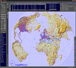
This add-on is an EXE application for Microsoft Flight Simulator and a DLL module for all other simulators. The DLL variant is activated via hotkeys or the simulator menu add-ons or plugins. Window size and layout are configurable for one or more screens. To avoid dazzling, the brightness of the entire application is customizable. Primarily it is a flight management system (FMS) with automatic control from start to landing. This also includes the observance of SID, STAR and Approaches in unmatched quality. The flight plan required for the FMS can be created manually or automatically, interactive changes and additions during the flight are possible. The basis of the flight planner is the 3D world map and the search function for airfields and navigation aids. The FMS by FSTramp relies on the autopilot of the aircraft. In case of incompatibility, the autopilot integrated in FSTramp will be used. This allows FSTramp to control almost all aircraft from airport to airport. The altitude profile of the flight plan, SID, STAR and approach is taken into account. This means that FSTramp extends the often incomplete airport procedures to and from the runway so that they can be flown completely automatically. During the fully automatic flight, the autopilot values ​​for HDG, ALT, VSPEED, SPD and MACH can be manually overridden. This is e.g. useful for being able to react to the instructions of the tower in the final approach without completely stopping the automatic flight. The rotating or north pointing 3D world map with numeric display of the terrain elevation under the mouse arrow is another special feature. It does not need an internet but is synthesized from included height profiles of the globe. The Data of continents, mountains and rivers are included in the setup. Airspaces, Airways, Waypoints and SID, STAR and Approaches are also included in the setup, but can be updated by installing additional AIRAC cycles. Airfields and navigation stations are taken from the simulator. NVIDIA: If the frame rate of the simulator drops sharply about 20 seconds after FSTramp's visibility, the power management of the GPU slows down prematurely. In the NVIDIA Control Panel, change the 'Manage 3D settings - Power management mode' option to 'Adaptive'.
| Filename: | FSTramp_v884_for_MSFS_FSXSE_Prepart3D_XPlane_Win.zip |
| License: | Shareware, time limited |
| Added: | 7th July 2023, 04:35:43 |
| Downloads: | 130 |
| Author: | Helge Schroeder |
| Size: | 358.21 MB |
| Category: Flight Simulator X - Scenery | |
| YFRV Oombugurri Community, Western Australia (Town closed 2011) |
|
File Description:
YFRV Oombugurri Community, Western Australia, formerly Forrest River Mission. Features extensive flattening of Forrest River which runs uphill. Take a flight there before installing the scenery.
Oombulgurri, was an Aboriginal community in the eastern Kimberley, 45 kilometres southeast of Wyndham.
The Anglican Forrest River Mission for Aborigines was founded in 1896���¢������97 by Harold Hale (Later Bishop of Prth) but was abandoned after a few months. A permanent mission, known as the Forrest River Mission, was established on the site in 1913 by the bishop of the north west, the Rt. Rev. Gerard Trower. In December 1913, Anglican priest Ernest Gribble took charge, three years after he was forced to resign as superintendent at Yarrabah. Gribble remained as superintendent until the early 1930s.
In 1926 the mission was plagued by an influenza epidemic and impacted by the Forrest River massacre where police killed a number of Aboriginal people. This event remains controversial.
The mission was closed in 1969, after the 1967 Aboriginal referendum.
In 1973, fifty Aboriginal people decided to resettle their abandoned tribal land and rename it Oombulgurri. Within a year, the population had grown to 200. Infrastructure and welfare programs were set up in the 1970s and 1980s to provide the residents with basic amenities and to allow the town to become self-sufficient.
In 2007 a Coronial Inquiry began into Aboriginal deaths in the Kimberley, including five in Oombulgurri. It revealed high levels of alcohol abuse, suicide and child neglect in Oombulgurri. Some time after the inquest, alcohol was banned there and the population began to move away to areas where alcohol was available.
It had a population of 107 as of the 2006 census. In 2011, the government of Western Australia encouraged residents of Oombulgurri to move elsewhere as it considered the community "unviable". The last residents from Oombulgurri were relocated to Wyndham just before Christmas 2011. REQUIRES Blencowe_LibraryKit.zip
REQUIRES blencowe_librarykit_309494.zip (Available HERE)
| Filename: | YFRV_Oombugurri_Community_Western_Australia_Town_c.zip |
| License: | Freeware |
| Added: | 28th February 2013, 02:37:06 |
| Downloads: | 229 |
| Author: | Alan Blencowe |
| Size: | 2.97 MB |
| Category: Prepar3D V5 - Utilities | |
| FSTramp v8.84 for Prepart3D 2-6, MSFS, FSX(-SE), X-Plane (Win) |
|
Images related to this file:
File Description:
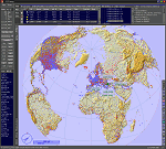
This add-on is an EXE application for Microsoft Flight Simulator and a DLL module for all other simulators. The DLL variant is activated via hotkeys or the simulator menu add-ons or plugins. Window size and layout are configurable for one or more screens. To avoid dazzling, the brightness of the entire application is customizable. Primarily it is a flight management system (FMS) with automatic control from start to landing. This also includes the observance of SID, STAR and Approaches in unmatched quality. The flight plan required for the FMS can be created manually or automatically, interactive changes and additions during the flight are possible. The basis of the flight planner is the 3D world map and the search function for airfields and navigation aids. The FMS by FSTramp relies on the autopilot of the aircraft. In case of incompatibility, the autopilot integrated in FSTramp will be used. This allows FSTramp to control almost all aircraft from airport to airport. The altitude profile of the flight plan, SID, STAR and approach is taken into account. This means that FSTramp extends the often incomplete airport procedures to and from the runway so that they can be flown completely automatically. During the fully automatic flight, the autopilot values ​​for HDG, ALT, VSPEED, SPD and MACH can be manually overridden. This is e.g. useful for being able to react to the instructions of the tower in the final approach without completely stopping the automatic flight. The rotating or north pointing 3D world map with numeric display of the terrain elevation under the mouse arrow is another special feature. It does not need an internet but is synthesized from included height profiles of the globe. The Data of continents, mountains and rivers are included in the setup. Airspaces, Airways, Waypoints and SID, STAR and Approaches are also included in the setup, but can be updated by installing additional AIRAC cycles. Airfields and navigation stations are taken from the simulator. NVIDIA: If the frame rate of the simulator drops sharply about 20 seconds after FSTramp's visibility, the power management of the GPU slows down prematurely. In the NVIDIA Control Panel, change the 'Manage 3D settings - Power management mode' option to 'Adaptive'.
| Filename: | FSTramp_v884_for_Prepart3D_26_MSFS_FSXSE_XPlane_Wi.zip |
| License: | Shareware, time limited |
| Added: | 7th July 2023, 04:35:26 |
| Downloads: | 42 |
| Author: | Helge Schroeder |
| Size: | 358.21 MB |
| Category: Flight Simulator 2004 - Scenery | |
| Port Hardy CYZT in British Columbia, Canada |
|
Images related to this file:
File Description:
Port Hardy airport is on the coast of Vancouver Island in BC, at the far northern end and 5 miles east of the town. The town and the airport are both gateways to local touristic attractions such as Cape Scott Provincial Park, the North Coast and BC Marine Trails, and kayaking, caving, surfing, fishing, camping, and scuba diving (and I discovered just how big orca are). Fishing, logging, and mining have been important and to an extent still are for the town population of just over 4,000. The airport, along with the ferries, connects Port Hardy to the rest of the west coast with Pacific Coastal Saab 340 or Beechcraft 1900C flights to and from Vancouver at least twice a day. There are also Grumman Goose amphibious flights to local float bases such as Port McNeill, Alert Bay, Whaletown, Surge Narrows, Echo Bay, and Minstrel Island. These are all included in the AI and previously posted. There are three runways: 11-29 of 5,000 feet with ILS on 11 and righthand circuits on 29, 07-25 of 4,000 feet with righthand circuits on 25, and 16-34 with a much shortened 3,500 feet on 34 due to a displaced threshold. There is a control tower but it is not manned 24 hours a day; a "mandatory frequency" (MF for short and a Canadian invention) is used by the tower when it is manned, and when there is no tower response the aircraft continues to announce intentions and position. Something I have been meaning to explain to those who query it, is that in real life as well as in FS9 helicopters at a mixed use airport or airfield will act as if they are planes and join downwind, turn on base and then finals, "land" along the runway and then use the taxiway to the parking. This means all aircraft are doing the same thing and an orderly queue avoids collisions. This is one of a series connected in some way with Pacific Coastal airline destinations, the first being Bella Coola. There is AI available for Pacific Coastal online.
| Filename: | Port_Hardy_CYZT_in_British_Columbia_Canada.zip |
| License: | Freeware, limited distribution |
| Added: | 11th November 2018, 16:48:50 |
| Downloads: | 234 |
| Author: | Roger Wensley |
| Size: | 19.26 MB |
| Category: Flight Simulator 2004 - Original Aircraft | |
| Ansaldo S.V.A.-5 (V.01) |
|
Images related to this file:
File Description:
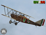
One of the faster airplane of WWI thanks to an innovative design, the S.V.A. was the first airplane conceived and built entirely in Italy. The initials "S.V.A." stand for the names of Savoia and Verduzio, the two engineers that designed it, and of Ansaldo, the firm that built over 2000 of them starting from 1917. The Ansaldo S.V.A. was an entire family of Italian reconnaissance biplane aircraft of World War I and the decade after. Originally conceived as a fighter, the S.V.A. was found inadequate for that role. Nevertheless, its impressive speed, range and operational ceiling made it an excellent reconnaissance aircraft and even light bomber.
The S.V.A. became legendary among pilots for some of its memorable flights; first, above all, the one over Vienna: this flight was an epic action performed by Italian poet and nationalist patriot Gabriele D'Annunzio on 9th August 1918. After the war, thanks to the strong determination of Arturo Ferrarin and Guido Masiero( the pilots), two S.V.A.9s (the two seater version of the S.V.A.-5) flew for 18000Km from Rome to Tokyo (14th February / 31st May 1920). Another S.V.A., piloted by Antonio Locatelli, first flew alone across the Andes (30th July 1919).
Production of the aircraft continued well after the war, with the final examples delivered in 1928. In 1919 some S.V.A.s were used in airmail routes by "Gruppo Sperimentale Comunicazioni Aeree", a group formed by the Italian Army in order to prove the feasibility of commercial air services. The Regia Aeronautica (Royal Italian Air Force, since 1923) employed the S.V.A. in operational units in Italy and North Africa (Lybia) as well as for pilot training. Many war-surplus planes were employed by commercial flying schools.
Complete aircraft, 5 Different Hi-Res GMax models (5 different versions, three S.V.A.-5 and two S.V.A.-9), features the usual moving parts, such as all flight controls. Five different liveries (three WWI and two post-war). VC and 2D Panel. Models, panels and paints by Manuele Villa, Flight dynamics, Handling notes and tutorials by FSAviator.
September 2008. Installation instructions included.
| Filename: | Ansaldo_SVA5_V01.zip |
| License: | Freeware |
| Added: | 6th May 2010, 08:49:53 |
| Downloads: | 3,207 |
| Author: | Manuele Villa |
| Size: | 40.55 MB |


© 2001-2026 AVSIM Online
All Rights Reserved
Privacy Policy |