
Where Flight Simulation Enthusiasts Gather from Around the World!
AVSIM Library - Search Results

| Category: Flight Simulator 2004 - Scenery | |
| Kogd-Ogden,Utah |

|
Images related to this file:
File Description:
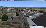
KOGD-Ogden,Ut Take your sailboat to the Great Salt Lake inland sea or hike the many mountains and enjoy the vistas offered atop the lofty peaks. Visit the quiet mountain valley town of Eden to the east of KOGD with its annual balloon festival and summer fun on Pineview dam or spend the day shopping the shops of Brigham City to the north or Salt Lake City to the south. Fly over the Great Salt Lake to the west. See the Ogden airport come alive with this must have add-on. With the help of Google Earth and FS Earth I have recreated the Ogden airport, with its new taxiway A (from a site visit), and the surrounding cities and towns to look as real as possible. Made with Ultimate Terrain, but the airport should be ok with default FS9. (No guarantee though ;-) The scenery enhancements were made with Ultimate Terrain in place. I modified the landclass to look more like the real thing. The airport is very close to a exact replica of KOGD! The crane by the tower was there when I took the pictures so I included it.
| Filename: | KogdOgdenUtah.zip |
| License: | Freeware |
| Added: | 15th December 2009, 00:45:07 |
| Downloads: | 725 |
| Author: | Alan C. Heiner |
| Size: | 15.59 MB |
| Category: Civil Flight Simulators - Looking Glass Flight Unlimited 3 | |
| Outer Terrain GTL Grid Structure Map v2.0 |
|
Images related to this file:
File Description:
This version of my GTL grid structure map includes Andre's new outer terrain area north of Seattle and adds a search facility, which enables you to search for a tile using FU3 world co-ordinates. To find out the world co-ordinates of any OT area simply open Fled, set the top-down view to the latitude/longitude of the area you're interested in and click the latitude/longitude figures that appear in the bottom left hand corner of the screen. The latitude/longitude figures will disappear and be replaced by FU3 world co-ordinates as easting and northing values. Enter these values into my FU3 GTL Map, click the button and the spreadsheet will map these co-ordinates to the correct tile and return the tile name. If you don't know the latitude/longitude of the area you're interested in then you can always obtain this from within the game itself. Just start a flight in the area you're interested in and press Ctrl-z at any time to enter Zoar mode. This will pause the game and display the current latitude/longitude in the top left hand corner of the screen.
| Filename: | Outer_Terrain_GTL_Grid_Structure_Map_v20.zip |
| License: | Freeware |
| Added: | 29th December 2009, 23:16:52 |
| Downloads: | 35 |
| Author: | Jonathan Stonehouse |
| Size: | 198.97 KB |
| Category: Flight Simulator 2004 - Aircraft Repaints, Textures and Modifications | |
| NAC de Havilland DH-114 Heron 1B |
|
Images related to this file:
File Description: In 1957 they were written from use. One Heron was sold to the UK but sadly suffered a fatal crash on delivery. The other three, including ZK-BBM, were stored and in 1960 sold to Fiji Airways (later Air Pacific). In November 1975 Rotorua-based Air North bought ZK-BBM from Air Pacific. Already in 1978 she made her final landing and was stored for years at Ardmore Airfield. Classic Flyers NZ, based at Tauranga Airport acquired the Heron in March 1989. Since then she has been restored for static display at the Classic Flyers Museum.
You will need the DH-114 package available at Classic British Flightsim.
New Zealand National Airways Corporation (NAC) was the first operator to receive the DH-114. From 1952 till 1957 NAC flew with four Herons 1B's, which were acquired to serve those airfields which could not take NAC's standard airliner of those days, the Douglas DC-3. The Herons primarily flew across Cook Strait (Rongotai-Blenheim-Nelson) and later also to Hamilton and Rotorua. Since many modifications were required for this new airliner, the Herons proved too costly.
| Filename: | NAC_de_Havilland_DH114_Heron_1B.zip |
| License: | Freeware, limited distribution |
| Added: | 14th March 2014, 05:31:12 |
| Downloads: | 180 |
| Author: | Maarten Brouwer |
| Size: | 1.85 MB |
| Category: Flight Simulator 2004 - Aircraft Repaints, Textures and Modifications | |
| Nordic AI Package |
|
File Description:
Complete package (repaints and flightplans) for the following scandinavian air companies:
BENAIR (EKVJ and ENGM)
-Let Kunovice L-410 (flying mail within Scotland and Denmark)
-Metroliner III (Business charter within Scandinavia and Northern Europe)
-Cessna 208B (Based mainly in ENGM, flying small cargo and newspapers)
NORTH FLYING (EKYT)
Metroliner III (Business charter and small cargo within Northern Europe, some flights to Middle Europe)
Metroliner III Air Norway (Scheduled services ENGM to ENOL and EKYT)
Piper Navajo (Business charter in Denmark, Sweden and the Baltic)
NORDFLYG (ESKN and ESSU)
Cessna 208B (two variations, flying mail between ESOK, ESSA, ESGJ and EFHK, flying fresh fish between LFRS to LFPG and parachuters around Sweden)
Piper Navajo (Business charter in Sweden)
GÖTA VINGAR (ESSB and ESSV)
Piper Navajo (Business Charter in and around Sweden)
The flightplans are of course fictious and incomplete. Some flights have accurate departure times and flight numbers. All destinations are +/- real and the planes usually get 'back home' at night.
Textures only - you'll need the following AI aircraft models:
Henry Tomkiewicz's Cessna Caravan 208B and Dee Waldron's Piper Navajo Pa-31, Viktor Schacht's Let L-410 and Dee Waldron's Fairchild Metroliner III. Thanks for the nice planes and paintkits!
| Filename: | Nordic_AI_Package.zip |
| License: | Freeware |
| Added: | 24th August 2004, 19:06:56 |
| Downloads: | 3,875 |
| Author: | Dominic Huber |
| Size: | 4.01 MB |
| Category: Flight Simulator 2004 - Scenery | |
| Camden Field in Trinidad |
|
File Description:
Camden Field was once a wartime American airfield, which shows up in the wide east-west runway that has more recently been partly resurfaced. There are no runway markings beyond a centre line, and it just sort of tapers off at the sides and the eastern end into the bush. In contrast to the renovated hangar to the north of the western end of the runway the buildings to the south haven't been touched by any recent tender-loving-care. There is a wonderful patched-together shed and a small control tower, which was built on the edge of the existing runway. This makes it appear rather close to the edge of the resurfaced runway area. Do not be fooled, this is not an illusion; it IS close to the edge of the runway. Just take comfort in the thought that the prevailing southeast winds (for much of the year) will tend to blow you away from it as you approach for a landing from the west. And I kept the pre-renovation version of the old hangar when I found some old pics of the crop dusting operation from five years ago.
| Filename: | Camden_Field_in_Trinidad.zip |
| License: | Freeware |
| Added: | 14th December 2008, 01:32:05 |
| Downloads: | 536 |
| Author: | Roger Wensley |
| Size: | 2.73 MB |
| Category: Flight Simulator X - Scenery | |
| NZWV - Waihi Beach Airfield, New Zealand |
|
Images related to this file:
File Description:
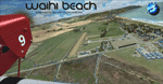
Waihi Beach (ICAO: NZWV) is a small airstrip north of Tauranga and near the small beach settlement of the same name, in the Bay of Plenty of New Zealand. It is a grass strip with offset thresholds giving usable landing lengths of 640m and 517m for RWY 13 and 31 respectively, a width of 55m and a group rating of 5. No night lighting or fuel is available. A very basic airstrip, there is only one recently built hanger and the airstrip is slowly being encroached on by
new housing developments. The airstrip itself is usually very sodden due to its low elevation but is a nice stop over for sightseeing from Tauranga and up the Coromandel peninsula.
The FSX model includes custom textures and models placed on a high resolution aerial image and a 15m mesh. It makes extensive use of items from the free VLC object libraries which are required to be installed (Available from www.vectorlandclass.co.nz Downloads menu). This scenery and
the VLC libraries have been funded by sales of VectorLandClass and although you do not need VLC to use it, your purchase helps further development.
| Filename: | NZWV__Waihi_Beach_Airfield_New_Zealand.zip |
| License: | Freeware, limited distribution |
| Added: | 1st November 2012, 10:01:38 |
| Downloads: | 1,006 |
| Author: | Tim Barnes / VectorLandClass |
| Size: | 11.13 MB |
| Category: Flight Simulator 2004 - Scenery | |
| Kogd-Ogden,Utah |
|
Images related to this file:
File Description:
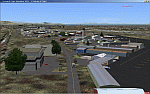
KOGD-Ogden,Ut
Take your sailboat to the Great Salt Lake inland sea or hike the many mountains and enjoy the vistas offered atop the lofty peaks. Visit the quiet mountain valley town of Eden to the east of KOGD with its annual balloon festival and summer fun on Pineview dam or spend the day shopping the shops of Brigham City to the north or Salt Lake City to the south. Fly over the Great Salt Lake to the west.
See the Ogden airport come alive with this must have add-on. With the help of Google Earth and FS Earth I have recreated the Ogden airport, with its new taxiway A (from a site visit), and the surrounding cities and towns to look as real as possible.
Made with Ultimate Terrain, but the airport should be ok with default FS9. (No guarantee though ;-)
The scenery enhancements were made with Ultimate Terrain in place. I modified the landclass to look more like the real thing. The airport is very close to a exact replica of KOGD! The crane by the tower was there when I took the pictures so I included it.
| Filename: | KogdOgdenUtah.zip |
| License: | Freeware |
| Added: | 20th January 2009, 13:42:09 |
| Downloads: | 1,344 |
| Author: | Alan C. Heiner |
| Size: | 15.59 MB |
| Category: Flight Simulator X - Scenery | |
| Odense Airport (EKOD), Funen, Denmark |
|
Images related to this file:
File Description:
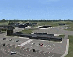
Odense Lufthavn (Odense Airport) is situated close the village of Beldringe, a few km north of Odense, the main city on the island of Funen, Denmark. Like several other Danish airports it was established as an airbase by the Germans during World War II. It was taken over by the Danish state after the war and owned by the state until 1998, at which time it was taken over by a consortium of local authorities, including the city of Odense.
Since the opening of the Great Belt Lin in 1997 there has been no regular passenger flights, apart from some charter traffic during the summer season. But there is a lot of traffic with one- and two-motor craft (including rotor craft) due to the many companies based in the airport.
The package is a complete scenery of the airport, including a few buildings around it. It includes approach lights, runway lights, taxiway lights and light on the apron, the car parking area and the surrounding roads. A traffic file with the (limited) charter traffic of the airport is also included.
| Filename: | Odense_Airport_EKOD_Funen_Denmark.zip |
| License: | Freeware, limited distribution |
| Added: | 31st October 2009, 10:29:34 |
| Downloads: | 3,728 |
| Author: | Peter H. Poulsen |
| Size: | 13.63 MB |
| Category: Prepar3D V1-4 - Scenery | |
| Brindisi Puglia Italy the city |
|
File Description:
Brindisi Puglia Italy. Brindisi stands on a natural harbor, an inlet that is wedged deeply on the Adriatic coast of Puglia. Within the outer arms of the port there are the Pedagne islands, a tiny archipelago that is currently not accessible because it was used for military purposes (the UN Schools Group, a base built at the time of the intervention in Bosnia). Presenting a morphology of the flat territory, the entire municipal territory falls within the Piana di Brindisi and is characterized by the high agricultural vocation of its land. It is located in the north-eastern part of the Salento plain, about 40 km from the Itria valley and then from the first offshoots of the low Murge. Not far from the city is the Torre Guaceto State Nature Reserve The Ionian Sea is located about 45 km instead.The northern municipal area is washed by the main watercourse of Salento, the Canale Reale which flows into Torre Guaceto. Important VFR point for approaching airport Brindisi.
Within the downloaded package you will find readme files for scenery installation. Good fly VFR. Pasquale Marrulli.
| Filename: | Brindisi_Puglia_Italy_the_city.zip |
| License: | Freeware |
| Added: | 1st March 2018, 00:31:30 |
| Downloads: | 241 |
| Author: | Pasquale Marrulli |
| Size: | 7.52 KB |
| Category: Flight Simulator 2004 - Aircraft Repaints, Textures and Modifications | |
| Caledonian Airways Douglas DC-7C |
|
Images related to this file:
File Description:

Textures only for Caledonian Airways 1961 DC-7C "Star of Robbie Burns" and Caledonian Airways 1962 DC-7C "Flagship Bonnie Scotland". You must have the DC-7C base back installed to fly this aircraft. That can be downloaded at www.calclassic.com. Caledonian Airways leased one SABENA DC-7C in the fall of 1961 and began flights in November, 1961 with G-ARUD "Star of Robbie Burns". That aircraft crashed in April of 1962 during takeoff at Douala, Cameroon. The cause turned out to be malfunctioning elevator spring tabs. Douglas had warned the airlines to fix these spring tabs, but for some reason or another SABENA did not do the work, and Caledonian didn't know about the airworthiness directive. A few weeks after the crash, Caledonian leased another SABENA DC-7C, G-AYRE "Flagship Bonnie Scotland" to resume flights. Caledonian flew out of Prestwick, Scotland, but London Gatwick was their main hub as far as traffic was concerned. These early 1961 and 1962 flights served secondary European cities with safari flights to Africa, pre-packaged flights to holiday destinations like Barbados and Jamaica, and low cost flights to and from North America.
| Filename: | Caledonian_Airways_Douglas_DC7C.zip |
| License: | Freeware, limited distribution |
| Added: | 24th September 2014, 09:20:48 |
| Downloads: | 196 |
| Author: | Mike Stevens |
| Size: | 13.97 MB |


© 2001-2026 AVSIM Online
All Rights Reserved
Privacy Policy |