
Where Flight Simulation Enthusiasts Gather from Around the World!
AVSIM Library - Search Results

| Category: Flight Simulator X - Aircraft Repaints, Textures and Modifications | |
| American Airlines Boeing 737-800 (N809NN / N838NN) Mega Pack |

|
Images related to this file:
File Description:

American Airlines is a major U.S. airline headquartered in Fort Worth, Texas. It operates an extensive international and domestic network, with scheduled flights throughout North America, the Caribbean, South America, Europe, and Asia. Its route network centers around five "cornerstone" hubs in Dallas/Fort Worth, New York, Los Angeles, Miami, and Chicago. Its primary maintenance base is located at Tulsa International Airport (TUL). American Airlines is part of the Oneworld airline alliance
American Airlines livery painted on PMDG Boeing 737 NGX WL model. The textures are saved in DDS format for quality graphics. Textures are also characterized by HD (High Definition). Its features are idle-reverser animation, animated pack vents and pressurisation outflow valve, detailed textures, accurate paint, dynamic shine & effects, dynamic flexing wings that respond to turbulence, fully independent suspension, trim animation, gear steering, accurate flight dynamics, spoiler animation, reflective cockpit windows, improved wingflex code with input from several new parameters including ground spoilers, fuel load, and angle of attack, transparent navigation light lenses and many more. "HD EXPERIENCE" INSIDE. Credits to PMDG Simulations.
Visit our Facebook page "Sky Level Textures" for news, updates and previews on my future repaint projects. Thanks for downloading & Happy flying.
| Filename: | American_Airlines_Boeing_737800_N809NN__N838NN_Meg.zip |
| License: | Freeware |
| Added: | 22nd May 2014, 14:07:02 |
| Downloads: | 7,626 |
| Author: | Giacomo Tomasini | Sky Level Textures | PMDG Simulations |
| Size: | 79.64 MB |
| Category: Flight Simulator X - Aircraft Repaints, Textures and Modifications | |
| De Havilland DH-98 Mosquito (W4072) 105 Sqn GB-D |
|
Images related to this file:
File Description:
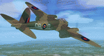
This folder contains a repaint for the DeHavilland DH98 Mosquito by Dave Garwood, in the colors of W4072 GB-D, a B Mk.IV of 105 squadron. On 25 june 1942, while being loaned to 139 squadron, it was being flown by Flt Lt Bagguley on a night attack on Stade aerodrome near Hamburg. He attacked the town of Dorum, near Bremerhaven. On leaving the target, instead of closing the bombdoors, he accidenatly lowered the flaps. These were torn away due to the speed of over 380 mph, and on arrival back at Horsham St Faith, W4072 overshot the runway, with the right undercarriage collapsing in a ditch. W4072 was delivered to 105 sqn on 27 februari 1942, and took part in the first bomb raid carried out by Mosquito's, when sqn ldr Oekeshott took it to Cologne on 31 May 1942. After the prang in june, W4072 was repaired and flew more missions with 105 sqn. Damaged again in March 1943, she passed to 627 sqn (AZ-Q), but crashed in the North Sea returning from a raid on Frankfurt on 8 january 1944. Repaint by Jan Kees Blom, based on the paintkit by Dave Garwood.
| Filename: | De_Havilland_DH98_Mosquito_W4072_105_Sqn_GBD.zip |
| License: | Freeware |
| Added: | 3rd August 2018, 23:43:28 |
| Downloads: | 146 |
| Author: | Jan Kees Blom |
| Size: | 2.77 MB |
| Category: Flight Simulator 2004 - Scenery | |
| Legnano scenery - Italy |
|
Images related to this file:
File Description:
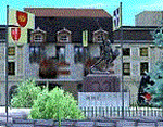
Homage to my town, scenery built mainly with existing objects, buildings by sintax and few experiments by GMax. It DOES NOT include any airport, but represents some pictures of Legnano town
Informations: Legnano is a town in north of Italy (approx 25 kmt NW Milan, ref coordinates N45 35.98 E8 54.59), reachable from Casorezzo ultralight airport (closest one) or all the near others of Milan area.
Here was done in 1176 the historical fight of the Alliance Lombarda's city-states against Federico Barbarossa German imperator. Legnano is also well known for his metallurgical and textile industries story.
Contents: rev.1 : down town square with municipal Palazzo Malinverni and S. Magno basilica, skyscraper, one of Olona river's bridges, G. Mari football stadium, Alberto da Giussano circus with related monument, encircled by the eight quarter's flags, F. Tosi and Manifattura industrial buildings, Rail station, external parking and glass building
rev.2 : Courthouse building with Teresa's face bronze statue and some more buidings, Palio hystorical figurants inside the stadium, Carroccio and Alberto da Giussano rider, Small goods train on railroad; S. Magno belltower reviewed, red sky-lights on top of skyscraper and chimney, Chimney smoke
| Filename: | Legnano_scenery__Italy.zip |
| License: | Freeware |
| Added: | 27th March 2011, 02:55:40 |
| Downloads: | 648 |
| Author: | Aldo Della Vedova |
| Size: | 6.83 MB |
| Category: Flight Simulator X - Scenery | |
| RAF Scorton |
|
File Description:
RAF Scorton was opened in October 1939 as part of 13 Group Fighter Command and a satellite station of RAF Catterick. It was located near the village of Scorton in North Yorkshire. It was used by the Royal Air Force, the Royal Canadian Air Force, and the United States Army Air Forces Ninth Air Force during the war.
The location was chosen for its flat terrain and its situation close to the now disbanded Eryholme-Richmond branch line that had a sub branch line to Catterick Garrison and RAF Catterick.
The famous No. 56 Squadron RAF flew Spitfires from Scorton during the Second World War. Also the USAAF 422d and 425th Night Fighter Squadrons were stationed at Scorton flying the Northrup P-61 "Black Widow" fighter.
The Aerodrome closed in 1945 and most of the concreted areas have been extensively quarried away for sand and gravel extraction. Most of what was the airfield is now under a lake or a quarry. There are a few military pre-fab buildings remaining in the area – they were dismantled after the war and moved to local farms to be used as agricultural buildings.
Source:Wikipedia
| Filename: | RAF_Scorton.zip |
| License: | Freeware |
| Added: | 26th February 2017, 07:30:57 |
| Downloads: | 86 |
| Author: | Terry Boissel |
| Size: | 2.52 MB |
| Category: Flight Simulator 2002 - AFCAD Files | |
| Simflyers KLAX AFCAD 2.1 |
|
File Description:
INSTRUCTIONS AND MORE INFO INCLUDED IN ZIP FILE. INCLUDES 3 OVERLAYS. Hi, I've created these AFCAD files for the Simflyers LAX scenery, as I could not find anything that was truly a; realistic, and b; functioned properly with the MS Fltsim 2002 AI. I've spent many hours testing and tweaking these AFCAD files, so I hope they are perfect enough to be widely used. However, I do stress that some previous experience of using AFCAD and changing aircraft radius sizes will be necessary. Please report any faults which may be discovered! Design tips for the future are always very useful!
WHATS NEW FOR 2.1:
I have changed the direction of takeoff / landing for all of the runways, as the AI appears to behave a lot better this way (less likeliness of aircraft getting stuck!). This has allowed me to move all of the runways used by the KLAX overlay to the north side of the airport, reducing the chances of aircraft landing on top of one another. KLAX also now has some extra Ramp GA Large bays to accomodate for all of the American Eagle Saab 340's! Finally, I have cleaned up the AFCAD removing unecessary nodes etc.
| Filename: | Simflyers_KLAX__AFCAD_21.zip |
| License: | Freeware, limited distribution |
| Added: | 19th July 2003, 01:41:28 |
| Downloads: | 671 |
| Author: | Carl Edwards |
| Size: | 127.41 KB |
| Category: Flight Simulator 2002 - Scenery | |
| Nakhon Phanom Royal Thai Air Force Base (NKP) |
|
File Description:
A model of Nakhon Phanom Royal Thai Air Force Base (NKP). Situated in the far northeast corner of Thailand right across the Mekong River from Laos, NKP was the smallest, remotest, and most primitive of the Thai airbases utilized by the US Air Force. Many of the operations conducted at NKP were top-secret. NKP was the headquarters of "Task Force Alpha", the underground command center directing "Arc Light" bombing of the Ho Chi Minh trail. The 56th Air Commando Wing employed a variety of fixed wing aircraft and helicopters for interdiction, close air support, psychological warfare, search and rescue, forward air control, and clandestine insertion and extraction of special operations personnel in Laos and North Vietnam. One of the key covert missions conducted at NKP was "Operation Igloo White", which involved the planting and monitoring of electronic sensors along the Ho Chi Minh Trail. Air America used NKP as a base to supply the various hill tribes in Laos.
This is the fourth in a series of Vietnam War era Thai airbase models. (It was preceded by Ubon, Udorn, and Korat.)
Note: This scenery requires the trees_v3.zip object library by Gerrish Gray.
| Filename: | Nakhon_Phanom_Royal_Thai_Air_Force_Base_NKP.zip |
| License: | Freeware |
| Added: | 21st July 2003, 20:44:51 |
| Downloads: | 829 |
| Author: | George Knowles |
| Size: | 1.71 MB |
| Category: Flight Simulator X - Scenery | |
| Caribbean, Montserrat, Blackburne airport |
|
File Description:
Blackburne Airport, also known as W.H. Bramble Airport, was a small international airport near the southwest coast of the island of Montserrat, a British Overseas Territory in the Caribbean.
The airport was located near the now-abandoned capital of Plymouth and was destroyed on the 25th of june 1997 by an eruption of the nearby Soufrière Hills volcano.
For several years afterwards, Montserrat had been only accessible by helicopters or boats until July 2005 when the new Gerald's Airport was completed on the north end of the island.
The approach to Blackburne's runway 15 was rather spectacular and difficult. That's why it was very popular among flightsimmers. Ever since the airport was destroyed end of june 1997 it was left out of subsequent releases of Flight Simulator. This scenery gives you the opportunity to fly over there again.
The scenery is provided with some special effects: the volcano Soufrière Hills shows an ash cloud and is erupting from time to time, including sounds, the capital Plymouth is burning at several places caused by debris from the volcano and fires are threatening the airport.
Please read the enclosed readme.txt for information on how and when the secial effects show.
| Filename: | Caribbean_Montserrat_Blackburne_airport.zip |
| License: | Freeware |
| Added: | 26th April 2008, 23:37:32 |
| Downloads: | 1,483 |
| Author: | Jaap van Hees |
| Size: | 186.96 KB |
| Category: Flight Simulator 2004 - Scenery | |
| LELC Murcia/San Javier, Spain |
|
File Description:
Googly scenery for LELC San Javier, Spain, a medium-sized airport on the Costa
Cálida 17 miles south of Murcia. The airport sees daily scheduled traffic
operated by Canadair Regional Jets and Dash 8 turboprops of Air Nostrum but a
large proportion of the airport's traffic is derived from tourist charter
traffic from operators such as Air Berlin, Easyjet, LTU International and
Ryanair and the airport can accept aircraft as large as the Boeing 767. The
north end of the airport is home to the Spanish Air Force Academy.
Flight Simulator 2004 has made little provision for traffic with facilities only
for general aviation aircraft and this scenery seeks to redress the situation.
The scenery does not purport to be ultra-accurate. Based on high quality
satellite imagery from Google Earth, the layout is proportionally correct but the
added airport features, such as buildings, are built from default Microsoft objects
and add-on libraries so will not look exactly like the real thing.
You are not obliged to download and install any additional scenery libraries,
but to enjoy this scenery in its entirety, you may wish to. It will work fine,
with or without.
| Filename: | LELC_MurciaSan_Javier_Spain.zip |
| License: | Freeware |
| Added: | 6th April 2008, 20:35:29 |
| Downloads: | 3,169 |
| Author: | John hinson |
| Size: | 20.51 KB |
| Category: Flight Simulator X - AFCAD Files | |
| Southern Cross Airport (C01), NJ |
|
File Description:
Located 03 miles SW of Williamstown, New Jersey on 18 acres of land, Southern Cross is a public turf airstrip with an ample 2400' runway. The runway is hard surfaced in order to allow for AI traffic to use this airport, however the end user must enable flights to arrive/depart from this airfield within their AI traffic program in order for AI to appear here. Tie down space is available north of Runway 09 and fuel is available at the tank next to the hangar. This airport is not lit at night so daytime VFR operations only are recommended. In addition to trees at the ends of both runways, power lines are strung up across there too.
Scenery constructed with use of satellite images/streetview/aerial photos - the author has not been there in person.
This scenery is meant to be used in conjunction with MegaScenery Earth New Jersey/Delaware 004. It is not required, but apron use is minimized to allow satellite scenery to show through as much as possible, and objects are placed based on the MSE textures - lack of it may make scenery look out of place.
| Filename: | Southern_Cross_Airport_C01_NJ.zip |
| License: | Freeware |
| Added: | 25th March 2011, 16:38:00 |
| Downloads: | 192 |
| Author: | Drew Sikora |
| Size: | 630.77 KB |
| Category: Flight Simulator X - Scenery | |
| 1F2 - Plateau Sky Ranch - Edinburg, NY |
|
File Description:
Here is an improved version of the stock Plateau Sky Ranch. This is a privately owned field, open to the public. It consists of two grass runways and is located just north of the Great Sacandaga Lake.
In FSX, there were no buildings at all, so I added the hangar, and the hangars and planes that are located across a public road. I moved both runways because, with UTX, the road crossed both runways. Now the runways clearthe road. In FSX there were taxiways with hold-short lines, taxiway signs, etc, which didn't belong so they
were removed. I added a dirt driveway, parking area, fuel station, light pole, flag, and a couple of local houses and barn.
There is a lot of nice scenery in any direction from Plateau Sky Ranch. If you take off from runway 6 and follow the waterway you will come to the earthen Conklingville dam and the upper Hudson River.
I've added an extra file for UTX users called Boats.bgl. It will add several marinas and boats in correct locations on the Great Sacandaga Lake.
| Filename: | 1F2__Plateau_Sky_Ranch__Edinburg_NY.zip |
| License: | Freeware |
| Added: | 22nd March 2009, 17:44:40 |
| Downloads: | 1,347 |
| Author: | Jim Cook |
| Size: | 4.56 KB |


© 2001-2026 AVSIM Online
All Rights Reserved
Privacy Policy |