
Where Flight Simulation Enthusiasts Gather from Around the World!
AVSIM Library - Search Results

| Category: Flight Simulator 2004 - AI Aircraft | |
| Tupolev Tu-22 Belaja (NATO-code 'Blinder') |

|
File Description:
Tupolev Tu-22 Belaja (NATO-code 'Blinder') for AI Traffic. This is an excellent addition to your retro military AI world, a classic Cold War medium bomber. A very mean, sleek design, but not always kind to its crews, with over 70 of roughly 350 production aircraft lost in accidents. This aircraft saw extensive combat in the 70s and 80s, in North Africa, the Middle East, and Southwest Asia. The Blinder also found work as a high-speed recce and electronic warfare platform. This is a complete aircraft package, with with two LOD6 model options and four serials (two -PD and two -RD) from the 341st TbAP (Heavy Bomber Regiment), home-based at Machluschi AB, Minsk; the regiment saw combat service in Afghanistan in the 1980s. This initial release only uses the RD model, but subsequent repaints will use both -R and -RD models. A multi-layer PSP paint kit is also included. Aircraft model by Sergey Bunevich, flight dynamics by Sergey Ivanov, Anglo-Russian diplomacy and Cyrillic spelling lessons by Rysiek Winauer, master textures, repaints, and paint kit by Michael Pearson.
| Filename: | Tupolev_Tu22_Belaja_NATOcode_Blinder.zip |
| License: | Freeware |
| Added: | 4th November 2008, 04:36:24 |
| Downloads: | 1,094 |
| Author: | Sergey Bunevich, Michael Pearson |
| Size: | 6.23 MB |
| Category: Flight Simulator X - Scenery | |
| Bornholm Island X DEMO |
|
Images related to this file:
File Description:
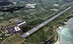
BORNHOLM ISLAND X DEMO features an extremely detailed scenery of Bornholm Island with EKRN Ronne airport in Denmark, fully compatible with both FSX and P3Dv1.
It's a fully functional DEMO version of the commercial payware product. It features same airport layout as in the full version but with limited 3D objects and low resolution textures. Using this free demo ensures no problems with online (VATSIM, IVAO, multiplayer etc.) flying in case some users use the payware scenery and some don't.
Bornholm is an island located in the Baltic Sea 37 km south of Sweden and the north of Poland. Bornholm Airport (RNN / EKRN) is a Danish airport located 2.7 nautical miles (5 km) southeast of Ronne.
This product is equipped with an automatic installer, which means that the scenery will be automatically added to the Flight Simulator Scenery Library.
Please uninstall all previous versions of this airport you may have installed before. Please make also sure that no duplicated AFCAD files are installed. Enjoy your virtual flying with Drzewiecki Design!
| Filename: | Bornholm_Island_X_DEMO.zip |
| License: | Commercial demo |
| Added: | 2nd September 2015, 21:47:52 |
| Downloads: | 1,785 |
| Author: | Drzewiecki Design |
| Size: | 15.39 MB |
| Category: Flight Simulator 2004 - Scenery | |
| Cape Dorset CYTE, Baffin Island, Nunavut, Canada |
|
Images related to this file:
File Description:
Cape Dorset is a village of 1,300 or so inhabitants at N 64 13 W 76 31 on Dorset Island, off the southwest corner of Baffin Island. It's Inuit name is Kinngait, which means "High Mountains"; watch out if you fly there in low clouds. The village (again) does not feature in FS9 but is included in this scenery with approximately the right shape, or shapes as there are separate parts. The airfield runway is just under 4,000 feet of gravel 100 feet wide at 158 feet above sea level. There is a double gradient to it, but unfortunately this cannot be replicated in FS.
Cape Dorset had a Hudson Bay Company store as long ago as 1913, and is now known as a centre for Inuit art. I added the roads, a new airfield background, a pond between apron and runway, plus of course there is the scenery file and the AFCAD and AI, which has two planes visiting, a First Air HS748 and a Canadian North Dash 8-100, as per real life.
| Filename: | Cape_Dorset_CYTE_Baffin_Island_Nunavut_Canada.zip |
| License: | Freeware, limited distribution |
| Added: | 9th December 2010, 18:45:06 |
| Downloads: | 1,014 |
| Author: | Roger Wensley |
| Size: | 2.75 MB |
| Category: Flight Simulator 2004 - Scenery | |
| Ontario Small Fields in Canada: #7 Lucan CPS4 |
|
Images related to this file:
File Description:
This is the seventh in a series of small airfields in southern Ontario Canada, Lucan CPS4; plus revised AI and parking for #6 Nixon CNX8 to include a crop spray plane (the Grumman 164) which I have just identified from a photograph; plus a note re an addition required to the different crop spray aircraft (the AT802) config file so that it parks correctly at St Thomas CYQS.
Lucan is 15 miles north of London Ontario, and 20 miles southeast of Lake Huron. The airfield is the base for a small crop spraying business and has a grass runway of 3,100 feet aligned 09/27, and with lighting. The overhead cables that previously imposed a 550 feet threshold displacement on the runway 09 approach (up to and including 2010) have now been buried. The lighting is owner-controlled and cannot be turned on from the air. Fuel and oil is available. The crop spray plane is a Grumman G164A Ag-Cat, which was manufactured in the 1970's and remains in use with a lot of owner-operators.
| Filename: | Ontario_Small_Fields_in_Canada_7_Lucan_CPS4.zip |
| License: | Freeware, limited distribution |
| Added: | 27th October 2015, 15:16:58 |
| Downloads: | 167 |
| Author: | Roger Wensley |
| Size: | 4.59 MB |
| Category: Flight Simulator X - Scenery | |
| NZOP- Opotiki Aerodrome (VectorLandClass, New Zealand) |
|
Images related to this file:
File Description:
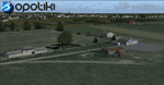
Opotiki aerodrome (ICAO: NZOP) is a small airstrip outside the township of of Opotiki, the gateway to the beautiful East coast of the North Island of New Zealand. Opotiki itself sits at the confluence of the Waioeka and Otara rivers and is surrounded by dairy farmland and Kiwifruit orchards with large areas of native bush to the south and east.
This scenery accompanies Tim Barnes'�� series of other small Bay of Plenty aerodromes (Whakatane,
Galatea, Waihi Beach) for use with VectorLandClass- It features custom modelled and textured buildings, large coverage of beautiful 0.5m aerial photography (fully auto-genned and including seasonal and night variations) and extensive use of high quality objects from the free VLC library. Installation of the library V1.1+ is required for this scenery to work properly and can be downloaded from the VectorLandClass website (www.vectorlandclass.co.nz)
This release, although not requiring it, works best with VectorLandClass topographic mesh and landclass addon covering all 268676 square kilometers of New Zealand. If you'��re not a VLC customer, you'��ll notice when the photoreal coverage runs out!
| Filename: | NZOP_Opotiki_Aerodrome_VectorLandClass_New_Zealand.zip |
| License: | Freeware, limited distribution |
| Added: | 21st February 2013, 13:52:47 |
| Downloads: | 969 |
| Author: | Tim Barnes |
| Size: | 146.68 MB |
| Category: Flight Simulator 2004 - Scenery | |
| The Greater Toronto Area Part 1 |
|
File Description:
Part 1 of Flight Ontario's scenery for the Greater Toronto Area and Southern Ontario.
Over a year in the making, this scenery for Fs 2002 and Fs 2004 is bounded by Detroit in the west, Kingston in the east, Huntsville in the north and Buffalo in the south and features:
* all-season scenery
* custom water textures
* completely modelled Toronto Airports...CYTZ (Toronto Island) and CYZD
(Downsview-home to Bombardier Aerospace and the Canadair Regional Jet
and Dash-8, and the Toronto Aerospace Museum)
* custom autogen for the GTA
* Custom landclass for southern Ontario
* custom shorelines (western Lake Ontario, Kingston area, Lake
Couchiching...Severn River...Sparrow Lake area, and the Muskoka Lake
area)
* prominent features around Hamilton include the Burlington Skyway and
Lift Bridge and steel mills
* the Welland Canal is featured with lift bridges, bascule bridge and
fixed link bridge from Pt Weller to Pt Colborne
* the Niagara area includes the Minolta Tower, and 3 hydro generating
plants with reservoirs
* compatibility with SimFlyers CYYZ
This scenery is downloadable in two parts and both parts are essential
| Filename: | The_Greater_Toronto_Area__Part_1.zip |
| License: | Freeware |
| Added: | 9th April 2004, 12:40:02 |
| Downloads: | 37,176 |
| Author: | Flight Ontario |
| Size: | 62.09 MB |
| Category: X-Plane - Original Aircraft | |
| P-40E Warhawk |
|
File Description:
P40E Warhawk for x-plane 6.4-6.6 - The P-40 Warhawk built by Curtiss was developed from the P-36 simply by replacing the radial engine with the liquid cooled Allison 1720 V12 with 1125 HP. It was America's foremost fighter in service when WWII began. P-40s engaged Japanese aircraft during the attack on Pearl Harbor and the invasion of the Philipines in December 1941. They also were flown in China early in 1942 by the famed Flying Tigers and in North Africa in 1943 by the first AAF all-black unit, the 99th Fighter Squadron.
The P-40 served in the Aleutian Islands, Italy, the Middle East, the Far East, the Southwest Pacific and some were sent to Russia. Though often outclassed by its adversaries in speed, maneuverability and rate of climb, the P-40 earned a reputation in battle for extreme ruggedness. At the end of the P-40's brilliant career, more than 14,000 had been produced for service in the air forces of 28 nations, of which 2,320 were of the "E" series.
| Filename: | P40E_Warhawk.zip |
| License: | Freeware, limited distribution |
| Added: | 9th April 2003, 02:38:25 |
| Downloads: | 646 |
| Author: | Robert App |
| Size: | 722.07 KB |
| Category: Flight Simulator X - Scenery | |
| LEMG-Xv4 |
|
Images related to this file:
File Description:
Shortly after the release of LEMG-Xv3 I've noticed it contained too many errors..A complete redo of the RWY 13+31 entrances. It's a little more complicated then FSX made it look like. Yet after finishing v4 I discovered a picture of the building of a second runway. I've tried to include this in my scenery. As in the pictures,it's under construction. This is the 2011situation. Includes D gates [T3 terminal] Jetways at the "D" gates now working. Removed buildings in the area, near the north side of the airport to make room for the new Runway. Adjusted Apron A1 for small aircraft. Added several parking spaces [A2 an A1 platform] Added some static planes on request. After some trial and error actions I was finally able to make some transitions plus missed approaches. You'll now have a proper RWY 13 - MAR transition [ILS13 in the GPS] A GDA Transition to [BLN2B / VIBAS1K] plus VJF1B STAR] Freeware scenery for FSX, just for fun.Made with ADE 1.47.07 Happy Landings!
| Filename: | LEMGXv4.zip |
| License: | Freeware, limited distribution |
| Added: | 30th April 2011, 00:16:20 |
| Downloads: | 2,324 |
| Author: | Joost Visser |
| Size: | 13.35 MB |
| Category: Flight Simulator X - Scenery | |
| Essweiler Gliderfield, Germany Ver. 1.0 |
|
Images related to this file:
File Description:
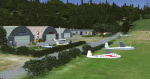
Essweiler is actually a classic glider field, but also engine aircrafts up to 2t are approved.
The field is situated in the region Rheinland-Pfalz/Germany at a hillside eastly of the village Essweiler, approximately 7,5 nautical miles north of the well known US-Airbase Ramstein.
The environment of the airfield is adapted by land classes. Surrounding villages and major roads are initially implemented.
As well the field is covered by a photo background, which includes four different images , each for one of the four seasons: spring, summer, autumn and winter. The buildings in this scenery should match quite good the originals. But also a lot of objects from three very popular freeware libraries are used.
If these libraries are not installed, many objects are not visible!
The following libraries are used:
1. FS-Piloten_Objektlibrary:
http://www.fs-piloten.de/thread.php?threadid=1063
2. FSX_FlightPortLib
http://www.flightport.de/libraries/flightport-library/
3: 3d People Library
http://library.avsim.net/download.php?DLID=192454
| Filename: | Essweiler_Gliderfield_Germany_Ver_10.zip |
| License: | Freeware |
| Added: | 29th November 2016, 19:15:50 |
| Downloads: | 605 |
| Author: | Wolfgang Allers |
| Size: | 168.18 MB |
| Category: Flight Simulator X - Scenery | |
| Gold Coast Airport (YBCG) |
|
File Description:
The Gold Coast Airport (formerly known as Coolangatta) is a busy international airport located some 100 ks south of Brisbane and 850 ks north of Sydney. This scenery contains and accurate depiction of the terminal, control tower, hangers and the very distinctive lighthouse at Coolangatta (with beacon) plus night lighting of the apron. In addition many buildings have been added to Coolangatta and Surfers some of which are original but many are stock buildings. The scenery has been reduced in complexity to attempt to be reasonably frame rate friendly. All models are GMAX or FSDS3.0. Extensive coastline changes has added beaches as far south as Byron Bay and the canal network behind Surfers Paradise, Bond Uni, Currumbin and Coolangatta. Recent upgrades of the airport to a 2500 metre runway have been reflected as well as a widened apron. Therefore it may look a little different from the current Google Earth image but it is accurate. The airport will now handle direct flights from Asia and typical planes landing might include Airbus 343 or similar wide bodied aircraft.
| Filename: | Gold_Coast_Airport_YBCG.zip |
| License: | Freeware |
| Added: | 12th July 2007, 15:08:44 |
| Downloads: | 6,175 |
| Author: | John Ross |
| Size: | 12.16 MB |


© 2001-2026 AVSIM Online
All Rights Reserved
Privacy Policy |