
Where Flight Simulation Enthusiasts Gather from Around the World!
AVSIM Library - Search Results

| Category: Flight Simulator 2004 - Scenery | |
| Northbrook East CF47 and Northbrook West CF48, Ontario, Canada |

|
File Description:
Thirty five miles north of the 401 on Highway 41 is a small town called Northbrook, and in the town itself is a dirt strip with a runway 11/29 1,830 feet long, which for the sake of telling them apart I have called Northbrook East. I have no idea of the history, or even of the reason why. Less than a mile west of the town is a second dirt strip with a runway 04/22 2,200 feet long. This one (Northbrook West) was built to support construction of the electrical power line installation and there is a dirt clearing between the strip and the power lines. There is absolutely nothing at either of these fields, no fuel, no oil, no hangar, and a very rough surface. Although I have made these as grass strips in fact they are dirt; the reason I didn't make them dirt is that dirt in FS9 stands out for miles and looks awful.
| Filename: | Northbrook_East_CF47_and_Northbrook_West_CF48_Onta.zip |
| License: | Freeware |
| Added: | 6th February 2010, 02:36:22 |
| Downloads: | 271 |
| Author: | Roger Wensley |
| Size: | 192.25 KB |
| Category: Flight Simulator 2004 - Scenery | |
| Anholt Isle, Denmark (EKAT) VFR Aerodromes |
|
File Description:
FS2004 Scenery--Anholt Isle, Denmark (EKAT) VFR Aerodromes. Anholt is a small island 75 nm north of Copenhagen. It has a unique nature, hence 80% of the island is classified as desert and potected by law. During the summer EKAT plays a significent role for the thousands of tourists who visit the island to experience the fantastic and rare nature, and the operator of the aerodrome has scheduled two to three flights a day, often with two engine planes. Hence EKAT can be very crowded, The aerodrome has a 650x20 grass runway and is only open for VMC daily operations. EKAT is considered to be the closest to a dangerous approach you can get in Denmark, because heavy winds often create an unexpected turbulence over the surrounding dunes. In contradiction to the busy summertime, you find only 160 habitants on the island during winther; they rest after all the tourists are gone, and the quietness on the island is nearly unbelievable.
| Filename: | Anholt_Isle_Denmark_EKAT_VFR_Aerodromes.zip |
| License: | Freeware |
| Added: | 14th July 2004, 20:44:28 |
| Downloads: | 3,504 |
| Author: | Jens Peter Bruun-Hansen |
| Size: | 5.11 MB |
| Category: Flight Simulator 2002 - Scenery | |
| LEBB Bilbao-Loiu Airport V2.0 |
|
File Description:
LEBB Bilbao-Loiu airport, in Pais Vasco(to the North of Spain ). The terminal, called "La Paloma", and the tower were designed by the Arquitech Santiago Calatrava, and they are a model of a modern and nice Airport. This escenary incluid dynamics macros like hangars, finguers, docking system,... all of them were created with NovaSim, by Rafael G. Sanchez.
This airport has been recommend by Julio Estefanía to be use with his fantastic Photorealistic scenery of Basque Contry, pais_vasco.zip.
El Aeropuerto Bilbao-Loiu, se encuentra situado en el País Vasco (al norte de España). Su terminal, "La paloma", y su torre de control, diseñadas por el arquitecto Santiago Calatrava, permiten descubrir un moderno y bello aeropuerto. Incluye macros dinámicas como hangares, finguers, sistema de ayuda de atraque,.... creados con NovaSim, de Rafael G.Sanchez.
Este aeropuerto ha sido recomendado por Julio Stefanía para ser usado junto con su escenario hiperrrealístico del Pais Vasco " pais_vasco.zip"
| Filename: | LEBB_BilbaoLoiu_Airport_V20.zip |
| License: | Freeware |
| Added: | 12th July 2003, 15:06:43 |
| Downloads: | 11,842 |
| Author: | Fernando Fajardo |
| Size: | 6.26 MB |
| Category: Flight Simulator X - Scenery | |
| Frankfurt Main Airport (EDDF), v3 |
|
Images related to this file:
File Description:
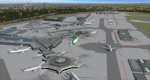
This is a major update to the previous airport package (Frankfurt ILS25R V2.2 package) using ADE 1.47 and represents the layout of the airport in June 2010.
Features now include updated ILS/DME capabilities to runways as per recent changes, a completely revised South City Cargo area, updated aprons including new flood lit lighting and a new Lufthansa A380 hangar built in Gmax.
Revised airline gate allocations for Terminal 1 and Terminal 2 included plus the addition of 5 new A380 gates at Terminal 2. A new control tower on the north parking apron has been added in preparation for the A-plus terminal expansion.
Runways and several taxiway textures changed to asphalt as per resurfacing work at real airport.
Improved quality CAT II/III signage available at intersections and new No Entry signage added for specific taxiways for extra realism.
Many other features from the previous packages are still included. See readme file for detailed information
| Filename: | Frankfurt_Main_Airport_EDDF_v3.zip |
| License: | Freeware |
| Added: | 25th October 2010, 10:30:49 |
| Downloads: | 3,691 |
| Author: | Mark Aldridge |
| Size: | 2.93 MB |
| Category: Flight Simulator X - Scenery | |
| Dieuze - Gueblange V2 |
|
Images related to this file:
File Description:
This scenery depicts Dieuze-Gueblange aerodrome located in the north east of France. It is a very accurate rendition of this aerodrome made with photoreal textures for the ground and the objects. The ground is covered with volumetric grass. I have modelled an animated sock that indicates the wind direction and velocity. To see this windsock, Sode (Sim Objects Display Engine) module must be installed (module availabale here : http://sode.12bpilot.ch/?page_id=9). A user manual (pdf) is included.
The windsock library may be used in your own sceneries. If you share a scenery using this library, you must add the BJP_SOCKS folder without any modification in order to avoid duplicate files. Please include my name in any of your included documents. This new release is now compatible with a landclass environment: snowy ground and trees in the hard winter (from the first day of december to the last day of january). Please read the specific enclosed manual.
| Filename: | Dieuze__Gueblange_V2.zip |
| License: | Freeware, limited distribution |
| Added: | 1st February 2015, 23:14:45 |
| Downloads: | 1,451 |
| Author: | Jacques-Paul Bollard |
| Size: | 21.98 MB |
| Category: Flight Simulator X - Scenery | |
| Cape_Verde_Mesh |
|
File Description:
To improve performance, FSX updated with SP1 loads DEM files in threads and only
the closer terrain (about 10 NM from the point of view) is rendered in high
detail, while at far distances FSX shows up its default low resolution mesh,
if it is not available a multi-resolution one. This terrain mesh file was multilod compiled from 90m SRTM2 source data, reprocessed with 3DEM to remove voids and spikes, providing a 76.4m (LOD9) horizontal resolution topography intended
for use only in FSX updated with SP1.
It covers the Cape Verde, a group of islands in the North Atlantic Ocean, that consist of two small archipelagos, about 400 miles off the western coast of Senegal (Africa), including: Boa Vista, Brava, Maio, Mosteiros, Paul, Praia, Porto Novo, Ribeira Grande, Sal, Santa Catarina, Santa Cruz, Sao Domingos, Sao Filipe, Sao Miguel, Sao Nicolau, Sao Vicente and Tarrafal (Geographic coordinates: 16ºN/24ºW).
Authors:
Hely Heck Junior - Magrao ( [email protected] ) and Jose Lobo (
[email protected] ) TerraBrasilis: www.terra-brasilis.org
| Filename: | Cape_Verde_Mesh.zip |
| License: | Freeware |
| Added: | 21st June 2007, 16:26:23 |
| Downloads: | 4,333 |
| Author: | Hely Heck Jr. and José Lôbo |
| Size: | 1.55 MB |
| Category: Flight Simulator 2004 - Scenery | |
| FS2004 Ernest Harmon Air Force Base and Stephenville Airport CYJT |
|
File Description:
FS2004 Scenery--Ernest Harmon Air Force Base and Stephenville Airport (CYJT), Newfoundland, 1957-62. Originally built to facilitate the transport of US aircraft to Europe during the Second World War, during the Cold War Harmon was the biggest US base outside the USA. Like nearby Gander it was a vital refuelling point for transatlantic crossings, but also an important part of the defences against the threat of Soviet bombers carrying muclear weapons attacking the USA via the North Pole. F-89 Scorpions and then F-102 Delta Daggers were based there, and this download includes F-89s especially made for this scenery by David Wooster. It also has custom landclass adjustments by Al Von Pingel and many custom buildings by Dan French. Flight plans are provided for 1957, 1959 and 1962, doing much to recreate this significant Cold War base as it really was. By Al Von Pingel, Dan French and Ken Lawson.
| Filename: | FS2004_Ernest_Harmon_Air_Force_Base_and_Stephenvil.zip |
| License: | Freeware |
| Added: | 10th October 2021, 17:08:19 |
| Downloads: | 212 |
| Author: | Al Von Pingel, Dan French and Ken Lawson |
| Size: | 23.96 MB |
| Category: Flight Simulator X - Scenery | |
| Benina International Airport HLLB 2010 V.1 FS2004/FSX-sp2 |
|
File Description:
Benina International Scenery. located in the town of Benina, 19 km east of Benghazi, from which it takes its name. The airport is operated by the Civil Aviation and Meteorology Bureau of Libya and is the second largest in the country after Tripoli International Airport. Benina International is also the secondary hub of both Buraq Air and flag carrier, Libyan Airlines. During World War II, the airport was used by the United States Army Air Force Ninth Air Force during the Eastern Desert Campaign. Known as Soluch Airfield, it was used by the 376th Bombardment Group, which flew B-24 Liberator heavy bombers from the airfield between 22 February & 6 April 1943. Once the combat units moved west, it was used as a logistics hub by Air Transport Command. It functioned as a stopover en-route to Payne Field near Cairo or to Mellaha Field near Tripoli on the North African Cairo-Dakar transport route for cargo, transiting aircraft and personnel.
| Filename: | Benina_International_Airport_HLLB_2010_V1_FS2004FS.zip |
| License: | Freeware |
| Added: | 28th November 2010, 19:49:42 |
| Downloads: | 4,294 |
| Author: | Emad Qtiefan |
| Size: | 10.79 MB |
| Category: Flight Simulator 2004 - Scenery | |
| Bumba Airport (FZFU/BMB) |
|
File Description:
Scenery for Bumba airport (FZFU/BMB), namely a small airport located in the North part of the Democratic Republic of Congo (DRC), Mondala Province, serving the small town of Bumba located near the Congo river. Bumba is an ideal reference point for VFR flights along the Congo river in that region, as well as around that part of the DRC forest. The scenery contains two parts: the landclass, that defines the terrain at and around the airport, and the airport scenery, which contains the runway, the aprons, and the 3D objects. In comparison with the default FS2004 scenery, this contains brand new runway and aprons, drawn using custom textures that should give a more realistic feeling of the airstrip, and the landclass has been modified in order to represent faithfully the real landscape around the airport. The Static Object Library of RWY12 is necessary in order to properly display the 3D objects: it can be found easily in the AVSIM library.
| Filename: | Bumba_Airport_FZFUBMB.zip |
| License: | Freeware |
| Added: | 30th April 2020, 18:31:15 |
| Downloads: | 159 |
| Author: | Marco Ruggieri |
| Size: | 7.52 MB |
| Category: Flight Simulator 2004 - Scenery | |
| Camden Field in Trinidad, original and renovated hangars |
|
File Description:
Camden Field is in southwest Trinidad near a town called Couva and the petrochem complex at nearby Point Lisas. This version has the renovated hangar which is how it is now, plus the older version. I have included a landclass file to put in some farm fields and also nearby housing, textures for an AI crop duster plane, (by Marvin Vandeweert) and an AFCAD, and I have finished all the things I didn't get to before, the tanks, the green railings for the control tower, etc. Camden Field was once a wartime American airfield, which shows up in the wide east-west runway that has more recently been partly resurfaced. There are no runway markings beyond a centre line, and it just sort of tapers off at the sides and the eastern end into the bush. There is a renovated hangar to the north of the runway and some older "patched together" buildings to the south which were fun to model.
| Filename: | Camden_Field_in_Trinidad_original_and_renovated_ha.zip |
| License: | Freeware |
| Added: | 12th January 2009, 12:48:20 |
| Downloads: | 944 |
| Author: | Roger Wensley |
| Size: | 6.66 MB |


© 2001-2026 AVSIM Online
All Rights Reserved
Privacy Policy |