
Where Flight Simulation Enthusiasts Gather from Around the World!
AVSIM Library - Search Results

| Category: Fly! II - Scenery | |
| Globe Tile D200159 Scenery Pack |

|
File Description:
This upload is a scenery package for globe tile D200159, an area of Pennsylvania that contains Clearfield to the north, State College (roughly center), and Altoona to the southwest. The West Branch of the Susquehanna R. is N., large Raymond Lake is ENE of Altoona, and the Juniata R. is SSE. The uploaded scenery package includes four edited gxx.trn for Fly!2, which flatten most of the bodies of water in globe tile 200159. Border areas were not edited to avoid compatibility problems with bordering globe tiles. Also included are Terrascene 2.1 day and watermask tga files for segments 5,4 and 6,3 plus the corresponding render options file OHPA.trp, which specifies the textures you need to match my segments with those segments you render. For your convenience, I included my Terrascene project file PennSt.tsp. Note: you must use my segment 5,4 for Raymond Lake to be flattened. The globe tile was rendered with options set for subdivideDensity=8 and subdivideTolerance=500.
| Filename: | Globe_Tile_D200159_Scenery_Pack.zip |
| License: | Freeware |
| Added: | 27th October 2002, 01:25:59 |
| Downloads: | 208 |
| Author: | Mark Steinmetz |
| Size: | 18.42 MB |
| Category: Flight Simulator X - Scenery | |
| Bella Coola Valley Landscape Enhancements |
|
File Description:
One of the most spectacular watersheds of British Columbia's Midcoast, the Bella Coola Valley looks pretty boring in its default FSX rendition and the oddly shaped default Bella Coola River cuts deep into the terrain. These files provide a terrain mesh made from CDED1 0.75-arcsec data (multi-LOD, with maximum resolution of 38-m grid spacing), updated land class, water class, and seasons files, and accurate placements of lakes, rivers, streams, roads, and bridges. Also added are the glaciers of the Monarch Mountain Icefield as well as several forestry roads and clearcuts in the side valleys. Main roads have vehicle traffic moving in both directions. Coverage area is N51*45'-52*40' and W125*35'-127*25'. These files are fully compatible with other landscape enhancements for FSX, such as FS Genesis North America terrain mesh, Cloud 9's X-class, Adam Mill's ground texture replacements, or Flight1's Ultimate Terrain Canada/Alaska.
| Filename: | Bella_Coola_Valley_Landscape_Enhancements.zip |
| License: | Freeware, limited distribution |
| Added: | 24th February 2007, 08:27:54 |
| Downloads: | 12,654 |
| Author: | Holger Sandmann |
| Size: | 15.68 MB |
| Category: Flight Simulator 2004 - AI Aircraft | |
| Executive Airbus A320 Package - Flightplans Included Version 2 |
|
File Description:
***This is an update to my original upload (evolveai_executive_a320s.zip). It was brought to my attention that the aircraft.cfg entry for the IAE model was incorrect. This upload contains the correct entry so if you installed the original you'll want to replace your IAE entry with the on in this packge. If you've not downloaded the original package this one will function as a stand-alone version. Installation insructions are provided in the readme. Thanks to Andrew Langille for pointing this out.***
This package contains repaints and flight plans for the two known Airbus A320 aircraft in executive service. The flight plans are based on photo locations as well as a great deal of internet research. These aircraft visit 16 airports in Europe and the Middle East as well as North America and Asia. This package contains textures only so you’ll need both the Evolve AI A320 CFM and IAE base packages installed on your system.
| Filename: | Executive_Airbus_A320_Package__Flightplans_Included_Version_2.zip |
| License: | Freeware, limited distribution |
| Added: | 1st July 2006, 13:44:03 |
| Downloads: | 1,429 |
| Author: | Kelly Freeman / Evolve AI |
| Size: | 502.98 KB |
| Category: Flight Simulator X - AFCAD Files | |
| FGBT - Bata Airport - Bata, Equatorial Guinea |
|
File Description:
Bata Airport (IATA: BSG, ICAO: FGBT) is the second largest airport in Equatorial Guinea, after Malabo Airport, and is the only other paved runway. The airport is located some way north of Bata and a short way south of Utonde, it has a
2.3 km runway that operates only during the daytime and in good light. The state carrier and four other private companies make up the majority of Bata's industry, transporting passengers from Bioko's international airport or the two
800m strips on Annobon or Mongomo. The airport is large enough to accommodate a Boeing 737. Bata served 15,000 passengers in 2001. In July 2002, all staff at the airport were arrested for allowing the leader of the Popular Union, an o
pposition party, to board a flight to the Gabon. The tower frequency is 118.800 MHz (VHF).
Airport elevation and two runways were corrected also the aprons and buildinds. Airport charts cortesy of vatcaf.flyvatsimafrica.org
This work is dedicated to West Wind Airlines.
| Filename: | FGBT__Bata_Airport__Bata_Equatorial_Guinea.zip |
| License: | Freeware |
| Added: | 19th May 2013, 17:22:05 |
| Downloads: | 765 |
| Author: | Anwar Gonzalez |
| Size: | 677.55 KB |
| Category: Flight Simulator 2004 - Scenery | |
| Vadodara International Airport (VABO) |
|
Images related to this file:
File Description:
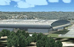
Vadodara International Airport (VABO) for FSX and FS2004.
Virtual aviation community stands basically on the grounds of what happens in the real world aviation and simulates the real thing, virtually. So that means they always have to be a step ahead and we follow. But my friend, we have a chance to make them follow us. Thats right! The proposed (final) integrated terminal at Vadodara shall have its construction commenced in mid of 2013 (the time can be altered, as real dudes define the situation). The design is finalized and here it is ..... the airport is basically " A basin kind".
Vadodara Airport or Civil Airport Harni (IATA: BDQ, ICAO: VABO) is a civilian airport located in the north-east of Vadodara, Gujarat, India in the suburb of Harni. A domestic airport until now, Vadodara Airport will become an international airport once the proposed new terminal is operational.
| Filename: | Vadodara_International_Airport_VABO.zip |
| License: | Freeware, limited distribution |
| Added: | 7th September 2010, 11:32:31 |
| Downloads: | 1,879 |
| Author: | Ashish Singh |
| Size: | 25.19 MB |
| Category: Flight Simulator X - AI Aircraft | |
| LCL Cargo Saab 340F |
|
File Description:
This is a complete "Project AI " Saab 340F aircraft of " LCL Cargo ".
That stands for " Low Cost Logistics ".
This ficticious airline/aircraft serves as a "newcomer" in the world of
parcel logistics , not seriously competing with the DHL's and Fedex.
To keep the operatingcosts in place , the airline is powered by
DFW Cargo , member of "The DFW group",
All just as ficticious.
This LCL-airline has a busy program of flying cargo runs in eastern France.
Routes are to :
Gap , Frejus and Toulon in the PACA-region (Provence/Alpes/Cote dAzur),
Grenoble and Chambery in the Isere and Savoie region respectively,
Dole-Tavaux in the Jura provence,
Metz / Nancy in the Lorraine / Moselle, up north in France
and serving Luxembourg Findel airport to connect with Cargolux ,
giving them the gateway to the rest of the world .
Original aircraft and flightdynamics by the "ProjectAI.com" website.
The re-paint is done by; " The DFW group " .
| Filename: | LCL_Cargo_Saab_340F.zip |
| License: | Freeware |
| Added: | 20th November 2009, 23:57:14 |
| Downloads: | 524 |
| Author: | Stellweg |
| Size: | 3.06 MB |
| Category: Flight Simulator 2004 - Scenery | |
| Kangirsuk CYAS in Quebec Canada |
|
Images related to this file:
File Description:
Kangirsuk is an Inuit village in northern Quebec, on the coast of Ungava Bay. The airport is the only means of access on this coast for the population of around 550, apart from a period in late summer. It is between Quaqtaq and Aupaluk, and around 140 miles north of Kuujjuaq, a major centre in this area for supplies, medical care, education, and anything to do with local government. This version of the airport and village is from around 2010, with the original terminal building that has now been replaced. The runway is just under 3,500 feet of lit gravel aligned 04-22 and the AI includes the daily Air Inuit flight that connects Kangirsuk with Kuujjuaq and other local airfields en route. This is almost certainly the last of the northern Quebec coastal airfields that I will be able to model with the correct buildings; only two missing so not too bad.
| Filename: | Kangirsuk_CYAS_in_Quebec_Canada.zip |
| License: | Freeware, limited distribution |
| Added: | 27th August 2020, 17:41:07 |
| Downloads: | 84 |
| Author: | Roger Wensley |
| Size: | 5.67 MB |
| Category: Flight Simulator 2004 - Scenery | |
| CYEK - Arviat - Nunavut, Canada v 1.1 |
|
Images related to this file:
File Description:
This version of Arviat corrects the VASI position on the runway, and also updates the taxiway edge lights to a newer and smaller version which is more realistically sized. This is a complete version and does not require you to have installed the old version. You can just replace the existing .bgl's and the existing textures in the scenery and texture folders if you already have this scenery. Arviat is a small town on the west coast of Hudson Bay in Nunavut, around 90 miles south of Whale Cove, 130 miles south of Rankin Inlet, and 160 miles north of Churchill. The airfield is just south of the town, and the 4,000 feet of gravel runway is aligned 149T/329T, as these are true bearings and not magnetic, as Arviat is just inside the Northern Domestic Airspace zone. There is 100LL fuel available in drums, with 2 hours prior notice. The visiting AI airline is Calm Air, plus a cargo delivery by Buffalo Air.
| Filename: | CYEK__Arviat__Nunavut_Canada_v_11.zip |
| License: | Freeware, limited distribution |
| Added: | 23rd August 2014, 11:20:05 |
| Downloads: | 226 |
| Author: | Roger Wensley |
| Size: | 2.33 MB |
| Category: Flight Simulator 2004 - Scenery | |
| Wabush CYWK in Labrador Newfoundland Canada |
|
Images related to this file:
File Description:
Wabush is a small town close to Labrador City, 200 miles north of the Gulf of St Lawrence coast and close to the border with Quebec. The area is known for it's iron mining activity which started in the 1960's. The airport that serves the area is located close to Wabush and there is also a float base on the lake that abutts Labrador. This version is from around 2014. The single runway is aligned 01-19 and is 6,000 feet long, with PAPI on 19 and ILS on 01. Flights by Pascan Aviation, Air Inuit, and Provincial Airlines are included in the AI provided, along with GA flights. I also have WOA ai that provides Air Canada Jazz flights (not included here but worth downloading for Canada). There is also AI for the float base on the lake, which connects to River Deep Lodge for trout fishing on Atikonak Lake around 100 miles to the east and also included here.
| Filename: | Wabush_CYWK_in_Labrador_Newfoundland_Canada.zip |
| License: | Freeware, limited distribution |
| Added: | 24th August 2020, 23:15:16 |
| Downloads: | 215 |
| Author: | Roger Wensley |
| Size: | 16.1 MB |
| Category: Flight Simulator 2004 - Scenery | |
| Ontario Small Fields in Canada: #04 Stoney Point (Le Cunff) CRML V1 |
|
Images related to this file:
File Description:
This is the fourth in a series of small airfields in southern Ontario, Canada. It is Stoney Point (Le Cunff) CRML, a field near a small town (Stoney Point) close to Lake St Clair. The airfield has a grass runway of 2,250 feet, aligned 18/36; with trees around the house gardens between road and runway the south threshold is displaced by 250 feet. The markers approximately show the touchdown point north of the runway end. Le Cunff is the family name of the owners, included to differentiate between this and another Stoney Point field, CRJ2. I found the default FS9 airfield at the correct elevation of 625 feet, but sitting on a plateau, despite my Genesis Mesh. This looked so unreal that I have revised this to an incorrect lower elevation of 580. So if you find the airfield sitting in a hole in your installation you now know the reason. Let me know, with a screenshot please.
| Filename: | Ontario_Small_Fields_in_Canada_04_Stoney_Point_Le_.zip |
| License: | Freeware, limited distribution |
| Added: | 29th July 2015, 16:08:32 |
| Downloads: | 146 |
| Author: | Roger Wensley |
| Size: | 1.6 MB |


© 2001-2026 AVSIM Online
All Rights Reserved
Privacy Policy |