
Where Flight Simulation Enthusiasts Gather from Around the World!
AVSIM Library - Search Results

| Category: Flight Simulator 2004 - Scenery | |
| Ontario Small Fields in Canada: #6 Nixon CNX8 |

|
Images related to this file:
File Description:
This is the sixth in a series of small airfields in southern Ontario Canada, Nixon CNX8, an airfield 20 miles south of Brantford and 10 miles north of Lake Erie, just west of the small town of Simcoe. It was not included in FS9 as it did not exist then; I do not know when it was first registered, but it was prior to April 2010 (the date of the oldest copy of the Canada Flight Supplement that I have with me). The airfield has a grass runway of 2,800 feet aligned 12/30, unlit. The owner has a small crop-spraying business, and there are also hangars rented to local plane owners. Fuel and oil is available.
This scenery post is not necessarily complete in itself and presumes you are adding it to the series of Ontario Small Fields.
| Filename: | Ontario_Small_Fields_in_Canada_6_Nixon_CNX8.zip |
| License: | Freeware, limited distribution |
| Added: | 27th October 2015, 12:11:48 |
| Downloads: | 145 |
| Author: | Roger Wensley |
| Size: | 5.41 MB |
| Category: Strike Fighters: Project 1 - Mods, Utilities and Patches | |
| Vietnam Tomcats |
|
File Description:
This campaign is a fictional event and the premise is as follows:
Vietnam 1975:
After almost a 3 year lull in hostilities, North Vietnam has invaded South Vietnam.
South Vietnam's request for assistance is not completely denied by the U.S. Congress (as it was historically). Carrier units stationed in the Area are cleared to assist the South Vietnamese in any way possible. Their mission is to control the immediate skies and help personnel evacuate quickly.
Three Squadrons, VF-21, VF-103 and VF 143 flying the Navy’s newest fighter plane, The F-14A Tomcat, will participate in this operation.
This is a Navy and USMC campaign only. There are no USAF units (exception long range B-52s) taking part in this operation.You need the F-14A plane installed and the latest Weapons pack. Brought to you by MK2aw
| Filename: | Vietnam_Tomcats.zip |
| License: | Freeware |
| Added: | 4th January 2005, 06:28:58 |
| Downloads: | 1,016 |
| Author: | Alex Aguila |
| Size: | 8.17 KB |
| Category: Flight Simulator X - Scenery | |
| CYCD - Nanaimo |
|
File Description:
Nanaimo is one of the greatest city situated on the east side of Vancouver Island, only 20mn Hop from/to YVR - Vancouver Intl and less than 10mn from Victoria,The capital.
Enjoy your stop in Nanaimo while soaring this beautifull island!
Nanaimo has as well a harbour to welcome all seaplane that I will develop in a near future so stay tuned!! :)
I have placed a larger terminal as it is today, all maintenance hangar located north and south, Both closed taxiway,the large oval parking lot and of course, the tower control that FSX completely forgot! :0
The push back truck is on auto for the two left side parking spot.(the nearest to the tower)
Nanaimo only offers an NDB for the Rwy 16.
Hope this will make your stop-over more Fun!
Airport already available:
-CZBB Boundary Bay
| Filename: | CYCD__Nanaimo.zip |
| License: | Freeware |
| Added: | 7th March 2009, 12:46:30 |
| Downloads: | 2,537 |
| Author: | Daniel Louvet |
| Size: | 1.29 MB |
| Category: Flight Simulator 2004 - Scenery | |
| The Greater Toronto Area for Ultimate Terrain 1.2 Part 1 |
|
File Description:
Part 1 of Flight Ontario's scenery for the Greater Toronto Area for Ultimate Terrain. The scenery is bounded by Detroit in the west, Kingston in the east, Huntsville in the north and Buffalo in the south and features: * all-season scenery * custom water textures * completely modelled Toronto Airports...CYTZ (Toronto Island) and CYZD (Downsview-home to Bombardier Aerospace and the Canadair Regional Jet and Dash-8, and the Toronto Aerospace Museum) * Niagara Helicopters CPQ3 (NEW) *custom autogen for the GTA * Custom landclass for southern Ontario * prominent features around Hamilton include the Burlington Skyway,lift bridge and steel mills * the Welland Canal is featured with lift bridges from Pt Weller to Pt Colborne * the Niagara area includes two hydro generating plants with reservoirs * compatibility with SimFlyers CYYZ.
This scenery is downloadable in two parts and both parts are essential.
| Filename: | The_Greater_Toronto_Area_for_Ultimate_Terrain_12_P.zip |
| License: | Freeware |
| Added: | 31st December 2005, 18:39:52 |
| Downloads: | 13,893 |
| Author: | Jim Kanold - Flight Ontario |
| Size: | 62.05 MB |
| Category: Flight Simulator 2004 - Scenery | |
| Comb Ridge, Rock Point (49AZ), Utah/Arizona, Photo-Scenery |
|
Images related to this file:
File Description:

Comb Ridge, Rock Point (49AZ), Utah/Arizona, Photo-Scenery (FS9 & FSX)
This scenery extends my Monument Valley scenery to the east. It covers the area between the San Juan River in the north down to Rock Point, AZ (49AZ). Most of the scenery lies on the Navajo Nation Reservation. It completes the southeastern corner of Utah and paves our way into Colorado.
High resolution versions of this scenery for FS9 and FSX (much sharper, but larger and multiple downloads) are available at www.blueskyscenery.com/CNY_South3West6.html . The screenies are taken from the high-res versions, so expect this version to be slightly more blurry. Thanks to Joop Mak for providing custom AFCADs that correct airport layouts so that they align with the photo-textures! They are available at www.blueskyscenery.com/AFCADs.html . YourDonation@Work: Dedicated to Olivier, Kevin and Ruben.
| Filename: | Comb_Ridge_Rock_Point_49AZ_UtahArizona_PhotoScener.zip |
| License: | Freeware, limited distribution |
| Added: | 9th April 2010, 21:57:41 |
| Downloads: | 1,356 |
| Author: | Gottfried Razek, blueskyscenery.com |
| Size: | 90.99 MB |
| Category: Prepar3D V1-4 - Scenery | |
| Lokpriya Gopinath Bordoloi International Airport Guwahati VEGT P3Dv4 |
|
Images related to this file:
File Description:
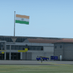
Lokpriya Gopinath Bordoloi Airport (IATA: GAU, ICAO: VEGT), also known as Guwahati Airport and formerly as 'Borjhar Airport', is the primary airport of the North-Eastern states of India. It is the 11th busiest airport in India. It is located at Borjhar, 26 km (16 mi) from Dispur, the capital city of the state of Assam and 28 km (18 mi) from Guwahati and is named after Late Gopinath Bordoloi, a freedom fighter and the first Chief Minister of Assam after India's independence. The airport is managed by Airports Authority of India and also serves as an Indian Air Force base.
Special Thanks to Ron Baruah for his VEGT Terminal Models, MFSG and MisterX for Vehicle Libs, Mayukh Deb for MD Libs and Taxi Lighting, Sriharsha K for Gate Signboards and Lightpoles and many more!
Compatible with Prepar3D v4.
| Filename: | Lokpriya_Gopinath_Bordoloi_International_Airport_G.zip |
| License: | Freeware |
| Added: | 15th June 2021, 18:55:10 |
| Downloads: | 603 |
| Author: | Saurabh Bansal |
| Size: | 257.15 MB |
| Category: Flight Simulator 2004 - Scenery | |
| FoxPine AirPark, New Zealand. NZFP. |
|
File Description:
Welcome to FoxPine Airpark ,NZFP.
FoxPine AirPark is situated by the small provincial town of Foxton on the South West coast of New Zealand’s North Island.
This Private Airfield set in park-like grounds is sited on a broad coastal plain of mixed farming and forestry bounded by sweeping beaches,
a meandering river, and off to the East, rugged bush-clad ranges, all great places to fly.
FoxPine is also where the "Jabiru" light aircraft is assembled, sold and serviced.
This scenery contains a bonus custom AI package, comprising of seven Jabiru-2's, a Cessna 172, and a Maule M6, and a traffic file for the aircraft. (AI Aircraft are complete with all files).
The AI aircraft, and the traffic file are fully compatible with GNZLAP traffic. Scenery requires some EZ Scenery Object Sets (see INSTALL instructions for details).
| Filename: | FoxPine_AirPark_New_Zealand__NZFP.zip |
| License: | Freeware, limited distribution |
| Added: | 14th August 2008, 21:27:16 |
| Downloads: | 929 |
| Author: | Lawrie Roache |
| Size: | 5.98 MB |
| Category: Flight Simulator 2004 - Scenery | |
| PAMR - Merrill Field - Anchorage, Alaska |
|
Images related to this file:
File Description:
Merrill Field is in Anchorage Alaska, between Anchorage International to the southwest and and Elmendorf Air Force Base to the north. It caters for general aviation and is the land equivalent of the Lake Hood float plane base (see my post) with fuel and numerous maintenance facilities, and several hundred parking spots for small planes. There are three runways, and the longest is 4,000 feet of 100 feet wide asphalt, the second 2,635 feet of asphalt 75 feet wide, and the third 2,000 feet of 60 feet wide gravel. It is a controlled airfield with a modern control tower. There are almost 50 buildings on the field and three quarters of them have been modeled specifically for this scenery. The download includes a LITE version for older computers as there are a lot of static parked aircraft.
| Filename: | PAMR__Merrill_Field__Anchorage_Alaska.zip |
| License: | Freeware, limited distribution |
| Added: | 3rd January 2011, 23:11:31 |
| Downloads: | 1,123 |
| Author: | Roger Wensley |
| Size: | 6.94 MB |
| Category: Flight Simulator 2004 - Scenery | |
| Killaloe CYXI near the Ottawa River in Ontario Canada |
|
File Description:
Killaloe is an old military airfield built for jet fighters in the 1950's,and now officially abandoned. It is 12 miles north of Madawaska Valley Airpark and just to the west of Round Lake, and there is no trouble spotting it as even from 20,000 feet (see the pic) it is very visible. This is mainly because it has a single 6,600 feet runway 29/11, which is likely to be useful if it all goes quiet and you need to land! So it is worth knowing about, even though the asphalt is not in a very good condition. It also continues to be used by the odd passing pilot who cannot resist adding another destination to his log book, though I have no personal knowledge of that. I understand local residents also use it for occasional drag racing, presumably unofficially.
| Filename: | Killaloe_CYXI_near_the_Ottawa_River_in_Ontario_Can.zip |
| License: | Freeware |
| Added: | 27th May 2008, 19:37:07 |
| Downloads: | 423 |
| Author: | Roger Wensley & Jim Turner |
| Size: | 593.04 KB |
| Category: Flight Simulator 2004 - Scenery | |
| Matheson Point CWMP in Nunavut, Canada |
|
Images related to this file:
File Description:
This was a DEW line I Station on the southeast shore of King William Island; the island is around 70 miles square and Gjoa Haven is also on the southeast corner, 20 miles to the south. The station was closed in 1963 and has now been totally dismantled and removed except for a fallen 300 feet communications tower. The runway is still there (mostly) and is around 3,360 feet of gravel 120' wide, aligned 146T/326T. There are no lights, signage, or windsock, or any building remaining. All of these DEW line stations are not particularly impressive or even interesting. However, you can bet that any pilot flying regularly in the north along the coast knows where all these runways are, in case one of them suddenly becomes his favourite in the whole world just after the sudden silence.
| Filename: | Matheson_Point_CWMP_in_Nunavut_Canada.zip |
| License: | Freeware, limited distribution |
| Added: | 22nd November 2012, 16:28:19 |
| Downloads: | 179 |
| Author: | Roger Wensley |
| Size: | 785.57 KB |


© 2001-2026 AVSIM Online
All Rights Reserved
Privacy Policy |