
Where Flight Simulation Enthusiasts Gather from Around the World!
AVSIM Library - Search Results

| Category: Flight Simulator 2004 - AFCAD Files | |
| Yellowknife and Ekati with voice file. |

|
File Description:
FS2004 Afcad2 files to replace the default "CYZF", Yellowknife and "CYOA" Ekati Airfield, North West Territories, Canada. By default CYOA in FS9 has no facilities so the afcad has been produced with necessary tower frequency, large and small GA ramps, a small gate and one reduced radius cargo ramp. In addition we have included an "Ekati" voice file as FS9 refers to it just by the ICAO. Just in case anyone is interested, we created these afcads to allow our own and AI flight movements for a pair of Dash 7 freighters from Yellowknife to the Ekati and Diavik diamond region. As well as have facilities for larger associated cargo aircraft at Yellowknife. But everyone else is welcome to use them too. www.matva.org.uk
| Filename: | Yellowknife_and_Ekati_with_voice_file.zip |
| License: | Freeware, limited distribution |
| Added: | 31st August 2006, 02:55:57 |
| Downloads: | 735 |
| Author: | Louie Maclennan MATVA |
| Size: | 6.63 KB |
| Category: Flight Simulator X - Scenery | |
| WMKC - Sultan Ismail Petra Airport - Chepa, Kelantan, Malaysia |
|
Images related to this file:
File Description:

Sultan Ismail Petra Airport is located in north Malaysia and is our first HD release of a Malaysian airport.
This has been a bit of a challenge due to the poor imagery of the area but we have certianly pushed the limits to bring you the best possible rendition of the airfield.
Features include:
- Realistic ground image.
- High definition ground detailing.
- Illuminated taxiway centre light effect.
- Illuminated Apron effects from Airport Wizard (Rights obtained).
- Precision placed trees and vehicles.
- New taxiway lighting from SFAE2.
- 3D approach lights.
- Low poly 3D grass.
- Hold short guards and wigwag.
- Reflective windows on main terminal.
- Customised AFCAD for improved AI.
- Realistic airport terminal building.
| Filename: | WMKC__Sultan_Ismail_Petra_Airport__Chepa_Kelantan_.zip |
| License: | Freeware, limited distribution |
| Added: | 15th November 2015, 14:13:46 |
| Downloads: | 4,278 |
| Author: | Mark Piccolo - Soarfly Concepts |
| Size: | 45.34 MB |
| Category: Flight Simulator 2004 - Scenery | |
| Asia Pacific 1962 Scenery |
|
Images related to this file:
File Description:
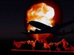
This scenery package contains the major airports for the Pacific Islands, China, and the Asian portion of the Pacific Rim as they were circa 1962, based upon material and photographs Mike has gathered. Major airports have been detailed with custom GMAX objects, and many other smaller airports/strips have been backdated by providing parking spots, correcting runway lengths, and removing the irritating strobes, taxi lines, and other features that did not normally exist during the 1950s and early 1960s. Cities/countries/islands covered include Fiji, Polynesia, Guam, Midway, Taipei, Korea, Philippines, New Guinea, China, and North Korea, among many others. Much of the rest of Asia has been already been covered by the Indochina 1962 scenery package, and is required for this package as well.
| Filename: | Asia_Pacific_1962_Scenery.zip |
| License: | Freeware, limited distribution |
| Added: | 23rd January 2012, 20:15:44 |
| Downloads: | 4,859 |
| Author: | Mike Stevens, Wolfgang Gersch, Tom Gibson |
| Size: | 12.24 MB |
| Category: Prepar3D V1-4 - Aircraft Repaints, Textures and Modifications | |
| De Havilland Canada DHC-3 Otter (VH-SBR) TAA Sunbird Services |
|
Images related to this file:
File Description:
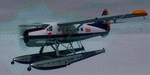
This folder contains a repaint for the Milviz DHC-3 Otter. It shows De Havilland Canada DHC-3 TAA VH-SBR. This was originally Qantas' VH-EAX, and first registered in May 1958. It was sold to TAA for its Sunbird Services operation in New Guinea in September 1960, and re-registered as VH-SBR in December of that year. It was carrying the name 'Kundiawa' (the capital of Simbu Province, PNG). It was withdrawn from TAA service in December of 1966 and sold in Canada in 1969 becoming C-FYLZ for North Canada Air. This 50+ year craft is still current and now flies for Wabakimi Air out of Armstrong Ontario. Repaint by Jan Kees Blom, based on the paintkit by Milviz.
| Filename: | De_Havilland_Canada_DHC3_Otter_VHSBR_TAA_Sunbird_S.zip |
| License: | Freeware |
| Added: | 19th January 2020, 18:24:48 |
| Downloads: | 131 |
| Author: | Jan Kees Blom |
| Size: | 36.25 MB |
| Category: Flight Simulator X - Scenery | |
| Saratoga County Airport v2.0 - 5B2 |
|
Images related to this file:
File Description:

5B2 - Saratoga County Airport v2.0 for FSX Acceleration. Located in the foothills of the Adirondack Mountains in upstate NY, USA. This facility is owned by Saratoga County, formerly housed Rich Air and currently houses North American Aviation. 5B2 is a non-controlled airfield catering to small engine a/c up to a few private jet daily traffic serving 'The Northcountry' and Saratoga Springs, New York.
All Objects fully designed and completely redone in GMAX using high resolution photo-real textures. Optional seasonal files included. Also includes new ADEX file, more accurate airport grounds perimeter, satellite photo-real grounds, custom taxiways, taxi-signs and taxi lights. ADEX file also designed to support general aviation AI. All textures mipmapped for performance.
| Filename: | Saratoga_County_Airport_v20__5B2.zip |
| License: | Freeware, limited distribution |
| Added: | 2nd May 2012, 09:00:25 |
| Downloads: | 1,106 |
| Author: | Ed 'Geneer' Cox |
| Size: | 23.4 MB |
| Category: Flight Simulator 2004 - Scenery | |
| CNU8 - Toronto - Markham Airport (2008), Ontario, Canada |
|
Images related to this file:
File Description:
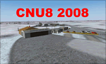
CNU8 - Toronto - Markham Airport (2008) - Markham v1. The airport is owned and operated by Markham Airport Inc., and is not part of the Greater Toronto Airport Authority.
The airport consists of a single 2,000 foot runway for small and private aircraft only (with night flying capabilities). The Royal Canadian Air Cadets Gliding Program uses the north side or the runway 09/27 for glider operations in the spring and fall months, and use a northern traffic pattern. This airport may disappear with the establishment of a planned Pickering Airport or re-location of Toronto/Buttonville Municipal Airport.
(This is a re-upload of the scenery to replace the original that was lost in the AVSIM hack. No changes have been made)
| Filename: | CNU8__Toronto__Markham_Airport_2008_Ontario_Canada.zip |
| License: | Freeware, limited distribution |
| Added: | 16th May 2010, 10:06:40 |
| Downloads: | 1,589 |
| Author: | Keith Murphy |
| Size: | 5.24 MB |
| Category: Flight Simulator 2004 - Scenery | |
| Chelsea Dams on the Gatineau River |
|
Images related to this file:
File Description:
The Chelsea Dams are on the Gatineau River, just north of Rockcliffe airfield. I have used the plural as while there is only one dam as such, there is a second generating station just south of the dam; so "it" is more generally called "the Chelsea Dams". The dams mark the point where, if you are flying south down the Gatineau River towards Rockcliffe, you should be either below 1,500 feet or talking to the Ottawa control tower. While not a reporting point as noted in the supplement notes about flying vfr in the Ottawa area the dams are still the natural reporting point when approaching Rockcliffe and announcing landing intentions. Plus they are a visible landmark from way off, so here they are.
| Filename: | Chelsea_Dams_on_the_Gatineau_River.zip |
| License: | Freeware, limited distribution |
| Added: | 14th February 2010, 23:11:15 |
| Downloads: | 256 |
| Author: | Roger Wensley |
| Size: | 879.08 KB |
| Category: Flight Simulator 2004 - Scenery | |
| Sturt Point CWSP in Nunavut, Canada |
|
Images related to this file:
File Description:
Sturt Point was a DEW line I Station on the south coast of Victoria Island, 50 miles east of Cambridge Bay. It was closed in 1963 but remains in place, though a 5 man I Station has such a small impact on its surroundings that it is hardly visible. The runway is 3,420 feet of gravel aligned 117T/297T, and there are no lights, signage, or windsock, but there are ruts in the gravel. A North Warning System station was built 15 miles inland and closer to Cambridge Bay, operating from 1991 onwards. This has a short (1,280'?) gravel runway aligned 138T/318T (and named CWSX here). No ruts in the gravel, but also still no lights, signage, or windsock.
| Filename: | Sturt_Point_CWSP_in_Nunavut_Canada.zip |
| License: | Freeware, limited distribution |
| Added: | 11th November 2012, 21:07:18 |
| Downloads: | 207 |
| Author: | Roger Wensley |
| Size: | 1.35 MB |
| Category: Flight Simulator X - Scenery | |
| Vancouver Extras |
|
Images related to this file:
File Description:
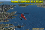
Vancouver Extras. A lot of new objects like high rise helipads (an aerial map showing their locations), more helipads on docks at the waters edge, many ships in port and out at sea including a carrier with escorts. The carrier has 3 Jayhawks and 1 RAC Bell 412 on it. Cruise ships, cargo ships and a super tanker.
Most of the objects are north of the city on the shoreline and the addition of several marinas with docks/boats. Also an area with cranes, vehicles and a shipping container yard with lots of other stuff.
Add the download "Indian Arm Float Base.zip" and really spruce up the area.
Designed to enhance your FSX world and make your flights more interesting.
Please enjoy! savageagle
| Filename: | Vancouver_Extras.zip |
| License: | Freeware |
| Added: | 24th July 2010, 09:06:13 |
| Downloads: | 3,617 |
| Author: | Tim Durham |
| Size: | 8.55 MB |
| Category: Flight Simulator X - Flight Plans | |
| Springfields in the US VFR Tour |
|
File Description:
As a tribute to the animated "Simpsons" TV series, I decided to plan and fly (virtually via FSX) VFR to a Springfield in each state that had one. There are over 40 Springfields in the US with some states having none and some greedy states having multiples. Not counting the multiples, this leaves by my count 33 Springfields. Pretending we have deep pockets and lots of time, we will fly a Cessna 172 to the airports closest to each Springfield in a circuitous route beginning and ending in North Carolina. The flights assume you understand VORs and flying them inbound and outbound as well as utilizing NDBs. The GPS is handy for positional awareness, but using it to get from waypoint to waypoint takes out the fun.
| Filename: | Springfields_in_the_US_VFR_Tour.zip |
| License: | Freeware |
| Added: | 24th November 2013, 20:29:59 |
| Downloads: | 166 |
| Author: | Matt Vitale |
| Size: | 49.26 KB |


© 2001-2026 AVSIM Online
All Rights Reserved
Privacy Policy |