
Where Flight Simulation Enthusiasts Gather from Around the World!
AVSIM Library - Search Results

| Category: Flight Simulator 2004 - Scenery | |
| Colville Lake CEB3 in Northwest Territories Canada |

|
Images related to this file:
File Description:
Colville Lake is a small village of around 150 Dene, located to the northwest of the Great Bear Lake and east of the Mackenzie River, 120 miles north of Norman Wells. The village and the airfield are next to each other and to the lake shore. I recently discovered which of the standard terminal buildings had been used there and this, along with information I already had, enabled me to now make the scenery, which is based on an approximate 2010 date. The gravel runway is lit and around 2,800 feet long, aligned 10-28. North Wright Air serves the village from it's headquarters at Norman Wells with daily flights by de Havilland Twin Otters, or "twotters" as they were quickly named among the northern Canadian airline personnel when they were first produced. The approximate time of this scenery is 2010. While testing this scenery I discovered that Tulita (previously called Fort Norman) which is another Mackenzie River airfield to the south of Norman Wells, needs to be reposted due to a terrain fault. If you find an error here then email me please, and note that my email address has been changed to rogwens at Gmail dot com.
| Filename: | Colville_Lake_CEB3_in_Northwest_Territories_Canada.zip |
| License: | Freeware, limited distribution |
| Added: | 31st July 2021, 18:23:48 |
| Downloads: | 68 |
| Author: | Roger Wensley |
| Size: | 4.51 MB |
| Category: Flight Simulator 2004 - Scenery | |
| Durban Island CWFB FOX-E DEW line station in Nunavut, Canada |
|
Images related to this file:
File Description:
Durban Island is 40 miles north of Cape Dyer on the southeast corner of Baffin Island, and around 60 miles southeast of Qikiqtarjuaq (known as Broughton until recently). Sitting on the top of the island is FOX-E, an intermediate station that was part of the DEW line. There is no runway (and once you have seen the island you will know why) and the station and its (usually) five man crew were supported by helicopter flights from Cape Dyer. The main feature is a 300' high mast, topped by comms gear to link both to Broughton to the north and Cape Dyer to the south. There was only one really habitable building, 80' x 30' in round figures, and this contained the generators, technical spaces, sleeping areas, kitchen, mess, and showers etc. There were also what were known as Anderson shelters, originally put up to house the construction crew and used in the summer for any maintenance people who visited for short periods. There was also a garage for a snow cat and tanks for fuel. And a view.
This post also includes new bgls for Cape Dyer to provide the 300' tower there too.
| Filename: | Durban_Island_CWFB_FOXE_DEW_line_station_in_Nunavu.zip |
| License: | Freeware, limited distribution |
| Added: | 1st July 2011, 22:11:33 |
| Downloads: | 313 |
| Author: | Roger Wensley |
| Size: | 1.87 MB |
| Category: Flight Simulator 2004 - Scenery | |
| Boundary Bay CZBB in British Columbia, Canada |
|
Images related to this file:
File Description:
Boundary Bay is south of Vancouver in British Columbia, close to the US/Canada border. It is the 5th busiest airfield in Canada measured in terms of take offs and landings as there are several training companies based there. The airfield was purchased by Alpha Aviation in 2009 and and modernised for the 2010 Winter Olympics, the main addition being a new terminal. This is an ex-military training base which was built in 1941, and one of the original hangars still survives. The two runways in use now (07/25 5,600' and 12/30 2,750', both of them 100' wide) are reduced asphalted areas of the original runways; the third runway is now an apron for GA parking and has had hangars built along it. There is JetA and 100LL available. The large building at the east end of the north apron is a HQ and maintenance facility for a helicopter company, Heli-one. All of the north apron buildings on the field have been modelled specifically for this scenery, plus the nearby huge greenhouse farm structures which are visible from further away than the airfield is. AI for Boundary Bay will be posted later this week.
| Filename: | Boundary_Bay_CZBB_in_British_Columbia_Canada.zip |
| License: | Freeware, limited distribution |
| Added: | 12th May 2011, 13:30:18 |
| Downloads: | 855 |
| Author: | Roger Wensley |
| Size: | 4.4 MB |
| Category: Flight Simulator 2004 - Scenery | |
| Inyokern Airport, Inyokern CA. , USA - Version 3 |
|
Images related to this file:
File Description:

FS2004 Scenery for Inyokern Airport (KIYK). SORRY everyone there were some libraries and textures missing from the recent release. This package contains all missing objects and libraries and is a complete replacement for ANY of my Inyokern sceneries previously installed, no other download required. (Nestled on the sunny side of the southern Sierras, Inyokern is a great jumping-off place for hi desert adventures. Known for decades for it's great soaring spots, Inyokern itself is busy enough with an average of 80 flights a day including it's United/Skywest commuter flights and occasional military traffic from the nearby China Lake Naval Weapons Test Center. Geographically, the airport is situated in the high desert of Southern California, 100 miles east-northeast of the county seat in Bakersfield, 80 miles north-northeast of the Lancaster and Palmdale areas, and 120 miles north-northwest of San Bernardino. The airport itself covers 1,640 acres at an elevation of 2,457 feet, with three asphalt paved runways that can accommodate almost any class of civilian, commercial, or military aircraft. Inyokern Airport is served by commercial airlines connecting through Los Angeles International Airport.)
| Filename: | Inyokern_Airport_Inyokern_CA__USA__Version_3.zip |
| License: | Freeware, limited distribution |
| Added: | 10th November 2013, 23:32:02 |
| Downloads: | 2,056 |
| Author: | John Stinstrom |
| Size: | 6.36 MB |
| Category: Flight Simulator 2004 - Scenery | |
| Airstrips of South-West France |
|
File Description:
Part two of my "Airstrips of Western Europe" project, these 90+ sceneries are mostly default basic airstrips from FS2004, enhanced with taxiways, parking spaces and aprons as appropriate, to facilitate the activation of lightweight GA AI traffic, primarily over the south-west of France. Hopefully these will allow a degree of continuity between my previous upload (Airstrips of North-West Europe) and the existing freeware releases for Spain and Portugal.
Again, there's no photo-realism here, just a selection of basic 'generic' buildings, more or less accurately sized and placed to reflect the airfield layout as seen on on-line satellite imagery and aerial photography. These buildings have minimal effect on frame-rates, so are ideal for this kind of job. The airfields are aligned as well as possible with the roads etc. in UT Europe and the Genesis Europe mesh, but should mostly be fine in a default installation or other configuration.
A good number of airfields in this area have been neatly implemented in the "Occitania_VFR" package, so I've not duplicated their work.
Also included are some "bonus" sceneries from further north that weren't included in my previous upload. Just copy them over as appropriate if required.
| Filename: | Airstrips_of_SouthWest_France.zip |
| License: | Freeware |
| Added: | 16th July 2024, 18:20:44 |
| Downloads: | 112 |
| Author: | Chris Eve |
| Size: | 274.73 KB |
| Category: Flight Simulator X - Aircraft Repaints, Textures and Modifications | |
| North American P-51D 353rd FG SX-B, SX-I, SX-R, SX-U, SX-V |
|
Images related to this file:
File Description:
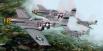
This folder contains a repaint for the Warbirdsim P-51D Little Friends package, in the colors of 4 P-51D's of the 352nd FS, 353rd FG, based in Raydon, UK, from april 1944. Included are:
P-51D-15NA 44-15587 SX-U "Stasia II" as flown by Capt Anthony R. Rosatone;
P-51D-15NA 44-15587 SX-I "Dallas Doll" as flown by Capt Frank H. Bouldin Jr.;
P-51D-10NA 44-14804 SX-R "El Gato" as flown by Capt Maurice M. Miller;
P-51D-15NA 44-15099 SX-V as flown by Capt Glenn G. Callans;
P-51D-15NA 44-15092 SX-B "Alabama Rammer Jammer" as flown by Lt Arthur C. Cundy;
Repaints by Jan Kees Blom, based on the paintkit by Warbirdsim.
| Filename: | North_American_P51D_353rd_FG_SXB_SXI_SXR_SXU_SXV.zip |
| License: | Freeware |
| Added: | 27th July 2018, 16:03:00 |
| Downloads: | 75 |
| Author: | Jan Kees Blom |
| Size: | 65.49 MB |
| Category: Flight Simulator 2004 - Scenery | |
| Zion National Park North, Cedar Breaks National Monument, Cedar City (KCDC), Utah, Photo-Scenery (FS9 & FSX) |
|
Images related to this file:
File Description:
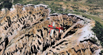
Cedar Breaks National Monument is a large amphitheater cliff in bright colors of red, orange and purple.
It lies east of Cedar City in the northern region of the scenery. The cliff was formed by erosion thru wind,
water and ice. Today erosion continues with a pace of about 2 inches every 5 years. Although it is called
Cedar Breaks, there are no cedars growing there but juniper trees. For a scenic flight to Cedar Breaks
National Monument best depart from Cedar City Regional Airport (KCDC) and head east. The scenery extends
south to Zion National Park and covers a large part of Zion Canyon and the Kolob Canyons area.
Zion National Park is another place where erosion of the Colorado Plateau formed the most beautiful colorful
stone formations of unique and wonderful shapes. There are nine different layers of stone visible in the park.
Most of them consist of sandstone. But there is also limestone, gypsum, siltstone, shale, clay and mudstone.
The Virgin River cut a spectacular and famous canyon thru Zion Park that is as narrow as 20ft and up to 2000ft tall.
High resolution versions of this scenery for FS9 and FSX (much sharper, but larger and multiple downloads)
are available at www.blueskyscenery.com/CNY_South2West5.html . The screenies are taken from the high-res versions,
so expect this version to be slightly more blurry.
Thanks to Joop Mak for providing a custom AFCADs that correct airport layouts so that they align with the photo-textures!
They are available here: www.blueskyscenery.com/AFCADs.html . YourDonation@Work: Dedicated to Richard, P.J. and Felix.
| Filename: | Zion_National_Park_North_Cedar_Breaks_National_Mon.zip |
| License: | Freeware, limited distribution |
| Added: | 14th March 2010, 00:30:28 |
| Downloads: | 1,564 |
| Author: | Gottfried Razek - blueskyscenery.com |
| Size: | 97.13 MB |
| Category: Flight Simulator X - Flight Plans | |
| Flight Plan for British Airways iFly 747-400v2 Atlantic City KACy to Charlotte North Carolina KCTL |
|
File Description:
iFly 747-400v2 British Airways Atlantic City to Charlotte
| Filename: | Flight_Plan_for_British_Airways_iFly_747400v2_Atla.zip |
| License: | Freeware |
| Added: | 25th March 2025, 18:12:08 |
| Downloads: | 4 |
| Author: | David M. Long |
| Size: | 3.74 KB |
| Category: Microsoft Flight Simulator (2020) - Aircraft Repaints, Textures and Modifications | |
| Britten-Norman BN-2A Islander OO-MMM |
|
Images related to this file:
File Description:

This folder contains a repaint for the Britten-Norman BN-2 Islander by Blackbox Simulations It shows BN-2A-20 c/n 468, in the older colors of OO-MMM. The aircraft has been registered to the Royal Belgian Institute of Natural Sciences and flies in the hands of the Management Unit of the North Sea Mathematical Models (MUMM). Missions consist to anti-pollution surveillance, control of maritime traffic, observation of various marine phenomena. It has now been repainted in Coast Guard colors (which I may do later). Repaint by Jan Kees Blom.
| Filename: | BrittenNorman_BN2A_Islander_OOMMM.zip |
| License: | Freeware |
| Added: | 19th May 2021, 19:30:04 |
| Downloads: | 24 |
| Author: | Jan Kees Blom |
| Size: | 23.19 MB |
| Category: Prepar3D V1-4 - AI Flight Plans | |
| Air Koryo Cargo 1998 Flightplans |
|
File Description:
Air Koryo's 3 IL-76's were operated as Air Koryo Cargo based in North Korea. Beijing gets at least 1 flight daily, sometimes 2, while there is a limited network of domestic flying and a few other international destinations that are sparsely served. The texture for the RATS IL-76 is on Avsim as "air_koryo_il-76md.zip".Flightplans by Chasen Richardson. Part of the 1998 Flight Simulator Project. Follow us on Facebook at facebook.com/flightsim98 and on instagram as @bayviationsim. For more Retro AI, check out the forums at: http://retroai.proboards.com/
| Filename: | Air_Koryo_Cargo_1998_Flightplans.zip |
| License: | Freeware, limited distribution |
| Added: | 5th November 2019, 06:13:24 |
| Downloads: | 89 |
| Author: | Chasen Richardson\Bayviation |
| Size: | 837.12 KB |


© 2001-2026 AVSIM Online
All Rights Reserved
Privacy Policy |