
Where Flight Simulation Enthusiasts Gather from Around the World!
AVSIM Library - Search Results

| Category: Flight Simulator 2004 - Scenery | |
| Colorado Lakes Project II |

|
File Description:
This project features the Blue Mesa Reservoir and the Black Canyon of the Gunnison and adds over 300 highly detailed lakes to the central portion of western Colorado. Three reservoirs, named for corresponding dams on the Gunnison River, form the heart of Curecanti National Recreation Area. Panoramic mesas, fjord-like reservoirs, and deep, steep and narrow canyons abound. Blue Mesa Reservoir is Colorado's largest body of water, and is the largest Kokanee Salmon fishery in the United States. Morrow Point Reservoir is the beginning of the Black Canyon of the Gunnison and below it is Crystal Reservoir.
These lakes are specifically designed to show off their photo realistic detail when used in combination with "FSGenesis-The Rockies 38.2m Terrain Mesh-Colorado" available as "fsg_dem38m_usrk_co.zip" at avsim.com, or comparable mesh. The free FSGenesis US National Landclass Project Beta 6 also adds beautifully to the landscape. These lakes work equally as well with the default mesh.
All lake information was projected from satellite imagery and compiled with a beta version of Jim Keir's "Slartibartfast" utility. Much thanks to Holger Sandmann and Jim Keir for their help and advice on interpreting the satellite data properly.
| Filename: | Colorado_Lakes_Project_II.zip |
| License: | Freeware |
| Added: | 1st June 2004, 02:34:42 |
| Downloads: | 6,055 |
| Author: | Carlyle Sharpe |
| Size: | 332.25 KB |
| Category: Flight Simulator 2004 - Scenery | |
| Colorado Lakes Project IV |
|
File Description:
This project features the lakes of North Central Colorado, replaces all of the prominent reservoirs and lakes of the region (Dillon, Green Mountain, Granby, Williams Fork, and more), and adds over 500 highly detailed lakes to Colorado. They fit seamlessly with my "Colorado Lakes Project III" (colorado_lakes_project_3.zip), "Colorado Lakes Project II" (colorado_lakes_project_2.zip) and "Colorado Lakes Project I" (colorado_lakes_project_1.zip) lakes.
These lakes are specifically designed to show off their photo realistic detail when used in combination with "FSGenesis-The Rockies 38.2m Terrain Mesh-Colorado" available as "fsg_dem38m_usrk_co.zip" at avsim.com, or comparable mesh. The free FSGenesis US National Landclass Project Beta 6 also adds beautifully to the landscape. These lakes work equally as well with the default mesh.
All lake information was projected from satellite imagery and compiled with a beta version of Jim Keir's "Slartibartfast" utility.
| Filename: | Colorado_Lakes_Project_IV.zip |
| License: | Freeware |
| Added: | 10th June 2004, 04:27:10 |
| Downloads: | 4,835 |
| Author: | Carlyle Sharpe |
| Size: | 743.4 KB |
| Category: Flight Simulator 2004 - Scenery | |
| Colorado Lakes Project I |
|
File Description:
These files ADD 15 highly detailed lakes to Colorado. Although these lakes are specifically designed to show off their photo realistic detail when used in combination with 38.2m mesh, they work equally as well with the default mesh. All lake information was derived from detailed map data.
Included lakes are: the Antero, Eleven Mile, Spinney, Paonia, Lemon, Vallecito, Ruedi and Taylor Reservoirs, Cheesman Lake, Lake Grant, Peanut Lake, Meridian Lake, Nicholson Lake, Lake Irwin, and McPhee Reservoir, which is the second largest reservoir in the state.
| Filename: | Colorado_Lakes_Project_I.zip |
| License: | Freeware |
| Added: | 8th February 2004, 23:33:51 |
| Downloads: | 5,280 |
| Author: | Carlyle Sharpe |
| Size: | 253.36 KB |
| Category: Flight Simulator X - Scenery | |
| North Central Ecuador v3, including SEQM (SEQU) and SEIB |
|
Images related to this file:
File Description:
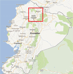
FSX/P3D Version 3 of this scenery is a completely new build of SEQM from the ground up. The entire complex is rendered using FSX objects along with the new highway that connects to the highway infrastructure with AI road traffic. The airport is now at a mean altitude that better blends with the newly included NASA SRTM GL1 30m mesh for the region. The tower is at the correct altitude. Buildings use more accurate footprints, new models, floating jetways, and updated landclass, and work seamlessly with the roads added by FTX Global/Vector. Lakes are corrected within roughly 100 square miles. Although the Ibarra/Atahualpa (SEIB) airport no longer exists, there is an option to add it back. Startup files are included to fly from the lakes and the Ibarra/Atahualpa (SEIB) airport. As a “bonusâ€, SEQU was restored in this version, because much of the footprint of the airport still remains as part of its conversion to a park. As such, a custom and fully functional SEQU is included for users who would like to revisit the old airport. AI Traffic can be restored at SEQU by simply using the "Reversed SEQU-SEQM AI Traffic" option. Scenery was created using Airport Design Editor X v1.76.6715, SBuilderX 3.13, and the FSX Object Placement Tool. Scenery objects were added and modified from stock FSX scenery to resemble as closely as possible the actual airport. Bill Leaming's Ramp Lights for P3D/FSX illuminate the aprons.
| Filename: | North_Central_Ecuador_v3_including_SEQM_SEQU_and_S.zip |
| License: | Freeware |
| Added: | 22nd March 2020, 22:13:37 |
| Downloads: | 4,120 |
| Author: | Carlyle Sharpe |
| Size: | 29.44 MB |
| Category: Flight Simulator X - Scenery | |
| MMTJ - Gen Abelardo L Rodriguez Intl - Tijuana, Mexico ----- KSDM - Brown Mun - San Diego, California - USA |
|
Images related to this file:
File Description:
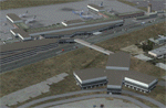
This scenery adds the new Cross Border Xpress (CBX) terminal to MMTJ, which opened on December 9, 2015, making it the first airport in the world to have connecting terminals in two different countries. All of MMTJ is also updated to reflect the most current airport layout. The neighboring KSDM is also completely updated and included in this scenery package. This scenery is optimized to fit seamlessly with FTX Global/Vector and also includes an optional CVX file which adds roads for default FSX users. All elements of both airports were traced directly from current satellite imagery and updated to reflect current satellite positioning. Scenery was created using Airport Design Editor X v1.61.5298, SBuilderX 3.13, and the FSX Object Placement Tool. Scenery objects were added and modified from stock FSX scenery to resemble as closely as possible the actual airports. The FSX apron lights included are from the set created by Jim Dhaenens.
| Filename: | MMTJ__Gen_Abelardo_L_Rodriguez_Intl__Tijuana_Mexic.zip |
| License: | Freeware |
| Added: | 3rd January 2016, 12:58:36 |
| Downloads: | 2,677 |
| Author: | Carlyle Sharpe |
| Size: | 3.58 MB |
| Category: Flight Simulator X - Scenery | |
| SEGU - Jose Joaquin de Olmedo International Airport - Guayaquil, Ecuador |
|
Images related to this file:
File Description:
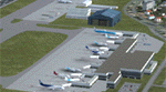
Building upon Menno Robert's original SEGU airport as a starting point, this project updates the coordinates of the airport, adds more visual detail, further expands aprons and the new terminal, and optimizes the scenery to fit seamlessly with FTX Global/Vector. This airport should also be fully functional in all FSX configurations. The airport is updated to reflect current satellite imagery and positioning. Scenery was created using Airport Design Editor X v1.61.5298, SBuilderX 3.13, and the FSX Object Placement Tool. Scenery objects were added and modified from stock FSX scenery to resemble as closely as possible the actual airport.
Thank you to Menno Robert for granting permission to edit his original SEGU file.
| Filename: | SEGU__Jose_Joaquin_de_Olmedo_International_Airport.zip |
| License: | Freeware |
| Added: | 4th July 2015, 18:22:13 |
| Downloads: | 4,216 |
| Author: | Carlyle Sharpe |
| Size: | 2.79 MB |
| Category: Flight Simulator X - Scenery | |
| SCIP - Isla de Pascua & Mataveri Intl - Easter Island |
|
Images related to this file:
File Description:
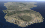
This project rebuilds Easter Island / Isla de Pascua. Mataveri Intl (SCIP) is completely overhauled, and all airport objects are aligned from satellite imagery. Landclass polygons and coastlines were meticulously hand-drawn directly from satellite imagery to provide the most detailed and accurate scenery available for this region. AI road and boat traffic is activated for the region. Accurate coastlines and road data, as well as corrected land and waterclass are provided based on the latest available satellite imagery. GA flights use default aircraft and include an option to add Chilean Air Force planes around the island. Numerous Moai (Easter Island heads) have been placed around the island according to satellite imagery. Scenery was created using Airport Design Editor X v1.61.5298, SBuilderX 3.13, and the FSX Object Placement Tool. Scenery objects were added and modified from stock FSX scenery to resemble as closely as possible the actual airports. The FSX apron lights included are from the terrific set created by Jim Dhaenens.
| Filename: | SCIP__Isla_de_Pascua__Mataveri_Intl___Easter_Islan.zip |
| License: | Freeware |
| Added: | 12th July 2014, 08:17:55 |
| Downloads: | 5,725 |
| Author: | Carlyle Sharpe |
| Size: | 5.33 MB |
| Category: Flight Simulator 2004 - AI Aircraft | |
| Ozark Fokker / Fairchild Hiller FH-227 |
|
Images related to this file:
File Description:
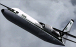
Kristopher Crook's textures, for the FH-227 in Ozark colors circa 1971, are adapted by Carlyle Sharpe for the new F-27 AI model from Dee Waldron. These are textures only and require Dee Waldron's Fokker/Fairchild F-27A AI model (AI_F27A_v2.zip) available at http://htai-models.com/downloads/dwai/fs_projects/. Thank you to Kristopher Crook for granting permission to convert his original files.
| Filename: | Ozark_Fokker__Fairchild_Hiller_FH227.zip |
| License: | Freeware |
| Added: | 3rd July 2015, 16:49:30 |
| Downloads: | 129 |
| Author: | Kristopher Crook /Carlyle Sharpe |
| Size: | 351.79 KB |
| Category: Flight Simulator X - Scenery | |
| KHOU - William P. Hobby airport - Houston, Texas - USA |
|
File Description:
AFCAD and scenery objects for FSX/P3D includes accurate runway lights and markings based on FAA NASR data, gate and taxiway placement based on Google Earth image dated 4/8/14 where new international terminal is still under construction. The gate placement relies on the Terminal Bldg object created by Carlyle Sharpe, which is a prerequisite for this scenery to perform as expected.
| Filename: | KHOU__William_P_Hobby_airport__Houston_Texas__USA.zip |
| License: | Freeware |
| Added: | 22nd August 2015, 17:21:50 |
| Downloads: | 1,132 |
| Author: | Dan Downs |
| Size: | 80.01 KB |
| Category: Flight Simulator X - AFCAD Files | |
| KHEE - Thompson-Robbins Airport | West Helena, Arkansas |
|
File Description:
KHEE - Thompson-Robbins Airport | West Helena, Arkansas. The amount of parking, as well as AI-Traffic handling efficiency is now double what it was before at this airport. Day & Night visual effects and performance have also been considerably enhanced. This was designed using Flight 1's excellent "Airport Facilitator X" program.
| Filename: | KHEE__ThompsonRobbins_Airport_____West_Helena_Arka.zip |
| License: | Freeware |
| Added: | 14th December 2008, 12:12:12 |
| Downloads: | 364 |
| Author: | Dakota Smith / Smith Graphics |
| Size: | 86.57 KB |


© 2001-2026 AVSIM Online
All Rights Reserved
Privacy Policy |