
Where Flight Simulation Enthusiasts Gather from Around the World!
AVSIM Library - Search Results

| Category: Flight Simulator 2004 - Original Aircraft | |
| LTV-Ryan XC142 |

|
Images related to this file:
File Description:

FS2004 Update to Richard Alexander van Hiens LTV-Ryan XC142 for FS2000/2002, with full VTOL capability via Rob Barendregts VTOL gauge (needs FSUIPC), fully functioning 2D panel and new sound set.
Because of the large number of changed files involved this is a complete aircraft pack. The VTOL function needs FSUIPC to be installed (available from
www.schiratti.com/dowson.html).
| Filename: | LTVRyan_XC142.zip |
| License: | Freeware |
| Added: | 24th June 2010, 16:53:52 |
| Downloads: | 1,966 |
| Author: | Brian Sharpe |
| Size: | 21.12 MB |
| Category: Flight Simulator X - Scenery | |
| Helgoland and Airports |
|
Images related to this file:
File Description:
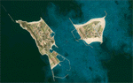
This project rebuilds Germany's Helgoland, upgrades the Duene (EDXH) and Wangerooge (EDWG) airports to be fully AI compliant, and includes AI flight plans between EDXH and EDWG to bring the airports to life. Accurate shorelines, as well as corrected landclass and waterclass, are provided. Updates were created or rebuilt in a manner which carefully aligned airport data with current satellite imagery. Scenery was created using Airport Design Editor X v1.61.5273, SBuilderX 3.13, and the FSX Object Placement Tool. Scenery objects were added and modified from stock FSX scenery to resemble as closely as possible the actual airports.
| Filename: | Helgoland_and_Airports.zip |
| License: | Freeware |
| Added: | 16th June 2014, 06:02:08 |
| Downloads: | 2,831 |
| Author: | Carlyle Sharpe |
| Size: | 1.65 MB |
| Category: Flight Simulator X - Scenery | |
| VTBS - Suvarnabhumi Intl - Bangkok, Thailand **Custom Airport Background** |
|
Images related to this file:
File Description:
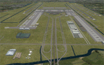
Provided is an airport background for Ray Smith's VTBS - Suvarnabhumi Intl - Bangkok, Thailand airport. This custom background can be easily added without disturbing the original airport, and it will also resolve water canal scenery conflicts for FTX Vector users. This background should work for all users, but it is optimized to take advantage of FTX Vector, and the airport road/highway system is now connected with all of the FTX Vector roads. Scenery was created using SBuilderX 3.13 and the FSX Object Placement Tool.
This scenery requires Ray Smith's VTBS - Suvarnabhumi Intl "fsx_vtbs_v1.5_rs.zip".
| Filename: | VTBS__Suvarnabhumi_Intl__Bangkok_Thailand_Custom_A.zip |
| License: | Freeware |
| Added: | 5th January 2015, 00:31:57 |
| Downloads: | 5,458 |
| Author: | Carlyle Sharpe |
| Size: | 1.32 MB |
| Category: Flight Simulator X - Scenery | |
| Bhutan Airports and Paro Valley |
|
Images related to this file:
File Description:
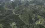
This project adds and updates all of the airports of Bhutan. Bathpalathang (VQBT) and Gelephu (VQGP) are added, Yongphulla (VQ10) is updated and recoded as VQTY, and Paro (VQPR) is fully updated to reflect current satellite imagery. These are all fully functioning AI airports as well. Special attention was given to the entire Paro Valley, and numerous road/river vectors were updated around Gelephu. Accurate coastlines, lakes, road and river data, as well as corrected landclass are provided based on the latest available satellite imagery. They are optimized to fit seamlessly with FTX Vector's roads/water, but they should be fully functional in all FSX configurations.
GA-encoded flight plans for the Buddha Air/Kathmandu charter are provided to enhance service to Paro. NASA SRTM Global 3 arc second terrain mesh is also included for all of Bhutan. Updates were created or rebuilt in a manner which carefully aligned airport data with current satellite imagery, when available. Scenery was created using Airport Design Editor X v1.61.5298, SBuilderX 3.13, and the FSX Object Placement Tool. Scenery objects were added and modified from stock FSX scenery to resemble as closely as possible the actual airports.
| Filename: | Bhutan_Airports_and_Paro_Valley.zip |
| License: | Freeware |
| Added: | 19th January 2015, 06:09:17 |
| Downloads: | 11,432 |
| Author: | Carlyle Sharpe |
| Size: | 21.4 MB |
| Category: Flight Simulator X - Scenery | |
| FIMP - Sir Seewoosagur Ramgoolam Intl - Mauritius - New Terminal & Airport Layout ** UPDATE ** |
|
Images related to this file:
File Description:

This update for the new terminal and airport layout at FIMP (Mauritius_FSX_New_Terminal.zip) adds the airport perimeter/service road, refines taxi sign information and layout, makes a minor fix to apron lights, improves traffic movement for airport vehicles, patches the "lake in hole" for default FSX users, provides an optional GA traffic file for FIMP, and adds numerous visual updates. The update was created using Airport Design Editor X v1.61.5298 and SBuilderX 3.13.
| Filename: | FIMP__Sir_Seewoosagur_Ramgoolam_Intl__Mauritius__N.zip |
| License: | Freeware |
| Added: | 13th July 2015, 15:18:19 |
| Downloads: | 5,840 |
| Author: | Carlyle Sharpe |
| Size: | 859.53 KB |
| Category: Flight Simulator X - Scenery | |
| FIMP - Sir Seewoosagur Ramgoolam Intl - Mauritius *New Terminal & Airport Layout* |
|
Images related to this file:
File Description:

This scenery adds the new terminal and taxiways, and rebuilds the aprons and runway to provide a fully functioning AI traffic extension for runway 14. The airport is assigned a mean elevation, allowing it to blend naturally with the surrounding terrain, and landclass is provided for the entire island. This scenery is most effective when used in combination with "mauritius_fsx.zip" by Max Kraus. This scenery is optimized to fit seamlessly with FTX Global/Vector and should also be fully functional in all FSX configurations. The airport is updated to reflect current satellite imagery and positioning. Scenery was created using Airport Design Editor X v1.61.5298, SBuilderX 3.13, and the FSX Object Placement Tool. Scenery objects were added and modified from stock FSX scenery to resemble as closely as possible the actual airport. The FSX apron lights included are from the set created by Jim Dhaenens.
| Filename: | FIMP__Sir_Seewoosagur_Ramgoolam_Intl__Mauritius_Ne.zip |
| License: | Freeware |
| Added: | 10th July 2015, 16:16:40 |
| Downloads: | 8,798 |
| Author: | Carlyle Sharpe |
| Size: | 5.06 MB |
| Category: Flight Simulator X - Scenery | |
| Honduras Islands v3 |
|
Images related to this file:
File Description:
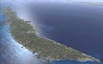
Version 3 includes all previous patches and updates. This version also restructures the file system to be fully compatible with the ORBX "FTX Global openLC North America" product as well as adding functionality for default FSX users. Additionally, water class scenery is updated to appear more realistic, MHRO is updated to reflect the newly expanded apron, and SRTMGL1 (30m) mesh is included. All landclass polygons and coastlines were meticulously hand-drawn directly from satellite imagery to provide the most detailed and accurate scenery available for this region.
This project rebuilds the islands of Roatán, Barbareta, Guanaja, and Utila, and adds Cayos Cochinos and the numerous cays associated with the "Islas de la Bahia" (Islands of the Bay). Roatán (MHRO), Guanaja (GJAJ/MHNJ) and Puerto Lempira (MHPL) are completely overhauled and positioning is corrected. New and fully functioning AI airports are added for Utila (MHUT), Fort Cay (MHFC) and Cochino Pequeño (MHCP) of the Cayos Cochinos chain, and La Ceiba (MHLC) is modified to accommodate more AI traffic. Accurate coastlines, lakes, road and river data, as well as corrected landclass are provided based on the latest available satellite imagery. GA flight plans are provided to add or enhance service to the smaller islands. Updates were created or rebuilt in a manner which carefully aligned airport data with current satellite imagery, when available. Scenery was created using Airport Design Editor X v1.70.6042, SBuilderX 3.13, and the FSX Object Placement Tool. Scenery objects were added and modified from stock FSX scenery to resemble as closely as possible the actual airports.
| Filename: | Honduras_Islands_v3.zip |
| License: | Freeware |
| Added: | 23rd December 2016, 08:17:26 |
| Downloads: | 1,614 |
| Author: | Carlyle Sharpe |
| Size: | 17.35 MB |
| Category: Flight Simulator X - Scenery | |
| St. Helena, Ascension, and Tristan da Cunha Islands |
|
Images related to this file:
File Description:
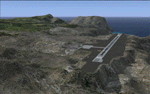
This project was begun to add the new airport (FHSH) to St. Helena Island and eventually was expanded to include a complete remake of Ascension Island (FHAW) and Tristan da Cunha (with an optional airport FHTC) and Gough Island with the actual weather station heliport (FHGH). Tested in both the default FSX/Acceleration and with FTX Global/Vector, accurate coastlines, lakes, road data, and SRTMGL1 (30m) mesh, as well as corrected landclass are provided based on the latest available satellite imagery. Flight plans are provided for the proposed commercial service to St. Helena, and some additional GA and military flights to the island are added as well.
The FSX St. Helena (FHSH) airport was created by aligning master plans for the airport with current satellite data and by studying many of the pictures that have been posted as the airport has taken shape. The official opening of the real airport on May 21, 2016, has been pushed back for more field tests due to challenging crosswinds. The Ascension Island (FHAW) airport was updated after I realized that Ascension could receive commercial service as a result of the new St. Helena airport. The entire airfield is redesigned to allow the volcanic terrain to display properly. The airbase, towns, BBC Atlantic relay station, and numerous satellite dishes, radomes, and wind turbines now appear in their real-world locations. Since I was already in the region, I added the Tristan da Cunha Islands (including Inaccessible, Nightingale and Gough Islands) and the Gough Island weather station maintained by the South African National Antarctic Programme. I also added an optional airport (and flight plans) to Tristan da Cunha (FHTC), which can be easily enabled/disabled. The FHTC airport is placed on the only part of the island that appears to be free of people or farmland, and the area is just long enough to accommodate a pared-down version of the St. Helena airport.
Updates were created or rebuilt in a manner which carefully aligns airport data with current satellite imagery. Scenery was created using Airport Design Editor X v1.67.5684, SBuilderX 3.13, and the FSX Object Placement Tool. Scenery objects were added and modified from stock FSX scenery to resemble as closely as possible the actual airports. The animated flag model is by Dietmar Loleit, the FSX apron lights included are from the set created by Jim Dhaenens, and the animated wind turbines and radomes are from the freeware package by Ray Porter.
| Filename: | St_Helena_Ascension_and_Tristan_da_Cunha_Islands.zip |
| License: | Freeware |
| Added: | 1st May 2016, 11:23:05 |
| Downloads: | 6,085 |
| Author: | Carlyle Sharpe |
| Size: | 10.52 MB |
| Category: Flight Simulator X - Scenery | |
| HALA - Hawassa Intl. - Hawassa, Ethiopia |
|
Images related to this file:
File Description:
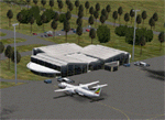
This project adds the booming city of Hawassa, Ethiopia, creates the new international airport (HALA), moves (and rebuilds) the downtown airport (recoded to HALX), and includes AI flight plans for the Ethiopian Airlines service that began April 2016. Tested in both the default FSX: Acceleration and with FTX Global/Vector, accurate coastlines, lakes, road data, and SRTMGL1 (30m) mesh, as well as corrected landclass are provided based on the latest available satellite imagery. The Hawassa International Airport was created using information from the current satellite footprint and the promotional video from Ethiopian Airports Enterprise (EAE). Although there is still very little published data on the airport, it is fully functional.
Updates were created or rebuilt in a manner which carefully aligns airport data with current satellite imagery. Scenery was created using Airport Design Editor X v1.70.6042, SBuilderX 3.13, and the FSX Object Placement Tool. Scenery objects were added and modified from stock FSX scenery to resemble as closely as possible the actual airports. The FSX apron lights included are from the set created by Jim Dhaenens. Thanks to Ron Blehm for bringing this part of the world to my attention.
| Filename: | HALA__Hawassa_Intl___Hawassa_Ethiopia.zip |
| License: | Freeware |
| Added: | 20th July 2016, 09:06:40 |
| Downloads: | 1,022 |
| Author: | Carlyle Sharpe |
| Size: | 10.41 MB |
| Category: Flight Simulator 2004 - Scenery | |
| Colorado Lakes Project III |
|
File Description:
This project features the lakes of Southwest Colorado, replaces the default Navajo Lake on the Colorado-New Mexico border, and adds over 300 highly detailed lakes to Colorado. They fit seamlessly with my "Colorado Lakes Project II" (colorado_lakes_project_2.zip) and "Colorado Lakes Project I" (colorado_lakes_project_1.zip) lakes. The original "Colorado Lakes Project I" is recommended to complete this package, as it contains McPhee, Lemon, and Vallecito Reservoirs.
These lakes are specifically designed to show off their photo realistic detail when used in combination with "FSGenesis-The Rockies 38.2m Terrain Mesh-Colorado" available as "fsg_dem38m_usrk_co.zip" at avsim.com, or comparable mesh. The free FSGenesis US National Landclass Project Beta 6 also adds beautifully to the landscape. These lakes work equally as well with the default mesh.
All lake information was projected from satellite imagery and compiled with a beta version of Jim Keir's "Slartibartfast" utility.
| Filename: | Colorado_Lakes_Project_III.zip |
| License: | Freeware |
| Added: | 3rd June 2004, 21:54:46 |
| Downloads: | 5,014 |
| Author: | Carlyle Sharpe |
| Size: | 444 KB |


© 2001-2026 AVSIM Online
All Rights Reserved
Privacy Policy |