
Where Flight Simulation Enthusiasts Gather from Around the World!
AVSIM Library - Search Results

| Category: Flight Simulator 2004 - Aircraft Repaints, Textures and Modifications | |
| Lufthansa Regional Bombardier CRJ-1000 (D-ACKZ) |

|
Images related to this file:
File Description:
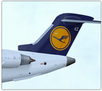
Lufthansa Regional Bombardier CRJ1000 NextGen. The model features exterior model, dynamic wing flex with XML coding, wing views, fully animated control surfaces, fully independent XML landing gear suspension, trim animation, highly realistic Opening Passenger Door L1 (integrated Airstair door) and opening forward and aft baggage holds (opened by the included POSKY Utility Panel), rolling wheels and extremely detailed animated landing gears with photorealistic textures, XML coded nose gear steering with steering lock at high rolling speed, animated thrust reversers, modeled built-in Lektro Pushback Tug (controlled by POSKY Utility Panel) and highly-detailed and accurate, 32bit day and night textures and realistic lighting effects.
Model: Maurino Brown, Hiroshi Igami and Nicholas Wilkinson. XML Coding: Hiroshi Igami. Flight Dynamics: Maurino Brown. Master Textures: Dickson Chan, Abdullah Rahman, & Stephen Groom.
Flight Testing & Information: Ben Fluth, Derek Rogy, Christopher Allen, Brian Kircher. Aircraft painted by SkySpirit member Abdullah Rahman.
For contact and information visit our Facebook Group! Thanks for downloading & Happy flying.
| Filename: | Lufthansa_Regional_Bombardier_CRJ1000_DACKZ.zip |
| License: | Freeware, limited distribution |
| Added: | 14th October 2012, 17:24:42 |
| Downloads: | 2,043 |
| Author: | Abdullah Rahman / SkySpirit2012 |
| Size: | 11.52 MB |
| Category: Flight Simulator 2004 - Utilities | |
| AirTrack Plug-in v1.4 |
|
Images related to this file:
File Description:

This is an update of the Microsoft Flight Simulator 9/2004 plug-in for the AirTrack iPhone, iPad and iPod Touch app. In order to install it run the executable that will deploy a gauge in the proper folder and automatically activate it.
AirTrack is an App that allows tracking of FS9 flights on your iPhone or iPad in real time using a local wireless network with built-in parameter reporting, an EFIS MFD, an FMC and Airport information. You can also command the plane from the application.
The current update fixes some bugs, improves the communication between the plug-in and the applicaiton and allows the flight plan created at the Flight Simulators to be displaid in the AirTrack. It also adds support for speeds limits, flight director bars in the PDF and VAS selector.
To learn more about the app and its availability please visit the product' site: air.ipobjects.com. If you have any question regarding the FSX plug-in you can contact us at [email protected]
| Filename: | AirTrack_Plugin_v14.zip |
| License: | Freeware |
| Added: | 10th May 2011, 13:46:01 |
| Downloads: | 189 |
| Author: | Jofre Palau |
| Size: | 296.36 KB |
| Category: Flight Simulator 2004 - Aircraft Repaints, Textures and Modifications | |
| AS 350 "Miami Dade Police" |
|
Images related to this file:
File Description:
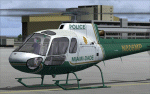
This is a repaint of the Nemeth Designs (ND) freeware AS 350 in the real world livery of the "Miami-Dade Police" AS350 for FS9 (FS2004) only. I believe this is the only repaint of the Miami Dade helicopter for public use as I was unable to locate any others, but that doesn't mean they may not exist somewhere. With that, I was unable to find too many decent photos of the chopper either so there has been a little guess work with this paint, primarily the under carriage. This is a complete aircraft, so no other files are required to fly her. All repainted textures have been saved in 32 bit format for enhanced detail. Installation, Distribution and Contact details can be located ion the TC Read Me file that is included with this download. Thanks to all of you who have supported my efforts, it is appreciated. In the event that someone from the Miami Dade Police Aviation Unit sees this - it would be appreciated if they could let me know of its accuracy - cheers :)
| Filename: | AS_350_Miami_Dade_Police.zip |
| License: | Freeware, limited distribution |
| Added: | 27th February 2012, 03:08:14 |
| Downloads: | 279 |
| Author: | Tony Cannon and Nemeth Designs |
| Size: | 18.21 MB |
| Category: Flight Simulator 2004 - Aircraft Repaints, Textures and Modifications | |
| Eurowings Bombardier CRJ-1000 NextGen (D-ACNU) - Fictional |
|
Images related to this file:
File Description:

This is a repaint of the excellent SkySpirit2012 CRJ-1000 NG, in Eurowings livery, D-ACNU (fictional). Model included. SkySpirit2012 Bombardier CRJ1000 NextGen Regional Jet. The model features exterior model, dynamic wing flex with XML coding, wing views, fully animated control surfaces, fully independent XML landing gear suspension, trim animation, highly realistic Opening Passenger Door L1 (integrated Airstair door) and opening forward and aft baggage holds (opened by the included POSKY Utility Panel), rolling wheels and extremely detailed animated landing gears with photorealistic textures, XML coded nose gear steering with steering lock at high rolling speed, animated thrust reversers, modeled built-in Lektro Pushback Tug (controlled by POSKY Utility Panel) and highly-detailed and accurate, 32bit day and night textures and realistic lighting effects. Model: Maurino Brown, Hiroshi Igami and Nicholas Wilkinson. XML Coding: Hiroshi Igami. Flight Dynamics: Maurino Brown. Master Textures: Dickson Chan, Abdullah Rahman, & Stephen Groom. Flight Testing & Information: Ben Fluth, Derek Rogy, Christopher Allen, Brian Kircher. Aircraft painted by SkySpirit member Stefan Bree. For contact and information visit our Facebook Group:- https://www.facebook.com/groups/366760436694515/
| Filename: | Eurowings_Bombardier_CRJ1000_NextGen_DACNU__Fictio.zip |
| License: | Freeware |
| Added: | 23rd May 2013, 20:10:10 |
| Downloads: | 594 |
| Author: | Stefan Bree / FSRepaintsGER, SkySpirit2012 |
| Size: | 11.45 MB |
| Category: Flight Simulator 2004 - Scenery | |
| Ocean Stations for Multiplayer Use |
|
File Description:
I've produced this scenery to provide all of the Ocean Stations I know about in the 1950's and 1960's. There is a Coast Guard ship on station (painted in the colors of the USA), an NDB to give you a bearing to the ship, a way to contact the ship using voice (you can get your position relative to the ship this way), and a DME for distances further than the limited 30 NM FS ATC gives you (normal communications would reach about 100 NM). You can also get a weather report, and if you are a seaplane you can be cleared to land. If you are a landplane, I guess this would constitute permission to ditch...
I want to give a big thank you to Mitsuya Hamaguchi (hama) for graciously supplying the ship used in this scenery.
This version uses scenery ships, which will not disappear in multiplayer. There is only a US ship, however. For the AI ship version (with ships of several countries) download OceanStations.zip instead.
| Filename: | Ocean_Stations_for_Multiplayer_Use.zip |
| License: | Freeware, limited distribution |
| Added: | 6th May 2008, 03:51:56 |
| Downloads: | 543 |
| Author: | Tom Gibson |
| Size: | 405.16 KB |
| Category: Flight Simulator X - Scenery | |
| Scappoose Industrial Airpark |
|
Images related to this file:
File Description:
Presenting KSPB Scappoose, Oregon Industrial Airpark, for FSX only. This is a nice area on the way from Portland, OR to St. Helens,OR around the Sauvie Island area.
ICAO is KSPB as mentioned above. VOWDME is 114.00 60nm range, ILS is 111.10 at 27 nm range.
This includes photo real file at high res for clarity. I made the red barn from pictures I found. One picture is included for comparison. This includes the mailbox and flower arrangement adjacent to it just for fun. Included are a few houses in the barn area and fencing which I did the best I could with what I have at the time.
Default vehicles and planes are added, but not too many so as not to cause frame rates issues. Included are a 55 Ford truck I made and one called fordtruck2 which is not as good as the '55 ford is, but I got in a rush...but it worked well. Enjoy. contact info is in the readme file. Bob
| Filename: | Scappoose_Industrial_Airpark.zip |
| License: | Freeware |
| Added: | 1st August 2012, 13:12:51 |
| Downloads: | 515 |
| Author: | Robert Lacy |
| Size: | 60.24 MB |
| Category: Flight Simulator 2004 - Scenery | |
| VIDP - Indira Gandhi International Airport (Performance) |
|
Images related to this file:
File Description:
Indira Gandhi International Airport (Performance) for both FSX and FS2004
The Scenery has been developed for Extreme frame rate loving/oriented Users, Friends ,who will never compromise performance in exchange of Aesthetics,('why?' is 'many'& beyond the scope of 'File description'). It does not have 3D twy edge/ctr/appr lts and other contents that are usually in my scenery like 3D grass, etc.... The AFCAD/AFX (as they call it) file has been worked to give equal/strict c/c distance. ( oh!.......... i mean center to center distance btwn lts ) avoiding all possible clutter(s) that are usually seen at twy Junctions. Basic Attraction is performance + terminal structures, interior as well as exterior. 'Click' and find out if it's worth at all.( by the way high intense graphics users using re-uploaded VIDP scenery, can surely have choice to suit their moods.....yes! i know what i just typed. (Contact me if you wish to use both sceneries at one time,....... one from here & two from there & so on.. )
| Filename: | VIDP__Indira_Gandhi_International_Airport_Performa.zip |
| License: | Freeware |
| Added: | 23rd August 2010, 15:11:33 |
| Downloads: | 3,979 |
| Author: | Ashish Singh |
| Size: | 17.93 MB |
| Category: Flight Simulator 2004 - Scenery | |
| St Lawrence Island AK: Gambell PAGM, Savoonga PASA, and Northeast Cape |
|
Images related to this file:
File Description:
St Lawrence Island is in Alaska, but "in" is slightly misleading as it is in fact in the Barents Sea and 120 miles from the Alaska mainland, and only 40 miles offshore of Russia. The island is around 100 miles long, with two villages and at the eastern end an old air force radar base that was cleared away some 25 years ago. Gambell is one of the two villages and is at the far western end of the island, with a population of around 700 living mainly from the sea. This northern airfield is unusual in that it has an asphalt runway and apron, the lit runway being aligned 16-34 and just over 4,500 feet long. The reason for the asphalt becomes apparent if you try walking in the vicinity, as underfoot there are rounded pebbles down to varying depths, and they are quite small and eventually slippery enough to trip you up. To base a flexible gravel runway on top of this would have been difficult, and when it was originally built it was for an air force base (closed long ago). The village is also fairly unique among northern settlements in that it has wind turbines and also solar panels. The second village is Savoonga and is around 40 miles east of Gambell with a similar population. The runway here is lit gravel aligned 5-23 and 4,900 feet long. This village also has wind turbines and solar panels. There are no vehicles (cars, pickups, trucks etc) on the island, mainly because there is nowhere far to go to and in the case of Gambell because roads as such would be difficult to create. ATV's are the standard way to go, along with small boats for fishing and whaling. At the eastern and of the island the remaining traces of the air force radar base are just the gravel runway and aprons, included with the Savoonga scenery. The AI included here is for daily flights from Nome by ERA and Bering Air, along with some GA. Also included here is the EZ library that includes the wind turbines, to save you looking for it. Installing this will also mean that a wind farm in my Cyprus scenery wii now be visible to the north of Larnaca, and there are other libraries in the series that include useful objects. The Lens_EZ_Animated library could go into your static objects folders, which is where I have it; up to you.
| Filename: | St_Lawrence_Island_AK_Gambell_PAGM_Savoonga_PASA_a.zip |
| License: | Freeware, limited distribution |
| Added: | 29th February 2020, 00:09:36 |
| Downloads: | 220 |
| Author: | Roger Wensley |
| Size: | 11.59 MB |
| Category: Flight Simulator 2004 - Scenery | |
| Peawanuck CYPO / Winisk CYWN - Northern Ontario, Canada |
|
Images related to this file:
File Description:
Peawanuck is on the bank of the Winisk River, 23 miles upstream from where the river empties into the Hudson Bay just west of James Bay. It has a population of around 240, and was established in 1986 when the original settlement (Winisk) at the mouth of the river was destroyed by a flood. The airport is on a bluff in a corner of the river at 171 feet ASL, with a gravel runway just over 3,500 feet long and aligned 11-29. There is only basic runway lighting, with no ILS, VASI, or PAPI; there is also no apron lighting, or fuel. Service is provided by Air Creebec with connector flights to Moosonee and Timmins, and on to Montreal. A search of their timetable did not provide any information regarding timings but I made the AI flight from Timmins a daily one; it is probably only once or twice a week. There is also a daily private Cessna from Moosonee. Winisk, at the mouth of the river, has another gravel runway which is over 6,000 feet long. There is also a large hangar and to the north the remaining buildings and fuel tanks etc of a Radar Control site which was closed in 1965 after only 7 years of use.
| Filename: | Peawanuck_CYPO__Winisk_CYWN__Northern_Ontario_Cana.zip |
| License: | Freeware, limited distribution |
| Added: | 29th December 2012, 09:14:03 |
| Downloads: | 280 |
| Author: | Roger Wensley |
| Size: | 2.61 MB |
| Category: Prepar3D V1-4 - Scenery | |
| Arecibo Observatory, Puerto Rico N18.20.39 W66.45.09 |
|
Images related to this file:
File Description:
Arecibo Observatory, Puerto Rico N18.20.39 W66.45.09 also known as the National Astronomy and Ionosphere Center,
National Center for Astronomy and the Ionosphere), is located about 15 km south-southwest of Arecibo, island of Puerto Rico.
It operates through Cornell University under a cooperative agreement with the National Science Foundation (a US government agency). NAIC refers more specifically to the organization that directs both the observatory and the associated laboratories
and the offices of Cornell University. The observatory is equipped with a radio telescope consisting of a 305 meter diameter
single-aperture antenna, the largest in the world up to the entry into service, in September 2016, of the 500 meter FAST radio telescope, located in the province of Guizhou. in China (soon to be realized).
It is mainly used for three large research areas: radio astronomy, atmospheric physics (using both the radio telescope and the observatory Lidar function) and the radar observation of objects in the solar system.
The telescope received further international recognition in 1999, when it began collecting data for the SETI project.Important VFR point for approaching airport of Rafael Hernandez TJBQ and airport Eugenio Maria De Hostos TJMZ.
Within the downloaded package you will find readme files for scenery installation. Good fly VFR. Pasquale Marrulli.
| Filename: | Arecibo_Observatory_Puerto_Rico_N182039___W664509.zip |
| License: | Freeware |
| Added: | 19th December 2017, 00:35:59 |
| Downloads: | 278 |
| Author: | Pasquale Marrulli |
| Size: | 1.15 KB |
© 2001-2026 AVSIM Online
All Rights Reserved
Privacy Policy |