
Where Flight Simulation Enthusiasts Gather from Around the World!
AVSIM Library - Search Results

| Category: Flight Simulator 2004 - Scenery | |
| Kigali International Airport (HRYR) V1 |

|
Images related to this file:
File Description:
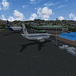
This is Kigali International Airport (HRYR) V1. This is the Largest Airport in the Republic of Rwanda. The Airport scenery was built from Sketchup, SBUILDER and ADE v1.78 utilizing Google Earth for correct positions. Runway lights by AFL Lights. This is version 1, it includes Main Terminal, VIP terminal/Control tower, Fire Station, hangars Afcad. Needs RWY12 Object library. See Readme file for Install instructions. Cheers!
| Filename: | Kigali_International_Airport_HRYR_V1.zip |
| License: | Freeware |
| Added: | 31st May 2020, 20:55:15 |
| Downloads: | 524 |
| Author: | Emmanuel Mwandosya |
| Size: | 11.52 MB |
| Category: Flight Simulator 2004 - Scenery | |
| Opa Locka Airport (KOPF) |
|
File Description:
FS2004 Scenery-Opa Locka Airport (KOPF) serves Miami and Dade County and is owned by Dade County Aviation Dept. The airport has more than one runway. The longest is a paved runway extending 8002 feet. The facility is at an elevation of 10 feet at a distance of about 10 miles from Miami. This scenery was created with FSDS2, Rwy12, FSE, AFCAD2 and Traffic Tools2x. Textures included.
| Filename: | Opa_Locka_Airport_KOPF.zip |
| License: | Freeware |
| Added: | 11th September 2005, 23:00:11 |
| Downloads: | 2,106 |
| Author: | John B. Loney, Jr. |
| Size: | 1.27 MB |
| Category: Flight Simulator 2002 - Miscellaneous Files | |
| Installing AI Traffic |
|
File Description:
Like you, I grew tired and frustrated of those tutorials that just assumed I knew what to do, and just ended up confusing me more than I was before. All I wanted was more AI traffic in my game, and those PAI auto-installers weren't satisfying my needs either. So I took it upon myself to convey my method--which worked for me. Try my thorough tutorial that is bound to get you what you want. If it doesnt, I will.
| Filename: | Installing_AI_Traffic.zip |
| License: | Freeware |
| Added: | 25th April 2003, 01:09:46 |
| Downloads: | 4,069 |
| Author: | Brian Futterman |
| Size: | 6.17 KB |
| Category: Flight Simulator 2004 - Gauges | |
| Pattern Gauge |
|
File Description:
FS2004 Pattern Gauge. This gauge calculates the heading for all five pattern legs around an airport for both left and right turns. After the pilot enters the two-digit runway data, heading information will be displayed for any desired leg by pressing an appropriate button. This gauge was the example used to illustrated a tutorial which shows how to make graphics for gauges. Part 1 of that file TutGG_P1.zip is available as a separate D/L. By Glenn Copeland.
| Filename: | Pattern_Gauge.zip |
| License: | Freeware |
| Added: | 14th September 2005, 14:34:48 |
| Downloads: | 2,876 |
| Author: | Glenn Copeland |
| Size: | 36.7 KB |
| Category: Flight Simulator X - Utilities | |
| McDonnell Douglas MD-11 GE flex data charts |
|
File Description:
Flex data (assumed temperature) charts for use with PMDG MD-11 GE version (FS2004 and FSX). These charts allow you to accurately determine assumed temperatures according to TOGW (all weights), runway length (7000-12000 feet), take-off flap setting (10-28) and density altitude (SL-12000 feet). Also contains conversion tables to correct for actual airport altitude, pressure, wind and use of anti-ice. Detailed description and tutorial included within file. MS Excel or Excel-viewer required. No further installation necessary.
| Filename: | McDonnell_Douglas_MD11_GE_flex_data_charts.zip |
| License: | Freeware, limited distribution |
| Added: | 9th April 2009, 10:41:36 |
| Downloads: | 2,904 |
| Author: | Bryan Schleipen |
| Size: | 240.81 KB |
| Category: Flight Simulator X - Miscellaneous Files | |
| Guidelines on Flying the Flight1 Mustang |
|
Images related to this file:
File Description:

This Guidelines document complements Flight1's Citation Mustang Pilot's Guide in two ways: (1) Explains how principal automated flight and navigation controls work in conjunction with one-another; and (2) Describes when a particular pilot procedure should be used--what is 'good practice'? This guide provides an overall orientation to Garmin's G1000 panel, including associated AFCS (autopilot) and MFD Controller (FMS) functions. Note: These guidelines are intended to be used in conjunction with Kurt Kalbfleisch's Mustang Tutorial also available in the Avsim Library.
| Filename: | Guidelines_on_Flying_the_Flight1_Mustang.zip |
| License: | Freeware |
| Added: | 19th February 2010, 02:54:31 |
| Downloads: | 1,865 |
| Author: | Maury Pratt |
| Size: | 2.06 MB |
| Category: Flight Simulator 2004 - Original Aircraft | |
| Fokker 28, v1 |
|
Images related to this file:
File Description:

The Fokker 28 base software is a complete bundled package for FS2004 and includes:
- Three Fokker 28 models representing the Mk.1000, Mk.4000 and Mk.6000
- Four prototype models
- Magnificent Flight Dynamics and ditto Sounds
- Various liveries to the detail: Fokker (4x), Tame and NLM Cityhopper
- Fully featured 2D panels, including functional gauges to the detail (No VC)
- Comprehensive User Manual + Flight Tutorial
(by Project Fokker: fokker.avsim.net)
| Filename: | Fokker_28_v1.zip |
| License: | Freeware, limited distribution |
| Added: | 13th December 2009, 17:32:22 |
| Downloads: | 137,950 |
| Author: | Ton van de Laar |
| Size: | 40.94 MB |
| Category: Flight Simulator 2004 - Scenery | |
| Caballococha, Peru FIx |
|
File Description:
This adds the missing AFCAD FILE ... I apologize for the inconvience.
Caballococha, Peru - Actually I have found only one photo of the town along the Amazon River and it was only of the Plaza. This is a total impressionistic file. Creates the town, riverside features (Piers, Ferry landing) and a few features to the default airport.
New AFCAD created offering parking and a taxiway, plus two water start locations. Again totally fictious. BUT enjoy.
One thing about Caballococha is that it is along a highly navagatable portion of the Amazon and with the fantastic array of Watercraft available offers, I believe, unlimited simming possibilities.
I included the .XML file for rwy12, if you are into enhancing your own scenery...please do feel free to modify or add as desired. This scenery DOES require both LAGO FSE (Payware) and RWY12 available here at avsim) to work.
questions or comments PLEASE do e-mail me ... I will respond as rapidly as possible.
[email protected]
| Filename: | Caballococha_Peru_FIx.zip |
| License: | Freeware |
| Added: | 9th April 2006, 23:24:04 |
| Downloads: | 602 |
| Author: | Dale Caruso |
| Size: | 1.84 KB |
| Category: Flight Simulator 2004 - Scenery | |
| New Jersey Vol 3 |
|
Images related to this file:
File Description:
Re-upload. New Jersey Vol 3: Six very small bush airfields located in New Jersey. All of the runways are grass. Created mostly with Rwy12 and Lago's FSE. One Airport has FSDS2 objects so the Nova texture sets are required. AFCAD2 and Traffic Tools are also required. The airfields include: Mar Bar L Farms, Folsom, Bradford Field, Mt Pleasant Landing Strip, Dave's Aerodrome and Alliance. By John B. Loney, Jr.
| Filename: | New_Jersey_Vol_3.zip |
| License: | Freeware, limited distribution |
| Added: | 23rd May 2010, 02:12:57 |
| Downloads: | 849 |
| Author: | John B. Loney, Jr. |
| Size: | 2.62 MB |
| Category: Flight Simulator 2004 - Scenery | |
| University-Oxford Airport |
|
File Description:
FS2004 Scenery-University-Oxford Airport (KUOX) serves Oxford and Lafayette County and is owned by University Of Mississippi. The paved runway extends for 4700 feet. The facility is at an elevation of 451 feet at a distance of about 2 miles from Oxford. Created with FSDS3, EZ Scenery, Rwy12 and Lago's FSE. Modified AFCAD2 file and Traffic Tools employed. Choice of two scenery variants. Read readme for details.
| Filename: | UniversityOxford_Airport.zip |
| License: | Freeware |
| Added: | 15th January 2006, 00:58:35 |
| Downloads: | 783 |
| Author: | John B. Loney, Jr. |
| Size: | 765 KB |


© 2001-2026 AVSIM Online
All Rights Reserved
Privacy Policy |