
Where Flight Simulation Enthusiasts Gather from Around the World!
AVSIM Library - Search Results

| Category: Flight Simulator 2004 - Scenery | |
| Ivanpah Valley Airport |

|
File Description:
FS2004 Scenery - Ivanpah Valley Airport is the planned relief airport for McCarran International Airport. Since there is only limited space left for expansion at McCarran, a new airport is the only alternative to increase capacity by a significant amount. The airport is planned to open in 2017. Created using Rwy12 and EZ Scenery objects. By Maurice Butz, with Jeff Hurd and John B. Loney, Jr.
| Filename: | Ivanpah_Valley_Airport.zip |
| License: | Freeware, limited distribution |
| Added: | 6th April 2010, 01:41:57 |
| Downloads: | 222 |
| Author: | Maurice Butz with Jeff Hurd and John B. Loney, Jr. |
| Size: | 3.05 MB |
| Category: Flight Simulator 2004 - Scenery | |
| Vandenberg Airport (KVDF) |
|
Images related to this file:
File Description:
FS2004 Scenery - Vandenberg Airport (KVDF) serves Tampa and Hillsborough County and is owned by Hillsborough Co Avia Auth. The paved runway extends for 3260 feet. The facility is at an elevation of 20 feet at a distance of about 6 miles from Tampa. Requires Nova, NovaGold and NovaSim Textures. Created with FSDS2, Rwy12 and Lago's FSE. AFCAD2 and Traffic Tools a must. By John B. Loney, Jr.
| Filename: | Vandenberg_Airport_KVDF.zip |
| License: | Freeware, limited distribution |
| Added: | 17th May 2010, 22:23:20 |
| Downloads: | 1,357 |
| Author: | John B. Loney, Jr. |
| Size: | 1.15 MB |
| Category: Flight Simulator 2004 - Scenery | |
| Indianapolis Executive KTYQ |
|
Images related to this file:
File Description:
FS2004 Scenery - Indianapolis Executive Airport (Formally known as Indianapolis Terry Airport) KTYQ, serves Indianapolis and Boone County and is owned by R. Vansickle. The paved runway extends for 5500 feet. The facility is at an elevation of 922 feet at a distance of about 14 miles from Indianapolis. Created with FSDS2, Rwy12 and Lago's FSE. AFCAD2 and Traffic Tools required. By John B. Loney, Jr.
| Filename: | Indianapolis_Executive_KTYQ.zip |
| License: | Freeware, limited distribution |
| Added: | 17th May 2010, 22:30:47 |
| Downloads: | 788 |
| Author: | John B. Loney, Jr. |
| Size: | 984.06 KB |
| Category: Flight Simulator 2004 - Scenery | |
| Northeast Philadelphia Airport |
|
File Description:
FS2004 Scenery-Northeast Philadelphia Airport (KPNE) serves Philadelphia and Philadelphia County and is owned by the City Of Philadelphia. The airport has more than one runway. The longest is a paved runway extending 7000 feet. The facility is at an elevation of 121 feet at a distance of about 10 miles from Philadelphia.Modular construction using FSDS2, Rwy12, Lago's FSE, Traffic Tools and AFCAD2. Both runways active.
| Filename: | Northeast_Philadelphia_Airport.zip |
| License: | Freeware |
| Added: | 20th November 2005, 07:12:58 |
| Downloads: | 1,484 |
| Author: | John B. Loney, Jr. |
| Size: | 2.27 MB |
| Category: Flight Simulator 2004 - Scenery | |
| Butler Memorial Airport |
|
File Description:
FS2004 Scenery-Butler Memorial Airport (KBUM) serves Butler and Bates County and is owned by the City Of Butler, Mo. The paved runway extends for 4000 feet. The facility is at an elevation of 892 feet at a distance of about 2 miles from Butler. Created with FSDS3, Rwy12, EZ Scenery and Lago's FSE. FSDS3 textures included. Scenery have challenging approach. Read readme file.
| Filename: | Butler_Memorial_Airport.zip |
| License: | Freeware |
| Added: | 23rd January 2006, 04:20:30 |
| Downloads: | 400 |
| Author: | John B. Loney, Jr. |
| Size: | 703.77 KB |
| Category: Flight Simulator 2004 - Scenery | |
| RAF Fairford 2007 |
|
File Description:
RAF Fairford 2007. Add-on scenery for the default FS2004 scenery - not tested with UK2000 or VFR scenery. This isn't photorealistic by any means but provides an accurate as possible representation of RAF Fairford, the home of the Royal International Air Tattoo. Zip file c6MB. Readme file contains instructions and recommended addon files.Readme recommends users download RWY12 package, Novagold textures and 4 other freeware object libraries.
| Filename: | RAF_Fairford_2007.zip |
| License: | Freeware, limited distribution |
| Added: | 6th September 2007, 23:34:12 |
| Downloads: | 2,571 |
| Author: | Dave Morgan |
| Size: | 6.05 MB |
| Category: Flight Simulator 2004 - Scenery | |
| Carrasco Intl. Montevideo – Uruguay Airport ( SUMU ) |
|
File Description:
Carrasco Intl. Montevideo – Uruguay Airport ( SUMU ). Lots of hours of hard and detailed work to manage a complete package which includes: accurate afcad file according to latest changes made in the real Airport, and scenery files to manage better area environment. Notice that you need to have Rwy12 ObjectPlacer installed to take fully advantage of the improvements; otherwise some building elements will not be shown in Fs9.
| Filename: | Carrasco_Intl_Montevideo__Uruguay_Airport__SUMU_.zip |
| License: | Freeware, limited distribution |
| Added: | 12th March 2006, 21:50:45 |
| Downloads: | 3,111 |
| Author: | Guillermo Morán |
| Size: | 925.38 KB |
| Category: Flight Simulator 2004 - Scenery | |
| Kigali International Airport (HRYR) V1 |
|
Images related to this file:
File Description:
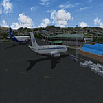
This is Kigali International Airport (HRYR) V1. This is the Largest Airport in the Republic of Rwanda. The Airport scenery was built from Sketchup, SBUILDER and ADE v1.78 utilizing Google Earth for correct positions. Runway lights by AFL Lights. This is version 1, it includes Main Terminal, VIP terminal/Control tower, Fire Station, hangars Afcad. Needs RWY12 Object library. See Readme file for Install instructions. Cheers!
| Filename: | Kigali_International_Airport_HRYR_V1.zip |
| License: | Freeware |
| Added: | 31st May 2020, 20:55:15 |
| Downloads: | 530 |
| Author: | Emmanuel Mwandosya |
| Size: | 11.52 MB |
| Category: Flight Simulator 2004 - Scenery | |
| Opa Locka Airport (KOPF) |
|
File Description:
FS2004 Scenery-Opa Locka Airport (KOPF) serves Miami and Dade County and is owned by Dade County Aviation Dept. The airport has more than one runway. The longest is a paved runway extending 8002 feet. The facility is at an elevation of 10 feet at a distance of about 10 miles from Miami. This scenery was created with FSDS2, Rwy12, FSE, AFCAD2 and Traffic Tools2x. Textures included.
| Filename: | Opa_Locka_Airport_KOPF.zip |
| License: | Freeware |
| Added: | 11th September 2005, 23:00:11 |
| Downloads: | 2,109 |
| Author: | John B. Loney, Jr. |
| Size: | 1.27 MB |
| Category: Flight Simulator 2004 - AI Flight Plans | |
| Japan Airlines(JAL) FlightPlans (Domestic) 2009Espring |
|
File Description:
Hello.
This flight plan was made based on an actual timetable. Domestic flight (spring of April of 2009 May)
The flight plan of JAL group JAL express(JAX), Japan Transocean(JTA), Japan Air Commute(JAC), J-Air, Hokkaido Air System(HAC), and Ryukyu Air Commuter(RAC) is contained besides JAL.
The recommendation: Please .."Traffic View Board" ..highest masterpiece Utilities development of Mr. Hans-Juergen Merkel.... enjoy using tutorial in the round. (tvb_tut.zip)
Then, a wonderful flight.
| Filename: | Japan_AirlinesJAL_FlightPlans_Domestic_2009Espring.zip |
| License: | Freeware |
| Added: | 21st April 2009, 22:47:06 |
| Downloads: | 748 |
| Author: | Kazu Ando |
| Size: | 123.89 KB |


© 2001-2026 AVSIM Online
All Rights Reserved
Privacy Policy |