
Where Flight Simulation Enthusiasts Gather from Around the World!
AVSIM Library - Search Results

| Category: Prepar3D V1-4 - Scenery | |
| DNMM - Murtala Muhammed - Lagos, Nigeria |

|
File Description:
this is a totally overhauled version of the default p3d airport as the default is a complete mess:
*updated runway dimensions and corrected positions, verified markings and lighting
*reconstructed all ramps and taxiways in the correct positions
*rebuilt terminal with default buildings and added more accurate parking
*current as of airac 2004
| Filename: | DNMM__Murtala_Muhammed__Lagos_Nigeria.zip |
| License: | Freeware |
| Added: | 9th April 2020, 18:22:15 |
| Downloads: | 1,184 |
| Author: | Mike Teague |
| Size: | 53.14 KB |
| Category: Flight Simulator X - AFCAD Files | |
| WASR (WAUU)- Rendani Airport, Manokwari, Indonesia. |
|
File Description:
This is a redesign of WASR (WAUU)- Rendani Airport, Manokwari, Indonesia. Google Maps and AIP Indonesia Charts have been used to provide the correct (as physically possible within FSX and ADE) position, size and type of runway, aprons and buildings. The immediate surrounding scenery has been included. ADE used to compile the design.
| Filename: | WASR_WAUU_Rendani_Airport_Manokwari_Indonesia.zip |
| License: | Freeware |
| Added: | 30th November 2018, 19:17:27 |
| Downloads: | 1,117 |
| Author: | Matthew Ward |
| Size: | 2.31 MB |
| Category: Flight Simulator 2004 - Scenery | |
| Santa Lucia, Mexico - MMSM - Mexico City secondary airport |
|
File Description:
Mexico City has a secondary airport in Santa Lucia airport MMSM formerly an old military base has been closed old runway a hundred feet away now new runways. Some airlines services today are Aeromexico, Viva Aerobus, Volaris, Arajet, Copa, Conviasa, and Aeromexico Connect. Possible future Int'l flight to Spain this summer 2023.
| Filename: | Santa_Lucia_Mexico__MMSM__Mexico_City_secondary_ai.zip |
| License: | Freeware |
| Added: | 10th December 2022, 16:35:40 |
| Downloads: | 627 |
| Author: | Stuart John Gilbert II |
| Size: | 6.55 MB |
| Category: Flight Simulator 2004 - Gauges | |
| Descentometer |
|
File Description:
FS2004 Gauge: Descentometer, for precise and controlled descents. This gauge will assist in positioning your aircraft at a specified altitude and distance from the destination airport. Using ICAO and altitude info, vertical speed and slope are continually processed and displayed during a flight. At any point, the VS needed to descend and arrive at a desired altitude and distance from the airport is known. D'meter handles both continuous or stepped descents from high altitudes. When placed in AUTO, the gauge will control the descent by continually updating the autopilot with VS data. When approaching the airport, the gauge can be placed in Runway mode to monitor or control slope flown to runway. With illustrated PDF and Icon Gauge. By Glenn Copeland.
| Filename: | Descentometer.zip |
| License: | Freeware |
| Added: | 14th August 2006, 02:53:00 |
| Downloads: | 5,649 |
| Author: | Glenn Copeland |
| Size: | 304.29 KB |
| Category: Flight Simulator 2004 - AFCAD Files | |
| Woodvale (EGOW) Ground Improvements (v1.0) |
|
File Description:
Includes: Military dispersals, light aircraft park, re-designation of runways to current format, runway placement, frequency changes, general taxiway adjustments, inclusion of Merseyside police helipad, and much more. I'd call it a little more than an improvement over Microsoft's 'two-runway-no-taxiway' version. Something for us Air Cadets out there! I've used my real-world charts and Google Earth to apply areas to the default AFCAD. I have noticed that there is an unused dispersal from its war-era on the south-side, but I haven't included it because it is not very significant - but if I notice any issues later on I'll make an effort to put it in for a little eye-candy and realism. See Readme file for more details...enjoy!
| Filename: | Woodvale_EGOW_Ground_Improvements_v10.zip |
| License: | Freeware, limited distribution |
| Added: | 12th October 2008, 20:27:40 |
| Downloads: | 255 |
| Author: | David Hunter |
| Size: | 40.77 KB |
| Category: Flight Simulator X - AFCAD Files | |
| Cincinnati/Northern Ky Intl - KCVG - Ohio |
|
File Description:
This airport was designed with the latest version of ADE (v1.47) and made only for the FSX default airport: now included is the new runway 18R/36L with ILS added for it by ADE, there is one file with the Crosswind rwy operating now activated by ADE where all 4 rwy's will be used for takeoff/landing and one file as the default rwy operation: runway 18C/36C corrected and the Navaids corrected for it, all taxiways and taxi signs updated to the latest charts, assigned parking with extra parking, extra fuel trucks, new control tower, support vehicle roads rebuilt and many other improvements, airport views are from inside the control tower (when in tower view) please view the readme before installation.
| Filename: | CincinnatiNorthern_Ky_Intl__KCVG__Ohio.zip |
| License: | Freeware |
| Added: | 15th January 2010, 19:55:19 |
| Downloads: | 4,761 |
| Author: | Ray Smith |
| Size: | 61.65 KB |
| Category: Flight Simulator 2004 - Scenery | |
| CNU8 - Toronto - Markham Airport (2008), Ontario, Canada |
|
Images related to this file:
File Description:
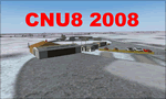
CNU8 - Toronto - Markham Airport (2008) - Markham v1. The airport is owned and operated by Markham Airport Inc., and is not part of the Greater Toronto Airport Authority.
The airport consists of a single 2,000 foot runway for small and private aircraft only (with night flying capabilities). The Royal Canadian Air Cadets Gliding Program uses the north side or the runway 09/27 for glider operations in the spring and fall months, and use a northern traffic pattern. This airport may disappear with the establishment of a planned Pickering Airport or re-location of Toronto/Buttonville Municipal Airport.
(This is a re-upload of the scenery to replace the original that was lost in the AVSIM hack. No changes have been made)
| Filename: | CNU8__Toronto__Markham_Airport_2008_Ontario_Canada.zip |
| License: | Freeware, limited distribution |
| Added: | 16th May 2010, 10:06:40 |
| Downloads: | 1,594 |
| Author: | Keith Murphy |
| Size: | 5.24 MB |
| Category: Flight Simulator X - Gauges | |
| FLTInfo V2 |
|
Images related to this file:
File Description:
This gauge has been developed for FSX Flight Simulator SP2 or SP1. It should also work with Acceleration, but this is not guaranteed by the author.
The gauge provides flight information for the pilot regarding the destination airport in terms of frequencies, runway conditions, altitude, bearing and distance, and basic information about the flight plan like current travelled miles and a estimated calculation about the Top Of Descent (TOD ) decision point.
This Version 2 includes 3 additional information pages for the runway layouts of the destination and the departure airport, and a page which provides graphical information about the terrain level relative to the aircraft on the selected flight plan.
For more information and installation instructions see the documentation inside the zip file.
| Filename: | FLTInfo_V2.zip |
| License: | Freeware, limited distribution |
| Added: | 12th October 2012, 18:05:11 |
| Downloads: | 1,553 |
| Author: | Dietmar Loleit |
| Size: | 853.38 KB |
| Category: Flight Simulator 2004 - Scenery | |
| Byron Bay CWBB plus Edinburgh Island CWEI in Nunavut, Canada |
|
Images related to this file:
File Description:
Byron Bay was a DEW line station on the south coast of Victoria Island, 105 miles east of Lady Franklin Point. It closed in 1993. The buildings are still there, slowly accumulating the patina so admired by collectors on Antiques Roadshow. The runway is just over 4,500 feet and aligned 58T-238T. At the mid point between Lady Franklin Point and Byron Bay there is a North Warning Site on the highpoint of Edinburgh Island, just south of the closed Ross Point station on the "mainland" Victoria Island. The runway is just over 1,400 feet and is also up on the top of the island. There is a steep road down 600 feet to the coast for the annual fuel resupply and maintenance.
| Filename: | Byron_Bay_CWBB_plus_Edinburgh_Island_CWEI_in_Nunav.zip |
| License: | Freeware, limited distribution |
| Added: | 11th November 2012, 21:07:05 |
| Downloads: | 248 |
| Author: | Roger Wensley |
| Size: | 2 MB |
| Category: Flight Simulator 2004 - Scenery | |
| Sturt Point CWSP in Nunavut, Canada |
|
Images related to this file:
File Description:
Sturt Point was a DEW line I Station on the south coast of Victoria Island, 50 miles east of Cambridge Bay. It was closed in 1963 but remains in place, though a 5 man I Station has such a small impact on its surroundings that it is hardly visible. The runway is 3,420 feet of gravel aligned 117T/297T, and there are no lights, signage, or windsock, but there are ruts in the gravel. A North Warning System station was built 15 miles inland and closer to Cambridge Bay, operating from 1991 onwards. This has a short (1,280'?) gravel runway aligned 138T/318T (and named CWSX here). No ruts in the gravel, but also still no lights, signage, or windsock.
| Filename: | Sturt_Point_CWSP_in_Nunavut_Canada.zip |
| License: | Freeware, limited distribution |
| Added: | 11th November 2012, 21:07:18 |
| Downloads: | 209 |
| Author: | Roger Wensley |
| Size: | 1.35 MB |


© 2001-2026 AVSIM Online
All Rights Reserved
Privacy Policy |