
Where Flight Simulation Enthusiasts Gather from Around the World!
AVSIM Library - Search Results

| Category: Flight Simulator X - Scenery | |
| California Central Coast with Megascenery Earth and FSGenesis Mesh |

|
Images related to this file:
File Description:
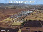
California Central Coast Scenery for FSX with Megascenery Earth and FSGenesis mesh. CCFSXMSG.ZIP covers the California coastal region from N36° 10' (Coalinga) to N34° 25' (Santa Barbara) and from the coast East to W119° 40'. It is a version of my previously created California Central Coast scenery redesigned and expanded to work with FSX MegaScenery Earth and FSGenesis USA Terrain Mesh for FSX V2 by Justin Tyme. Airstrips in the area covered by this scenery have been added for a total of 27 airports and airstrips. 6 imaginary water runways are also added for AI float plane traffic. Several other areas of interest such as the Santa Barbara marina, Morro Bay, etc. are included for a total of 41 points of interest. All airports, airstrips and related structures have been adjusted and realigned to conform to actual positions and dimensions as indicated by the MegaScenery Earth satellite textures. Megascenery Earth California-13, -14 and -15 are required and -12, -28 and -29 are recommended. By Al Wheeler 9/25/09.
| Filename: | California_Central_Coast_with_Megascenery_Earth_an.zip |
| License: | Freeware |
| Added: | 7th January 2010, 19:54:57 |
| Downloads: | 870 |
| Author: | Al Wheeler |
| Size: | 8.13 MB |
| Category: Flight Simulator 2004 - Scenery | |
| Koyuk PAKK in Alaska |
|
Images related to this file:
File Description:
Koyuk is a coastal village around 125 miles east of Nome at the mouth of the Koyuk River, with a population just under 400 living from fishing and the land. The airfield is close by and has a gravel runway aligned 18-36, 3,300 feet long with VASI at both ends. Apart from the airfield itself, and it's buildings, this scenery modifies the local land class, adds village buildings while reducing the village size to reality, and creates a new airfield background. Bering Air and ERA both fly into Deering and are included in the AI. A note here about my scenery making. This is post number 506 and there will not be many more to follow this as I am almost at the end of the photos I either took or found for scenery purposes. There is a limit to what can be located online and I have already been making use of the little there is; eg Unalakleet. So, if you are near an airport (preferably Canadian or Alaskan) and have a camera..... Let me know.
| Filename: | Koyuk_PAKK_in_Alaska.zip |
| License: | Freeware, limited distribution |
| Added: | 15th August 2019, 17:56:50 |
| Downloads: | 142 |
| Author: | Roger Wensley |
| Size: | 3.88 MB |
| Category: Flight Simulator 2004 - Scenery | |
| Alaska North Slope 4: Lonely Air Force Station (AK71) |
|
Images related to this file:
File Description:
The town of Barrow is in the far north of Alaska, and these are coastal villages or radar installations to the west, south, and now east of Barrow. There will be further additions. Lonely Air Force Station AK71 is 80 miles east of Barrow and on the coast. It was, and at first sight appears still to be, a DEW station until you are close enough to see that the gravel apron is deteriorating. There is a gravel runway around 5,000 feet long, a large hangar, the DEW buildings, radar under the domes, the remains of huge line-of-sight communications reflectors, and oil tanks. Some DEW sites are not worth a visit; others are surprisingly intact and this is one of those. The AI takes place three days a week and is a C130, in which case the DEW site is still functioning or under mothball maintenance, a chartered Reeve Aleutian in which case the site is closed and they are documenting wildlife, and a Cessna with a group of the curious.
| Filename: | Alaska_North_Slope_4_Lonely_Air_Force_Station_AK71.zip |
| License: | Freeware, limited distribution |
| Added: | 20th June 2016, 08:02:18 |
| Downloads: | 307 |
| Author: | Roger Wensley |
| Size: | 2.32 MB |
| Category: Flight Simulator 2004 - Scenery | |
| Alaska South Slope 8; Shishmaref PASH |
|
Images related to this file:
File Description:
There are four main northwestern Alaska towns which are serviced by Alaska Airlines, and from which local flights spread out. The northernmost is Barrow. Southwest of Barrow is Kotzebue, then Nome, and the furthest south is Bethel (not yet made). This is the first in a series for flights from Nome, and it is Shishmaref, 125 miles north of Nome on the far side of the Seward Peninsula.
Shishmaref is a village on one of a string of islands off the northern shore of the Seward Peninsula, with a population of around 560. Like other similarly-sited villages (Kivalina, for instance) it is feeling the effects of coastal erosion and there are plans for a relocation, eventually. The airfield is just beside the village, with a runway of just under 5,000 feet of lit asphalt aligned 05-23, with PAPI on both ends. There are scheduled flights by Era (now renamed Ravn) and by Bering Air, both of them originating in Nome. The AI includes these flights along with Everts Air and GA.
| Filename: | Alaska_South_Slope_8_Shishmaref_PASH.zip |
| License: | Freeware, limited distribution |
| Added: | 20th October 2016, 04:37:02 |
| Downloads: | 213 |
| Author: | Roger Wensley |
| Size: | 2.32 MB |
| Category: Flight Simulator 2004 - Scenery | |
| Anaktuvuk Pass PAKP in Alaska |
|
Images related to this file:
File Description:
Anaktuvuk Pass is a village located 85 miles north of Bettles and just north of the Brooks Range, in a valley that is a route between north and south. The inhabitants are mainly Numamiut, a section of the Inupiat that existed in history (and until today) away from the coastal food supply of fish etc. The current population is around 350. The airport has one gravel runway, aligned 1-19 with PAPI at both ends, and 5,500 feet long as there is no connection to the outside world other than the runway for all necessities that are not available on the tundra. There are two aprons, with light planes and passengers at the northern end of the runway and the Everts cargo flights unloading at the mid runway apron. A note here about my scenery making. There will not be many more to follow this as I am almost at the end of the photos I either took or found for scenery purposes, plus I expect to move on from FS9 at some point during next year.
| Filename: | Anaktuvuk_Pass_PAKP_in_Alaska.zip |
| License: | Freeware, limited distribution |
| Added: | 25th November 2019, 17:51:38 |
| Downloads: | 242 |
| Author: | Roger Wensley |
| Size: | 8.59 MB |
| Category: Flight Simulator X - Scenery | |
| * Darłowo AFB * - EPDA |
|
Images related to this file:
File Description:
EPDA Airport in Darłowo is a military airfield located on the Polish Baltic coast.
It serves as a base for the naval aviation of the Polish Navy, primarily used for helicopter operations.
Its main tasks include coastal patrols, search and rescue missions, and anti-submarine warfare.
The airfield is home to multi-role helicopters, including the Mi-14 and W-3 Sokół.
Its history dates back to World War II when it was built by the Germans.
After the war, it was taken over by the Polish military and has since functioned as a naval aviation base.
The airport features a concrete runway and infrastructure adapted for the operation of helicopters and military aircraft.
Due to its strategic location on the Baltic Sea, it plays a crucial role in operations related to the security of Poland’s territorial waters.
The airfield is not open to civilian aviation and is used exclusively for military purposes.
Nowadays, it remains an essential part of Poland’s defense system and participates in NATO exercises.
| Filename: | _Darowo_AFB____EPDA.zip |
| License: | Freeware |
| Added: | 10th February 2025, 17:41:56 |
| Downloads: | 72 |
| Author: | Dawid Drobik |
| Size: | 10.44 MB |
| Category: Prepar3D V1-4 - Scenery | |
| TNCA - Queen Beatrix International Airport - Aruba |
|
File Description:
The scenery was made using the Airport Design Editor, ModelConverterX, FSEarthTiles, SketchUp 2017 an others.
Queen Beatrix International Airport (Dutch: Internationale luchthaven Koningin Beatrix; Papiamento: Aeropuerto Internacional Reina Beatrix), colloquially known as Aruba Airport (IATA: AUA, ICAO: TNCA), is an international airport located in Oranjestad, Aruba. It has flight services to the United States, several countries in the Caribbean, the northern coastal countries of South America, Canada, as well as some parts of Europe, notably the Netherlands.
It is named after Beatrix of the Netherlands, who was Queen of the Netherlands from 1980 to 2013.
The airport offers United States border preclearance facilities. A terminal for private aircraft opened in 2007. The airport used to serve as the hub for bankrupt airline Air Aruba, which was for many years an international airline. Before Aruba's separation from the Netherlands Antilles in 1986 it was also one of three hubs for ALM Antillean Airlines as well as a home base for Tiara Air until 2016.
This scenario was only tested on P3Dv4.5.
History - fron Wikipedia.com
| Filename: | TNCA__Queen_Beatrix_International_Airport__Aruba.zip |
| License: | Freeware |
| Added: | 8th May 2021, 17:39:28 |
| Downloads: | 678 |
| Author: | Eduardo Puelker |
| Size: | 3.78 MB |
| Category: Flight Simulator X - Scenery | |
| Noi Bai International Airport, Hanoi, Vietnam |
|
Images related to this file:
File Description:
Ná»™i Bà i International Airport (IATA: HAN, ICAO: VVNB) (Vietnamese: Sân bay Quốc tế Ná»™i Bà i) in Hanoi, the capital of Vietnam, is the largest airport in Vietnam in terms of total capacity. It's also the second busiest airport in Vietnam after Tan Son Nhat International Airport. It is the main airport serving Hanoi. The airport consists of two passenger terminals. Terminal 1 serves domestic flights, and the newly-built Terminal 2 serves all international flights to and from Hanoi. The airport is located in Phu Minh Commune in Soc Son District, about 35 kilometers (21 miles) northeast of downtown Hanoi, via the new Nháºt Tân Bridge. The airport is currently the main hub of the country's flag carrier Vietnam Airlines, as well as a major hub of low-cost carriers Vietjet Air and Jetstar Pacific. There are Aeroflot, AirAsia, Air Macau, All Nippon Airways, Asiana Airlines, Cambodia Angkor Air, Cathay Dragon, Cebu Pacific,
China Airlines, China Eastern Airlines, China Southern Airlines, Eastar Jet, EVA Air, Emirates, Hainan Airlines, Hai Au Aviation, Hong Kong Airlines, Japan Airlines, Jeju Air, Jin Air,,Kenya Airways, Korean Air, Lao Airlines, Lucky Air, Malaysia Airlines, Malindo Air, Mandarin Airlines, Nok Air, Qatar Airways, Scoot, Silk Air, Singapore Airlines, Thai AirAsia, Thai Airways, Thai Lion Air, Turkish Airlines, VASCO flying from and to here everyday.
| Filename: | Noi_Bai_International_Airport_Hanoi_Vietnam.zip |
| License: | Freeware |
| Added: | 22nd September 2017, 19:17:59 |
| Downloads: | 8,376 |
| Author: | QuocTuan737 |
| Size: | 14.45 MB |
| Category: Flight Simulator 2004 - Aircraft Repaints, Textures and Modifications | |
| Cathay Pacific Airways Boeing 747-200B 'VR-HIB' The Spirit of Hong Kong 97 |
|
File Description:
This is a repaint of the Project Open Sky Boeing 747-200B version 3. I hand-painted the plane and it looks better than the old version now. The plane uses 32bit and DXT3 textures with highly reflection effect. The Spirit of Hong Kong 97 (VR-HIB) is a Boeing 747-200B and was the first commercial aeroplane landing on the new Hong Kong International Airport. By Charles Cheng. Details - http://www.kaitak.tk/
| Filename: | Cathay_Pacific_Airways_Boeing_747200B_VRHIB_The_Sp.zip |
| License: | Freeware, limited distribution |
| Added: | 2nd April 2004, 20:37:43 |
| Downloads: | 4,715 |
| Author: | Charles Cheng, Project Opensky |
| Size: | 3.17 MB |
| Category: Flight Simulator X - Aircraft Repaints, Textures and Modifications | |
| FSX Project Airbus Cebu Pacific Airbus A320-214 RP-C4156 and RP-C4160 Liveries |
|
File Description:
I remade the textures from my month old "let's fly every Juan" Liveries. The following is what I changed and added:
-Added reflections (lowered the opacity)
-Changed the colors to be more accurate
-Changed the allignments of the texts
-Changed the placement of the registration under the left wing from the center to the left side
In order to use these textures, you have to download the Project Airbus A32x Family with FD-FMC v2.0. It could be found in AVSIM Library. File name of the plane: pa_a32x_family_fd-fmc_2.0_377637.zip
The following is registrations that is included in this file:
RP-C4156 ("let's fly every Juan" Livery)
RP-C4160 ("let's fly every Juan" Livery)
RP-C4156 (Albino Livery)
RP-C4160 (Albino Livery)
readme, fltsim txt files is included here
FILE NAME: CEBU PACIFIC LET'S FLY EVERY JUAN PA320-200 IMPROVED.zip
| Filename: | FSX_Project_Airbus_Cebu_Pacific_Airbus_A320214_RPC.zip |
| License: | Freeware |
| Added: | 2nd November 2023, 10:52:54 |
| Downloads: | 56 |
| Author: | Rye Kristian Bunao |
| Size: | 23.74 MB |


© 2001-2026 AVSIM Online
All Rights Reserved
Privacy Policy |