
Where Flight Simulation Enthusiasts Gather from Around the World!
AVSIM Library - Search Results

| Category: Flight Simulator 2004 - Scenery | |
| Ría de Vigo (Bay of Vigo) |

|
File Description:
Comprehensive revision of the area surroinding the Bay of Vigo, near the Vigo Airport (LEVX, aprox. at 42º18'N 8º38'W), in Galicia, Spain, including a more accurate coastline, from the Ría de Aldán until Toralla Island, plus the San Simon Island and other minor islands, detailed piers in Vigo and Cangas, several beaches, and a lot of 3D VFR references (more than 180 macros added), such as buildings (the City Hall, the Hospital Xeral, the Balaídos Stadium, the Castro stronghold...), working lighthouses, several monuments and statues, some main streets redrawn, a new version of my Rande Bridge, now with collision detection and landable surface, and a handfull of eye-candies I can't even remember! -
Completa revisión da costa da Ría de Vigo, dende a Ría de Aldán ata pasada a Illa de Toralla, incluíndo, por suposto, á Illa de San Simón e outros pequenos illotes, praias (Samil, Nerga...), os peiraos de Cangas e de Vigo, dende o Areal ata Bouzas, unha morea de novas referencias visuais (máis de 180 macros), con edificios (o Concello, o Hospital Xeral, o estadio de Balaídos, o castelo do Castro, o lazareto de San Simón...), faros (nas Cíes e na costa...), algún que outro monumento, unha revisión do trazado dalgunhas das vías principais, unha nova versión da miña Ponte de Rande, con detección de colisións e superficie "aterrable", e moitas cousas máis que xa nin eu mesmo lembro. -
Completa revisión de la costa de la Ría de Vigo (Galicia, España, aprox. en 42º18'N 8º38'O), desde la Ría de Aldán hasta pasada la Isla de Toralla, incluyendo la Isla de San Simón y otros pequeños islotes, playas (Samil, Nerga...), los muelles de Cangas y de Vigo, desde el Areal hasta Bouzas, un montón de nuevas referencias visuales (más de 180 macros), con edificios (el Ayuntamiento, el Hospital Xeral, el estadio de Balaídos, el castillo del Castro, el lazareto de San Simón...), faros (en las Cíes y en la costa...), algún que otro monumento, una revisión del trazado de algunas de las vías principales, una nueva versión de mi Puente de Rande, con detección de colisiones y superficie "aterrizable", y muchas cosas más de las que ni yo mismo me acuerdo.
| Filename: | Ra_de_Vigo_Bay_of_Vigo.zip |
| License: | Freeware |
| Added: | 16th May 2004, 23:48:38 |
| Downloads: | 4,478 |
| Author: | Rubén Castiñeiras |
| Size: | 366.85 KB |
| Category: Flight Simulator X - Scenery | |
| Freeware Project Kobe X (RJBE) Japan |
|
Images related to this file:
File Description:
Freeware project KOBE X (RJBE) Japan. Contains fully detailed airport with custom ground polygons. Accurate 3d model and texture of all the building of the airport including the terminal, control tower, hangars, bridge and many more. Please note that this project was my initial experience in many fields of scenery design so take it as it is and enjoy flying in Japan. The design is never done but I think it was ready to be released. Still have some work to do with the animated jetways and night lighting for my next "payware" project (KSAN, San Diego Intl). It's going to be far better than this freeware.
You can download the world of ai installer and install the All Nippon Airways package and maybe the JAL too. The jetways are not animated but you can park a 747 in gate 1, a 767 in gate 5 and a 737 in gate 6 and be perfectly aligned with the jetway door.
Also I've not try this scenery in a less powerful computer than mine. I run a Windows 7, I7-950 @ 3.8 GHz and a GTX 570. So don't get mad if you're having bad performances :). With all sliders in the "display settings" set to max I've around 20 fps in the virtual cockpit of the level-d 767. You'll get a nicer airport with also the global texture resolution set to max, water effects set to High 2.x and traffic to ultra-high. Do not turn on Ground scenery shadows as it will make a shadow for the entire airport (ground poly).
I've some tutorial on my YouTube channel (n170toga) on how to make fsx sceneries if you are interested. Don't forget to subscribe there and have updates for the upcoming scenery. Please review this airport if you like as I will learn a lot for my next
project and it's only going to be better.
This scenery is a freeware and should be considered as a freeware. Arigato, Sagga Toure (Devinci), Devinci Design and Development (3De)
| Filename: | Freeware_Project_Kobe_X_RJBE_Japan.zip |
| License: | Freeware |
| Added: | 12th June 2011, 08:28:51 |
| Downloads: | 6,653 |
| Author: | Sagga Toure |
| Size: | 66.48 MB |
| Category: Flight Simulator 2004 - Scenery | |
| Cameri and Turbigo sceneries (rev. 3) - north Italy |
|
Images related to this file:
File Description:
The following files are required by this file:
http://library.avsim.net/esearch.php?DLID=163723&UploadID=&Name=&FileName=&Author=&CatID=root
http://library.avsim.net/esearch.php?DLID=186350&UploadID=&Name=&FileName=&Author=&CatID=root
This scenery includes a global review of the previous Sceneries of Cameri Military airport (rev.2 Oct 2011), Cameri Museum (rev. 2 Oct 2011), Cameri Babini (rev. 2 oct 2011), Turbigo power station (rev. 2 Sep 2011 and update rev. 2.1 Oct 2014). All the above ARE NOW INCLUDED in this new unique scenery. Contents: Terrain in new version photo-realistic multi-seasons/night; adapted to Western Europe special elevation meshes; cover area of over 120 sqkm from Bellinzago-Oleggio (NW) to Magnago-Bienate (NE), from Novara (SW) to Cuggiono-Inveruno (SE); all the terrain has been restorated with 3D buildings, either through autogen that with specific dedicated objects (by GMax) and with significant addition of library objects ("dva51" and other existings). This scenery (located on the final approach to the Milan Malpensa international airport) includes the Cameri's Mil Airport with the Babini closed Army area and the planes of the Historical Museum of the airport; it is also included the thermoelectric power station of Turbigo. All the buildings are placed to recreate cities and villages covered in the photo-realistic terrain, including Bellinzago, Bienate, Buscate, Caltignaga, Cameri, Castano Primo, Castelletto Ticino, Cuggiono, Galliate, Inveruno, Magnago, Malvaglio, Nibbia, Novara, Oleggio, Pernate, Robecchetto, Romentino, Sant'Anna, San Pietro Mosezzo, Turbigo , Vanzaghello, and the covered Turin-Milan highway.
Details of the new buildings for the care and maintenance to F35 completely recreated, as obtainable from the current satellite view.
It REQUIRES the use of the following, to be downloaded separately :
- the libraries dva51 - the system of vegetations TreePlanter - the West Europe Meshes of Daniele Lanfranchi. See the Readme file. Enjoy!
Videos available here:
https://dl.dropboxusercontent.com/u/38829151/FS9/Cameri_Turbigo_v3%20shots.WMV
http://youtu.be/yVI2KeJKS5o
http://youtu.be/oKa0e_5kxIk
| Filename: | Cameri_and_Turbigo_sceneries_rev_3__north_Italy.zip |
| License: | Freeware |
| Added: | 21st January 2015, 21:32:36 |
| Downloads: | 994 |
| Author: | Aldo Della Vedova, Daniele Lanfranchi and Gian Mario Verga |
| Size: | 103.7 MB |
| Category: Prepar3D V1-4 - Gauges | |
| GPS2020 – V12.4 |
|
Images related to this file:
File Description:
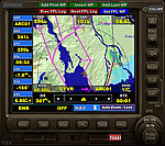
For those that still want to use FSX/P3D, it is recommended to replace GPS2020 V12.0 with this V12.4!
V12.4: Major fault corrected:
- When flying a normal flight plan, then setting a Direct-To destination, quite regularly after a few seconds the DTO was aborted prematurely
and the normal flight plan was restored. Obviously, this is intolerable. A solid cure has been found.
Some additions and smaller corrections:
- WPT infobox upper left: if GPS NAV Lock set, background gets color of active leg (purple).
- When the aircraft reaches the Direct-To destination, normally it starts circling around it (only with the autopilot).
From now on, if a flight plan was active before the Direct-To was started, it will automatically be resumed when the destination is reached.
- Direct-To flight plan: occasionally, the destination waypoint shown in the 2-point DTO flight plan changed to 'Aircraft', although the autopilot navigation
functioned correctly. Now the Direct-To flight plan should always be correct.
- Adding an approach procedure (PROC) to the flight plan, then removing it, then Direct-To to a WP, then cancel DTO:
the flight plan should be restored WITHOUT the PROC, but it was restored WITH the previously deleted PROC. Corrected now.
| Filename: | GPS2020__V124.zip |
| License: | Freeware |
| Added: | 29th August 2020, 20:49:10 |
| Downloads: | 567 |
| Author: | Hugo Jansen |
| Size: | 4.61 MB |
| Category: Dovetail Games Flight Sim World - Scenery | |
| NEW YORK CITY X DEMO |
|
Images related to this file:
File Description:

NEW YORK CITY X DEMO features a detailed scenery of New York city in the United States of America, fully compatible with FSX, FSX STEAM, P3D v1/v2/v3/v4 and FSW by Dovetail.
A demo version of New York City X is provided. This is a fully functional freeware scenery, perfectly aligned with the full payware version. This ensures no problems with online (VATSIM, IVAO and multiplayer) flying in case some users have the payware scenery and some don't. The demo gives you the most important (largest) downtown buildings with a low quality photoreal ground for Manhattan area, as well as low quality heliports.
This scenery add-on features 2500 sq km of terrain with autogen and over 6100 photoreal New York buildings in the city, which is the most populous in the United States and the center of the New York Metropolitan Area, one of the most populous urban agglomerations in the world.
The product is equipped with an automatic installer, which means that the scenery will be automatically added to the Flight Simulator Scenery Library.
Please uninstall all previous versions of similar sceneries you may have installed before. Please make also sure that no duplicated AFCAD files are installed.
Enjoy your virtual flying with Drzewiecki Design!
| Filename: | NEW_YORK_CITY_X_DEMO.zip |
| License: | Freeware, limited distribution |
| Added: | 16th August 2017, 14:27:36 |
| Downloads: | 187 |
| Author: | Drzewiecki Design |
| Size: | 25.8 MB |
| Category: Flight Simulator X - Scenery | |
| 80 AI Ships and AI Ship Traffic |
|
Images related to this file:
File Description:
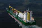
This package contains 80 new AI Ships including cruise ships, frigates, patrol vessels, LNG tankers, fishing boats, bulk carriers, and sail ships. Several of these have heli pads with hard surface and most have lights, small animations, and smoke and wake effects. This package also contains new AI shipping routes for most of the world, but in particular for the North American continent including Greenland and the Great Lakes. Ships visit among other places Toronto, Chicago, Duluth, Trois Rivieres, Vancouver, Valdez, Anchorage, Una Alaska, Boston, New York, Miami, Panama, Caracas, St.Thomas, St.Croix, Saint Martin, Natal, Fortaleza, Belem, Rio de Janeiro, Buenos Aires, Ushuaia, Los Angeles, San Francisco, Seattle, Singapore, Jakarta, Wenzhou, Arkhangelsk, Murmansk, Cork, Oslo, Bergen, Lagos, Dakar, the Galapagos, Antarctica, Nuuk, Sisimut, and many more.
This package will work in both P3D and FSX. It has been tested with several freeware and payware sceneries and default. This package requires prior installation of the other ship packages by Henrik Nielsen to achieve full benefit with the more the 520 ships included in the project to date. Models, effects, and textures by Knud Kristoffersen, Milton Shupe, Manfred Siedler, Jean-Pierre Fillion, Erwin Welker, Bernardo Barroso, and Henrik Nielsen.
| Filename: | 80_AI_Ships_and_AI_Ship_Traffic.zip |
| License: | Freeware |
| Added: | 28th June 2015, 01:44:59 |
| Downloads: | 5,428 |
| Author: | Henrik Nielsen |
| Size: | 101.4 MB |
| Category: Flight Simulator X - Miscellaneous Files | |
| FeelThere Map screens megapack |
|
File Description:
This package looks to be my final release of its' kind. Here are over 250 different screens for use with FeelThere Map; an amalgamation of my prior work into one package. You must have the payware add-on, FeelThere Map installed. These screens will work in FS9 and FSX, but were not tested in other sims. They should work in any sim that works with FeelThere Map (i.e. compatible versions of P3D). Many more complete airline sets are found here, along with a few sensible national groupings, a new bizjet operator grouping, and the addition of luxury brand advertisements for our high-end GA cockpit interiors, or to perhaps complete a set for an airline that might only have 2 or 3 screens of its' own. Lots of retro carriers, and some of the complete sets draw from historic timetable art, and/or bring type specificity. There are other packages from different authors available on the internet that would enable the construction of several more complete airline sets, for the dedicated VA pilot. Speaking of VAs, there's a few VA-specific groupings herein, as well. There's literally something here for every Map-enabled aircraft and flight context in your hangar. Enjoy your flights.
| Filename: | FeelThere_Map_screens_megapack.zip |
| License: | Freeware |
| Added: | 25th April 2026, 17:13:15 |
| Downloads: | 26 |
| Author: | Henry Douglas |
| Size: | 18.38 MB |
| Category: Prepar3D V1-4 - Scenery | |
| NEW YORK CITY X DEMO |
|
Images related to this file:
File Description:

NEW YORK CITY X DEMO features a detailed scenery of New York city in the United States of America, fully compatible with FSX, FSX STEAM, P3D v1/v2/v3/v4 and FSW by Dovetail.
A demo version of New York City X is provided. This is a fully functional freeware scenery, perfectly aligned with the full payware version. This ensures no problems with online (VATSIM, IVAO and multiplayer) flying in case some users have the payware scenery and some don't. The demo gives you the most important (largest) downtown buildings with a low quality photoreal ground for Manhattan area, as well as low quality heliports.
This scenery add-on features 2500 sq km of terrain with autogen and over 6100 photoreal New York buildings in the city, which is the most populous in the United States and the center of the New York Metropolitan Area, one of the most populous urban agglomerations in the world.
The product is equipped with an automatic installer, which means that the scenery will be automatically added to the Flight Simulator Scenery Library.
Please uninstall all previous versions of similar sceneries you may have installed before. Please make also sure that no duplicated AFCAD files are installed.
Enjoy your virtual flying with Drzewiecki Design!
| Filename: | NEW_YORK_CITY_X_DEMO.zip |
| License: | Freeware |
| Added: | 10th August 2017, 18:06:09 |
| Downloads: | 698 |
| Author: | Drzewiecki Design |
| Size: | 25.8 MB |
| Category: Flight Simulator X - Gauges | |
| GPS2020 – V12.4 |
|
Images related to this file:
File Description:
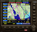
For those that still want to use FSX/P3D, it is recommended to replace GPS2020 V12.0 with this V12.4!
V12.4: Major fault corrected:
- When flying a normal flight plan, then setting a Direct-To destination, quite regularly after a few seconds the DTO was aborted prematurely
and the normal flight plan was restored. Obviously, this is intolerable. A solid cure has been found.
Some additions and smaller corrections:
- WPT infobox upper left: if GPS NAV Lock set, background gets color of active leg (purple).
- When the aircraft reaches the Direct-To destination, normally it starts circling around it (only with the autopilot).
From now on, if a flight plan was active before the Direct-To was started, it will automatically be resumed when the destination is reached.
- Direct-To flight plan: occasionally, the destination waypoint shown in the 2-point DTO flight plan changed to 'Aircraft', although the autopilot navigation
functioned correctly. Now the Direct-To flight plan should always be correct.
- Adding an approach procedure (PROC) to the flight plan, then removing it, then Direct-To to a WP, then cancel DTO:
the flight plan should be restored WITHOUT the PROC, but it was restored WITH the previously deleted PROC. Corrected now.
| Filename: | GPS2020__V124.zip |
| License: | Freeware |
| Added: | 29th August 2020, 20:48:56 |
| Downloads: | 809 |
| Author: | Hugo Jansen |
| Size: | 4.61 MB |
| Category: Flight Simulator X - Scenery | |
| Airport update for Pudong Intl with New Satellite Terminal (ZSPD) |
|
Images related to this file:
File Description:
This is a reasonably accurate and up-to-date version of Pudong Intl airport and made only for FSX users, not suitable for use in P3D: I have given this airport a complete makeover which now includes the new Satellite terminal S1 and S2, assigned parking as per their website with extra overflow parking, all gates/parking numbered correctly where possible with gates included for the A380 (Gates are 24 at T1, 71,75 at T2, 504 remote stand near S1 on taxiway L2, between taxiway P2 and south of P3 and 170 at S2), taxiways and taxi signs updated to the latest charts, extra fuel trucks, drainage channels, support vehicle roads rebuilt, and many other scenery improvements and objects added, airport views are from inside the control tower (when in tower view)
I have also added the new runway 15/33 and its taxiways, although not officially in operation yet, i have opened it so AI traffic will use it and be able to get to the terminals, because there are no charts available to me there are no approaches or taxiway designators for this runway,
I will try to update the approaches and taxiways for runway 15/33 when the updated charts become available to me, please view the readme before installation.
| Filename: | Airport_update_for_Pudong_Intl_with_New_Satellite_.zip |
| License: | Freeware, limited distribution |
| Added: | 15th December 2020, 03:51:37 |
| Downloads: | 44,887 |
| Author: | Ray Smith |
| Size: | 4.07 MB |


© 2001-2026 AVSIM Online
All Rights Reserved
Privacy Policy |