
Where Flight Simulation Enthusiasts Gather from Around the World!
AVSIM Library - Search Results

| Category: Flight Simulator 2002 - Scenery | |
| All 34 airports of Nepal - Part 6 of 6 |

|
File Description:
This scenery adds taxi-ways, parking, buildings, airport vehicles etc., and tower/ground ATC to facilitate AI traffic, to the existing FS 2002 scenery. It is fictional, and any resemblance with the real airport is coincidental.
| Filename: | All_34_airports_of_Nepal__Part_6_of_6.zip |
| License: | Freeware, limited distribution |
| Added: | 30th April 2003, 17:54:23 |
| Downloads: | 1,566 |
| Author: | Einar Aarvik |
| Size: | 6.1 MB |
| Category: Flight Simulator 2002 - AFCAD Files | |
| Patch for Wash_BC.zip - 63 Airports around Vancouver,BC, Canada |
|
File Description:
Resolves problem with receiving weather reports immediately after take-off.
| Filename: | Patch_for_Wash_BCzip__63_Airports_around_Vancouver.zip |
| License: | Freeware |
| Added: | 5th June 2003, 21:03:31 |
| Downloads: | 349 |
| Author: | John Brace |
| Size: | 17.01 KB |
| Category: Flight Simulator 2004 - Miscellaneous Files | |
| Sorted POI global cities and airports pack for FSDiscover! |
|
File Description:
README:
FSDiscover! Global Point of Interest pack.
Here is a poi pack of roughly 147 000 cities, 40 000 small airports,
1 177 seaplane bases, 4695 medium airports and 475 of the largest
airports.
Airports are split up in categories, small, medium, big, seaplane base.
Cities are split up into files of 10 000 cities each by size.
There are 15 files for cities.
The smallest cities are in xaa, xab, xac, xad, and so on.
The biggest cities are in xam, xan, until xao.
You should open the files in notepad to see for yourself which city
files to activate in FSDiscover! to balance clutter and detail.
This has been my main problem with the default populated places list;
there is no way to sort by population size
Compared to the default FSDiscover! populated places here are some
notes:
I have noticed that in the default FSDiscover! set for europe and many
other places, the coordinates are placed like on a "honeycomb" grid
which obviously is not very precise. In general, in terms of city map
precision, this pack should be better.
In the default pack, in an area I am familiar with, a city was placed on the other side of
a river compared to reality. In many other areas, you can clearly see
that the cities are not well-aligned with Ultimate Terrain europe or
even some places in UT USA. My theory is that either data was not super
precise for europe to begin with or that the dataset has been arranged
in the honeycomb grid fashion perhaps to reduce clutter or something.
Mostly though, the default populated places FSDiscover! file is very
useful for really small villages since these tend to be forgotten in
other datasets. The problems come when you want to filter out smaller
villages or airports. This is where this pack comes in handy.
Since no data is perfect, you can use this pack alone or in
combination with the FSDiscover! defaults. Personally, I put the same
files in both "Documents/FSDiscover Files" and
"Program Files/FSDiscover" so I can pick and choose a useful combo
from relevant sets inside the options.
Personally, I prefer the cities from this pack and the rest
(mountains, rivers etc.) from the default FSDiscover! pack.
INSTALLATION:
Just unzip the archived files into "C:\Users\YOURUSERNAME\Documents\FSDiscover Files"
or "C:\Program Files (x86)\FSDiscover!\geodata" or both!
I do not know if the geodata folder is completely overwritten some
times or not so keep that in mind. (probably safe, though)
AUTHOR:
fs9_2003 thanks to data made available by opendatasoft.com and ourairports.com
The source for cities:
https://public.opendatasoft.com/explore/dataset/geonames-all-cities-with-a-population-1000
The source for airports:
https://ourairports.com/data
| Filename: | Sorted_POI_global_cities_and_airports_pack_for_FSD.zip |
| License: | Freeware |
| Added: | 6th May 2024, 14:13:54 |
| Downloads: | 53 |
| Author: | Kim Husainov |
| Size: | 3.18 MB |
| Category: Flight Simulator 2004 - Scenery | |
| Nanjing Dajiaochang Z08T - Chinese Airports From Yesteryear No.1 |
|
Images related to this file:
File Description:
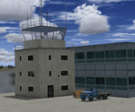
Built with ADE with satellite aligning. Reqiures EZ scenery library: https://www.flightsim.com/files/file/143843-fs2004-ez-scenery-librarys-exe/.
This is the first airport in this series, focusing on old airports in China that now only lives in memory. Nanjing Dajiaochang Airport (NKG/Z08T) was an airport that served Nanjing, the capital of East China's Jiangsu province. It is located 6.2 kilometres (3.9 mi) south of Xinjiekou, the center of Nanjing, and is surrounded on three sides by the Qinhuai River. Opened in 1934, it was an important Chinese airbase during WWII. Civil aviation moved to the new Lukou International Airport in 1997, and then the airforce moved out in 2015 when Dajiaochang finally closed.
| Filename: | Nanjing_Dajiaochang_Z08T__Chinese_Airports_From_Ye.zip |
| License: | Freeware |
| Added: | 23rd July 2024, 00:59:47 |
| Downloads: | 49 |
| Author: | Yue Pan |
| Size: | 101.1 KB |
| Category: Flight Simulator 2004 - AFCAD Files | |
| Antarctica Airports (SAWB, SCRM, NZWD, NZIR, NZPG, NZ0B, NZ0A) |
|
File Description:
These are AFCAD2 files for the seven Airports of the Antartica, Base Marambio (SAWB), Isla Rey Jorge (SCRM), McMurdo Station (NZWD), McMurdo Ice Runaway (NZIR), McMurdo Station Pegasus Field (NZPG), Palmer Station (NZ0B) and Petrel (NZ0A). These files are for the default FS2004 scenery.
| Filename: | Antarctica_Airports_SAWB_SCRM_NZWD_NZIR_NZPG_NZ0B_.zip |
| License: | Freeware |
| Added: | 9th May 2007, 22:09:56 |
| Downloads: | 2,484 |
| Author: | Max Habighorst |
| Size: | 6.55 KB |
| Category: Flight Simulator 2004 - Scenery | |
| 1959 Louisiana-Mississippi-Little Rock-Memphis Scenery |
|
File Description:
FS2004 scenery for the Southern USA in the 1959 to 1962 era. Includes New Orleans (pic 1), Memphis (pic 2), Little Rock (pic 3), and many smaller airports in Louisiana and Mississippi (like Natchez, pic 4). Many town's landclass reduced in size for the earlier era. Includes period billboards along many roads and drive-in theaters too. All custom objects created in GMAX and all objects placed in XML with SceneGenX, to maximize frame rates. Created by Mike Stevens with help from Tom Gibson.
| Filename: | 1959_LouisianaMississippiLittle_RockMemphis_Scener.zip |
| License: | Freeware, limited distribution |
| Added: | 13th December 2005, 23:18:47 |
| Downloads: | 8,772 |
| Author: | Mike Stevens and Tom Gibson |
| Size: | 5.46 MB |
| Category: Flight Simulator 2004 - AFCAD Files | |
| GVNP Praia, Cape Verde (new airport) - UPDATED |
|
Images related to this file:
File Description:
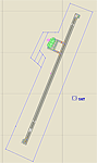
AFCAD for GVNP Praia, Cape Verde. For the FS2004 default scenery. --- This is a new airport which is not included in the FS2004 default scenery. It replaces the old airport GVFM. The readme contains instructions how to remove the old airport. --- IMPORTANT UPDATE: if you want to remove the old airport be sure to install the sceneries by John Hinson and Antonio L. Delgado linked above to restore the missing other airports. --- See the readme for the required "flatten" line to make the airport terrain flat
| Filename: | GVNP_Praia_Cape_Verde_new_airport__UPDATED.zip |
| License: | Freeware, limited distribution |
| Added: | 31st January 2011, 03:19:28 |
| Downloads: | 3,763 |
| Author: | Michael Meier |
| Size: | 32.96 KB |
| Category: Flight Simulator X - Scenery | |
| Agrinio-Itea |
|
Images related to this file:
File Description:
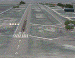
AS REAL AS IT GETS.
This is a detailed photorealistic scenery of Agrinio and the area from Ionio Pelagos in the West, to Itea in the East.
This scenery borders the south part of the Chalkida- Oinoi photoscenery.
See bellow for scenery choices.
Default FSX airports of Agrinio AB (LGAG) and Agrinio (GX01) were completely redone, positioned to their exact location, many buildings and objects were added in the airport compounds.
New aprons with commercial and military parking and 2 aircraft traffic files included.
| Filename: | AgrinioItea.zip |
| License: | Freeware |
| Added: | 13th August 2011, 17:05:04 |
| Downloads: | 2,185 |
| Author: | Angelo Tassoglou |
| Size: | 241.81 MB |
| Category: Flight Simulator 2002 - Scenery Design | |
| Taxiway Signs for HongKong and Macau |
|
File Description:
FS2002 Scenery--HongKong International Airport Chek Lap Kok (VHHH) and Macau Intl (VMMC). Features taxiway signs for the default sceneries of VHHH and VMMC, which are illuminated at night. Night lighting central
lines also added. The signs might be not exactly designed as in reality, but the taxiways numbering is correct so the signs are pretty helpful. Taxiway map, AFCAD files + AFInstaller and flight plans of both airports for your convenience included. AFCAD files have been corrected and all textures are new. By Yves Camus.
| Filename: | Taxiway_Signs_for_HongKong_and_Macau.zip |
| License: | Freeware |
| Added: | 11th September 2004, 21:04:10 |
| Downloads: | 583 |
| Author: | Yves Camus |
| Size: | 456.43 KB |
| Category: Flight Simulator 2002 - AFCAD Files | |
| ScotFlight Update |
|
File Description:
Replacement AFCADs for Scotflight AFCAD_V1.zip
My original upload had corrupted files for Jura, Gigha and Dornoch. These are three small airfields in the excellent Scotflight scenery by Iain Gallacher, Iain Murray and VisualFlight www.ScotFlight.co.uk.
Install using AFCAD V1.3.2 or the new V1.4 by Lee Swordy.
These airports will now appear in the WORLD/GOTO menu and the FS2002 GPS, as originally intended. Sorry for the error. PLEASE NOTE: There are no parking spots or towers at these fields, they are for location purposes only.
| Filename: | ScotFlight_Update.zip |
| License: | Freeware |
| Added: | 26th March 2003, 20:56:37 |
| Downloads: | 355 |
| Author: | David (The Fid) Fidler |
| Size: | 3.17 KB |


© 2001-2026 AVSIM Online
All Rights Reserved
Privacy Policy |