
Where Flight Simulation Enthusiasts Gather from Around the World!
AVSIM Library - Search Results

| Category: Flight Simulator 2004 - Scenery | |
| Port McNeill CAT5 in British Columbia, Canada |

|
Images related to this file:
File Description:
Port McNeill is at the northern end of Vancouver Island, on the coast and around 20 miles east of Port Hardy. The town population is just over 2,000 and the main industry is logging, followed by sand and gravel quarrying and exporting for the construction industry. Tourism rates third.
The airport, a mile or so east of the town, provides a swift connection for nearby islands and the surrounding area to the rest of the west coast, and serves as the HQ main base for West Coast Helicopters. Their newly built large hangar and office accommodation is next to their older hangar to one side of the central public parking area, opposite the club house cum terminal and hangars. There are two runways: 06-24 which is asphalt, 2,400 feet long, and lit; and 11-29 of gravel, 3,650 feet long and also lit. There is some taxiway lighting, but not, for instance, for the connection between runways, which is in real life a ramp up to the gravel runway which is 15 feet higher. There are no regularly scheduled flights and traffic consists mainly of the West Coast helicopters, plus GA and irregular charters, the latter being mostly from Port Hardy.
| Filename: | Port_McNeill_CAT5_in_British_Columbia_Canada.zip |
| License: | Freeware, limited distribution |
| Added: | 18th November 2018, 05:49:13 |
| Downloads: | 136 |
| Author: | Roger Wensley |
| Size: | 13.29 MB |
| Category: Flight Simulator 2004 - AFCAD Files | |
| SBCH - Chapeco Airport in Santa Catarina - Brazil |
|
File Description:
This is AFCAD for Chepeco Airport. - SBCH ( Default Scenery )
Airport of small city in Brazil. This AFCAD have real gates position, real lights and ETC, all basing on Real Charts and Google Earth photos
| Filename: | SBCH__Chapeco_Airport_in_Santa_Catarina__Brazil.zip |
| License: | Freeware |
| Added: | 2nd September 2007, 01:47:44 |
| Downloads: | 539 |
| Author: | Luis Phelippe da Silva |
| Size: | 20.86 KB |
| Category: Flight Simulator 2004 - Scenery | |
| Fort Graham CBW3 in British Columbia Canada |
|
Images related to this file:
File Description:
Fort Graham is what looks like a very small village on the eastern shore of Williston Lake in northern British Columbia, around 100 miles north of Mackenzie (a previous post). The lake, while not large by Canadian standards, is well over 100 miles long but squeezed in width to a maximum of 5 miles amid the surrounding Rockies. The airfield has a gravel runway of 5,000 feet aligned 13-31 and at 2,230 feet ASL. There is no lighting. The operator of the airfield (and presumably the "village" too) is Finlay River Outfitters, a company that is based in Mackenzie and "outfits" hunting trips in the local area. I have posted this as Fort Graham CBW3, but I suggest that you just add it to your previously created "BC airfields" and avoid the inevitable doubling up of common textures etc. Up to you. If you find a defect, email me.
| Filename: | Fort_Graham_CBW3_in_British_Columbia_Canada.zip |
| License: | Freeware, limited distribution |
| Added: | 23rd November 2020, 20:13:11 |
| Downloads: | 105 |
| Author: | Roger Wensley |
| Size: | 7.75 MB |
| Category: Flight Simulator 2004 - Scenery | |
| Parry Sound Harbour CPS1 in Ontario REPOST |
|
File Description:
This is a repost of yesterday's post of the Parry Sound Harbour as it seems one of the files didn't make it through the upload intact. Parry Sound Harbour float base is at the mouth of the Seguin River, where it flows into Parry Sound and Georgian Bay on Lake Huron, 110 miles north of Toronto. The base is run by Georgian Bay Airways Ltd who in 2006 were operating a Beaver and a Cessna 180, if I am remembering that right; the Beaver for sure. There is fuel and oil available, and food! This version has the modelled version of the float base building, after three years.
| Filename: | Parry_Sound_Harbour_CPS1_in_Ontario_REPOST.zip |
| License: | Freeware |
| Added: | 17th February 2009, 00:26:11 |
| Downloads: | 682 |
| Author: | Roger Wensley |
| Size: | 1.88 MB |
| Category: Flight Simulator X - Aircraft Repaints, Textures and Modifications | |
| JetBlue "Vets in Blue" Airbus A320 (N775JB) |
|
Images related to this file:
File Description:
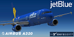
Repaint for the Aerosoft A320 JetBlue (N775JB). Textures only. Readme instructions included. Don't forget to visit http://elmikey.wix.com/hangar226 for future releases!
| Filename: | JetBlue_Vets_in_Blue_Airbus_A320_N775JB.zip |
| License: | Freeware |
| Added: | 25th February 2015, 23:05:29 |
| Downloads: | 1,856 |
| Author: | Miguel Angel Taboada |
| Size: | 8.48 MB |
| Category: Flight Simulator 2004 - Aircraft Repaints, Textures and Modifications | |
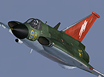
| Saab Draken In Austrian Dragon Knights Scheme |
|
File Description:
Repaint for the Alphasim payware Saab Draken in Austrian Dragon Knights scheme
| Filename: | Saab_Draken_In_Austrian_Dragon_Knights_Scheme.zip |
| License: | Freeware |
| Added: | 2nd January 2006, 01:15:32 |
| Downloads: | 702 |
| Author: | Plane by Alphasim ( http://www.alphasim.co.uk/ ) – repaint by P. Lheureux |
| Size: | 1.9 MB |
| Category: Flight Simulator 2004 - Aircraft Repaints, Textures and Modifications | |
| Draken in Swedish Saab J35F red tail |
|
Images related to this file:
File Description:
Re-uploaded ALPHASIM Draken in Swedish Saab J35F red tail
| Filename: | Draken_in_Swedish_Saab_J35F_red_tail.zip |
| License: | Freeware |
| Added: | 12th May 2010, 00:25:10 |
| Downloads: | 402 |
| Author: | Repaints by pierre lheureux - Plane by Alphasim |
| Size: | 2.26 MB |
| Category: Flight Simulator 2004 - Scenery | |
| Chicoutimi / St-Honore CYRC in Quebec Canada |
|
Images related to this file:
File Description:
This is the third of five sceneries around Lac Saint-Jean in Quebec, Canada. Saint-Honore is a village on a crossroads 32 miles east of the lake, and the airport, called Chicoutimi in the Nav Canada Flight Supplement, is a mile or so east of the village. It is of the familiar triangular military design with three runways 12-30, 06-24, and 18-36. Of these, the longest is 12-30 at over 6,000 feet and has approach lighting and glide slope indicators. Of the other two 06-24 is now closed, but this scenery is based on the 2010 situation with all three open. There are two apron areas, one just to the south of 12-30 and a second to the northwest of 06-24 and served by a separate taxiway. The largest operator is a training establishment based on the northern apron and with a sizeable fleet of Beechcraft trainers (Skipper) that does not exist as an FS9 plane, so these are represented by a similar stand-in substitute. There is also a helicopter emergency evacuation operation to the east of the large control tower, and other hangars. The south apron has two main companies, Max Aviation and Exact Air, both of which run local regular scheduled flights in the area (though both appear to have now subcontracted these out to other companies) and also engage in training and charter flights. There is also a parachute training company. The ai includes flights by the companies on the field and also GA. The list of AI planes is explained in the AI folder, with details of downloads etc. The fleet of training aircraft is one of the planes in the revised (by Nick Tselepides) Piper Aircraft, designed for AI Traffic by Andras Neumann with a Paintkit by Charles Dayhuff adapted by Graham Eccleston, and Paints by Graham Eccleston, Andras Neuman and Frank Cooper along with the trainer repaint by Nick Tselepides. The Max and Exact aircraft textures are approximations by me; apologies. The use of the runways also as taxiways complicates the AI on runway 12-30 as directed by ATC. The AI will always leave 12-30 by the earliest exit, which means that the fleet of trainers will exit to the southern apron but will then taxi back onto the runway to reach taxiway A or runway 36 (according to wind direction) to proceed to the northern apron. In real life they land long and then taxi straight to the end of the runway to reach taxiway A or runway 36 without using the south apron at all. There is no way to correct this so just be ready to go around.
| Filename: | Chicoutimi__StHonore_CYRC_in_Quebec_Canada.zip |
| License: | Freeware, limited distribution |
| Added: | 12th November 2017, 17:35:21 |
| Downloads: | 342 |
| Author: | Roger Wensley |
| Size: | 29.03 MB |
| Category: Flight Simulator 2004 - Scenery | |
| Wekweeti CFJ2 in the Northwest Territories, Canada |
|
Images related to this file:
File Description:
Wekweeti is a small village in the Northwest Territories, around 120 miles north of Yellowknife and 100 east of Gameti, which was recently posted. It has a population of around 125. There is no all-weather road access and the village is reliant upon the airfield for supplies, along with an ice road in the winter months. The area is a complex collection of lakes and small rivers and the airfield is around 3 miles east of the village on a lake shore. The lit gravel runway of 3,400 feet with PAPI at both ends is aligned 307T-127T with T standing for "true" and not the unreliable magnetic heading in the Canadian northern domestic airspace. The airfield is served by Air Tindi from Yellowknife on an almost daily basis, included in the AI here along with some GA and a Thursday delivery by a Buffalo DC3. A note here about my scenery making. There will not be many more to follow this as I am almost at the end of the photos I either took or found for scenery purposes, plus I expect to move on from FS9 at some point during next year.
| Filename: | Wekweeti_CFJ2_in_the_Northwest_Territories_Canada.zip |
| License: | Freeware, limited distribution |
| Added: | 4th January 2020, 18:23:59 |
| Downloads: | 152 |
| Author: | Roger Wensley |
| Size: | 4.39 MB |
| Category: Flight Simulator 2004 - AFCAD Files | |
| SBMQ - Macapa International Airport in Amapa - Brazil |
|
File Description:
This is AFCAD for Macapa INTL. - SBMQ ( Default Scenery )
Internacional airport of Macapa City in Brazil. This AFCAD have real gates position, real lights and ETC, all basing on Real Charts and Google Earth photos.
| Filename: | SBMQ__Macapa_International_Airport_in_Amapa__Brazi.zip |
| License: | Freeware |
| Added: | 2nd September 2007, 01:48:26 |
| Downloads: | 548 |
| Author: | Luis Phelippe da Silva |
| Size: | 21.09 KB |
© 2001-2026 AVSIM Online
All Rights Reserved
Privacy Policy |