
Where Flight Simulation Enthusiasts Gather from Around the World!
AVSIM Library - Search Results

| Category: Flight Simulator 2002 - Aircraft Repaints, Textures and Modifications | |
| DHC-8 ver1.004, Air Canada Jazz |

|
File Description:
This is a repaint of Oleksiy Frolov's fantastic Dash 8 ver1.004. THIS IS TEXTURES ONLY. YOU MUST HAVE THE ORIGINAL AIRCRAFT FOR THESE TO WORK.
In January 2001, a newly-merged carrier called Air Canada Regional Inc. took to the skies. A wholly-owned subsidiary of Air Canada, this company combined the individual strengths of the four regional airline brands – AirBC, Air Nova, Air Ontario, and Canadian Regional. The challenging and complex process of consolidating these four companies was completed in 2002. This achievement was marked with the launch of the new name and brand -- Air Canada Jazz.
Air Canada Jazz is one of the largest regional airlines in the world, serving 80 destinations in Canada and the United States, and providing customers with seamless connections to the worldwide networks of Air Canada and the Star Alliance.
Air Canada Jazz is headquartered in Halifax, Nova Scotia. Additional offices and operations bases are located in Sainte-Foy and Montreal, Quebec; London and Toronto, Ontario; Saskatoon, Saskatchewan; Calgary, Alberta and Vancouver and Victoria, British Columbia.
| Filename: | DHC8_ver1004_Air_Canada_Jazz.zip |
| License: | Freeware, limited distribution |
| Added: | 17th February 2003, 01:31:38 |
| Downloads: | 1,403 |
| Author: | Dan Port |
| Size: | 1.51 MB |
| Category: Flight Simulator 2004 - Scenery | |
| Terrace CYXT in BC Canada Updated |
|
Images related to this file:
File Description:
This version of Terrace has night textures that work, good news for the 319 downloaders who did not tell the author that the ones already posted did not work. Why? Terrace is fifteen miles east and inland from Prince Rupert, which is 500 miles north of Vancouver up the BC coast. It is at the point in the mountains where two fjords meet, one coming from Prince Rupert and the other from Kitimat. There are two runways, the main one is a recently-extended 7,500 feet long and lighted 33/15 and the second is 5,373 feet of unlit 03/21. The apron has been enlarged to be able to accomodate a Boeing 737; though I don't think there is an airline using a 737 for flights to Terrace I have parked an Air Canada jet and the pics show the planes that do fly to Terrace, Air Canada and Hawk Air Dash 8-300's. The aircraft and the textures are down-loadable and and can be used for AI.
| Filename: | Terrace_CYXT_in_BC_Canada_Updated.zip |
| License: | Freeware, limited distribution |
| Added: | 3rd July 2010, 03:28:31 |
| Downloads: | 1,064 |
| Author: | Roger Wensley |
| Size: | 3.72 MB |
| Category: Flight Simulator 2004 - Scenery | |
| Cape Dorset CYTE, Baffin Island, Nunavut, Canada |
|
Images related to this file:
File Description:
Cape Dorset is a village of 1,300 or so inhabitants at N 64 13 W 76 31 on Dorset Island, off the southwest corner of Baffin Island. It's Inuit name is Kinngait, which means "High Mountains"; watch out if you fly there in low clouds. The village (again) does not feature in FS9 but is included in this scenery with approximately the right shape, or shapes as there are separate parts. The airfield runway is just under 4,000 feet of gravel 100 feet wide at 158 feet above sea level. There is a double gradient to it, but unfortunately this cannot be replicated in FS.
Cape Dorset had a Hudson Bay Company store as long ago as 1913, and is now known as a centre for Inuit art. I added the roads, a new airfield background, a pond between apron and runway, plus of course there is the scenery file and the AFCAD and AI, which has two planes visiting, a First Air HS748 and a Canadian North Dash 8-100, as per real life.
| Filename: | Cape_Dorset_CYTE_Baffin_Island_Nunavut_Canada.zip |
| License: | Freeware, limited distribution |
| Added: | 9th December 2010, 18:45:06 |
| Downloads: | 1,014 |
| Author: | Roger Wensley |
| Size: | 2.75 MB |
| Category: Flight Simulator X - Scenery | |
| Mid West Victoria UPDATED. 14 airports. YARA YSWL YMBU YSTA YDOD YWYF YBIR YHPN YKER YSLK YSWH + *NEW* YNHL YHML YWKB |
|
Images related to this file:
File Description:
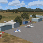
This is an updated version (original Jan 2018). Fixed some ground texture problems plus a lot of added and improved objects and 3 NEW airports. There are 14 airports starting at Ararat and extending up to the Murray at Swan Hill. YARA Ararat YSWL Stawell YMBU Maryborough YSTA Saint Arnaud YDOD Donald YWYF Wycheproof YBIR Birchip YHPN Hopetoun YKER Kerang YSLK Sealake YSWH Swanhill + *NEW* YNHL Nhill YHML Hamilton YWKB Warracknabeal. A lot of airports but not a quicky slap dash effort. It is several hundred hours over many months. Surrounding scenery modified to match real life. Towns, race courses, forests, sewage treatment ponds, obstacles (towers etc) have been added. Included is an AI traffic file that covers all airports that don't already have AI. These files are for Flight Simulator X. Made using Airport Design Editor using some objects borrowed from Robert Budd's excellent Baccus Marsh. RECOMMENDED The scenery is designed to interface with ORBX FTX_AU scenery for Australia (payware). It will work without ORBX but will not interface as well with standard scenery.
| Filename: | Mid_West_Victoria_UPDATED_14_airports_YARA__YSWL__.zip |
| License: | Freeware |
| Added: | 16th May 2019, 18:19:35 |
| Downloads: | 418 |
| Author: | Colin Jeffery |
| Size: | 5.23 MB |
| Category: Flight Simulator 2004 - Scenery | |
| The Greater Toronto Area Part 1 |
|
File Description:
Part 1 of Flight Ontario's scenery for the Greater Toronto Area and Southern Ontario.
Over a year in the making, this scenery for Fs 2002 and Fs 2004 is bounded by Detroit in the west, Kingston in the east, Huntsville in the north and Buffalo in the south and features:
* all-season scenery
* custom water textures
* completely modelled Toronto Airports...CYTZ (Toronto Island) and CYZD
(Downsview-home to Bombardier Aerospace and the Canadair Regional Jet
and Dash-8, and the Toronto Aerospace Museum)
* custom autogen for the GTA
* Custom landclass for southern Ontario
* custom shorelines (western Lake Ontario, Kingston area, Lake
Couchiching...Severn River...Sparrow Lake area, and the Muskoka Lake
area)
* prominent features around Hamilton include the Burlington Skyway and
Lift Bridge and steel mills
* the Welland Canal is featured with lift bridges, bascule bridge and
fixed link bridge from Pt Weller to Pt Colborne
* the Niagara area includes the Minolta Tower, and 3 hydro generating
plants with reservoirs
* compatibility with SimFlyers CYYZ
This scenery is downloadable in two parts and both parts are essential
| Filename: | The_Greater_Toronto_Area__Part_1.zip |
| License: | Freeware |
| Added: | 9th April 2004, 12:40:02 |
| Downloads: | 37,176 |
| Author: | Flight Ontario |
| Size: | 62.09 MB |
| Category: Flight Simulator 2004 - Scenery | |
| Terrace CYXT in British Columbia, Canada - REVISED |
|
Images related to this file:
File Description:
This version includes the correct Piper Cub texture, unreported by all but one downloader (why?).
Terrace is fifteen miles east and inland from Prince Rupert, which is 500 miles north of Vancouver up the BC coast. It is at the point in the mountains where two fjords meet, one coming from Prince Rupert and the other from Kitimat. The airport is a couple of miles south of the town and on the south side of the Skeene River. There are two runways, and the main one is a recently-extended 7,500 feet long and lighted 33/15. The second is 5,373 feet of unlit 03/21. The apron has been enlarged to be able to accommodate a Boeing 737 so I have parked an Air Canada jet there, but the pics show the planes that do fly to Terrace, and these are Air Canada and Hawk Air Dash 8-300's. The original aircraft and the textures are down-loadable and and can be used for AI.
| Filename: | Terrace_CYXT_in_British_Columbia_Canada__REVISED.zip |
| License: | Freeware, limited distribution |
| Added: | 21st February 2010, 16:25:38 |
| Downloads: | 1,110 |
| Author: | Roger Wensley |
| Size: | 3.39 MB |
| Category: Flight Simulator X - Aircraft Repaints, Textures and Modifications | |
| GMG Airlines Boeing 737-800 |
|
Images related to this file:
File Description:

GMG Airline was established in 1997 and started domestic operations on 6 April 1998. International services were launched six years later on 8 September 2004, with a service from Chittagong to Kolkata.
GMG began regular flights to Bangkok, Delhi and Kathmandu on 20 October 2006. It started services to Kuala Lumpur on 24 January 2007. The airline started its operation to the Middle East with daily flights to Dubai on 1 February 2008. In July 2010, GMG initiated flights to Jeddah and Riyadh.
The airline also served Abu Dhabi and Karachi as well as domestic stations Jessore and Sylhet
A GMG Airlines Bombardier Dash 8 In February 2008 the airline added a leased Boeing 747-300 to the fleet starting wide-body operations, this proved to be a White Elephant in an era which saw Global economic problems and an unprecedented peak in oil prices, thus causing a substantial loss to the carrier, the 747 was eventually phased out after just five months of service.On 17 June 2009, the largest conglomerate of Bangladesh, BEXIMCO took a 50% stake in the airline, re-branding it and raising service standards to a higher level. For the PMDG 737NGX-800
| Filename: | GMG_Airlines_Boeing_737800.zip |
| License: | Freeware |
| Added: | 27th November 2016, 22:04:14 |
| Downloads: | 136 |
| Author: | MacHelix1, PMDG |
| Size: | 19.32 MB |
| Category: Flight Simulator 2004 - Scenery | |
| LELC Murcia/San Javier, Spain |
|
File Description:
Googly scenery for LELC San Javier, Spain, a medium-sized airport on the Costa
Cálida 17 miles south of Murcia. The airport sees daily scheduled traffic
operated by Canadair Regional Jets and Dash 8 turboprops of Air Nostrum but a
large proportion of the airport's traffic is derived from tourist charter
traffic from operators such as Air Berlin, Easyjet, LTU International and
Ryanair and the airport can accept aircraft as large as the Boeing 767. The
north end of the airport is home to the Spanish Air Force Academy.
Flight Simulator 2004 has made little provision for traffic with facilities only
for general aviation aircraft and this scenery seeks to redress the situation.
The scenery does not purport to be ultra-accurate. Based on high quality
satellite imagery from Google Earth, the layout is proportionally correct but the
added airport features, such as buildings, are built from default Microsoft objects
and add-on libraries so will not look exactly like the real thing.
You are not obliged to download and install any additional scenery libraries,
but to enjoy this scenery in its entirety, you may wish to. It will work fine,
with or without.
| Filename: | LELC_MurciaSan_Javier_Spain.zip |
| License: | Freeware |
| Added: | 6th April 2008, 20:35:29 |
| Downloads: | 3,169 |
| Author: | John hinson |
| Size: | 20.51 KB |
| Category: Flight Simulator 2004 - Scenery | |
| Akulivik CYKO in northern Quebec Canada |
|
Images related to this file:
File Description:
This is another of the many airfields that are all around the coast of Hudson Bay, this one being on the eastern, Quebec side. Akulivik is around 110 miles south of Ivujivik, which is on the northeastern corner of the Bay, and some 60 miles north of Puvirnituq. The population is 630 or so and the village grew from a move back to the area by one family in 1973, followed by others in the following years; the closure of the Hudson Bay trading post post in 1952 had pushed all residents to move south to Puvirnituq. The village is unusual in that it has a built harbour instead of the usual beached storage of boats. The village is built on the central prong of a three pronged spear of headlands (from which the village name is derived) while the airfield is a mile or so further inland. I have no information regarding what I think may be a new terminal building, so this includes only the old original one. The runway is just under 3,500 feet of gravel aligned 09-27, and the ai includes the scheduled flight by an Air Inuit Dash 8-300, plus GA.
| Filename: | Akulivik_CYKO_in_northern_Quebec_Canada.zip |
| License: | Freeware, limited distribution |
| Added: | 9th September 2018, 03:43:25 |
| Downloads: | 162 |
| Author: | Roger Wensley |
| Size: | 4.69 MB |
| Category: Flight Simulator 2004 - Scenery | |
| MYER Rock Sound International, Eleuthera Island, Bahamas |
|
File Description:
Googly scenery for Rock Sound International (ICAO: MYER), a grand-sounding but
quiet airport located on Eleuthera Island, Bahamas. Eleuthera is a long
and thin island east of Nassau and has three commercial airports, the busiest
being Governor's Harbour. Rock Sound is at the southern end and is served twice
daily by Dash 8 turboprops of Bahamasair, along with occasional flights by
operators such as Southern Air Charter. The airport has seen busier days and
was once even served from Europe by Alitalia.
Microsoft have only provided general aviation facilities at this airport in
Flight Simulator 2004 and this scenery seeks to redress the situation
so that you and your "AI" traffic can use the airport realistically.
The scenery does not purport to be ultra-accurate. Based on high quality
satellite imagery from Google Earth, the layout is proportionally correct but the
added airport features, such as buildings, are built from default Microsoft objects
and add-on libraries so will not look exactly like the real thing.
You are not obliged to download and install any additional scenery libraries,
but to enjoy this scenery in its entirety, you may wish to. It will work fine,
with or without.
| Filename: | MYER_Rock_Sound_International_Eleuthera_Island_Bah.zip |
| License: | Freeware |
| Added: | 13th October 2008, 11:01:56 |
| Downloads: | 1,467 |
| Author: | John Hinson |
| Size: | 61.42 KB |
© 2001-2026 AVSIM Online
All Rights Reserved
Privacy Policy |